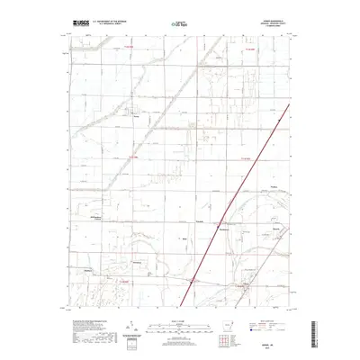
2020 Map of Joiner
USGS Topo · Published 2020About this map
Dyess and the surrounding agricultural landscapes of Mississippi County are defined by a network of drainage bayous and rural farm roads in this 2020 survey. The terrain is notably flat, carved by the winding Tyronza River in the northwest and Frenchmans Bayou in the south. The map provides significant genealogical value through its dense concentration of family and community burial sites, including Saint Marys Cem, Mount Pisby Cem, and Uzzell Cem. Small settlements like Joiner, Bassett, and Wardell serve as local hubs along the road network, while the layout of Dyess reflects its unique history as a planned resettlement community. The survey also identifies smaller locales such as McClendons Corner, Chelford, and Norden, documenting the persistent pattern of rural life in the Arkansas Delta.
Find a feature on this map
44 named features on this map. Tap any name to fly to it.
Don’t see what you’re looking for? This feature index may not catch every label — zoom into the map to look around manually.
Map Details
Editions of this 2020 Joiner Map
This is the sole edition of this map. No revisions or reprints were ever made.
Other maps of this area

1931 · Jericho
USGS Topo · 1:62,500

1939 · Jericho
USGS Topo · 1:62,500

1939 · Evadale
USGS Topo · 1:62,500

1940 · Deckerville
USGS Topo · 1:62,500

1941 · Marked Tree
USGS Topo · 1:62,500

1952 · Jericho
USGS Topo · 1:62,500

1953 · Memphis
USGS Topo · 1:250,000

1956 · Evadale
USGS Topo · 1:62,500

1956 · Marked Tree
USGS Topo · 1:62,500

1956 · Memphis
USGS Topo · 1:250,000