Old Maps of Polk County, Arkansas for Genealogy
Trace your family roots with 161 historic maps of Polk County. These high-res maps reveal old neighborhoods, homesites, landmarks, and streets — helping you uncover where your ancestors lived and how the area evolved over time.
- Explore historic neighborhoods: Identify where your relatives may have lived in the 1800s or 1900s.
- Compare maps over time: Trace the changes in streets, buildings, and landmarks for multi-generational research.
- Perfect for genealogy & ancestry research: Used by family historians and researchers to map out lineage and migration.
These maps are an incredible resource for exploring your personal connection to Polk County's past.
Polk County, AR maps
(161)- 1890 Map of Mount Ida
 1890 Mount Ida1890 Print · USGSMontgomery and Scott counties are shown in the late nineteenth century, dominated by the ridges of the Ouachita Mountains and the winding Washita or Ouachita River. Genealogists and historians can trace early settlements like Mt. Ida, Oden, and the mining camp at Silver City.7 unique versions available
 - 1890 Map of Poteau Mountain
 1890 Poteau Mountain1890 Print · USGSWestern Arkansas and the Indian Territory border are mapped in the late 1880s as the frontier gives way to established settlements. Genealogists can trace early homesteads and post offices like Waldron, Dallas, and Cherry Hill, or locate the historic Toll Gate and Talihina Trail.2 unique versions available
 - 1899 Map of Poteau Mountain
 1899 Poteau Mountain1899 Print · USGSThe Arkansas borderlands and the Choctaw Nation frontier are captured here just before the turn of the century. Local historians can trace old homesteads and post offices near Waldron, Dallas, and the remote Cherry Hill (Egger P.O.) along the upper Ouachita.6 unique versions available
 - 1906 Map of Caddo Gap
 1906 Caddo Gap1906 Print · USGSWest-central Arkansas at the dawn of the twentieth century shows a rugged landscape defined by the Ouachita ridges and early mountain industries. Researchers can trace defunct mining communities like Slatington and Fancy Hill, or locate long-gone railway stops at Hickory Station and Brocktown.3 unique versions available
 - 1913 Map of De Queen
 1913 De Queen1913 Print · USGSThe southern Ouachita Mountains and the Arkansas-Oklahoma borderlands appear here in the early twentieth century as the railroad transformed the timber and mining industries. Researchers can trace historic sites like the Welcome Home School, the Kansas City Southern RR corridor, and the early streets of De Queen.4 unique versions available
 - 1936 Map of Athens
 1936 Athens1936 Print · USGSThe rural communities of western Arkansas were still deeply connected by river valleys and mountain gaps in the mid-1930s. Genealogists can trace family footprints at Athens, Langley, and Misels Chapel, or locate remote burials at Hutchinsons Cem and Abernathy Cem.4 unique versions available
 - 1942 Map of Athens
 1942 Athens1942 Print · USGSThe Ouachita highlands of western Arkansas are captured here in the early 1940s, showing a rugged network of forest ridges and small farm settlements. Researchers can locate family sites and local landmarks including Misels Chapel, Cox Cem, and schoolhouses like Miller Sch or Pleasant Hill Sch.
 - 1950 Map of Mcalester
 1950 Mcalester1950 Print · USGSThe Ouachita Mountains and the coal country of Southeast Oklahoma are shown here in the late 1940s. Genealogists and historians can trace the rail-driven growth of McAlester, Wilburton, and Antlers alongside the rugged terrain of Kiamichi Mountain.2 unique versions available
 - 1955 Map of Little Rock, 1978 Print
 1955 Little Rock1978 Print · USGSCentral Arkansas in the mid-fifties exhibits a landscape of growing cities, massive military installations, and mountain reservoirs. Genealogists and historians can trace the industrial Bauxite Mines, regional rail lines, and local landmarks like Antioch Church.
 - 1956 Map of Little Rock
 1956 Little Rock1956 Print · USGSCentral Arkansas in the mid-fifties shows a landscape defined by burgeoning military bases and the timber-and-mineral wealth of the Ouachitas. Genealogists and researchers can trace old rail lines like the Missouri Pacific and find established communities such as Bauxite, Sheridan, and Mabelvale.
 - 1958 Map of Board Camp, 1959 Print
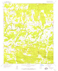 1958 Board Camp1959 Print · USGSPolk County life in the late fifties centered on the Ouachita River valley and its surrounding timberlands. Local historians can trace old homesteads and community hubs like Board Camp, Yocana Ch, and the Lower Big Fork Cem.2 unique versions available
 - 1958 Map of Mena, 1959 Print
 1958 Mena1959 Print · USGSPolk County life in the late fifties centered on the mountain valleys around Mena and the Ouachita National Forest boundary. Researchers can trace rural school locations like Stilwell Sch, the Kansas City Southern Railroad corridor, and many family burial grounds including Yocana Cem.
 - 1958 Map of Potter, 1959 Print
 1958 Potter1959 Print · USGSThe Arkansas-Oklahoma borderlands are shown here in the late fifties, dominated by the ridges of the Ouachita National Forest. Researchers can locate old settlements like Zafra and Potter, family cemeteries such as Sexton Cem, and the path of the Kansas City Southern RR.3 unique versions available
 - 1958 Map of Zafra, 1959 Print
 1958 Zafra1959 Print · USGSThe Arkansas-Oklahoma state line in the late fifties was a land of high peaks and isolated community life. Genealogists and historians can trace family locations through Zafra Sch, Stinett Cem, and the rural Alder Springs Ch along the Little River.4 unique versions available
 - 1958 Map of Mena, 1959 Print
 1958 Mena1959 Print · USGSMena and its neighboring settlements in the late fifties reveal a bustling railroad town integrated with the surrounding Ouachita highlands. Trace local genealogy and industry through the Mena Municipal Landing Field, Holly Springs Ch, and the Dallas settlement.3 unique versions available
 - 1958 Map of Y City, 1959 Print
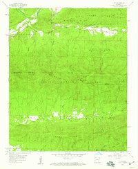 1958 Y City1959 Print · USGSThe northern reaches of the Ouachita National Forest are captured here in the late 1950s, detailing the isolated settlements along the Scott and Polk county line. Researchers can locate family landmarks like Chant Cem, the high Wolf Pinnacle Lookout Tower, and the site of Eureka Sch (Abandoned).2 unique versions available
 - 1958 Map of Rich Mountain, 1959 Print
 1958 Rich Mountain1959 Print · USGSRich Mountain and the Ouachita National Forest are shown in the late fifties as a high-altitude corridor of recreation and rail. Genealogists can trace family names at Sexton Cem and Center Point Ch near the Kansas City Southern line.3 unique versions available
 - 1958 Map of Potter, 1959 Print
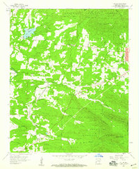 1958 Potter1959 Print · USGSPolk County at the end of the fifties reveals a landscape where the Kansas City Southern railroad linked forest industry with mountain settlements. Researchers can locate numerous family burial sites like Foster Cem and McKinney Cem, alongside landmarks such as Gann Chapel and Lake Wilhelmina.3 unique versions available
 - 1958 Map of Acorn, 1959 Print
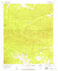 1958 Acorn1959 Print · USGSThe Ouachita Mountains of western Arkansas come into focus in the late fifties, showing the interplay of the timbered hills and small valley settlements. Genealogists and historians can trace the Kansas City Southern rail line as it passes Acorn, noting local landmarks like Foran Cem and Acorn Ch.2 unique versions available
 - 1958 Map of Mountain Fork, 1959 Print
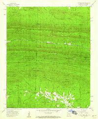 1958 Mountain Fork1959 Print · USGSThe Arkansas-Oklahoma state line runs through these high ridges in the late fifties, where the Kansas City Southern railroad winds through the mountains. Researchers can trace the development of Wilhelmina State Park and locate historic sites like Healy Cem and the settlement at Mountain Fork.3 unique versions available
 - 1959 Map of Umpire, 1960 Print
 1959 Umpire1960 Print · USGSThe rural borderlands of Polk and Howard counties come into focus in the late fifties, showing the isolated homesteads and forest clearings of the Ouachita foothills. Genealogists can trace family footprints through sites like Umpire, Mineola, and the Cedar Hill Cem.3 unique versions available
 - 1959 Map of Oden, 1960 Print
 1959 Oden1960 Print · USGSThe Ouachita River valley in the late fifties is a landscape of mountain ridges and riverside settlements. Researchers can trace family history through local landmarks like Pine Ridge, the Goodner Cem, and the Gaston Lookout Tower.2 unique versions available
 - 1959 Map of Cove, 1960 Print
 1959 Cove1960 Print · USGSWestern Arkansas and the Oklahoma borderlands are captured here in the late fifties, showing the mountain corridor of the Kansas City Southern. Trace local history through landmark sites like Old Cove, Bethel Chapel, and several family burial grounds including Piney Cem.2 unique versions available
 - 1960 Map of Little Rock
 1960 Little Rock1960 Print · USGSCentral Arkansas in the late fifties shows a landscape of growing military bases and massive new reservoirs. Local historians can trace the mid-century expansion of Little Rock and Hot Springs alongside the industrial works at Bauxite and the Pine Bluff Arsenal.
 - 1962 Map of McAlester
 1962 McAlester1962 Print · USGSSoutheastern Oklahoma and western Arkansas are shown here during the early sixties, a time of transition for the region's mountain communities and timberlands. Researchers can trace the paths of the Kansas City Southern RR through Heavener or locate settlements like Talihina and Broken Bow near the Kiamichi Mountains.2 unique versions available
Showing maps 1-25 of 161
Top cities of Polk County
- Mena historical maps
- Wickes historical maps
- Grannis historical maps
- Hatfield historical maps
- Cove historical maps
- Vandervoort historical maps
Frequently asked questions
- What are the different types of historical maps available for Polk County?
- What is the oldest map of Polk County?
- Where can I purchase historical maps of Polk County for my home or office?
- Where can I download high-res historical maps of Polk County?
- Are there historical topographic maps available for Polk County?
- Is there historical aerial imagery available for Polk County?
- Where are historical maps of Polk County sourced from?