1960s Maps of Randolph County, Arkansas
Explore 19 historic maps of Randolph County from the 1960s. These maps offer a rare glimpse into what life looked like during the 1960s — showing old roads, neighborhoods, homes, and landmarks that have changed or disappeared over time.
Whether you're researching your family's past, planning a metal detecting trip, or studying how Randolph County's landscape evolved across the 1960s, these high-resolution maps are a powerful tool for exploring the history of this region.
- Focus on a specific era: All maps on this page are from the 1960s, giving you a focused view of this time period.
- See what’s changed: Compare century-old streets, trails, and buildings to today's modern landscape using overlays and satellite layers.
- Research with precision: Use these maps for genealogy, historical research, land use analysis, or educational projects.
- View, download, or print: Maps are fully viewable online in high resolution, and can be downloaded or printed for your own records.
Start exploring Randolph County's history through authentic maps from the 1960s. This is your window into the past.
Randolph County, AR maps
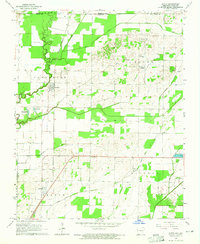
(19)- 1960 Map of Poplar Bluff
 1960 Poplar Bluff1960 Print · USGSSoutheast Missouri and Northeast Arkansas are captured here during the post-war era, showing the transition from the Ozark highlands to the Delta. Genealogists and historians can trace rail corridors like the St. Louis Southwestern RR and remote settlements such as Birch Tree and Warm Springs.
 - 1964 Map of Datto, 1965 Print
 1964 Datto1965 Print · USGSIn the mid-1960s, the Arkansas-Missouri border was a landscape of fertile bottomlands and evolving drainage systems. Genealogists can trace family roots at Hitt Cem and Grassyhead Ch or follow the St Louis-San Francisco rail line through Success.2 unique versions available
 - 1964 Map of Peach Orchard, 1965 Print
 1964 Peach Orchard1965 Print · USGSNortheast Arkansas in the mid-sixties is defined here by the winding channels of the Black River and the industrial backbone of two major railroads. Genealogists can locate family landmarks like Pirtle Ch, Allen Cem, and the small community of Brookings tucked along the riverbanks.3 unique versions available
 - 1965 Map of O'Kean, 1966 Print
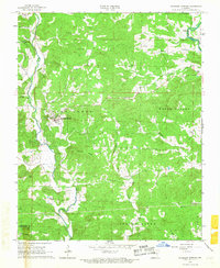
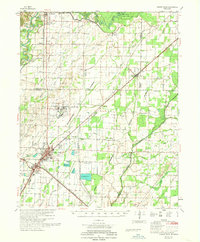
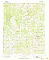
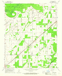 1965 O'Kean1966 Print · USGSRandolph and Lawrence counties are captured here in the mid-1960s, a landscape defined by its winding river bottoms and the Missouri Pacific line. Genealogists can locate family-named sites like Sharum, Frye Cem, and Rickey Chapel.3 unique versions available
 - 1965 Map of Manson, 1966 Print
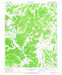
 1965 Manson1966 Print · USGSRandolph and Lawrence Counties come alive in this mid-century survey as the river and rail network shaped local commerce. Genealogists and historians can trace family locations near College City, the St Louis-San Francisco railroad, and old burial sites like Mt Zion Cemetery.
 - 1966 Map of Ravenden Springs, 1967 Print
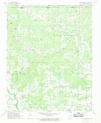
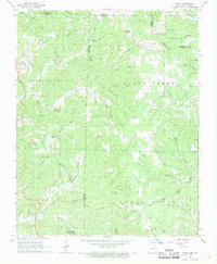
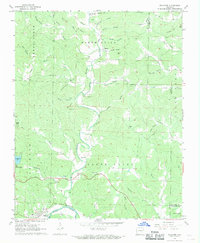
 1966 Ravenden Springs1967 Print · USGSRavenden Springs and the surrounding Ozark foothills are captured here in the mid-1960s, showing a landscape of small farms and family-led communities. Genealogists can trace deep local roots through several family burial grounds, including Wells Cem, Janes Cem, and Brown Cem.2 unique versions available
 - 1966 Map of Ravenden Springs SE, 1967 Print
 1966 Ravenden Springs SE1967 Print · USGSRandolph County's river valleys and timbered ridges are captured here in the mid-sixties, showing the rural communities along the Eleven Point River. Genealogists and local researchers can trace family landmarks like McIlroy Cem, Stony Point Ch, and the crossing at Black Ferry Bridge.2 unique versions available
 - 1966 Map of Imboden, 1967 Print
 1966 Imboden1967 Print · USGSIn the mid-1960s, the riverside town of Imboden thrived along the St Louis - San Francisco rail line. Researchers can trace family history through numerous rural sites like Annieville, Pleasant Grove Ch, and the Nation Cem.2 unique versions available
 - 1966 Map of Pocahontas, 1967 Print
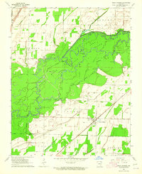
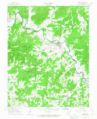
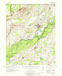
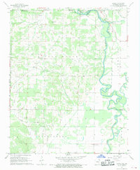
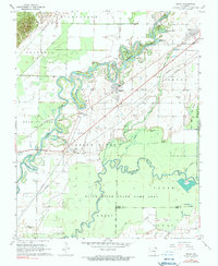
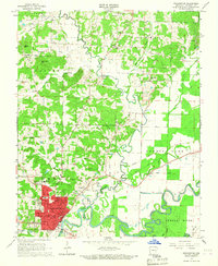 1966 Pocahontas1967 Print · USGSRandolph County's river-driven landscape is captured here in the mid-sixties as the Black River and Fourche River meet at Pocahontas. Genealogists can locate family sites like the Masonic Cemetery, Friendship Cem, and rural outposts like Stokes.2 unique versions available
 - 1967 Map of Knobel
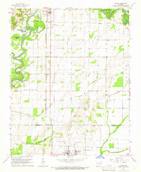
 1967 Knobel1967 Print · USGSNortheast Arkansas in the late 1960s reveals a landscape of river-bottom settlements and a sophisticated network of agricultural drainage. Trace the family roots of early residents near Corning, Success, and Knobel, or locate family sites at Richwoods Cem and Browns Chapel.
 - 1967 Map of Warm Springs, 1969 Print
 1967 Warm Springs1969 Print · USGSThe Missouri-Arkansas border region comes alive in the late sixties, showcasing a landscape of Ozark springs and remote homesteads. Genealogists can trace family names through Upshaw Cem and Roach Cem or locate the quiet crossroads of Hamil and Tyer.2 unique versions available
 - 1968 Map of Walnut Ridge
 1968 Walnut Ridge1968 Print · USGSNortheast Arkansas in the late sixties reveals a landscape of industrial rail hubs and complex river drainage systems. Genealogists can trace family roots through rural landmarks like Surridge School, Rickey Chapel, and the Whittaker Cemetery near Hoxie.
 - 1968 Map of Hardy NE, 1969 Print
 1968 Hardy NE1969 Print · USGSRandolph County, Arkansas, and the Missouri state line meet in this late 1960s survey of the Ozark foothills. Researchers can trace family history through numerous rural burial sites like James Cem and Davis Cem or locate community centers like English Bluff Ch.2 unique versions available
 - 1968 Map of Wirth, 1969 Print
 1968 Wirth1969 Print · USGSThe borderlands of Sharp and Fulton County come to life in the late 1960s, showing a rural landscape of winding hollows and small family settlements. Genealogists can locate several remote burial grounds and churches, including Ed Collins Cemetery, Bethel Cemetery, and Union Hill Church.2 unique versions available
 - 1968 Map of Supply, 1969 Print
 1968 Supply1969 Print · USGSThe Arkansas-Missouri borderlands come into focus in the late sixties as a network of small settlements and river bottoms. Researchers can locate family landmarks like Supply Ch, Ingram Cem, and the old community at Pitman.2 unique versions available
 - 1968 Map of Maynard, 1969 Print
 1968 Maynard1969 Print · USGSThe Fourche River valley and the town of Maynard are captured here in the late sixties as they appeared just south of the Missouri line. Genealogists can trace family landmarks and rural homesteads near Middlebrook, Barnett Cem, and Siloam Ch.
 - 1968 Map of Dalton, 1969 Print
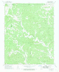
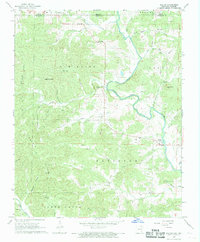 1968 Dalton1969 Print · USGSRandolph County sits at the Missouri border in the late sixties, where the Eleven Point River carves through the Ozark foothills. Researchers can pinpoint old homesteads and community hubs like Elm Store, Yadkin Ch, and Bryan Cem.2 unique versions available
 - 1968 Map of Williford, 1969 Print
 1968 Williford1969 Print · USGSSharp County land records and family histories come to life in the late 1960s as the Spring River passes through Williford. Trace ancestral sites at Bradford Chapel, Kellett Cem, and the historic St Louis - San Francisco rail line.2 unique versions available
 - 1968 Map of Reyno, 1970 Print
 1968 Reyno1970 Print · USGSNortheast Arkansas river country is captured here in the late sixties, where the winding channels of the Current River define the local geography. Genealogists can trace family names through numerous burial sites like Old Reyno Cem and Yellow Hill Cem.2 unique versions available
End of results
Showing maps 1-19 of 19
Top cities of Randolph County
- Pocahontas historical maps
- Reyno historical maps
- Maynard historical maps
- Biggers historical maps
- O'Kean historical maps
- Ravenden Springs historical maps
Frequently asked questions
- What are the different types of historical maps available for Randolph County?
- What is the oldest map of Randolph County?
- Where can I purchase historical maps of Randolph County for my home or office?
- Where can I download high-res historical maps of Randolph County?
- Are there historical topographic maps available for Randolph County?
- Is there historical aerial imagery available for Randolph County?
- Where are historical maps of Randolph County sourced from?