1990s Maps of White County, Arkansas
Explore 13 historic maps of White County from the 1990s. These maps offer a rare glimpse into what life looked like during the 1990s — showing old roads, neighborhoods, homes, and landmarks that have changed or disappeared over time.
Whether you're researching your family's past, planning a metal detecting trip, or studying how White County's landscape evolved across the 1990s, these high-resolution maps are a powerful tool for exploring the history of this region.
- Focus on a specific era: All maps on this page are from the 1990s, giving you a focused view of this time period.
- See what’s changed: Compare century-old streets, trails, and buildings to today's modern landscape using overlays and satellite layers.
- Research with precision: Use these maps for genealogy, historical research, land use analysis, or educational projects.
- View, download, or print: Maps are fully viewable online in high resolution, and can be downloaded or printed for your own records.
Start exploring White County's history through authentic maps from the 1990s. This is your window into the past.
White County, AR maps
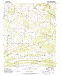
(13)- 1992 Map of Russellville, 1993 Print
 1992 Russellville1993 Print · USGSCentral Arkansas in the early nineties shows a landscape defined by the Arkansas River valley and the surrounding national forests. Trace the development of river towns like Russellville and Dardanelle alongside landmarks such as Lake Dardanelle and Magazine Mtn.
 - 1994 Map of Mount Vernon
 1994 Mount Vernon1994 Print · USGSThe borderlands of Faulkner and White Counties come into focus in the 1990s, centered on the historic settlements of Mount Vernon and Romance. Genealogists can trace family names through landmarks like Hammons Chapel Cem, Adkisson Cem, and Union Hill Ch.
 - 1994 Map of Kensett
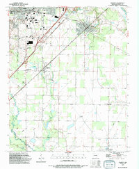 1994 Kensett1994 Print · USGSWhite County’s late-century landscape is defined by the intersection of rail lines and emerging educational centers. Researchers can trace family ties through Lessenberry Cem and Ellis Chapel or locate historic structures near Harding College and Morning Sun.
 - 1994 Map of Walker
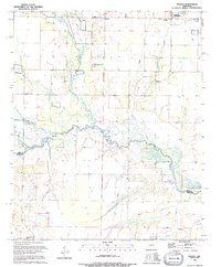 1994 Walker1994 Print · USGSThe border of White and Prairie Counties in the mid-1990s showcases a landscape defined by meandering waterways and small rural communities. Researchers can trace the heritage of the region through landmarks like Walker Cem, Dogwood Ch, and Griffithville.
 - 1994 Map of Mountain Springs
 1994 Mountain Springs1994 Print · USGSLonoke County and the surrounding tri-county borders were captured in the mid-1990s as a landscape of rural family homesteads and ridges. Researchers can locate historic congregational centers and burial grounds such as Sixteenth Section Ch, Baugh Chapel, and Shirley Cem.
 - 1994 Map of Sidon
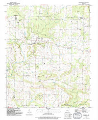
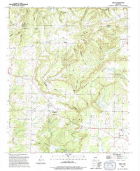 1994 Sidon1994 Print · USGSThe rural communities of White County appear here during the mid-nineties, showing a landscape of high ridges and winding creek bottoms. Genealogists and historians can trace the sites of Sidon, Joy, and Center Hill, along with local landmarks like Pleasant Ridge Cem and Georgia Ridge.
 - 1994 Map of Judsonia
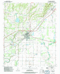
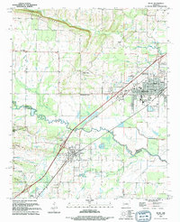
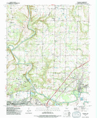 1994 Judsonia1994 Print · USGSWhite County life in the mid-1990s is captured here, centered on the Little Red River and the growing communities of Judsonia and SEARCY. Genealogists can locate numerous landmarks including Evergreen Cem, Holly Springs Ch, and Plainview.
 - 1994 Map of Floyd
 1994 Floyd1994 Print · USGSCentral Arkansas at the end of the twentieth century shows a landscape of ridges and river valleys centered on Floyd. Genealogists can locate family landmarks like Quattlebaum Cem, Shiloh Ch, and the rural community of Antioch.
 - 1994 Map of West Point
 1994 West Point1994 Print · USGSThe Little Red River valley is shown in the early nineties, revealing a landscape defined by its waterways and flood management. Researchers can trace the Old Railroad Grade and locate local landmarks like New Hope Ch and West Point Cem.
 - 1994 Map of Rose Bud
 1994 Rose Bud1994 Print · USGSIn the hills of northern Arkansas during the 1990s, the community of Rose Bud sits at the intersection of three counties. Researchers can trace family roots through numerous landmarks like Rose Bud High Sch, St Marys Ch, and the Starkey Cem.
 - 1994 Map of Bald Knob
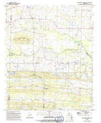
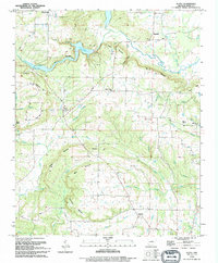
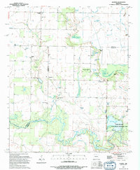
 1994 Bald Knob1994 Print · USGSThe mid-Arkansas landscape around Bald Knob is captured here in the mid-nineties, showing the intersection of the Missouri Pacific rail line and the Little Red River. Local historians can trace family sites at Shady Grove Cem, Midway, and the Liberty Valley Ch.
 - 1994 Map of Beebe
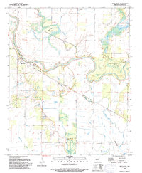
 1994 Beebe1994 Print · USGSThe rail-and-river corridor of central Arkansas comes into focus in the mid-1990s as the town of Beebe expands. Genealogists and historians can locate dozens of landmarks including the Dunkard Brethren Cemetery, Stony Point, and the Beebe Speedway.
 - 1994 Map of Jasmine
 1994 Jasmine1994 Print · USGSPrairie and White counties met in a mosaic of bottomlands and small settlements in the 1990s. Researchers can locate family landmarks like Belcher Cem or trace the drainage of the Bayou Des Arc past Jasmine and Showalters Corner.
End of results
Showing maps 1-13 of 13
Top cities of White County
- Searcy historical maps
- Beebe historical maps
- Bald Knob historical maps
- Judsonia historical maps
- Kensett historical maps
- Bradford historical maps
See more
Frequently asked questions
- What are the different types of historical maps available for White County?
- What is the oldest map of White County?
- Where can I purchase historical maps of White County for my home or office?
- Where can I download high-res historical maps of White County?
- Are there historical topographic maps available for White County?
- Is there historical aerial imagery available for White County?
- Where are historical maps of White County sourced from?