Old Maps of Georgetown, Arkansas for Hiking & Exploration
Hike through history with 18 historic maps of Georgetown. Explore old trails, ghost towns, and forgotten backroads — perfect for outdoor adventurers and local explorers.
- Rediscover forgotten places: Map out old mining camps, roads, and footpaths that no longer exist on modern maps.
- Layer with modern tools: Combine with LiDAR or satellite views to plan hikes through historical terrain.
- Made for exploration: Popular among hikers, overlanders, and local history lovers.
Use these maps to find adventure and explore the hidden past of Georgetown.
Georgetown, AR maps
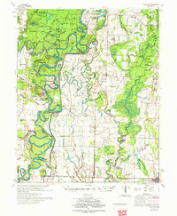
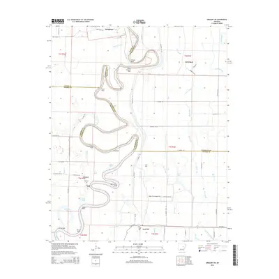
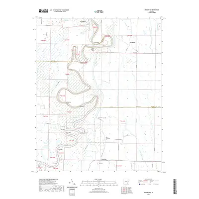
(18)- 1935 Map of Gregory, 1946 Print
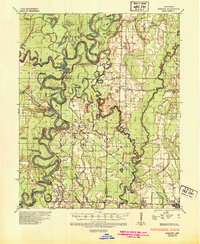 1935 Gregory1946 Print · USGSThe Arkansas Delta comes to life in the mid-1930s, showing a river-rich landscape of timber and rail commerce. Genealogists can trace family footprints through rural landmarks like Revel Cem, McClelland, and the riverfront at Georgetown.
 - 1953 Map of Memphis, 1966 Print
 1953 Memphis1966 Print · USGSEastern Arkansas and the Memphis riverfront are shown here during the mid-century period of regional growth and river management. Local historians can trace the paths of the Chicago Rock Island & Pacific RR through Forrest City or locate river landmarks like President's Island.3 unique versions available
 - 1956 Map of Memphis
 1956 Memphis1956 Print · USGSThe Mississippi Delta and the bluffs of West Tennessee meet in the mid-fifties, showing a landscape defined by massive river systems and rail hubs. Researchers can trace the path of Crowleys Ridge or locate vanished river landings near Centennial Island and Island No 35.
 - 1957 Map of Gregory
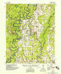 1957 Gregory1957 Print · USGSThe White River valley comes into sharp focus during the late fifties, showing a landscape of river-bend settlements and rail hubs. Genealogists can trace family names and rural communities through Walnut Grove Sch, Crutcher Cem, and the streets of Cotton Plant.
 - 1968 Map of Gregory SW, 1970 Print
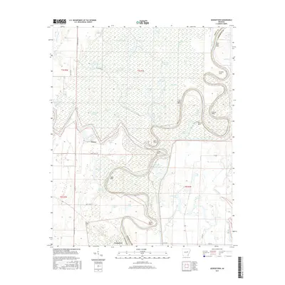
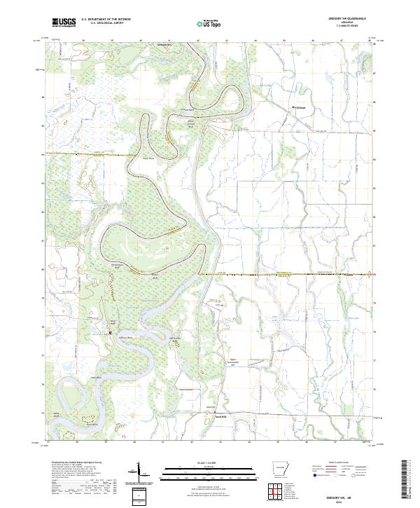
 1968 Gregory SW1970 Print · USGSThe White River lowlands in the late sixties reveal a landscape of deep oxbows and river-fed sloughs. Genealogists and historians can trace the small settlements of Georgetown and McClelland, find the secluded Kings Cem, or follow the Old Railroad Grade through the bottoms.3 unique versions available
 - 1968 Map of Georgetown, 1970 Print
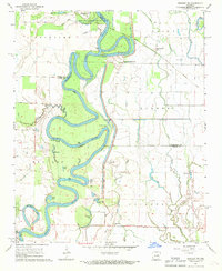
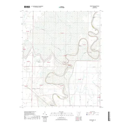
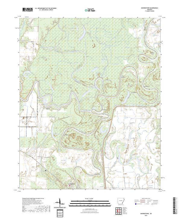
 1968 Georgetown1970 Print · USGSGeorgetown and the White River bottomlands are captured here in the late sixties, showing a landscape defined by oxbow lakes and river commerce. Genealogists and local historians can locate the Nelson Cem, Postal Landing, and the small settlement at Nimmo.5 unique versions available
 - 1972 Map of Gregory
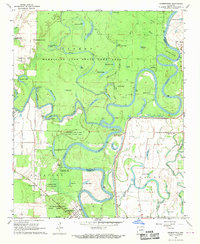
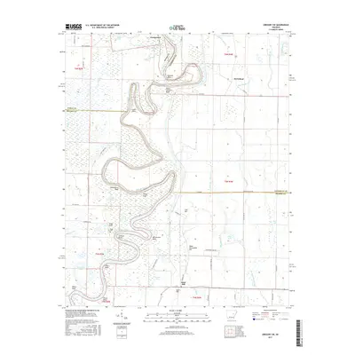
 1972 Gregory1972 Print · USGSIn the Arkansas Delta during the early 1970s, the river-carved landscape of Woodruff and White counties supported a mix of timber and agriculture. Trace the footprints of rural life at Cotton Plant, Georgetown, and the Indian Mound Cemetery.2 unique versions available
 - 1986 Map of Searcy
 1986 Searcy1986 Print · USGSWhite County and its neighbors reached a period of established agricultural and rail prosperity by the mid-1980s. Local researchers can trace the routes of the Missouri Pacific RR and locate rural communities like Velvet Ridge, Sunnydale, and Cotton Plant.2 unique versions available
 - 2011 Map of Georgetown, 2011 Print
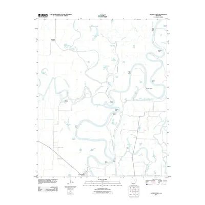 2011 Georgetown2011 Print · USGSCovers Georgetown, including Mitchell Corner, Nimmo, and other nearby areas
 - 2011 Map of Gregory SW, 2011 Print
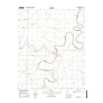
 2011 Gregory SW2011 Print · USGSCovers Georgetown, including Sand Hill, McClelland, and other nearby areas
 - 2014 Map of Georgetown, 2014 Print
 2014 Georgetown2014 Print · USGSCovers Georgetown, including Mitchell Corner, Nimmo, and other nearby areas
 - 2014 Map of Gregory SW, 2014 Print
 2014 Gregory SW2014 Print · USGSCovers Georgetown, including Sand Hill, McClelland, and other nearby areas
 - 2017 Map of Georgetown, 2017 Print
 2017 Georgetown2017 Print · USGSCovers Georgetown, including Mitchell Corner, Nimmo, and other nearby areas
 - 2017 Map of Gregory SW, 2017 Print
 2017 Gregory SW2017 Print · USGSCovers Georgetown, including Sand Hill, McClelland, and other nearby areas
 - 2020 Map of Georgetown, 2020 Print
 2020 Georgetown2020 Print · USGSCovers Georgetown, including Mitchell Corner, Nimmo, and other nearby areas
 - 2020 Map of Gregory SW, 2020 Print
 2020 Gregory SW2020 Print · USGSCovers Georgetown, including Sand Hill, McClelland, and other nearby areas
 - 2024 Map of Gregory SW, 2024 Print
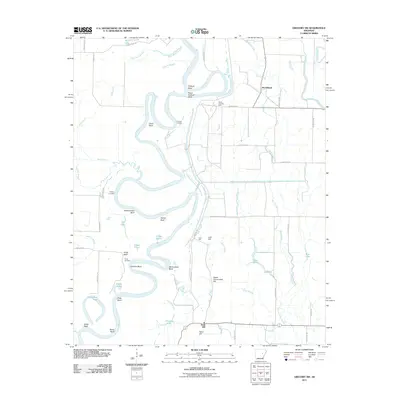
 2024 Gregory SW2024 Print · USGSThe river-bottom country of central Arkansas is meticulously detailed here during the early 2020s. Local researchers can trace family landmarks along the river bends or locate sites like Georgetown, the Kings Cem, and Peach Orchard Bluff.
 - 2024 Map of Georgetown, 2024 Print
 2024 Georgetown2024 Print · USGSThe riverbottoms of White County come into focus here, showing the intricate bends of the White River and Little Red River. Genealogists and local historians can trace the roads around Georgetown, locate Nelson Cem, and explore the wetlands of Bald Knob National Wildlife Refuge.
End of results
Showing maps 1-18 of 18
Top cities near Georgetown
- Searcy historical maps
- Bald Knob historical maps
- Augusta historical maps
- Judsonia historical maps
- Des Arc historical maps
- Kensett historical maps
See more
Frequently asked questions
- What are the different types of historical maps available for Georgetown?
- What is the oldest map of Georgetown?
- Where can I purchase historical maps of Georgetown for my home or office?
- Where can I download high-res historical maps of Georgetown?
- Are there historical topographic maps available for Georgetown?
- Is there historical aerial imagery available for Georgetown?
- Where are historical maps of Georgetown sourced from?