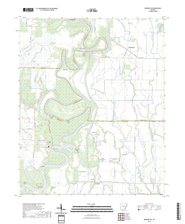
2024 Map of Gregory SW
USGS Topo · Published 2024About this map
The White River carves a winding path through this central Arkansas landscape, defining the borders between White, Woodruff, and Prairie counties. This riparian corridor is marked by numerous tight meanders and named landmarks such as Calhoun Bend, McCrutchen Bend, and Hicks Bend. High ground is noted along the river at Smokehouse Bluff and Peach Orchard Bluff, rising above the extensive wetlands of the Cache River National Wildlife Refuge.
Find a feature on this map
75 named features on this map. Tap any name to fly to it.
Don’t see what you’re looking for? This feature index may not catch every label — zoom into the map to look around manually.
Map Details
Editions of this 2024 Gregory SW Map
This is the sole edition of this map. No revisions or reprints were ever made.
Other maps of this area

1932 · Kensett
USGS Topo · 1:62,500

1935 · Kensett
USGS Topo · 1:62,500

1935 · Hazen
USGS Topo · 1:62,500

1935 · Gregory
USGS Topo · 1:62,500

1941 · Hazen
USGS Topo · 1:62,500

1941 · De Valls Bluff
USGS Topo · 1:62,500

1948 · Helena
USGS Topo · 1:250,000

1950 · Helena
USGS Topo · 1:250,000

1953 · Memphis
USGS Topo · 1:250,000

1955 · Helena
USGS Topo · 1:250,000