1980s Maps of Alameda County, California
Explore 3 historic maps of Alameda County from the 1980s. These maps offer a rare glimpse into what life looked like during the 1980s — showing old roads, neighborhoods, homes, and landmarks that have changed or disappeared over time.
Whether you're researching your family's past, planning a metal detecting trip, or studying how Alameda County's landscape evolved across the 1980s, these high-resolution maps are a powerful tool for exploring the history of this region.
- Focus on a specific era: All maps on this page are from the 1980s, giving you a focused view of this time period.
- See what’s changed: Compare century-old streets, trails, and buildings to today's modern landscape using overlays and satellite layers.
- Research with precision: Use these maps for genealogy, historical research, land use analysis, or educational projects.
- View, download, or print: Maps are fully viewable online in high resolution, and can be downloaded or printed for your own records.
Start exploring Alameda County's history through authentic maps from the 1980s. This is your window into the past.
Alameda County, CA maps
(3)- 1982 Map of Palo Alto, 1983 Print
 1982 Palo Alto1983 Print · USGSThe Santa Cruz Mountains and the Peninsula's bayshore are captured here in the early eighties as tech-driven growth reshaped the valley. Researchers can trace the sprawling grounds of Stanford University or explore coastal landmarks like the Pigeon Point Lighthouse.2 unique versions available
 - 1985 Map of San Francisco, 1989 Print
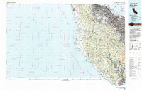
 1985 San Francisco1989 Print · USGSThe Bay Area is captured in the mid-1980s through experimental Landsat satellite imagery, offering a unique technological perspective of the California coast. Trace the urban boundaries of San Francisco and Alameda against the San Francisco Bay and Lorenzo.
 - 1989 Map of Stockton
 1989 Stockton1989 Print · USGSDuring the late 1980s, the California Delta and San Joaquin Valley saw a massive convergence of water infrastructure and military logistics. Researchers can trace the sprawling Lawrence Livermore Laboratory (Univ of Calif) and Sharpe Army Depot alongside the complex waterways of Union Island and Victoria Island.2 unique versions available
End of results
Showing maps 1-3 of 3
Top cities of Alameda County
- Oakland historical maps
- Fremont historical maps
- Hayward historical maps
- Berkeley historical maps
- San Leandro historical maps
- Livermore historical maps
See more
Frequently asked questions
- What are the different types of historical maps available for Alameda County?
- What is the oldest map of Alameda County?
- Where can I purchase historical maps of Alameda County for my home or office?
- Where can I download high-res historical maps of Alameda County?
- Are there historical topographic maps available for Alameda County?
- Is there historical aerial imagery available for Alameda County?
- Where are historical maps of Alameda County sourced from?