Old Maps of Amador County, California for Hiking & Exploration
Hike through history with 204 historic maps of Amador County. Explore old trails, ghost towns, and forgotten backroads — perfect for outdoor adventurers and local explorers.
- Rediscover forgotten places: Map out old mining camps, roads, and footpaths that no longer exist on modern maps.
- Layer with modern tools: Combine with LiDAR or satellite views to plan hikes through historical terrain.
- Made for exploration: Popular among hikers, overlanders, and local history lovers.
Use these maps to find adventure and explore the hidden past of Amador County.
Amador County, CA maps
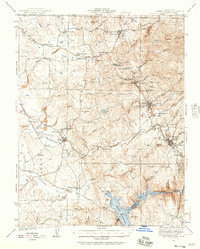
(204)- 1889 Map of Jackson
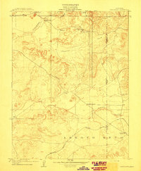
 1889 Jackson1889 Print · USGSThe Mother Lode foothills thrive in the late nineteenth century as mining and rail expansion reshape the landscape between the San Joaquin Valley and the Sierra Nevada. Genealogists and historians can trace the early layout of Jackson, locate vanished sites like Lancha Plana, and follow the path of the San Joaquin and Sierra Nevada Railroad.
 - 1889 Map of Pyramid Peak, 1954 Print
 1889 Pyramid Peak1954 Print · USGSThe high Sierra and Lake Tahoe shores appear here in the late nineteenth century, long before the arrival of modern highways. Researchers can locate early alpine outposts and family homesteads like Uncle Toms Cabin, Glen Alpine Springs, and Yanks.
 - 1891 Map of Sacramento
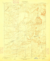
 1891 Sacramento1891 Print · USGSNorthern California foothills and the valley plains emerge in the late nineteenth century as the rail-and-road network expands. Trace early family landmarks and river crossings like Mormon Island, Whitney Ranch, and the historic Rattlesnake Bridge.
 - 1891 Map of Big Trees
 1891 Big Trees1891 Print · USGSThe Sierra Nevada high country and gold country are seen here in the 1890s, a period defined by the mining economy and early mountain passage. Historians can trace early routes like the Bloods Toll Road and locate sites such as Sheep Ranch, the Keltz Mine, and Swiss Ranch.
 - 1891 Map of Placerville
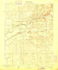
 1891 Placerville1891 Print · USGSEl Dorado County was a thriving network of mining camps and timber mills in the 1890s. Genealogists can trace family roots through old landmarks like Diamond Springs, Coloma, and the Placerville and Sacramento Railroad.
 - 1891 Map of Pyramid Peak
 1891 Pyramid Peak1891 Print · USGSThe High Sierra in the early 1890s appears as a land of early resorts and rugged outposts along the southwest shores of Lake Tahoe. Genealogists and historians can locate early family-named settlements like Phillips and trace the historic Strawberry Valley Road past Tragedy Spring.
 - 1892 Map of Jackson
 1892 Jackson1892 Print · USGSThe California Gold Country comes alive in the late nineteenth century as mining settlements and river-side camps define the landscape. Genealogists and historians can trace family roots through Mokelumne Hill, San Andreas, and the remote Whiskey Slide.
 - 1892 Map of Sacramento
 1892 Sacramento1892 Print · USGSThe rail-and-river economy of Northern California is on full display in the 1890s as the Central Pacific Railroad links the valley to the foothills. Genealogists and historians can trace early settlements like Mormon Island, Salmon Falls, and the Whitney's Ranch before modern development changed the landscape.5 unique versions available
 - 1892 Map of Placerville
 1892 Placerville1892 Print · USGSEl Dorado County is documented during the late nineteenth-century mining era, showing the rugged network of river canyons and early mountain roads. Researchers can trace the Sacramento and Placerville Railroad or locate historic sites like the Mile Hill Toll House and Spanish Diggings.
 - 1893 Map of Placerville
 1893 Placerville1893 Print · USGSEl Dorado and Placer counties during the late nineteenth-century mining era reveal a landscape of deep canyons and booming industrial camps. Genealogists and historians can trace the Sacramento and Placerville Railroad to its terminus or locate early operations like Mammoth Mine and Spanish Diggings.9 unique versions available
 - 1893 Map of Sacramento, 1900 Print
 1893 Sacramento1900 Print · USGSThe Sacramento Valley and Sierra foothills come alive in this late nineteenth-century survey during the height of the railroad era. Researchers can trace the early layout of Roseville, locate family landmarks like Whitney's Ranch, or follow the Placerville Road through the gold country.
 - 1894 Map of Big Trees
 1894 Big Trees1894 Print · USGSCentral California's high Sierra region is documented here in the 1890s, where river crossings and giant sequoia groves defined the landscape. Researchers can trace old mountain routes through Abbott Ferry and Parrott Ferry or locate early mining sites like the Riverside Mine.
 - 1894 Map of Lodi
 1894 Lodi1894 Print · USGSThe northern Central Valley and Sierra foothills come alive in the late nineteenth century as railroads reshape the landscape. Local historians can trace early transit hubs like Lodi and Galt alongside rural landmarks like Alabama House and Michigan Bar.3 unique versions available
 - 1895 Map of Pyramid Peak
 1895 Pyramid Peak1895 Print · USGSThe high Sierra peaks and the southwestern shores of Lake Tahoe are captured here in the late nineteenth century. Researchers can trace early mountain transit and remote outposts like Uncle Toms Cabin, Slippery Ford, and Glen Alpine Springs.2 unique versions available
 - 1896 Map of Pyramid Peak, 1905 Print
 1896 Pyramid Peak1905 Print · USGSThe high Sierra Nevada backcountry of El Dorado County is captured here in the late nineteenth century, showing a landscape of early trail stops and timber camps. Researchers can trace historic routes to Slippery Ford, find the location of Uncle Toms Cabin, or locate early lakeside destinations like Tallac and Yanks.7 unique versions available
 - 1897 Map of Jackson
 1897 Jackson1897 Print · USGSAmador and Calaveras counties are shown here during the late nineteenth-century mining era, when the Mother Lode's river-and-rail economy was in full swing. Genealogists can trace family roots through settlements like Mokelumne Hill, San Andreas, and the remote Whiskey Slide.
 - 1897 Map of Big Trees
 1897 Big Trees1897 Print · USGSThe Sierra Nevada foothills and deep river canyons of the late nineteenth century are mapped here in detail before modern development. Genealogists and historians can trace early mountain life through landmarks like Bloods Toll, the Riverside Mine, and historic crossings at Abbott Ferry.
 - 1901 Map of Big Trees
 1901 Big Trees1901 Print · USGSThe High Sierra and Gold Country meet in this turn-of-the-century look at the groves and mining camps of the Mokelumne and Stanislaus watersheds. Trace the early boundaries of the Calaveras Grove, locate the Riverside Mine, or find river crossings like Parrott Ferry.9 unique versions available
 - 1902 Map of Jackson
 1902 Jackson1902 Print · USGSAmador and Calaveras counties are captured at the height of the mining era in this late nineteenth-century survey. Genealogists and historians can trace the rail lines of the Stockton and Copperopolis Railroad and find long-established camps like Lancha Plana and Jesus Maria.7 unique versions available
 - 1909 Map of Carbondale
 1909 Carbondale1909 Print · USGSSacramento and Amador counties meet along the river and rail lines in the first decade of the twentieth century. Genealogists can locate established rural centers like Carbondale and Alabama House, alongside local schoolhouses such as Stone House School and Buckeye School.2 unique versions available
 - 1909 Map of Goose Creek
 1909 Goose Creek1909 Print · USGSThe foothills where Sacramento, Amador, and San Joaquin counties meet are captured here in the years before the Great War. Genealogists and historians can locate the Hutson School and trace the path of the Southern Pacific R. R. (Amador Branch) alongside Dry Creek.2 unique versions available
 - 1909 Map of Clements
 1909 Clements1909 Print · USGSClements and the Mokelumne River valley appear here in the early twentieth century, showing a landscape defined by ranching and rail. Researchers can locate vanished landmarks like Dogtown, Justice School, and the Southern Pacific R R line.2 unique versions available
 - 1939 Map of Bellota, 1958 Print
 1939 Bellota1958 Print · USGSThis late 1930s survey of the San Joaquin Valley captures a landscape of fertile river bottoms and emerging rail corridors. Genealogists and historians can trace numerous rural schoolhouses and rail stops like Lockeford, Elliott, and the Central California Traction line.2 unique versions available
 - 1941 Map of Sutter Creek, 1957 Print
 1941 Sutter Creek1957 Print · USGSAmador County is shown at the height of its historic gold-country development in the early 1940s. Researchers can trace the Mother Lode through Amador City and Sutter Creek or locate local landmarks like the Preston School of Industry.
 - 1941 Map of Folsom, 1957 Print
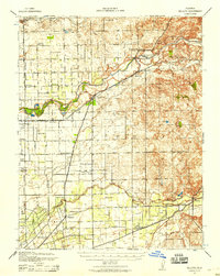
 1941 Folsom1957 Print · USGSThe foothills of the Sierra Nevada meet the Central Valley in the early 1940s, showing the river and rail corridors before major reservoirs were built. Researchers can trace the original tracks of the Southern Pacific and locate historic rural hubs like Natoma, Clarksville, and Mormon Island Sch.2 unique versions available
Showing maps 1-25 of 204
Top cities of Amador County
- Ione historical maps
- Jackson historical maps
- Sutter Creek historical maps
- Plymouth historical maps
- Amador City historical maps
Frequently asked questions
- What are the different types of historical maps available for Amador County?
- What is the oldest map of Amador County?
- Where can I purchase historical maps of Amador County for my home or office?
- Where can I download high-res historical maps of Amador County?
- Are there historical topographic maps available for Amador County?
- Is there historical aerial imagery available for Amador County?
- Where are historical maps of Amador County sourced from?