1950s Maps of Amador County, California
Explore 19 historic maps of Amador County from the 1950s. These maps offer a rare glimpse into what life looked like during the 1950s — showing old roads, neighborhoods, homes, and landmarks that have changed or disappeared over time.
Whether you're researching your family's past, planning a metal detecting trip, or studying how Amador County's landscape evolved across the 1950s, these high-resolution maps are a powerful tool for exploring the history of this region.
- Focus on a specific era: All maps on this page are from the 1950s, giving you a focused view of this time period.
- See what’s changed: Compare century-old streets, trails, and buildings to today's modern landscape using overlays and satellite layers.
- Research with precision: Use these maps for genealogy, historical research, land use analysis, or educational projects.
- View, download, or print: Maps are fully viewable online in high resolution, and can be downloaded or printed for your own records.
Start exploring Amador County's history through authentic maps from the 1950s. This is your window into the past.
Amador County, CA maps
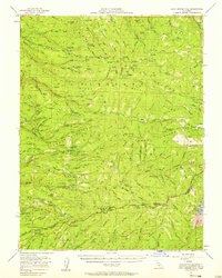
(19)- 1950 Map of Fiddletown
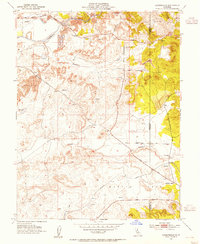
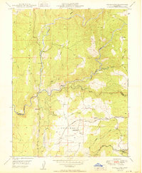 1950 Fiddletown1950 Print · USGSMid-century Amador and El Dorado counties are captured here during a time of rural persistence in the Sierra foothills. Genealogists and historians can trace family-named sites like Bell Ranch alongside community centers like the Shenandoah Sch and the historic settlement of Fiddletown.
 - 1950 Map of Latrobe
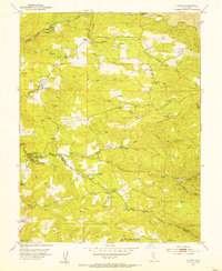
 1950 Latrobe1950 Print · USGSEl Dorado County ranching and mining life are captured here at mid-century, just before the modernization of the foothills. Genealogists can trace family landmarks like Miller Ranch and Brandon Corner or locate the Chinese Cem and early schoolhouses.2 unique versions available
 - 1951 Map of Caldor, 1952 Print
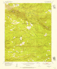
 1951 Caldor1952 Print · USGSEl Dorado County logging and mining operations are captured here at mid-century, just as the forest service infrastructure was expanding. Researchers can locate remote sites like the Arbor Mine, the Fort Grizzly Site, and settlements at Caldor and Cooks Station.5 unique versions available
 - 1951 Map of Peddler Hill, 1953 Print
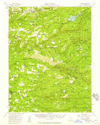
 1951 Peddler Hill1953 Print · USGSThe high ridges of the El Dorado and Amador county line are captured here in the early fifties, showcasing a landscape of active timber management and emerging recreation. Researchers can locate the Lumberyard Ranger Station, trace the Caldor Logging Road, and find seasonal sites like Grellich Camp and the local Ski Lodge.5 unique versions available
 - 1951 Map of Leek Spring Hill, 1958 Print
 1951 Leek Spring Hill1958 Print · USGSThe western Sierra Nevada slopes in the early fifties reveal a landscape of active forestry and deep-rooted mining history. Researchers can trace the timber and mineral economy through locations like Girard Mill (Site), the Tiger Mine, and the settlement of Caldor.3 unique versions available
 - 1952 Map of Clements, 1954 Print
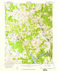
 1952 Clements1954 Print · USGSSan Joaquin County agriculture and industry meet along the river in the early fifties. Genealogists can trace family sites at Clements Glen View Cemetery while historians study the Southern Pacific rail line and the large Dredge Tailings near Clements.2 unique versions available
 - 1952 Map of Aukum, 1954 Print
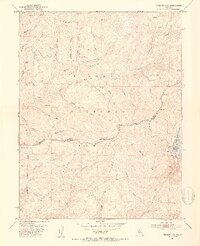
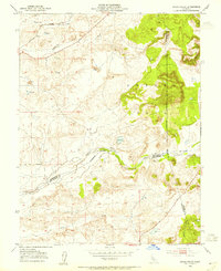
 1952 Aukum1954 Print · USGSEl Dorado County in the early fifties shows a landscape defined by the forks of the Cosumnes River and a legacy of gold mining. Genealogists can trace family footprints at Melsons Corner or Tylers Corner, and locate sites like the Lawrence Mill or the Golden Treasure Mine.5 unique versions available
 - 1952 Map of Omo Ranch, 1954 Print
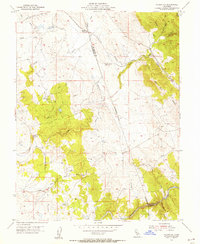
 1952 Omo Ranch1954 Print · USGSEl Dorado County was a hive of industrial activity in the early fifties, dominated by hydraulic mining and timber harvesting. Researchers can trace the legacies of local families and laborers at Andreason Cemetery or the site of Dogtown, alongside dozens of named lode mines like Caldor Mine and Texas Mine.5 unique versions available
 - 1952 Map of Camino, 1959 Print
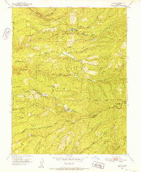
 1952 Camino1959 Print · USGSEl Dorado County foothills are shown in the early fifties as the region's mining and logging legacy remained etched across the Sierra Nevada landscape. Genealogists and researchers can trace family roots through numerous mountain schools and camps, including Indian Diggings Sch, Omo Ranch, and the site of Old Fort Jim.3 unique versions available
 - 1953 Map of Carbondale, 1954 Print
 1953 Carbondale1954 Print · USGSThe Sacramento and Amador borderlands appear here in the early 1950s, during an era defined by the massive Dredge Tailings along the river. Genealogists and historians can trace the Southern Pacific rail line to Carbondale or locate burials at the Michigan Bar and Live Oak Cemetery.2 unique versions available
 - 1953 Map of Goose Creek, 1955 Print
 1953 Goose Creek1955 Print · USGSThe borderlands of Sacramento, Amador, and San Joaquin Counties come alive in the early 1950s, showing a landscape of seasonal creeks and railroad engineering. Genealogists and historians can trace the Southern Pacific rail line and find rural landmarks like the windmill and the extensive levee system along Dry Creek.2 unique versions available
 - 1954 Map of Folsom SE, 1955 Print
 1954 Folsom SE1955 Print · USGSThe Gold Country foothills of Sacramento and El Dorado counties are shown here during the mid-1950s. Genealogists and historians can trace old mining sites near Walltown, the path of the Southern Pacific, and the Carson Creek Sch (Aban'd).5 unique versions available
 - 1956 Map of Sacramento
 1956 Sacramento1956 Print · USGSMid-century California unfolds from the delta to the high Sierra, capturing a landscape of growing valley cities and burgeoning military airbases. Genealogists and historians can trace the rail lines and river towns from Woodland to Lodi, or explore the foothill settlements of Placerville and Jackson.2 unique versions available
 - 1956 Map of Blue Mountain, 1959 Print
 1956 Blue Mountain1959 Print · USGSThe High Sierra backcountry of Amador and Calaveras Counties is shown here in the mid-fifties as forestry and recreation began to overlap. Researchers can find deep-woods sites like Hamilton Camp, the Black Wonder Mine, and the historic Swiss Ranch near Arnold.3 unique versions available
 - 1956 Map of Silver Lake, 1959 Print
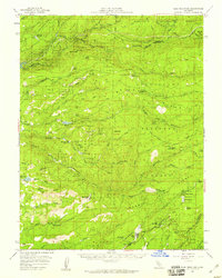
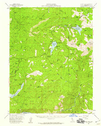 1956 Silver Lake1959 Print · USGSThe Sierra Nevada high country during the mid-fifties reveals a landscape of hydroelectric expansion and legacy summer camps. Researchers can locate family outposts like Schneider Camp, trace the site of the Plasse Trading Post, or find the Lost Cabin Mine.4 unique versions available
 - 1956 Map of Big Meadow, 1959 Print
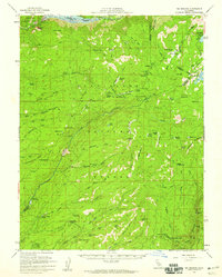 1956 Big Meadow1959 Print · USGSThe High Sierra backcountry near the Calaveras and Tuolumne border is captured here during the mid-1950s. Local history researchers can trace the locations of Bloods Toll Sta (Site), seasonal retreats like Cuneo Camp, and the early footprint of Calaveras Big Trees State Park.4 unique versions available
 - 1956 Map of Valley Springs, 1960 Print
 1956 Valley Springs1960 Print · USGSCalaveras County ranching and mining life is captured here in the mid-fifties, just as major water projects began to reshape the Mokelumne River valley. Genealogists and historians can locate family landmarks like Ospital Ranch, the Evergreen School, and old rail stops at Wallace or Burson.
 - 1957 Map of Sutter Creek, 1959 Print
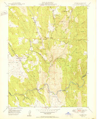
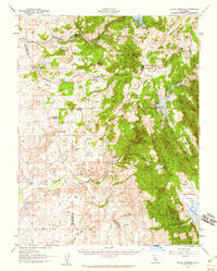
 1957 Sutter Creek1959 Print · USGSAmador County’s gold-mining heart is preserved in this mid-century survey as the region balanced its industrial heritage with modern growth. Researchers can trace deep-shaft operations like the Argonaut Mine, the campus of the Preston School of Industry, and vanished settlements such as Forest Home (Site).
 - 1957 Map of Sacramento, 1966 Print
 1957 Sacramento1966 Print · USGSIn the mid-twentieth century, the California heartland was a hub of river transport, rail lines, and military airbases. Genealogists and historians can trace the development of Gold Country towns like Angels Camp and Sonora or follow the path of the Southern Pacific RR through the growing suburbs of Sacramento.4 unique versions available
End of results
Showing maps 1-19 of 19
Top cities of Amador County
- Ione historical maps
- Jackson historical maps
- Sutter Creek historical maps
- Plymouth historical maps
- Amador City historical maps
Frequently asked questions
- What are the different types of historical maps available for Amador County?
- What is the oldest map of Amador County?
- Where can I purchase historical maps of Amador County for my home or office?
- Where can I download high-res historical maps of Amador County?
- Are there historical topographic maps available for Amador County?
- Is there historical aerial imagery available for Amador County?
- Where are historical maps of Amador County sourced from?