Old Maps of Oroville, California for Hiking & Exploration
Hike through history with 36 historic maps of Oroville. Explore old trails, ghost towns, and forgotten backroads — perfect for outdoor adventurers and local explorers.
- Rediscover forgotten places: Map out old mining camps, roads, and footpaths that no longer exist on modern maps.
- Layer with modern tools: Combine with LiDAR or satellite views to plan hikes through historical terrain.
- Made for exploration: Popular among hikers, overlanders, and local history lovers.
Use these maps to find adventure and explore the hidden past of Oroville.
Oroville, CA maps
(36)- 1888 Map of Marysville
 1888 Marysville1888 Print · USGSThe Sacramento Valley in the late nineteenth century was a landscape of fertile river bottoms and emerging rail towns. Researchers can trace the river economy through Moons Ferry and Eddys Ferry or locate early family holdings like Hock Farm and Butte House.
 - 1891 Map of Chico
 1891 Chico1891 Print · USGSUpper Sacramento Valley life in the late nineteenth century revolved around the rail lines and river landings of Chico and Oroville. Genealogists and researchers can trace the early layout of mountain settlements like Magalia and Nimshew or locate old industrial sites including Keefers Old Mill and Doons Mill.
 - 1891 Map of Marysville
 1891 Marysville1891 Print · USGSThe Sacramento Valley in the late nineteenth century centers on the volcanic peaks of the Marysville Buttes. Genealogists and historians can trace pioneer landings and river crossings such as Hock Farm, Princeton Ferry, and the early street grids of Sutter City.
 - 1893 Map of Chico
 1893 Chico1893 Print · USGSNorthern California at the height of the nineteenth-century rail and ranching era reveals a network of valley landings and mountain mining camps. Genealogists and historians can trace family locations from Chico to remote spots like Helltown, Old Lovelock, and the Lucretia Mine.
 - 1894 Map of Marysville
 1894 Marysville1894 Print · USGSThe Sacramento Valley in the 1890s is captured here as a landscape of river ferries and expanding rail lines. Genealogists can trace family footprints in Sutter City, identify old river crossings like Moons Ferry, or locate the historic Hock Farm.
 - 1895 Map of Marysville
 1895 Marysville1895 Print · USGSThe Sacramento Valley in the 1890s centered on the dramatic profile of the Marysville Buttes and a bustling river-and-rail economy. Researchers can trace early river crossings like Moons Ferry, the historic Hock Farm, and the early footprints of Marysville and Yuba City.6 unique versions available
 - 1895 Map of Chico
 1895 Chico1895 Print · USGSNorthern California at the close of the nineteenth century reveals a landscape defined by the Southern Pacific R. R. and early foothill industry. Trace the locations of historic lumber and mining operations like Keefer's Mill, Lucky Jim Mine, and Chapman's Mill.8 unique versions available
 - 1912 Map of Oroville
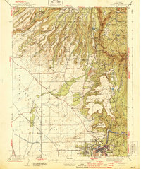
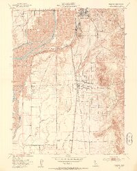
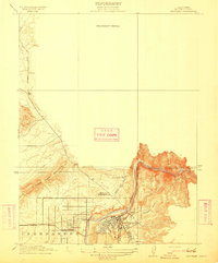 1912 Oroville1912 Print · USGSButte County's gold-mining heartland is shown here in the early twentieth century as it transitioned into a rail-and-agriculture hub. Genealogists can locate family landmarks like the Odd Fellows Home, the Butte County Infirmary, and early settlements such as Thermalito and Thompson Flat.2 unique versions available
 - 1912 Map of Palermo
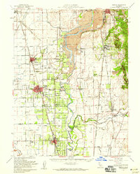
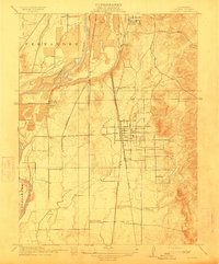 1912 Palermo1912 Print · USGSButte County agriculture and industry are in full swing at the start of the century as two major railroads compete for transit. Genealogists and historians can locate the Chinese Cem near South Oroville or trace family sites near Union School and Palermo.2 unique versions available
 - 1912 Map of Biggs
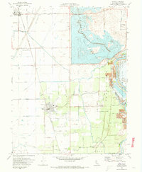
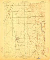 1912 Biggs1912 Print · USGSButte County agriculture was in full bloom at the start of the century, shaped by an intricate system of canals and competing rail lines. Researchers can trace family sites like Ord Ranch and Richland or find the early footprint of the River District School.
 - 1942 Map of Oroville, 1958 Print
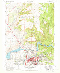
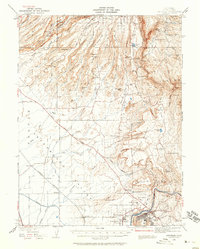 1942 Oroville1958 Print · USGSButte County foothills and the Sacramento Valley meet here in the early 1940s, just before the landscape was altered by mid-century water projects. Genealogists and historians can trace gold-era remnants at Cherokee, Oregon City, and the Bumble Bee Mines along the river.2 unique versions available
 - 1944 Map of Oroville
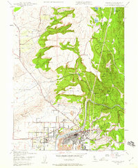
 1944 Oroville1944 Print · USGSButte County at the height of the mid-century mining and rail era shows a landscape defined by the Feather River and the massive Table Mountains. Researchers can locate historic sites like Oregon City, the New Era Mine, and the Concow Sch.2 unique versions available
 - 1947 Map of Oroville, 1959 Print
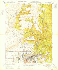
 1947 Oroville1959 Print · USGSButte County life in the late 1940s is centered here on the Feather River and the growing communities of Oroville and Thermalito. Genealogists and researchers can trace local landmarks like Morris Ravine Sch, the Monte de Oro Mine, and the historic site of Oregon City.2 unique versions available
 - 1949 Map of Oroville
 1949 Oroville1949 Print · USGSButte County life in the late 1940s was shaped by the steep canyons and basalt plateaus surrounding the Feather River. Genealogists and historians can trace the early irrigation and mining footprints of Oregon City, the Monte de Oro Mine, and the Morris Ravine Sch.2 unique versions available
 - 1952 Map of Biggs, 1953 Print
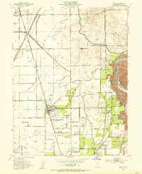 1952 Biggs1953 Print · USGSButte County agriculture is in full swing during the early fifties, dominated by rice trials and rail transport. Researchers can trace family-named holdings like the Onstott Ranch or locate ancestors at the Gridley-Biggs Cemetery.2 unique versions available
 - 1952 Map of Palermo, 1953 Print
 1952 Palermo1953 Print · USGSButte County in the early 1950s shows a landscape transformed by gold mining and the railroad. Genealogists and historians can trace Dredge Tailings along the river, local schools like Lone Tree Sch, and the old Vista Robles Siding.3 unique versions available
 - 1952 Map of Gridley, 1959 Print
 1952 Gridley1959 Print · USGSThe agricultural heart of the Sacramento Valley is captured here in the early fifties, showing the intricate canal networks and rail lines of the day. Researchers can trace family roots through the Onstott Ranch, Lone Tree School, and the Gridley-Biggs Cem.2 unique versions available
 - 1958 Map of Chico, 1962 Print
 1958 Chico1962 Print · USGSMid-century Northern California comes to life across the Central Valley and high Sierras as the postwar economy transformed the landscape. Trace the rail lines of the Southern Pacific RR, locate family roots near Chico Cem, or explore the early layout of Paradise and Beale Air Force Base.4 unique versions available
 - 1960 Map of Chico
 1960 Chico1960 Print · USGSThe Northern California high country and Sacramento Valley meet in this 1960s-era landscape of mining towns and river settlements. Trace the rail-and-water economy of the gold country through the Empire Mine, Beale Air Force Base, and the Western Pacific Railroad.
 - 1970 Map of Biggs, 1973 Print
 1970 Biggs1973 Print · USGSButte County agriculture is at its height in the early 1970s as massive irrigation projects reshape the Sacramento Valley. Researchers can trace family-named roads and landmarks like the Gridley-Biggs Cemetery, the USDA Rice Experimental Sta, and the shoreline of the Thermalito Afterbay.2 unique versions available
 - 1970 Map of Oroville, 1973 Print
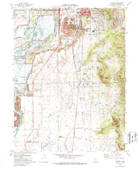
 1970 Oroville1973 Print · USGSThe Gold Country meets modern hydro-engineering in Butte County during the early seventies. Trace the evolution of Oroville from its mining roots at Oregon City to the complex water systems of the Thermalito Afterbay and Lake Oroville.2 unique versions available
 - 1970 Map of Palermo, 1973 Print
 1970 Palermo1973 Print · USGSButte County saw significant industrial and residential shifts in the early seventies as mining landscapes met expanding suburbs. You can trace the path of the Western Pacific Railroad or locate local landmarks like Lone Tree School and the Oroville Cem.3 unique versions available
 - 1980 Map of Chico
 1980 Chico1980 Print · USGSButte County and the Sierra foothills are shown here in the 1980s as the region's water and timber economies matured. Genealogists and researchers can trace old land grants like Rancho Capay or locate mountain mining sites and settlements such as Cherokee, Magalia, and the Big Bend Mine.2 unique versions available
 - 1993 Map of Yuba City, 1994 Print
 1993 Yuba City1994 Print · USGSThe Sacramento Valley and Sierra Nevada foothills meet in the 1990s, where agricultural bypasses and river networks surround the iconic Sutter Buttes. Researchers can trace the rail corridors of the Southern Pacific and Western Pacific through hubs like Marysville and Gridley.
 - 2012 Map of Palermo, 2012 Print
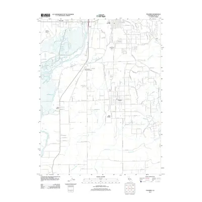 2012 Palermo2012 Print · USGSCovers Oroville, including South Oroville, Palermo, and other nearby areas
Showing maps 1-25 of 36
Top cities near Oroville
- Chico historical maps
- Live Oak historical maps
- Gridley historical maps
- Durham historical maps
- Biggs historical maps
Frequently asked questions
- What are the different types of historical maps available for Oroville?
- What is the oldest map of Oroville?
- Where can I purchase historical maps of Oroville for my home or office?
- Where can I download high-res historical maps of Oroville?
- Are there historical topographic maps available for Oroville?
- Is there historical aerial imagery available for Oroville?
- Where are historical maps of Oroville sourced from?