1940s Maps of Calaveras County, California
Explore 27 historic maps of Calaveras County from the 1940s. These maps offer a rare glimpse into what life looked like during the 1940s — showing old roads, neighborhoods, homes, and landmarks that have changed or disappeared over time.
Whether you're researching your family's past, planning a metal detecting trip, or studying how Calaveras County's landscape evolved across the 1940s, these high-resolution maps are a powerful tool for exploring the history of this region.
- Focus on a specific era: All maps on this page are from the 1940s, giving you a focused view of this time period.
- See what’s changed: Compare century-old streets, trails, and buildings to today's modern landscape using overlays and satellite layers.
- Research with precision: Use these maps for genealogy, historical research, land use analysis, or educational projects.
- View, download, or print: Maps are fully viewable online in high resolution, and can be downloaded or printed for your own records.
Start exploring Calaveras County's history through authentic maps from the 1940s. This is your window into the past.
Calaveras County, CA maps
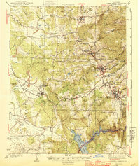
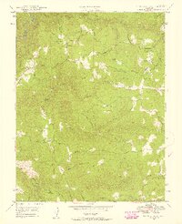
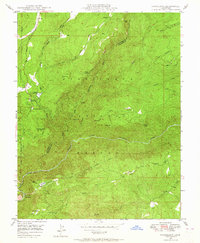
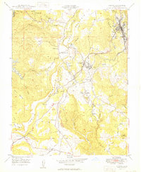
(27)- 1941 Map of Sutter Creek, 1957 Print
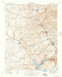 1941 Sutter Creek1957 Print · USGSAmador County is shown at the height of its historic gold-country development in the early 1940s. Researchers can trace the Mother Lode through Amador City and Sutter Creek or locate local landmarks like the Preston School of Industry.
 - 1942 Map of Farmington
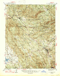
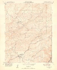
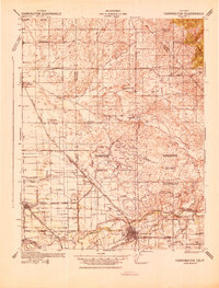 1942 Farmington1942 Print · USGSThe San Joaquin and Stanislaus border country is revealed in the early 1940s as a complex network of rail lines and irrigation canals. Genealogists and historians can trace old school districts like Burwood Sch, the tracks of the Southern Pacific, and the early layout of Escalon.
 - 1942 Map of Copperopolis
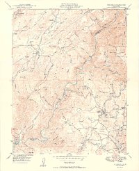
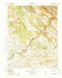 1942 Copperopolis1942 Print · USGSThe Mother Lode's mining and water heritage is preserved here in the early 1940s, centered on the copper-rich hills and the Stanislaus River. Genealogists and historians can trace family-named sites like Curtin Ranch, old schools such as O'Byrnes School, and active mines including the Wilbur Womble Mine.
 - 1944 Map of Valley Springs
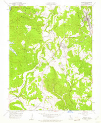
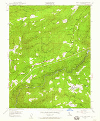
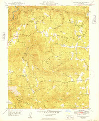
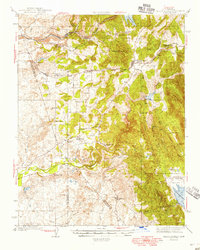 1944 Valley Springs1944 Print · USGSCalaveras County was a landscape of ranching and river engineering during the early 1940s, just as the regional water system was expanding. Genealogists and historians can trace the foundations of Camanche and Lancha Plana or locate local landmarks like Stone Corral Ch and Hogan Dam.4 unique versions available
 - 1944 Map of Sutter Creek
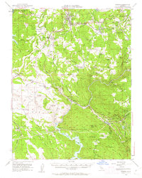
 1944 Sutter Creek1944 Print · USGSThe California Gold Country is captured here during the war years, showing the established mining towns and ranching valleys of the foothills. Researchers can trace the Southern Pacific line into Ione, locate the Preston School of Industry, or find rural landmarks like Willow Springs Sch and Jackson Gate.2 unique versions available
 - 1945 Map of San Andreas, 1959 Print
 1945 San Andreas1959 Print · USGSThe Mother Lode region of the Sierra foothills is captured here at a mid-century peak of ranching and deep-shaft mining. Genealogists and historians can trace family landholdings from Bernasconi Ranch to Felix, alongside legendary mines like the Utica Mine and Gold Cliff Mine.
 - 1947 Map of San Andreas
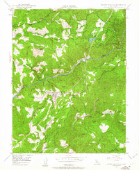
 1947 San Andreas1947 Print · USGSCalaveras County gold country is recorded here in the mid-1940s, showing the height of local industrial mining and ranching. Genealogists and historians can trace the foundations of San Andreas, the mine-rich hills around Altaville, and the location of rural schoolhouses like Fricot Ranch Sch.2 unique versions available
 - 1947 Map of Sacramento, 1948 Print
 1947 Sacramento1948 Print · USGSThe Sacramento Valley meets the high Sierra during a period of post-war expansion. Trace the historic river delta islands like Grand Island or locate early airfield footprints at McClellan Air Force Base and Mather Air Force Base.2 unique versions available
 - 1947 Map of San Jose, 1948 Print
 1947 San Jose1948 Print · USGSNorthern California's heartland is captured here just after the war, showing the rapid growth of the Santa Clara and Central Valleys. Researchers can trace the legacy of rail and water at Castle Air Force Base, Stockton, and the Hetch Hetchy Aqueduct.
 - 1948 Map of Sacramento, 1951 Print
 1948 Sacramento1951 Print · USGSPost-war Northern California comes alive in this regional survey, capturing the era of expansion between the Central Valley and the High Sierra. Researchers can trace the rail networks of the Central California Traction and Sacramento Northern RR or locate landmarks like the State Capitol and University of California Davis.
 - 1948 Map of Columbia, 1953 Print
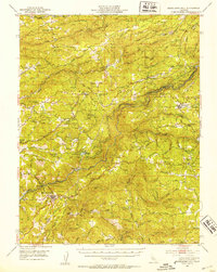
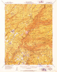 1948 Columbia1953 Print · USGSTuolumne and Calaveras counties in the late 1940s reveal a landscape shaped by the gold rush and emerging state preservation. Genealogists can trace family homesteads near Columbia and Murphys, or locate industrial sites like the Sheep Ranch Mine and Experimental Mine.6 unique versions available
 - 1948 Map of Sonora, 1953 Print
 1948 Sonora1953 Print · USGSTuolumne County’s historic mining district is documented here in the late 1940s, centered on the corridor between the county seat and the Sierra foothills. Genealogists and historians can trace family locations from the Mark Twain Cabin to the Harvard Mine and the rail stops of the Sierra RR.5 unique versions available
 - 1948 Map of Mokelumne Hill, 1953 Print
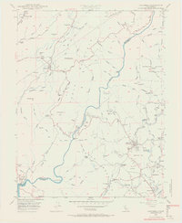
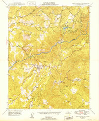
 1948 Mokelumne Hill1953 Print · USGSThe Mother Lode region of the Sierra foothills is captured here during the late 1940s, showing a landscape defined by mining history and new hydro-power infrastructure. Researchers can trace family ranch lands and historic town sites such as Butte City, Railroad Flat, and the Victory Dude Ranch.3 unique versions available
 - 1948 Map of Columbia, 1956 Print
 1948 Columbia1956 Print · USGSTuolumne County's gold rush heartland is documented here in the late 1940s, showing the preservation of Columbia before modern expansion. You can trace early mining claims and water routes like the Utica Ditch, Carson Hill Mine, and the now-familiar Moaning Caves.5 unique versions available
 - 1948 Map of Murphys, 1957 Print
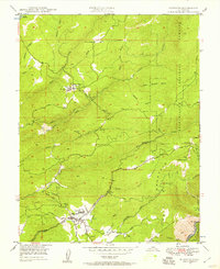 1948 Murphys1957 Print · USGSCalaveras County's mining and sanatorium history is documented here in the late 1940s. Genealogists and historians can trace the foundations of Sheep Ranch, locate the Bret Harte Sanatorium, and find old mines like the Red Top Mine.3 unique versions available
 - 1948 Map of Railroad Flat, 1958 Print
 1948 Railroad Flat1958 Print · USGSCalaveras County gold country is documented here just after the war, showing the deep canyons and mining camps of the Sierra foothills. Researchers can trace historic workings like the Wolverine Mine and the settlement at Railroad Flat.6 unique versions available
 - 1948 Map of West Point, 1960 Print
 1948 West Point1960 Print · USGSThe Mother Lode foothills near West Point are documented in the late 1940s, highlighting a landscape shaped by gold mining and water engineering. Genealogists and historians can trace the foundations of Bummerville, Sandy Gulch, and the Amador Columbia Mine.4 unique versions available
 - 1948 Map of Sonora, 1962 Print
 1948 Sonora1962 Print · USGSTuolumne County's Mother Lode country comes alive in this post-war survey of the Sierra Foothills. Researchers can trace the path of the Sierra RR, locate the Harvard Mine, and explore historic communities from Chinese Camp to Soulsbyville.2 unique versions available
 - 1948 Map of Mokelumne Hill, 1963 Print
 1948 Mokelumne Hill1963 Print · USGSGold Country life in the late 1940s is captured here as the ranching and mining legacy of the Mokelumne River transition into a hydroelectric era. Researchers can trace historic sites like the (Butte City) Ruins, Middle Bar (Site), and the Le Roi Mine.4 unique versions available
 - 1948 Map of Stanislaus, 1966 Print
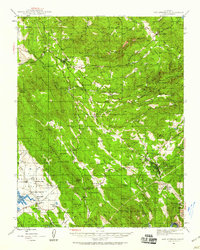
 1948 Stanislaus1966 Print · USGSThe Stanislaus National Forest comes alive in this post-war survey of the Tuolumne and Calaveras county line. Researchers can trace the development of Avery and Hathaway Pines, or locate remote points like Douds Landing, Avery Ranch, and the McCormick Lookout.4 unique versions available
 - 1949 Map of Murphys
 1949 Murphys1949 Print · USGSCalaveras County's Mother Lode heritage is on full display in the late 1940s, highlighting a landscape shaped by deep-shaft mining and mountain water systems. Genealogists and historians can locate family-named sites like Fisher Place and Skunk Ranch, or trace the legacy of the Sheep Ranch Mine.2 unique versions available
 - 1949 Map of Columbia
 1949 Columbia1949 Print · USGSThe Gold Country of Tuolumne and Calaveras counties is captured here just after World War II, showing a landscape defined by deep canyons and mining history. Researchers can trace the legacy of the 1849 rush through sites like Columbia State Park, the Vine Spring Mine, and the now-quiet settlement of Squabbletown.2 unique versions available
 - 1949 Map of Railroad Flat
 1949 Railroad Flat1949 Print · USGSThe Mother Lode foothills of Calaveras County appear here in the late 1940s as a land of persistent mining and rugged terrain. Local historians can trace old mining claims like Etna Mine and Wolverine Mine or explore the mid-century life at Victory Dude Ranch and Glencoe.
 - 1949 Map of Sonora
 1949 Sonora1949 Print · USGSTuolumne County's mining heartland is captured here in the late 1940s, showing the intricate network of camps and mines around Sonora. Researchers can trace old family sites and mining claims near Jamestown, Tuttletown, and the Harvard Mine.
 - 1949 Map of Mokelumne Hill
 1949 Mokelumne Hill1949 Print · USGSMokelumne Hill and the surrounding Gold Country transition into the post-war era as seen in this late 1940s survey. Researchers can trace historic family lands like McSorley Ranch, locate the (Butte City) Ruins, and follow the complex water system of the Amador Canal.2 unique versions available
Showing maps 1-25 of 27
Top cities of Calaveras County
Frequently asked questions
- What are the different types of historical maps available for Calaveras County?
- What is the oldest map of Calaveras County?
- Where can I purchase historical maps of Calaveras County for my home or office?
- Where can I download high-res historical maps of Calaveras County?
- Are there historical topographic maps available for Calaveras County?
- Is there historical aerial imagery available for Calaveras County?
- Where are historical maps of Calaveras County sourced from?