Old Maps of Orange Cove, California for Metal Detecting
Plan your next treasure hunt with 26 historic maps of Orange Cove. Find old homesites, ghost towns, trails, and gathering spots that may be lost to time — perfect for identifying promising metal detecting locations.
- Locate forgotten sites: Uncover places like long-lost settlements, abandoned rail lines, or gathering spots.
- Plan better hunts: Use map overlays combined with LiDAR or satellite views to narrow in on historically rich areas.
- Made for detectorists: Thousands of hobbyists use these maps to discover relics, coins, and hidden history.
Use these historic maps to boost your research and find new opportunities beneath the surface of Orange Cove.
Orange Cove, CA maps
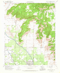
(26)- 1921 Map of Squaw Valley
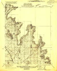 1921 Squaw Valley1921 Print · USGSSettlement and irrigation transform the Sierra foothills in the early twenties as the citrus industry takes root. Genealogists and historians can trace the early grid of Orange Cove and the development of the Citrus Cove School along the Atchison Topeka and Santa Fe line.
 - 1922 Map of Trimmer
 1922 Trimmer1922 Print · USGSThe foothills of eastern Fresno County meet the San Joaquin Valley floor during a period of booming citrus and rail development. Researchers can trace early family-run rangelands and specialized sites like the Wahtoke Winery, the Sunnyside Mine, and the Sycamore Creek Indian School.
 - 1923 Map of Sultana
 1923 Sultana1923 Print · USGSCentral Valley agriculture and rail lines dominate the landscape during the early 1920s. Genealogists can trace family footprints near Sultana, Orosi, and Cutler, or locate rural school sites like Mt Olive School.
 - 1924 Map of Citrus Cove
 1924 Citrus Cove1924 Print · USGSIn the early 1920s, the citrus-growing region at the edge of the Sierra foothills was just beginning its expansion. Researchers can trace the development of Orange Cove and the path of the Atchison Topeka and Santa Fe railroad near Citrus Cove School.2 unique versions available
 - 1924 Map of Dinuba
 1924 Dinuba1924 Print · USGSThe Central Valley meets the Sierra foothills in the early twenties, showing a landscape defined by new canals and citrus groves. Genealogists can locate family holdings like Stair Ranch and dozens of country schools, including the Sycamore Creek Indian School and Great Western School.5 unique versions available
 - 1948 Map of Fresno
 1948 Fresno1948 Print · USGSThe San Joaquin Valley and the High Sierra met during a period of rapid post-war growth and industrial expansion. Genealogists and researchers can trace family lines through small rail towns like Calwa City, find early aviation sites at Fresno-Chandler, or locate the Fresno Copper Mine.
 - 1950 Map of Orange Cove South
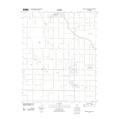
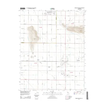
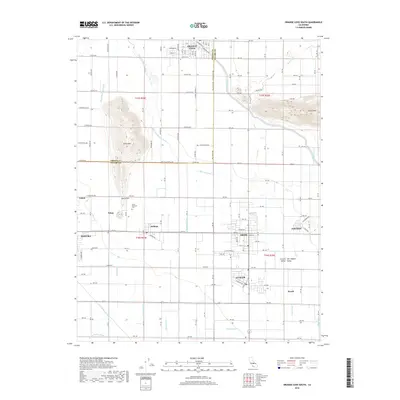
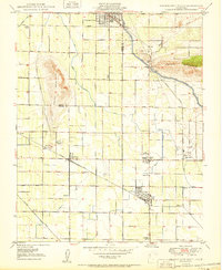 1950 Orange Cove South1950 Print · USGSTulare County's agricultural heartland is documented here at mid-century, revealing a dense grid of irrigation canals and rail lines. Genealogists and historians can locate family landmarks such as Smith Mtn Cemetery, Mt Olive School, and the busy rail hubs of Sultana and Cutler.
 - 1950 Map of Orange Cove North
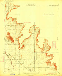
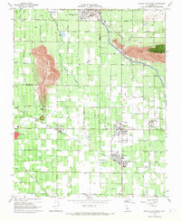
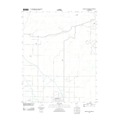
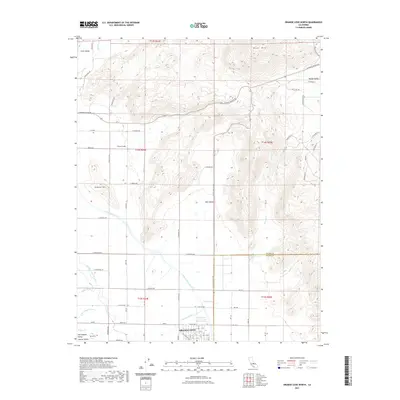
 1950 Orange Cove North1950 Print · USGSOrange Cove and the surrounding citrus groves are shown at mid-century as the local irrigation and rail networks reached their peak. Researchers can trace the path of the Atchison Topeka and Santa Fe railroad or locate the Saint Rita Indian Mission near Squaw Valley.
 - 1955 Map of Fresno
 1955 Fresno1955 Print · USGSThe Central Valley and High Sierra meet in this mid-fifties study of California’s agricultural and wilderness heart. Researchers can trace the rail-side growth of Sanger, Selma, and Reedley or locate high-altitude landmarks like Mt Whitney and Hume Lake.
 - 1956 Map of Fresno
 1956 Fresno1956 Print · USGSThe Central Valley and High Sierra meet in this mid-fifties survey of a rapidly developing California interior. Researchers can trace the rail-and-water networks of Visalia, the footprint of Tulare Lake, and the remote heights of Sequoia National Park.
 - 1958 Map of Fresno
 1958 Fresno1958 Print · USGSThe Central Valley and High Sierra meet in this mid-century survey of the California heartland. Researchers can trace the rail-and-road network connecting Fresno and Visalia or locate high-country landmarks like Mt Whitney and Sequoia National Park.
 - 1960 Map of Fresno
 1960 Fresno1960 Print · USGSThe San Joaquin Valley's mid-century agricultural boom meets the high peaks of the Sierra Nevada in this detailed survey. Genealogists and historians can trace the rail-driven growth of Fresno, Tulare, and Visalia or locate family roots in smaller towns like Raisin City and Calwa City.2 unique versions available
 - 1962 Map of Fresno, 1968 Print
 1962 Fresno1968 Print · USGSThe Central Valley and High Sierra meet in this mid-century survey, capturing the region's massive irrigation systems and mountain wilderness. Researchers can trace the rail corridors of the Southern Pacific and locate landmarks like the Tulare Lake Bed and Mount Whitney.3 unique versions available
 - 1966 Map of Fresno
 1966 Fresno1966 Print · USGSCentral California in the mid-1960s showcases a high-production agricultural valley rising into the granite peaks of the High Sierra. Researchers can trace irrigation networks, rail spurs like the Southern Pacific, and landmarks from Mount Whitney to the Lemoore Naval Air Station.
 - 1966 Map of Orange Cove North, 1967 Print
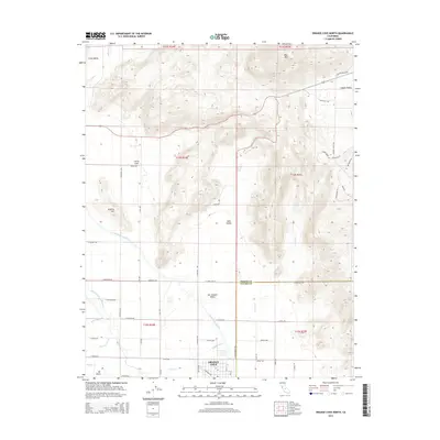
 1966 Orange Cove North1967 Print · USGSThe Fresno-Tulare county line comes alive in the mid-1960s as a productive agricultural landscape at the edge of the Sierra foothills. Researchers can trace the path of the Friant Kern Canal and locate old rural landmarks like Kaktus Korner and Saint Rita Indian Mission.
 - 1966 Map of Orange Cove South, 1967 Print
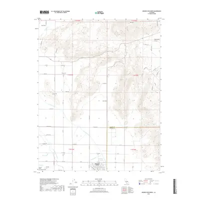
 1966 Orange Cove South1967 Print · USGSThe San Joaquin Valley's citrus belt is captured here in the mid-1960s, showing the intersection of vital irrigation and rail transport. Genealogists and researchers can trace family landmarks like Smith Mtn Cem and rural centers such as Sultana, Orosi, and Palm Sch.2 unique versions available
 - 1982 Map of Fresno, 1983 Print
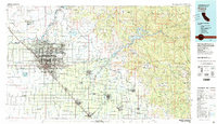 1982 Fresno1983 Print · USGSThe San Joaquin Valley's agricultural and urban landscape is captured here in the early eighties as Fresno expanded northward. Researchers can trace the rail lines of the Southern Pacific RR and identify landmarks like Raisin City and Kingsburg.2 unique versions available
 - 2012 Map of Orange Cove South, 2012 Print
 2012 Orange Cove South2012 Print · USGSCovers Orange Cove, including Dinuba, Orosi, and other nearby areas
 - 2012 Map of Orange Cove North, 2012 Print
 2012 Orange Cove North2012 Print · USGSCovers Orange Cove, including Fresno County, Tulare County, and other nearby areas
 - 2015 Map of Orange Cove South, 2015 Print
 2015 Orange Cove South2015 Print · USGSCovers Orange Cove, including Dinuba, Orosi, and other nearby areas
 - 2015 Map of Orange Cove North, 2015 Print
 2015 Orange Cove North2015 Print · USGSCovers Orange Cove, including Fresno County, Tulare County, and other nearby areas
 - 2018 Map of Orange Cove North, 2018 Print
 2018 Orange Cove North2018 Print · USGSCovers Orange Cove, including Fresno County, Tulare County, and other nearby areas
 - 2018 Map of Orange Cove South, 2018 Print
 2018 Orange Cove South2018 Print · USGSCovers Orange Cove, including Dinuba, Orosi, and other nearby areas
 - 2021 Map of Orange Cove North, 2021 Print
 2021 Orange Cove North2021 Print · USGSCovers Orange Cove, including Fresno County, Tulare County, and other nearby areas
 - 2021 Map of Orange Cove South, 2021 Print
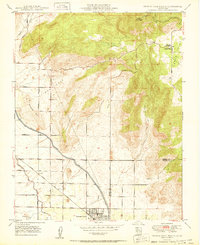
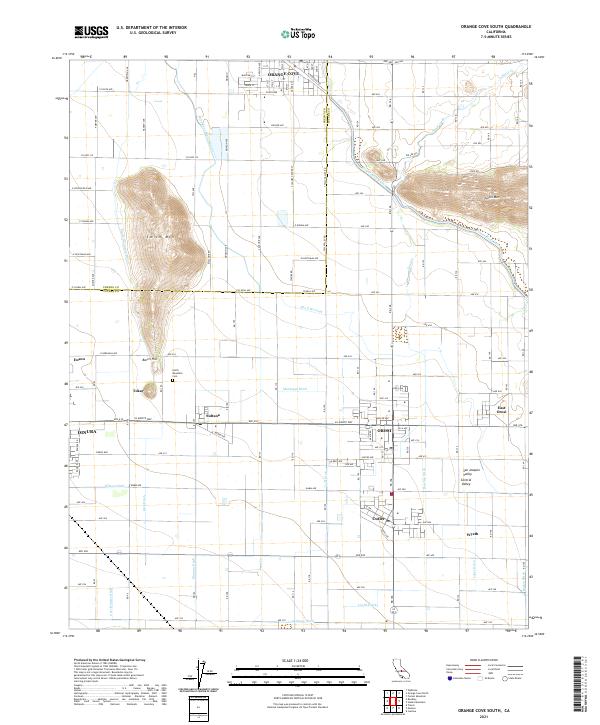 2021 Orange Cove South2021 Print · USGSThe fertile San Joaquin Valley comes into focus in this recent survey of the citrus and vineyard lands surrounding Orange Cove and Orosi. Genealogists and historians can trace the irrigation networks of Friant-Kern Canal and find local landmarks like Smith Mountain Cem and Sultana.
Showing maps 1-25 of 26
Top cities near Orange Cove
- Reedley historical maps
- Sanger historical maps
- Dinuba historical maps
- Parlier historical maps
- Parlier historical maps
- Kingsburg historical maps
See more
Frequently asked questions
- What are the different types of historical maps available for Orange Cove?
- What is the oldest map of Orange Cove?
- Where can I purchase historical maps of Orange Cove for my home or office?
- Where can I download high-res historical maps of Orange Cove?
- Are there historical topographic maps available for Orange Cove?
- Is there historical aerial imagery available for Orange Cove?
- Where are historical maps of Orange Cove sourced from?