Old Maps of Delano, California for Academic Research
Study the evolution of Delano with 36 high-resolution historic maps. Whether you're teaching, researching, or modeling changes in land use, these maps provide essential visual documentation of urban, environmental, and geographic change.
- Analyze long-term change: Track patterns in development, transportation, and natural features.
- Ideal for environmental or urban studies: Support academic projects with primary historical map data.
- Use in the classroom or lab: Educators and researchers rely on these maps to bring historical context to life.
These maps are a powerful tool for teaching, research, and visualizing how Delano has changed over the decades.
Delano, CA maps
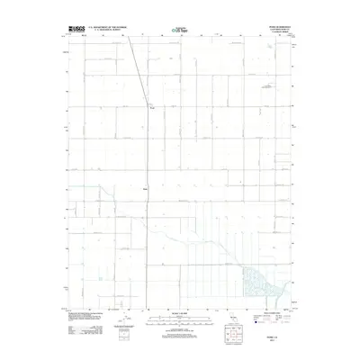
(36)- 1927 Map of McFarland
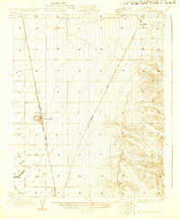 1927 McFarland1927 Print · USGSCentral Valley agriculture and transportation converge in the late twenties near the Kern County line. Genealogists and historians can trace the early townsite of McFarland and the settlement of Jasmine along the Southern Pacific rail lines.
 - 1929 Map of Delano
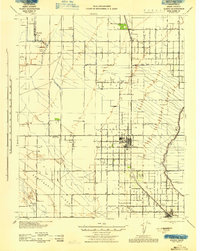
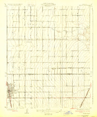 1929 Delano1929 Print · USGSThe San Joaquin Valley's agricultural heartland is captured here in the late twenties, showing the growth of the Central Valley rail corridor. Genealogists and local historians can trace early town plats in Delano, rural school locations like Columbine Sch, and the original route of the Orange Belt Highway.2 unique versions available
 - 1929 Map of Stone
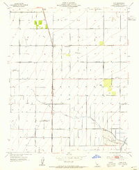
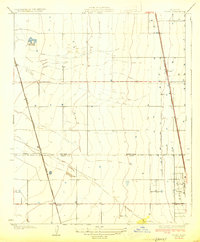 1929 Stone1929 Print · USGSThe southern San Joaquin Valley during the late 1920s shows a landscape of expanding rail and agricultural lines. Genealogists and local historians can trace the early layout of Stone, Delano, and Kernell along the Southern Pacific tracks.3 unique versions available
 - 1930 Map of McFarland
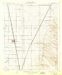 1930 McFarland1930 Print · USGSThe San Joaquin Valley's agricultural heart is captured here in the late twenties as irrigation and rail lines transformed the landscape. Researchers can trace the development of McFarland and Jasmin along the Southern Pacific and the Golden State Highway.2 unique versions available
 - 1930 Map of Pond
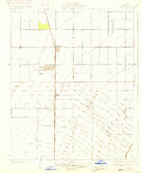 1930 Pond1930 Print · USGSKern County's industrial and rail corridor comes into focus in the late 1920s as the petroleum industry reshaped the valley floor. Researchers can trace the massive Standard Oil Co Storage Tanks at Petro and the small settlements of Pond and Elmo along the Santa Fe line.2 unique versions available
 - 1942 Map of Slater
 1942 Slater1942 Print · USGSKern County during the early war years shows an landscape of evolving rail towns and major irrigation works. Genealogists and historians can trace the early footprints of McFarland and Famoso, alongside family holdings like the Doyle Ranch and Kimberlina Ranch.
 - 1942 Map of Earlimart
 1942 Earlimart1942 Print · USGSThe southern San Joaquin Valley comes alive in the early 1940s, showing a grid of irrigation canals and major rail lines. Genealogists and historians can trace the foundations of Allensworth, locate numerous sportsmen's outposts like the Widgeon Gun Club, and follow the historic Southern Pacific route.2 unique versions available
 - 1942 Map of Terra Bella
 1942 Terra Bella1942 Print · USGSThe San Joaquin Valley's agricultural heartland is captured here during the early 1940s, highlighting the vital rail-and-water network of the Tulare-Kern border. Researchers can trace historic family holdings like Menne Ranch or locate vanished rural schoolhouses such as Columbine Sch and Saucelito Sch.
 - 1943 Map of Wasco
 1943 Wasco1943 Print · USGSAgricultural and oil interests converge in 1940s Kern County as the irrigation network expands. Genealogists can trace family holdings like Goose Lake Ranch or local landmarks including Pondham Sch and the Wasco Oil Field.
 - 1948 Map of Bakersfield
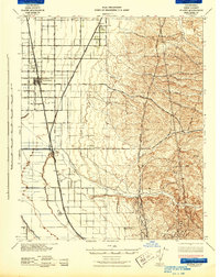
 1948 Bakersfield1948 Print · USGSBakersfield and the southern San Joaquin Valley appear in the late 1940s, showing a landscape of burgeoning oil towns, rail junctions, and early irrigation canals. Genealogists and historians can trace the foundations of local industry through Gardner Field, the Sunset Railway, and the shores of Buena Vista Lake.2 unique versions available
 - 1953 Map of Pond, 1955 Print
 1953 Pond1955 Print · USGSIn the fertile San Joaquin Valley during the mid-fifties, this area shows the transition from open range to intensive irrigation. Genealogists and local researchers can trace the rail corridor of the Atchison Topeka and Santa Fe through Pond and find the rural Pondham Sch.4 unique versions available
 - 1953 Map of Delano East, 1955 Print
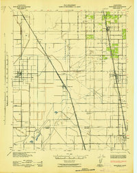
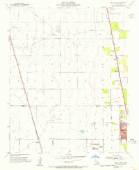
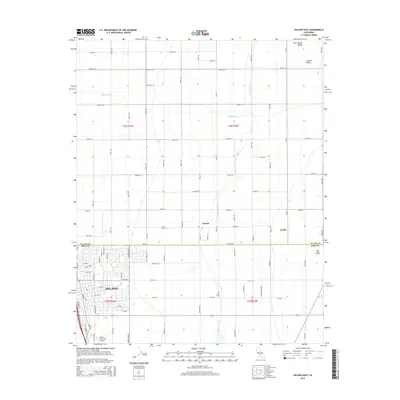
 1953 Delano East1955 Print · USGSThe eastern edge of Delano is shown here at the peak of mid-century agricultural expansion, split by the Tulare and Kern County line. Genealogists and researchers can locate family-named roads and landmarks like Columbine Sch, Sierra Vista Ranch, and the Delano Airport.3 unique versions available
 - 1954 Map of Mc Farland, 1955 Print
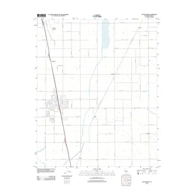
 1954 Mc Farland1955 Print · USGSKern County agriculture and rail industry are in sharp focus during the mid-fifties as irrigation canals transformed the landscape. Researchers can trace family-named roads like Hart Road, locate the Cem near Calico, and see the footprint of McFarland along the Southern Pacific line.3 unique versions available
 - 1954 Map of Delano West, 1955 Print
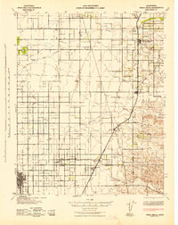
 1954 Delano West1955 Print · USGSThe San Joaquin Valley’s industrial-agricultural fringe is captured in the mid-fifties, showing the vital intersection of two major railroads. Researchers can trace the local shipping economy through numerous sidings like Caratan and locate institutions such as Fremont Sch and the Delano-McFarland District Cem.5 unique versions available
 - 1955 Map of Bakersfield
 1955 Bakersfield1955 Print · USGSThe southern San Joaquin Valley in the mid-fifties shows an era of massive oil production and industrial irrigation. Trace family roots in Allensworth, the oil fields of Oildale, or the shorelines of Tulare Lake and Buena Vista Lake.
 - 1956 Map of Bakersfield
 1956 Bakersfield1956 Print · USGSThe southern San Joaquin Valley and High Sierra come alive in the mid-fifties, showing the region's complex agricultural and rail networks. Genealogists and historians can trace family roots in towns like Bakersfield, Taft, and Delano, or locate early infrastructure along the Sunset Railway.
 - 1960 Map of Bakersfield
 1960 Bakersfield1960 Print · USGSThe Southern San Joaquin Valley at mid-century reveals a complex landscape of petroleum development and massive irrigation projects. Researchers can trace the rail lines of the Southern Pacific, explore oil-era landmarks like Oil City, and locate early settlements including Allensworth and Pixley.2 unique versions available
 - 1962 Map of Bakersfield, 1969 Print
 1962 Bakersfield1969 Print · USGSThe Southern San Joaquin Valley is shown in the 1960s as a bustling intersection of petroleum production, irrigation agriculture, and mountain recreation. Researchers can trace the rail lines of the Southern Pacific through the valley or locate early desert developments like California City and Tehachapi.4 unique versions available
 - 1966 Map of Bakersfield
 1966 Bakersfield1966 Print · USGSThe southern San Joaquin Valley in the mid-sixties reveals a massive industrial and agricultural landscape shaped by water and oil. Genealogists and historians can trace the growth of Bakersfield and Oildale, or locate remote airfields like Minter Field and Mojave-Kern County No. 7 Airport.
 - 1993 Map of Delano
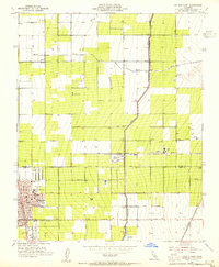
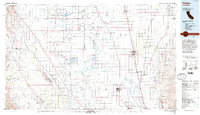 1993 Delano1993 Print · USGSThe San Joaquin Valley's industrial and agricultural heartland is captured here in the early nineties, showing a landscape shaped by petroleum and irrigation. Genealogists and historians can trace settlements from McFarland to Alpaugh, alongside the Colonel Allensworth State Historic Park and the sprawling Trico Gas Field.2 unique versions available
 - 2012 Map of Delano West, 2012 Print
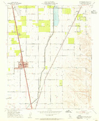
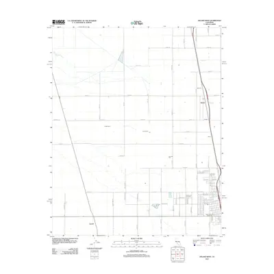 2012 Delano West2012 Print · USGSCovers Delano, including Earlimart, Kern County, and other nearby areas
 - 2012 Map of Delano East, 2012 Print
 2012 Delano East2012 Print · USGSCovers Delano, including Cypress Gardens Mobile Home Community, Delano Mobile Home Park, and other nearby areas
 - 2012 Map of Pond, 2012 Print
 2012 Pond2012 Print · USGSCovers Delano, including McFarland, Pond, and other nearby areas
 - 2012 Map of McFarland, 2012 Print
 2012 McFarland2012 Print · USGSCovers Delano, including McFarland, City of McFarland, and other nearby areas
 - 2015 Map of Delano East, 2015 Print
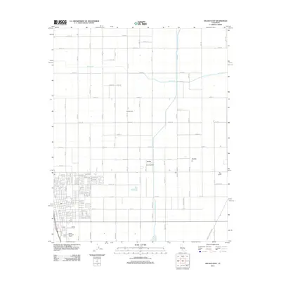
 2015 Delano East2015 Print · USGSCovers Delano, including Cypress Gardens Mobile Home Community, Delano Mobile Home Park, and other nearby areas
Showing maps 1-25 of 36
Top cities near Delano
- Wasco historical maps
- Shafter historical maps
- McFarland historical maps
- Earlimart historical maps
- Terra Bella historical maps
- Pixley historical maps
See more
Top neighborhoods of Delano
Frequently asked questions
- What are the different types of historical maps available for Delano?
- What is the oldest map of Delano?
- Where can I purchase historical maps of Delano for my home or office?
- Where can I download high-res historical maps of Delano?
- Are there historical topographic maps available for Delano?
- Is there historical aerial imagery available for Delano?
- Where are historical maps of Delano sourced from?