Old Maps of Corcoran, California for Metal Detecting
Plan your next treasure hunt with 22 historic maps of Corcoran. Find old homesites, ghost towns, trails, and gathering spots that may be lost to time — perfect for identifying promising metal detecting locations.
- Locate forgotten sites: Uncover places like long-lost settlements, abandoned rail lines, or gathering spots.
- Plan better hunts: Use map overlays combined with LiDAR or satellite views to narrow in on historically rich areas.
- Made for detectorists: Thousands of hobbyists use these maps to discover relics, coins, and hidden history.
Use these historic maps to boost your research and find new opportunities beneath the surface of Corcoran.
Corcoran, CA maps
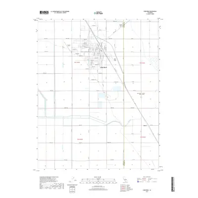
(22)- 1928 Map of Waukena
 1928 Waukena1928 Print · USGSThe agricultural landscape of the southern Central Valley is revealed in the mid-twenties, centered on the settlement of Waukena. Researchers can trace the early irrigation network and rural infrastructure including the Lakeside School, Aurora School, and the Sweet Canal.2 unique versions available
 - 1928 Map of Corcoran
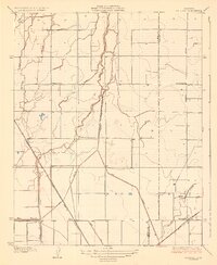
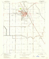
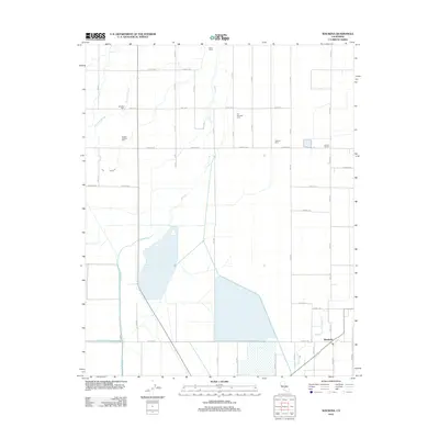
 1928 Corcoran1928 Print · USGSThe San Joaquin Valley's agricultural transformation is on full display here during the late 1920s as irrigation projects reshaped the land. Trace the early growth of Corcoran and vanished points like Turnbull alongside rural landmarks like Riverdale School and the Tule River.3 unique versions available
 - 1942 Map of Corcoran
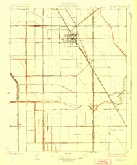
 1942 Corcoran1942 Print · USGSThe Central Valley agricultural landscape of Kings and Tulare counties is shown here during the early years of the war. Genealogists and historians can trace rail-side commerce and rural schooling at Waukena, Corcoran, and several family outposts like the El Rico Ranch.
 - 1948 Map of Fresno
 1948 Fresno1948 Print · USGSThe San Joaquin Valley and the High Sierra met during a period of rapid post-war growth and industrial expansion. Genealogists and researchers can trace family lines through small rail towns like Calwa City, find early aviation sites at Fresno-Chandler, or locate the Fresno Copper Mine.
 - 1950 Map of Waukena
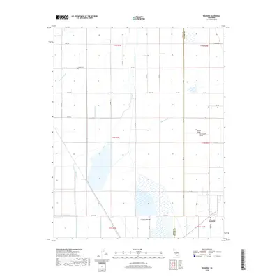
 1950 Waukena1950 Print · USGSThe rural stretch between Kings and Tulare Counties comes into focus in this mid-century edition, based on earlier surveys of the valley's irrigation. Genealogists and historians can trace the foundations of the Waukena community and locate old landmarks like Lakeside School and Aurora School.
 - 1954 Map of Corcoran, 1957 Print
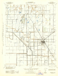
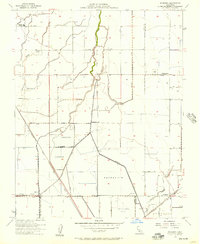
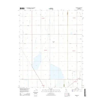
 1954 Corcoran1957 Print · USGSCorcoran and the surrounding Tulare Lake Basin are shown in the mid-1950s at a peak of agricultural and industrial activity. Genealogists and historians can trace the community's growth through sites like John Muir Junior High and worker outposts such as Boswell Camp One.3 unique versions available
 - 1954 Map of Waukena, 1957 Print
 1954 Waukena1957 Print · USGSMid-century Tulare County is defined here by its heavy investment in water infrastructure and rail access. Researchers can trace family roots at Lakeside Cemetery or locate the site of the Aurora School (Aban'd) and the busy community of Waukena.3 unique versions available
 - 1955 Map of Fresno
 1955 Fresno1955 Print · USGSThe Central Valley and High Sierra meet in this mid-fifties study of California’s agricultural and wilderness heart. Researchers can trace the rail-side growth of Sanger, Selma, and Reedley or locate high-altitude landmarks like Mt Whitney and Hume Lake.
 - 1956 Map of Fresno
 1956 Fresno1956 Print · USGSThe Central Valley and High Sierra meet in this mid-fifties survey of a rapidly developing California interior. Researchers can trace the rail-and-water networks of Visalia, the footprint of Tulare Lake, and the remote heights of Sequoia National Park.
 - 1958 Map of Fresno
 1958 Fresno1958 Print · USGSThe Central Valley and High Sierra meet in this mid-century survey of the California heartland. Researchers can trace the rail-and-road network connecting Fresno and Visalia or locate high-country landmarks like Mt Whitney and Sequoia National Park.
 - 1960 Map of Fresno
 1960 Fresno1960 Print · USGSThe San Joaquin Valley's mid-century agricultural boom meets the high peaks of the Sierra Nevada in this detailed survey. Genealogists and historians can trace the rail-driven growth of Fresno, Tulare, and Visalia or locate family roots in smaller towns like Raisin City and Calwa City.2 unique versions available
 - 1962 Map of Fresno, 1968 Print
 1962 Fresno1968 Print · USGSThe Central Valley and High Sierra meet in this mid-century survey, capturing the region's massive irrigation systems and mountain wilderness. Researchers can trace the rail corridors of the Southern Pacific and locate landmarks like the Tulare Lake Bed and Mount Whitney.3 unique versions available
 - 1966 Map of Fresno
 1966 Fresno1966 Print · USGSCentral California in the mid-1960s showcases a high-production agricultural valley rising into the granite peaks of the High Sierra. Researchers can trace irrigation networks, rail spurs like the Southern Pacific, and landmarks from Mount Whitney to the Lemoore Naval Air Station.
 - 1993 Map of Visalia
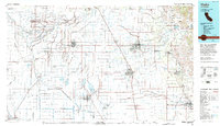 1993 Visalia1993 Print · USGSThe San Joaquin Valley comes alive in the early nineties, showing a landscape defined by the Tulare Lake Bed and its vast network of canals. Trace family roots and local history near Santa Rosa Rancheria, Pixley Nat Wildlife Ref, and the Tulare Co Fairgrounds.2 unique versions available
 - 2012 Map of Corcoran, 2012 Print
 2012 Corcoran2012 Print · USGSCovers Corcoran, including Tulare County, Kings County, and other nearby areas
 - 2012 Map of Waukena, 2012 Print
 2012 Waukena2012 Print · USGSCovers Corcoran, including Waukena, Tulare County, and other nearby areas
 - 2015 Map of Waukena, 2015 Print
 2015 Waukena2015 Print · USGSCovers Corcoran, including Waukena, Tulare County, and other nearby areas
 - 2015 Map of Corcoran, 2015 Print
 2015 Corcoran2015 Print · USGSCovers Corcoran, including Tulare County, Kings County, and other nearby areas
 - 2018 Map of Waukena, 2018 Print
 2018 Waukena2018 Print · USGSCovers Corcoran, including Waukena, Tulare County, and other nearby areas
 - 2018 Map of Corcoran, 2018 Print
 2018 Corcoran2018 Print · USGSCovers Corcoran, including Tulare County, Kings County, and other nearby areas
 - 2021 Map of Corcoran, 2021 Print
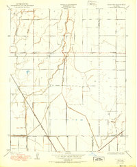
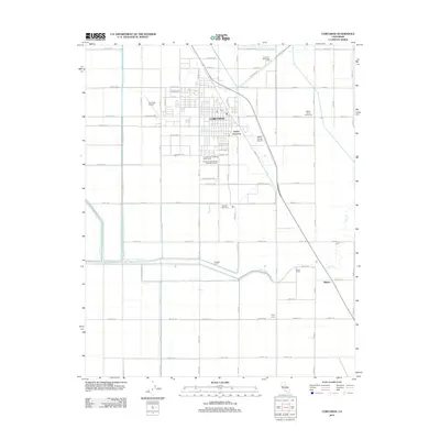
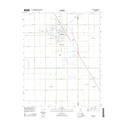
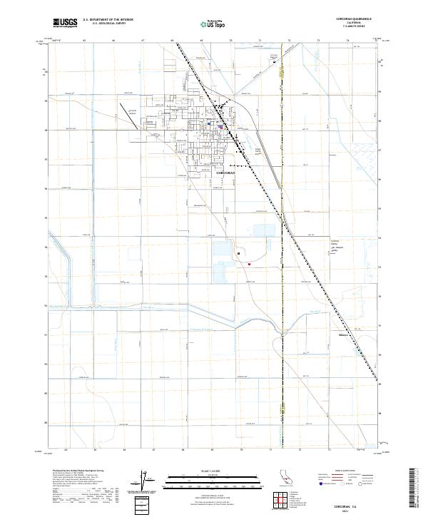 2021 Corcoran2021 Print · USGSCorcoran and the surrounding San Joaquin Valley are captured in this recent survey of California's agricultural heartland. Researchers can trace irrigation networks like the Helm-Lewis Ditch and Tule River or locate family sites at Corcoran Memorial Park and Blanco.
 - 2021 Map of Waukena, 2021 Print
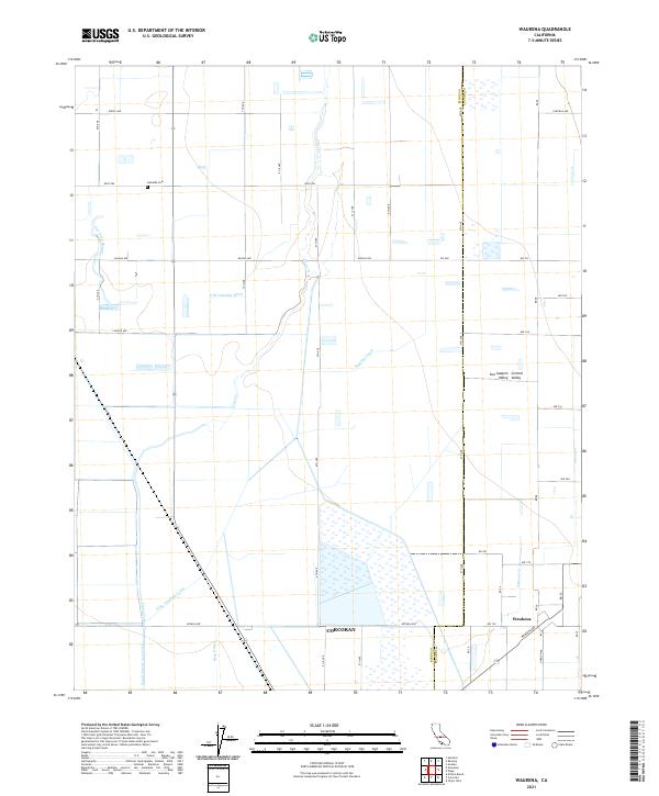 2021 Waukena2021 Print · USGSThe Tulare County agricultural landscape at the edge of the Tulare Basin is captured here in the early 2020s. Researchers can trace the sophisticated irrigation network of the Highline Canal and Bean Ditch surrounding the settlement of Waukena.
End of results
Showing maps 1-22 of 22
Top cities near Corcoran
- Visalia historical maps
- Tulare historical maps
- Hanford historical maps
- Lemoore historical maps
- Home Garden historical maps
- Waukena historical maps
Frequently asked questions
- What are the different types of historical maps available for Corcoran?
- What is the oldest map of Corcoran?
- Where can I purchase historical maps of Corcoran for my home or office?
- Where can I download high-res historical maps of Corcoran?
- Are there historical topographic maps available for Corcoran?
- Is there historical aerial imagery available for Corcoran?
- Where are historical maps of Corcoran sourced from?