1980s Maps of Lassen County, California
Explore 78 historic maps of Lassen County from the 1980s. These maps offer a rare glimpse into what life looked like during the 1980s — showing old roads, neighborhoods, homes, and landmarks that have changed or disappeared over time.
Whether you're researching your family's past, planning a metal detecting trip, or studying how Lassen County's landscape evolved across the 1980s, these high-resolution maps are a powerful tool for exploring the history of this region.
- Focus on a specific era: All maps on this page are from the 1980s, giving you a focused view of this time period.
- See what’s changed: Compare century-old streets, trails, and buildings to today's modern landscape using overlays and satellite layers.
- Research with precision: Use these maps for genealogy, historical research, land use analysis, or educational projects.
- View, download, or print: Maps are fully viewable online in high resolution, and can be downloaded or printed for your own records.
Start exploring Lassen County's history through authentic maps from the 1980s. This is your window into the past.
Lassen County, CA maps
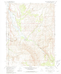
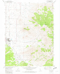
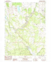
(78)- 1980 Map of Pegleg Mountain
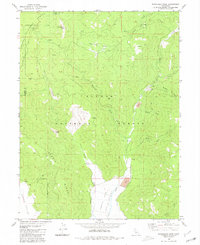
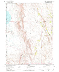
 1980 Pegleg Mountain1980 Print · USGSHigh in the Lassen National Forest during the late twentieth century, this terrain reveals the vital intersection of water storage and mountain transit. Trace the rail heritage of the Western Pacific and Westwood Junction alongside Pegleg Mtn.
 - 1980 Map of Moonlight Peak
 1980 Moonlight Peak1980 Print · USGSThe high Sierra terrain of Plumas County is mapped here in the late twentieth century, showing a landscape defined by forest boundaries and remote mining. Historians can trace early industry and mountain life at the Engel Mine, Shake Cabin, and Ruins.2 unique versions available
 - 1980 Map of Roop Mountain
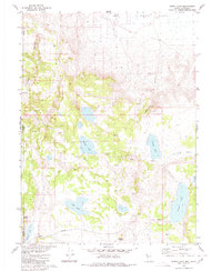
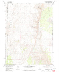
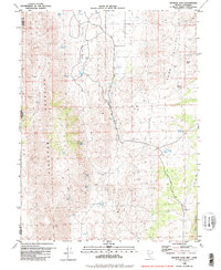
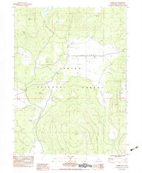
 1980 Roop Mountain1980 Print · USGSLassen County's high forest terrain is documented here in the early eighties, showing the transition from mountain peaks to ranching lands. Researchers can locate established sites like Barrell Ranch and Sunan or trace the course of the Susan River.2 unique versions available
 - 1980 Map of Fredonyer Pass
 1980 Fredonyer Pass1980 Print · USGSThe high Sierra Nevada divide between Lassen and Plumas counties comes into focus in the early 1980s. Researchers can trace the legacy of mountain ranching at Stephens Ranch and Flemings Sheep Camp, or locate landmarks like Fredonyer Pass and Coyote Peak.
 - 1980 Map of Burnt Lake
 1980 Burnt Lake1980 Print · USGSThe Nevada-California borderlands are shown in the early 1980s as a landscape of remote basins and essential desert springs. Researchers can trace historic water sources like Pilgrim Spring and Rowland Spring or locate the Lackerman Airstrip near the edge of Duck Flat.2 unique versions available
 - 1980 Map of Red Rock Canyon
 1980 Red Rock Canyon1980 Print · USGSThe high desert border between Nevada and California comes into focus in the early eighties. Researchers can trace water rights and grazing history through landmarks like Sheep Camp Draw Reservoir, Mustang Spring, and Willow Reservoir.
 - 1980 Map of Westwood East
 1980 Westwood East1980 Print · USGSWestwood and Pine Town are documented here in the mid-1970s, nestled within the timberlands of the Lassen National Forest. Local historians can trace the Pacific Western route, locate the Westwood Cemetery, and find family-named outposts like 101 Ranch.2 unique versions available
 - 1980 Map of Pegleg Canyon
 1980 Pegleg Canyon1980 Print · USGSThe California-Nevada borderlands are captured in the early eighties as a landscape of remote ranching and rugged desert hydrology. Trace early water rights and land use at the Murphy Ranch, Pegleg Reservoir, and a geothermal Spring (Hot).
 - 1980 Map of Parker Canyon
 1980 Parker Canyon1980 Print · USGSThe high-desert borderlands of Washoe County are captured here in the late 1970s, showing a landscape defined by seasonal water and remote trails. Researchers can trace the location of the Skedadle Dam (Site), local caves, and ruins near Parker Canyon.
 - 1980 Map of Mixie Flat
 1980 Mixie Flat1980 Print · USGSThe high-desert terrain of the Nevada-California border comes into focus in this 1980s-era study of the Washoe County backcountry. Researchers can trace the water sources and livestock trails that sustained this region, including Mixie Flat, the Horse Corral, and Twin Peaks.2 unique versions available
 - 1980 Map of Westwood West
 1980 Westwood West1980 Print · USGSNortheastern California at the start of the 1980s reveals a landscape shaped by water management and timber transport. Genealogists and historians can trace the growth of Westwood and Hamilton Branch alongside the Western Pacific railroad and the Indian Ole Dam.2 unique versions available
 - 1980 Map of Reno
 1980 Reno1980 Print · USGSReno and its high-desert surroundings appear in transition during the 1980s, balancing rapid urban expansion with its deep mining and ranching roots. Genealogists and historians can trace the Southern Pacific line through Fernley or locate local landmarks like Mountain View Cem and the Ruth Mine.3 unique versions available
 - 1980 Map of Hole In The Ground
 1980 Hole In The Ground1980 Print · USGSThe high desert borderlands of Nevada and California are captured here in the early 1980s, documenting a remote landscape of seasonal basins and volcanic peaks. Researchers can trace historic water sources like Hole in the Ground Spring and Piute Spring or follow the path of Mike Flat Rd across Painters Flat.
 - 1980 Map of Smoke Creek Ranch, 1981 Print
 1980 Smoke Creek Ranch1981 Print · USGSThe high desert border of Nevada and California comes into focus in the early 1980s, centered on the historic Smoke Creek corridor. Researchers can trace remnants of regional travel and ranching history at the Smoke Creek Station (Ruins) and the Robbers Roost (Site).2 unique versions available
 - 1980 Map of Granite Peak, 1981 Print
 1980 Granite Peak1981 Print · USGSThe high-desert borderlands of Washoe County come into focus in the early 1980s, showcasing a landscape of isolated peaks and vital water sources. Researchers can trace remote mining prospects and find named landmarks like Whitney Spring, Granite Peak, and Pasture Well.2 unique versions available
 - 1981 Map of High Rock Canyon
 1981 High Rock Canyon1981 Print · USGSNorthwestern Nevada at the dawn of the eighties remains a landscape of remote outposts and dramatic geological shifts. Genealogists and historians can trace the sites of Leadville, isolated features like Powers Well, and the vast boundaries of the Black Rock Desert.2 unique versions available
 - 1981 Map of Gerlach
 1981 Gerlach1981 Print · USGSThe high desert of northwestern Nevada and eastern California is mapped here during the early eighties, centered on the vital rail and mining hub of Gerlach. Researchers can trace the Western Pacific corridor through Trego and locate remote operations like the Arcturus Mine and the gypsum works at Empire.2 unique versions available
 - 1981 Map of Loyalton, 1982 Print
 1981 Loyalton1982 Print · USGSLoyalton and the surrounding Sierra Valley are captured here in the early eighties as a hub of ranching and forestry. Genealogists and researchers can locate the local Cemetery and Hospital, or trace the rugged geography of Mount Ina Coolbrith and Smithneck Creek.
 - 1983 Map of Champs Flat
 1983 Champs Flat1983 Print · USGSLassen County's high-plateau cattle country is captured in the early 1980s, showcasing the remote ranching infrastructure of the Sierra Nevada. Researchers can trace historic grazing outposts and seasonal sites like Salt Cabin (Site), Smith Cow Camp, and Stones Headquarters (Site).3 unique versions available
 - 1983 Map of Corders Reservoir
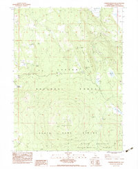 1983 Corders Reservoir1983 Print · USGSLassen County in the early eighties was a landscape of specialized forestry and pioneer memory. Genealogists and historians can trace the Lassen Trail and locate the Eldridge Homestead (Site) near Blacks Mountain.2 unique versions available
 - 1983 Map of Pine Creek Valley
 1983 Pine Creek Valley1983 Print · USGSLassen County's high-country terrain was captured in the early 1980s, showing a landscape defined by timber, grazing, and rail history. Researchers can trace the Old RR Grade and locate historical outposts like Lodgepole (Site) and Bogard Ranger Station.
 - 1983 Map of Sheepshead
 1983 Sheepshead1983 Print · USGSLassen County in the early 1980s reveals a high-country landscape of reservoirs and isolated mountain peaks. Researchers can locate the Gooch Camp (Site), trace the Grasshopper Valley Ditch, and identify family-named landmarks like Swanberger Reservoir.2 unique versions available
 - 1983 Map of Spalding Tract
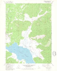
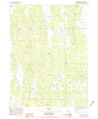
 1983 Spalding Tract1983 Print · USGSLassen County's northeastern forest and the shores of Eagle Lake come into focus in the early eighties. Researchers can trace the layout of the Spalding Tract, locate the Old Spalding Cabin, and identify regional landmarks from Whaleback Mtn to the Dow L.O. station.
 - 1983 Map of Little Valley
 1983 Little Valley1983 Print · USGSLittle Valley and the surrounding timberlands of northern California are shown in the early 1980s as the rail and ranching industries shaped the terrain. Genealogists and local historians can trace family sites like the Klett Homestead and The Round Barn near the banks of the Pit River.
 - 1983 Map of Bullard Lake
 1983 Bullard Lake1983 Print · USGSLassen County's high forest and grazing lands are captured here in the early eighties, showcasing a landscape of seasonal camps and springs. Researchers can find old water sources and forest outposts like Pat Morris Station, Camp Stanford, and Ashurst Well.
Showing maps 1-25 of 78
Top cities of Lassen County
- Susanville historical maps
- Janesville historical maps
- Westwood historical maps
- Johnstonville historical maps
- Patton Village historical maps
- Doyle historical maps
See more
Frequently asked questions
- What are the different types of historical maps available for Lassen County?
- What is the oldest map of Lassen County?
- Where can I purchase historical maps of Lassen County for my home or office?
- Where can I download high-res historical maps of Lassen County?
- Are there historical topographic maps available for Lassen County?
- Is there historical aerial imagery available for Lassen County?
- Where are historical maps of Lassen County sourced from?