1970s Maps of Lassen County, California
Explore 24 historic maps of Lassen County from the 1970s. These maps offer a rare glimpse into what life looked like during the 1970s — showing old roads, neighborhoods, homes, and landmarks that have changed or disappeared over time.
Whether you're researching your family's past, planning a metal detecting trip, or studying how Lassen County's landscape evolved across the 1970s, these high-resolution maps are a powerful tool for exploring the history of this region.
- Focus on a specific era: All maps on this page are from the 1970s, giving you a focused view of this time period.
- See what’s changed: Compare century-old streets, trails, and buildings to today's modern landscape using overlays and satellite layers.
- Research with precision: Use these maps for genealogy, historical research, land use analysis, or educational projects.
- View, download, or print: Maps are fully viewable online in high resolution, and can be downloaded or printed for your own records.
Start exploring Lassen County's history through authentic maps from the 1970s. This is your window into the past.
Lassen County, CA maps
(24)- 1972 Map of Diamond Mtn
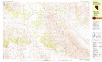
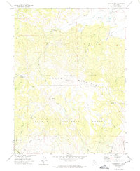 1972 Diamond Mtn1972 Print · USGSThe high Diamond Mountains in the early 1970s reveal a landscape of forest management and early pioneer history. Researchers can locate the Peter Lassen Grave, trace the Skyline Motorway, and find remote landmarks like Richmond Sch.3 unique versions available
 - 1972 Map of Standish, 1974 Print
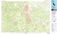
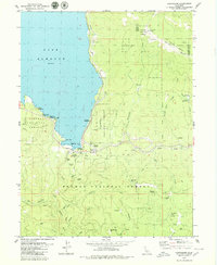
 1972 Standish1974 Print · USGSLassen County life in the early 1970s is centered here between the high peaks and the shores of Honey Lake. Genealogists and local historians can trace family lands along Alexander Lane, locate the old Lake Sch, and explore the rural settlement at Standish.
 - 1972 Map of Antelope Lake, 1974 Print
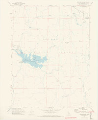 1972 Antelope Lake1974 Print · USGSThe high country of Plumas County is documented here in the early 1970s, shortly after the creation of the reservoir. Researchers can trace the locations of isolated forest outposts like Wemple Cabin and Harwood Cabin or the early layout of Antelope Lake.2 unique versions available
 - 1972 Map of Janesville, 1974 Print
 1972 Janesville1974 Print · USGSThe Honey Lake Valley and the Diamond Mountains meet in this early 1970s survey of Lassen County. Genealogists and historians can trace the local cemetery sites at Johnstonville Cem or locate family-named landmarks like Jim Peterson Hill and the community of Janesville.
 - 1975 Map of Beckwourth Pass, 1977 Print
 1975 Beckwourth Pass1977 Print · USGSUpper Long Valley in the mid-seventies is a high Sierra corridor shaped by rail lines and ranching trails. Researchers can trace the Western Pacific Railroad through the Beckwourth Pass Tunnel and locate the historic Summit (Site).
 - 1975 Map of Susanville NE, 1979 Print
 1975 Susanville NE1979 Print · USGSThe Lassen County high desert meets the irrigated Susan River valley in this mid-seventies photographic survey. Genealogists and historians can trace the rural layouts of Johnstonville and Leavitt or the steep terrain around Antelope Mtn.2 unique versions available
 - 1975 Map of Susanville NW, 1980 Print
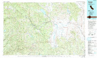
 1975 Susanville NW1980 Print · USGSNorthern California at the mid-seventies is documented in this detailed aerial perspective of the Lassen County seat. Researchers can trace the development of Susanville along the Susan River and the confluence of Piute Creek.
 - 1975 Map of Prospect Peak SE, 1981 Print
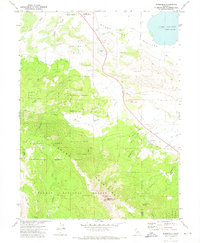
 1975 Prospect Peak SE1981 Print · USGSThe Lassen wilderness in the mid-1970s is revealed through this detailed aerial survey of volcanic landforms. Researchers can examine the sharp margins of lava fields near Cinder Cone and the shoreline of Snag Lake below the heights of Prospect Peak.
 - 1976 Map of Burney, 1992 Print
 1976 Burney1992 Print · USGSShasta and Lassen counties come alive in the mid-seventies, documenting a rugged landscape of volcanic peaks and timbered wilderness. Genealogists and hikers can trace the Pacific Crest Trail, early ranger outposts like Poison Station, and tribal lands at Montgomery Creek Indian Rancheria.3 unique versions available
 - 1977 Map of Ferris Creek, 1978 Print
 1977 Ferris Creek1978 Print · USGSThe Diamond Mountains straddle the Lassen and Plumas county line in the late seventies, showing a landscape of resource extraction and forest management. Genealogists and historians can locate remote landmarks like Johnson Mill, the Plinco Mine, and the high-elevation Lookout Tower.
 - 1977 Map of Constantia, 1978 Print
 1977 Constantia1978 Print · USGSLassen County at the Nevada border was a land of high peaks and rail corridors in the 1970s. Researchers can locate the mountain settlements of Constantia and Omira or trace the route of the Western Pacific Railroad past Zamboni Hot Springs.2 unique versions available
 - 1977 Map of Milford, 1978 Print
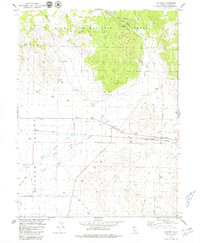
 1977 Milford1978 Print · USGSNorthern California's high desert basin and forest fringe meet in the late seventies near the Lassen and Plumas county line. Trace the rugged terrain of the Diamond Mountains to find the Corona Mine, Milford, and the Sierra Army Depot.
 - 1978 Map of Stony Ridge
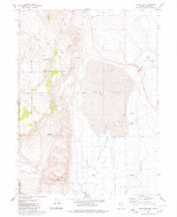
 1978 Stony Ridge1978 Print · USGSThe high Sierra terrain meets the western edge of HONEY LAKE in the late 1970s, where military and ranching interests coexist. Genealogists and historians can trace family locations like Clark Ranch or locate the sprawling Sierra Army Depot boundary.
 - 1978 Map of Evans Canyon
 1978 Evans Canyon1978 Print · USGSThe high-desert ranching country of the Sierra-Nevada border is captured here in the late seventies. Researchers can trace the Western Pacific rail line through Long Valley or locate local landmarks like Balls Ranch and Purdy.2 unique versions available
 - 1978 Map of Mc Kesick Peak
 1978 Mc Kesick Peak1978 Print · USGSThe Diamond Mountains and the high basin of Honey Lake define this California landscape in the late seventies. Researchers can trace the Western Pacific rail line or locate remote sites like Hall Cabin Spring and the Meadow View Forest Service Station.3 unique versions available
 - 1979 Map of Dogskin Mtn
 1979 Dogskin Mtn1979 Print · USGSThe Nevada and California borderlands during the late seventies reveal a high-desert landscape centered on the Winnemucca Ranch Road. Researchers can trace old livestock hubs like Lees Flat or locate specific pioneer sites such as a lonely Grave and scattered Prospects.3 unique versions available
 - 1979 Map of Red Cinder
 1979 Red Cinder1979 Print · USGSThe Plumas and Lassen county lines meet here in the late seventies, showing a remote wilderness of volcanic peaks and high-country meadows. Researchers can locate the Heckle Ranch (Site) or trace alpine routes past Star Butte and Silver Lake.2 unique versions available
 - 1979 Map of Chilcoot
 1979 Chilcoot1979 Print · USGSThe High Sierra meets the valley floor in the late 1970s, where ranching and rail lines define the landscape. Trace early settlement history through the Vinton Cem, the Summit Sch, and local landmarks like Troei Canyon Ranch.2 unique versions available
 - 1979 Map of Greenville
 1979 Greenville1979 Print · USGSGreenville and the surrounding Sierra Nevada foothills are captured in the late 1970s as timber and mining interests shaped the Plumas County landscape. Genealogists and historians can trace the Indian Mission, Stroing Ranch, and the path of the Western Pacific railroad.
 - 1979 Map of Frenchman Lake
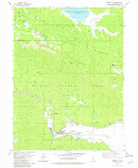
 1979 Frenchman Lake1979 Print · USGSThe Plumas National Forest transitioned toward modern recreation in the late seventies as the reservoir shoreline developed. Researchers can trace the layout of Frenchman Lake, the Frenchman Dam infrastructure, and older sites like Ramelli or Grigsby Camp.
 - 1979 Map of Swain Mountain
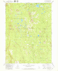
 1979 Swain Mountain1979 Print · USGSLassen National Forest in the late 1970s reveals a landscape of high-elevation meadows and vital water sources at the county divide. Trace the historic Lassen Trail as it crosses the terrain near Swain Mountain or follow the Western Pacific rail line past Lake Norvell.2 unique versions available
 - 1979 Map of Canyondam
 1979 Canyondam1979 Print · USGSLake Almanor and the rugged Plumas County canyons come into focus in the late 1970s during a period of active mountain industry. Genealogists and researchers can trace old workings at the Goldstripe Mine, locate the cemetery near Almanor, or follow the Western Pacific rail line.3 unique versions available
 - 1979 Map of Duck Lake, 1980 Print
 1979 Duck Lake1980 Print · USGSRemote ranching and desert aviation define this corner of the Nevada-California border in the late seventies. Researchers can trace land use through landmarks like Cockrell Ranch, the Lackerman Air Strip, and Bud Brown Cabin.2 unique versions available
 - 1979 Map of Portola, 1993 Print
 1979 Portola1993 Print · USGSThe northern Sierra Nevada and its timber-and-rail economy are captured here during the late seventies, spanning from the Feather River canyons to the high basins. Researchers can trace the path of the Western Pacific RR and locate historic hubs like Quincy, Portola, and Loyalton.2 unique versions available
End of results
Showing maps 1-24 of 24
Top cities of Lassen County
- Susanville historical maps
- Janesville historical maps
- Westwood historical maps
- Johnstonville historical maps
- Patton Village historical maps
- Doyle historical maps
See more
Frequently asked questions
- What are the different types of historical maps available for Lassen County?
- What is the oldest map of Lassen County?
- Where can I purchase historical maps of Lassen County for my home or office?
- Where can I download high-res historical maps of Lassen County?
- Are there historical topographic maps available for Lassen County?
- Is there historical aerial imagery available for Lassen County?
- Where are historical maps of Lassen County sourced from?