1990s Maps of Lassen County, California
Explore 84 historic maps of Lassen County from the 1990s. These maps offer a rare glimpse into what life looked like during the 1990s — showing old roads, neighborhoods, homes, and landmarks that have changed or disappeared over time.
Whether you're researching your family's past, planning a metal detecting trip, or studying how Lassen County's landscape evolved across the 1990s, these high-resolution maps are a powerful tool for exploring the history of this region.
- Focus on a specific era: All maps on this page are from the 1990s, giving you a focused view of this time period.
- See what’s changed: Compare century-old streets, trails, and buildings to today's modern landscape using overlays and satellite layers.
- Research with precision: Use these maps for genealogy, historical research, land use analysis, or educational projects.
- View, download, or print: Maps are fully viewable online in high resolution, and can be downloaded or printed for your own records.
Start exploring Lassen County's history through authentic maps from the 1990s. This is your window into the past.
Lassen County, CA maps
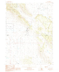
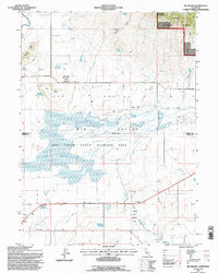
(84)- 1990 Map of Ash Valley
 1990 Ash Valley1990 Print · USGSThe high ranchlands of Lassen County are shown here as they appeared in the 1990s. Trace old family sites and water sources like Fleming Sheep Camp, Oxendine Spring, and the small Cem on the valley floor.
 - 1990 Map of Letterbox Hill
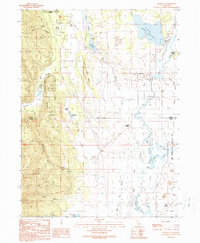
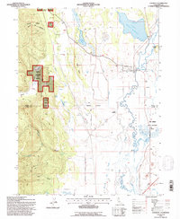
 1990 Letterbox Hill1990 Print · USGSUpper Lassen County in the early 1990s was a landscape of high-country reservoirs and protected forest lands. Researchers can trace historic water routes and crossings like Stonebreaker Crossing or locate landmarks such as Hayden Hill and McClelland Reservoir.
 - 1990 Map of Big Swamp
 1990 Big Swamp1990 Print · USGSBig Valley and the Modoc-Lassen county line are captured here in the early nineties, showing a landscape of wetlands and volcanic buttes. Researchers can trace the boundaries of Lookout Rancheria and locate geothermal landmarks like Kellog Hot Springs and Hot Springs.
 - 1990 Map of Likely
 1990 Likely1990 Print · USGSLikely and its surrounding rangelands are documented here in the early nineties, where the high Modoc plateau meets the irrigated South Fork valley. Researchers can trace the ranching landscape through landmarks like the South Fork Union Sch, the village Cem, and the isolated Depau settlement.
 - 1990 Map of Coble Mountain
 1990 Coble Mountain1990 Print · USGSThe volcanic highlands of the Shasta and Lassen county line are captured here in the late twentieth century. You can trace the rugged geography of the Lassen National Forest and locate specific sites like Burton Ranch, Big Cave, and the Pit River.
 - 1990 Map of Lookout
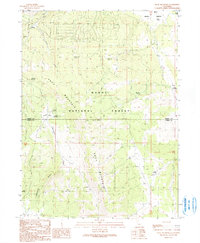
 1990 Lookout1990 Print · USGSThe Big Valley region at the Modoc and Lassen county line appears here during the 1990s as a hub of riparian management and ranching life. Genealogists and researchers can trace local family landmarks and water infrastructure from Lookout to the Fulcher Dam and the Lookout Siding rail stop.
 - 1990 Map of Jellico
 1990 Jellico1990 Print · USGSLassen County timber and ranch lands are mapped here during the late twentieth century as they appeared within the national forest. Researchers can trace remote locales like the Cone and Ward Ranch, the Butte Camp (Site), and the high grounds of Negro Camp Mountain.
 - 1990 Map of Day
 1990 Day1990 Print · USGSUpper Modoc and Shasta counties appear as a rugged landscape of volcanic peaks and forest basins during the 1990s. Researchers can trace the Old Railroad Grade, locate the isolated settlement of Day with its cemetery, and identify the Widow Mountain Radio Facility.
 - 1990 Map of Pittville
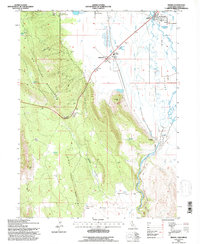
 1990 Pittville1990 Print · USGSThe northern California ranching and river country comes into focus in the 1990s, centered on the settlement of Pittville. Researchers can trace irrigation history and valley landmarks from Young Falls and Hot Springs to the Lee Drainage Canal.
 - 1990 Map of Hog Valley
 1990 Hog Valley1990 Print · USGSLassen County ranching and timber lands meet in the 1990s at the edge of the Modoc National Forest. Researchers can trace old family holdings through landmarks like Billy Packwood Spring, Walker Spring, and the rural settlement of Pumpkin Center.
 - 1990 Map of Adin
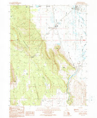
 1990 Adin1990 Print · USGSThe town of Adin stands at the intersection of forest and valley in this 19900s survey of Modoc and Lassen counties. Genealogists and local historians can trace the rural infrastructure of the era, from the local Cem and Dibble Place to the Big Valley Ranger Station.
 - 1990 Map of Bieber
 1990 Bieber1990 Print · USGSBieber and Nubieber are shown in the 1990s as the rail and agricultural hubs of this valley landscape. Researchers can trace the local infrastructure from the Bieber Station and Pit River to the Cem and Intermountain Conservation Camp.
 - 1990 Map of Lane Reservoir
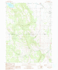
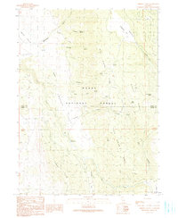
 1990 Lane Reservoir1990 Print · USGSLassen County forest lands and high-plateau springs are captured here during the 1980s and 90s. Researchers can trace remote habitations like Scotty Place and Niles Cabin alongside vital water sources such as Lane Reservoir and Wayman Spring.
 - 1990 Map of Knox Mountain
 1990 Knox Mountain1990 Print · USGSThe Modoc and Lassen county line comes alive in the late twentieth century, showing a remote landscape of forest management and high-desert hydrology. Genealogists and historians can locate the Old Likely Mill (Site), the settlement at Hilton, and seasonal water sources like Comfort Cabin Springs.
 - 1990 Map of Holbrook Canyon
 1990 Holbrook Canyon1990 Print · USGSLassen County ranching and water management are detailed here during the late twentieth century. Genealogists and historians can trace family-named landmarks like Williams Ranch, Bill Allen Spring, and the reach of the Madeline Plains.
 - 1990 Map of Ambrose Valley
 1990 Ambrose Valley1990 Print · USGSThe Modoc and Lassen County border area was documented in the late twentieth century as a landscape of timber and remote springs. Hikers and historians can trace the Ash Creek Trail and locate named landmarks like Sweagert Flat and John Spring.
 - 1992 Map of Eagle Lake
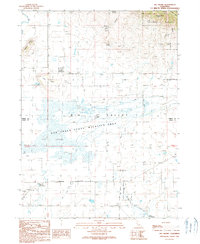
 1992 Eagle Lake1992 Print · USGSHigh desert plains and volcanic peaks meet the shores of Eagle Lake in the early nineties. Genealogists and local historians can trace the Southern Pacific rail line through Ravendale and Termo or locate remote sites like Fredonyer and Karlo.2 unique versions available
 - 1993 Map of Lane Reservoir, 1996 Print
 1993 Lane Reservoir1996 Print · USGSNortheastern California at the edge of the Modoc National Forest is captured here in the early nineties, revealing a landscape of high flats and remote cabins. Researchers can locate family-named landmarks like Scotty Place and Avila, alongside vital water sources such as Moll Reservoir and Johnson Mill Spring.
 - 1993 Map of Cold Spring Mtn, 1996 Print
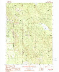
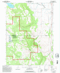
 1993 Cold Spring Mtn1996 Print · USGSThe high Warner Mountains of Lassen County are shown here in the 1990s, revealing a landscape of remote forest outposts and alpine reservoirs. Genealogists and historians can locate family-named landmarks like Christensen Corral and Hall Cabin.
 - 1993 Map of Big Swamp, 1996 Print
 1993 Big Swamp1996 Print · USGSThe Modoc and Lassen county borderlands in the early nineties were defined by the vast wetlands of the Big Swamp and the Ash Creek State Wildlife Area. Genealogists and researchers can trace local landmarks like Lookout Rancheria, Kellog Hot Springs, and the small settlement of Hays.
 - 1993 Map of Lookout, 1996 Print
 1993 Lookout1996 Print · USGSThe community of Lookout and its surrounding Big Valley ranchlands are shown in the 1990s as the regional landscape balanced timber and irrigation. Trace local landmarks like Lookout Siding, the cemetery, and various water controls from Fulcher Dam to Twin Bridges.
 - 1993 Map of Silva Flat Reservoir, 1996 Print
 1993 Silva Flat Reservoir1996 Print · USGSThe high plateau of Lassen and Modoc counties was a landscape of remote ranching and water engineering in the 1990s. Genealogists and historians can trace water rights and family-named landmarks like Ollie Rivis Spring, Summers Hill, and the isolated Cem near Hayden Hill.
 - 1993 Map of Bieber, 1996 Print
 1993 Bieber1996 Print · USGSIn the early 1990s, the river-and-rail hub of Lassen County remained centered on the confluence of the Pit River and Big Valley. Genealogists and local historians can trace family-named sites and infrastructure like the Cem at Nubieber, Bieber Station, and the Intermountain Conservation Camp.
 - 1993 Map of Likely, 1996 Print
 1993 Likely1996 Print · USGSLikely and the surrounding Modoc County ranchlands are documented here in the early nineties as the local economy balanced forest management and river-valley agriculture. Researchers can locate the South Fork Union Sch, the town Cem, and rural landmarks like the Fireguard Station (BLM).
 - 1993 Map of Little Hat Mtn., 1996 Print
 1993 Little Hat Mtn.1996 Print · USGSLassen County's high-desert and mountain transition is captured here in the early nineties within the Modoc National Forest. Researchers can trace the footprints of remote ranching life at the Old Marr Ranch or follow old tracks through Tuledad Canyon and the heights of Little Hat Mtn.2 unique versions available
Showing maps 1-25 of 84
Top cities of Lassen County
- Susanville historical maps
- Janesville historical maps
- Westwood historical maps
- Johnstonville historical maps
- Patton Village historical maps
- Doyle historical maps
See more
Frequently asked questions
- What are the different types of historical maps available for Lassen County?
- What is the oldest map of Lassen County?
- Where can I purchase historical maps of Lassen County for my home or office?
- Where can I download high-res historical maps of Lassen County?
- Are there historical topographic maps available for Lassen County?
- Is there historical aerial imagery available for Lassen County?
- Where are historical maps of Lassen County sourced from?