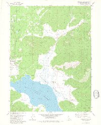
1980 Map of Westwood East
USGS Topo · Published 1980About this map
Westwood and the adjacent Pine Town serve as the primary residential anchors in this part of the Lassen National Forest during the mid-1970s. The landscape is defined by the expansive Mountain Meadows Reservoir, which dominates the southern half of the sheet, and the high-elevation terrain of Goodrich Mountain. Evidence of early 20th-century industry and infrastructure is visible through the Flume following Goodrich Creek and the presence of the Pacific Western line.
Find a feature on this map
27 named features on this map. Tap any name to fly to it.
Don’t see what you’re looking for? This feature index may not catch every label — zoom into the map to look around manually.
Map Details
Editions of this 1980 Westwood East Map
2 editions found
Other maps of this area

1886 · Honey Lake
USGS Topo · 1:250,000

1886 · Lassen Peak
USGS Topo · 1:250,000

1891 · Honey Lake
USGS Topo · 1:250,000

1892 · Lassen Peak
USGS Topo · 1:250,000

1893 · Honey Lake
USGS Topo · 1:250,000

1894 · Lassen Peak
USGS Topo · 1:250,000

1950 · Greenville
USGS Topo · 1:62,500

1955 · Westwood
USGS Topo · 1:62,500

1955 · Almanor
USGS Topo · 1:62,500

1955 · Westwood
USGS Topo · 1:250,000