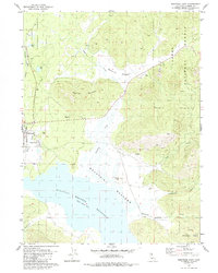
1980 Map of Westwood East
USGS Topo · Published 1985About this map
Lassen National Forest terrain dominates this 1980 survey, where the timbered slopes of Goodrich Mountain and Round Mtn overlook the expansive Mountain Meadows Reservoir. The industrial and social life of the region is anchored at Westwood, with the nearby enclave of Pine Town and the Western Pacific railroad line providing the necessary transport links for this mountain economy.
Find a feature on this map
29 named features on this map. Tap any name to fly to it.
Don’t see what you’re looking for? This feature index may not catch every label — zoom into the map to look around manually.
Map Details
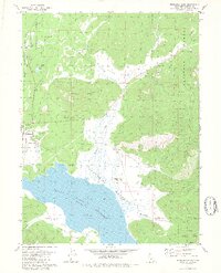
Editions of this 1980 Westwood East Map
2 editions found
Other maps of this area

1886 · Honey Lake
USGS Topo · 1:250,000

1886 · Lassen Peak
USGS Topo · 1:250,000

1891 · Honey Lake
USGS Topo · 1:250,000

1892 · Lassen Peak
USGS Topo · 1:250,000

1893 · Honey Lake
USGS Topo · 1:250,000

1894 · Lassen Peak
USGS Topo · 1:250,000

1950 · Greenville
USGS Topo · 1:62,500

1955 · Westwood
USGS Topo · 1:62,500

1955 · Almanor
USGS Topo · 1:62,500

1955 · Westwood
USGS Topo · 1:250,000