Old Maps of Buntingville, California for Genealogy
Trace your family roots with 16 historic maps of Buntingville. These high-res maps reveal old neighborhoods, homesites, landmarks, and streets — helping you uncover where your ancestors lived and how the area evolved over time.
- Explore historic neighborhoods: Identify where your relatives may have lived in the 1800s or 1900s.
- Compare maps over time: Trace the changes in streets, buildings, and landmarks for multi-generational research.
- Perfect for genealogy & ancestry research: Used by family historians and researchers to map out lineage and migration.
These maps are an incredible resource for exploring your personal connection to Buntingville's past.
Buntingville, CA maps
(16)- 1886 Map of Honey Lake
 1886 Honey Lake1886 Print · USGSLassen and Plumas counties were a frontier of ranching and early commerce in the late nineteenth century. Genealogists can locate family-named settlements like Stocktons and Taylorsville or trace the early water rights near Susanville and Honey Lake.
 - 1891 Map of Honey Lake
 1891 Honey Lake1891 Print · USGSLassen and Plumas counties appear here in the early 1890s, when the region's cattle ranches and mountain towns were first being systematically mapped. Genealogists and local historians can trace early residents through family-named sites like Halls, Buntingville, and Stocktons.
 - 1893 Map of Honey Lake
 1893 Honey Lake1893 Print · USGSNortheastern California at the close of the 19th century was a landscape of terminal lakes and early valley settlements. Genealogists and historians can trace family-named sites like Moultons and Stocktons, alongside regional hubs like Susanville and the lakeside town of Amedee.6 unique versions available
 - 1954 Map of Litchfield, 1955 Print
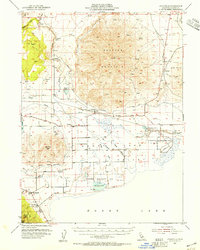 1954 Litchfield1955 Print · USGSLassen County's high desert landscape comes alive in the mid-fifties, showing the intersection of ranching and rail as the Southern Pacific spans the valley. Researchers can find old community hubs like Standish and Litchfield, alongside the remote Wendel Hot Springs and Lake School.3 unique versions available
 - 1955 Map of Westwood, 1959 Print
 1955 Westwood1959 Print · USGSIn the mid-fifties, the northeastern California interior supported a landscape of mountain timber and high-desert basins. Genealogists and historians can locate early settlements and industrial sites like Susanville, Herlong, and the Sierra Ordinance Depot.
 - 1958 Map of Westwood
 1958 Westwood1958 Print · USGSNorthern California in the late fifties shows a landscape of volcanic peaks and rising reservoirs. Researchers can locate the Sierra Ordinance Depot and trace mountain infrastructure through the Hat Creek Ranger Station and Stacy Siding.
 - 1959 Map of Westwood
 1959 Westwood1959 Print · USGSNortheastern California during the late 1950s was a hub of timber, military logistics, and mountain railroading. Researchers can trace the path of the Southern Pacific through the Honey Lake Valley and locate landmarks like the Sierra Ordinance Depot and Lassen Peak.
 - 1962 Map of Susanville, 1965 Print
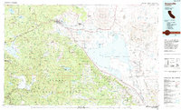
 1962 Susanville1965 Print · USGSNortheastern California's high desert and volcanic peaks meet in the early sixties, showing the region's timber and rail hubs in transition. Local historians can trace the Southern Pacific lines through Susanville and Litchfield, or explore the sprawling Sierra Army Depot and Lassen Volcanic National Park.2 unique versions available
 - 1968 Map of Susanville
 1968 Susanville1968 Print · USGSThe high Sierras and the Great Basin collide in the late 1960s, showing a landscape of volcanic peaks, timber settlements, and desert plains. Genealogists and researchers can trace historic rail lines like the Western Pacific or locate residents in Susanville, Westwood, and Janesville.
 - 1972 Map of Standish, 1974 Print
 1972 Standish1974 Print · USGSLassen County life in the early 1970s is centered here between the high peaks and the shores of Honey Lake. Genealogists and local historians can trace family lands along Alexander Lane, locate the old Lake Sch, and explore the rural settlement at Standish.
 - 1984 Map of Susanville
 1984 Susanville1984 Print · USGSLassen and Plumas counties in the mid-1980s showcase a high-altitude landscape of timber, military installations, and valley settlements. Genealogists and local historians can trace the rail corridors of the Southern Pacific and Western Pacific near Susanville or locate smaller locales like Crescent Mills and the Sierra Army Depot.2 unique versions available
 - 1994 Map of Standish, 1998 Print
 1994 Standish1998 Print · USGSIn the Honey Lake Valley during the 1990s, the landscape remained a complex tapestry of high-desert agriculture and military installations. Genealogists and researchers can trace the roads and waterworks near Standish, Buntingville, and the Sierra Army Depot.
 - 2012 Map of Standish, 2012 Print
 2012 Standish2012 Print · USGSCovers Buntingville, including Standish, Lassen County, and other nearby areas
 - 2015 Map of Standish, 2015 Print
 2015 Standish2015 Print · USGSCovers Buntingville, including Standish, Lassen County, and other nearby areas
 - 2018 Map of Standish, 2018 Print
 2018 Standish2018 Print · USGSCovers Buntingville, including Standish, Lassen County, and other nearby areas
 - 2022 Map of Standish, 2022 Print
 2022 Standish2022 Print · USGSHoney Lake and the surrounding high-desert valley are shown here in the early twenty-first century, revealing a complex irrigation and conservation landscape. Researchers can trace local lineage and land use through features like Standish Cem, the Honey Lake Waterfowl Management Area, and the village of Buntingville.
End of results
Showing maps 1-16 of 16
Top cities near Buntingville
- Susanville historical maps
- Susanville historical maps
- Janesville historical maps
- Johnstonville historical maps
- Litchfield historical maps
- Milford historical maps
Frequently asked questions
- What are the different types of historical maps available for Buntingville?
- What is the oldest map of Buntingville?
- Where can I purchase historical maps of Buntingville for my home or office?
- Where can I download high-res historical maps of Buntingville?
- Are there historical topographic maps available for Buntingville?
- Is there historical aerial imagery available for Buntingville?
- Where are historical maps of Buntingville sourced from?