Old Maps of Marin County, California for Genealogy
Trace your family roots with 168 historic maps of Marin County. These high-res maps reveal old neighborhoods, homesites, landmarks, and streets — helping you uncover where your ancestors lived and how the area evolved over time.
- Explore historic neighborhoods: Identify where your relatives may have lived in the 1800s or 1900s.
- Compare maps over time: Trace the changes in streets, buildings, and landmarks for multi-generational research.
- Perfect for genealogy & ancestry research: Used by family historians and researchers to map out lineage and migration.
These maps are an incredible resource for exploring your personal connection to Marin County's past.
Marin County, CA maps
(168)- 1895 Map of San Francisco
 1895 San Francisco1895 Print · USGSThe San Francisco Bay Area thrives as a maritime and rail power at the close of the nineteenth century. Genealogists and researchers can trace early neighborhoods in Berkeley, the layout of the Presidio Military Reservation, and rail terminals like the Oakland Mole.
 - 1897 Map of Tamalpais
 1897 Tamalpais1897 Print · USGSMarin County's ridges and coastal lagoons are shown in the late nineteenth century as rail lines began to stitch together its small towns and land grants. Genealogists and historians can trace the early footprints of Eastland, Larkspur, and Woodville alongside the winding routes of the North Pacific Coast R. R.12 unique versions available
 - 1899 Map of San Francisco
 1899 San Francisco1899 Print · USGSThe Bay Area at the close of the nineteenth century reveals a burgeoning metropolis still tied to its maritime and rail roots. Trace the early layouts of the University of California and the Presidio, or locate the now-vanished Lone Mt. Cem. and Shell Mound.7 unique versions available
 - 1902 Map of Napa
 1902 Napa1902 Print · USGSThe Napa Valley and Carquinez Strait are captured at the turn of the century, showing a landscape defined by maritime military posts and early vineyards. Genealogists and historians can trace the Mare Island Navy Yard, the Insane Asylum, and rail stops at Zinfandel and Rutherford.6 unique versions available
 - 1914 Map of Petaluma
 1914 Petaluma1914 Print · USGSThe North Bay region near the turn of the century shows a landscape of tidal marshes and rising ridges connected by the Northwestern Pacific. Genealogists and historians can trace old family ranch sites like Freitas Ranch and numerous rural schoolhouses including Iowa School and Burdell School.5 unique versions available
 - 1915 Map of San Francisco
 1915 San Francisco1915 Print · USGSSan Francisco and the East Bay appear at a pivotal moment just before the First World War, featuring the grand layout of the Panama-Pacific International Exposition. Genealogists and historians can trace the early rail networks of the Key Route Pier, the industrial waterfront at Winehaven, and historic landmarks like Cliff House.6 unique versions available
 - 1916 Map of Mare Island
 1916 Mare Island1916 Print · USGSThe northern San Pablo Bay region comes alive in this survey, showcasing a landscape of tidal marshes and rail-driven growth during the mid-1910s. Researchers can trace the layout of the Mare Island Navy Yard, the remote rail stop at Wingo, and the rural classrooms of Fly School.4 unique versions available
 - 1916 Map of Point Reyes
 1916 Point Reyes1916 Print · USGSCoastal Marin County during the mid-1910s reveals a working landscape of shorefront landings and family ranches. Researchers can trace early settlements and schools like Lairds Landing, Olema, and Franklin School before modern park designations.2 unique versions available
 - 1918 Map of Point Reyes
 1918 Point Reyes1918 Print · USGSMarin County's rugged coast appears here in the years following the turn of the century, showing a working landscape of ranches and rail. Genealogists can locate family landmarks like Lairds Landing, rural schoolhouses, and the Northwestern Pacific line.6 unique versions available
 - 1935 Map of Sebastopol
 1935 Sebastopol1935 Print · USGSThe Sonoma County hills and the Gold Ridge fruit district are captured here in the mid-1930s, just as the regional rail network still connected small agricultural hamlets. Genealogists can trace family footprints at Watson Sch, Two Rock Ch, and the rural community of Bloomfield.
 - 1941 Map of Tamalpais
 1941 Tamalpais1941 Print · USGSMarin County's coastal defenses and rail-connected towns are captured here just as the nation entered World War II. Researchers can trace the early fortifications at Fort Cronkhite, the path of the Northwestern Pacific RR, and old landmarks like Bolinas School.
 - 1942 Map of Mare Island
 1942 Mare Island1942 Print · USGSThe northern reaches of San Pablo Bay come alive in this wartime survey, showing a landscape of vital naval yards and marshland agriculture. Genealogists and historians can trace rail depots like Napa Junction, rural landmarks like American Canyon School, and the industrial waterfronts of Vallejo and Oleum.
 - 1942 Map of Sebastopol
 1942 Sebastopol1942 Print · USGSWestern Sonoma County comes into focus in the early 1940s, showing a landscape defined by apple orchards and redwood groves. Genealogists can trace family footprints through rural sites like Gold Ridge Sch, the Northwestern Pacific RR line, and Bohemian Grove.3 unique versions available
 - 1942 Map of Petaluma
 1942 Petaluma1942 Print · USGSThe Marin and Sonoma county line runs through this early 1940s landscape of tidal marshes and ranch lands. Genealogists can trace family names at Mt Oliver Cemetery or find historic rural institutions like the Olompali School and St Vincent Station.
 - 1942 Map of Bodega Head, 1956 Print
 1942 Bodega Head1956 Print · USGSThe Sonoma coast during the early 1940s reveals a landscape of sheltered harbors and high coastal ridges. Genealogists and historians can trace the foundations of Bodega Bay, locate the Ocean View Sch, and explore landmarks from Arched Rock Beach to Swallow City.3 unique versions available
 - 1944 Map of Bodega Head
 1944 Bodega Head1944 Print · USGSThe Sonoma coast at the height of the Second World War shows a landscape of quiet harbors and remote coastal gulches. Researchers can trace the layout of Bodega Bay, locate the Ocean View Sch, and explore the terrain around Mount Roscoe and Swallow City.3 unique versions available
 - 1947 Map of Santa Rosa
 1947 Santa Rosa1947 Print · USGSNorthern California in the late 1940s was a landscape of agricultural valleys and vital rail hubs. Trace the historic routes of the Northwestern Pacific through Healdsburg or explore the mid-century waterfronts of Vallejo and Benicia near Mare Island.
 - 1947 Map of San Francisco, 1948 Print
 1947 San Francisco1948 Print · USGSThe Bay Area in the late 1940s reveals a region transitioning from wartime intensity to post-war suburban growth. Trace the historic rail lines of the Southern Pacific RR or locate early military footprints at Fort Funston and Moffett Field.
 - 1947 Map of San Francisco North, 1955 Print
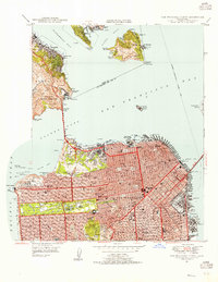 1947 San Francisco North1955 Print · USGSSan Francisco and the Marin coastline are captured here in the years following World War II, just as the city's modern skyline began to take shape. Researchers can trace historic landmarks like Mission Dolores, early waterfront infrastructure at Mission Rock, and the military outposts of Fort Baker Military Reservation.
 - 1947 Map of San Quentin, 1956 Print
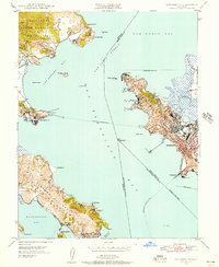 1947 San Quentin1956 Print · USGSThe San Francisco Bay area in the late 1940s reveals a landscape of ferry-connected shores and burgeoning industry. Trace the historic Richmond-San Rafael Ferry route, the State Penitentiary, and the Tiburon Naval Net Depot.
 - 1948 Map of San Quentin
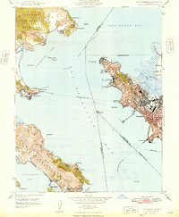 1948 San Quentin1948 Print · USGSThe North Bay waterfront comes alive in the late 1940s, showing the active ferry routes and military installations of the era. Genealogists and historians can trace the Richmond-San Rafael Ferry, the State Penitentiary, and the Tiburon Naval Net Depot.2 unique versions available
 - 1948 Map of San Francisco, 1951 Print
 1948 San Francisco1951 Print · USGSThe Bay Area in the late 1940s reveals a landscape defined by rapid post-war growth and a heavy military presence at the Golden Gate. Trace the development of early trans-bay infrastructure like the Oakland-Bay Bridge and historic coastal defense sites such as Fort Funston and Alcatraz Island.
 - 1949 Map of Santa Rosa
 1949 Santa Rosa1949 Print · USGSThe North Bay and Wine Country appear here in the late 1940s, when the Northwestern Pacific RR still dominated regional transit. Genealogists and historians can trace old coastal outposts like Anchor Bay Settlement and the early layout of Santa Rosa.2 unique versions available
 - 1949 Map of Mare Island, 1957 Print
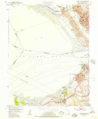 1949 Mare Island1957 Print · USGSThe Carquinez Strait and San Pablo Bay waterfronts are captured here during the post-war industrial peak. Researchers can trace historic shorelines and rail lines through Vallejo, the Mare Island Naval Reservation, and early industry at Oleum and Hercules.
 - 1950 Map of San Francisco North
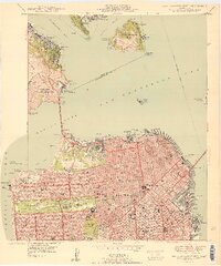 1950 San Francisco North1950 Print · USGSMid-century San Francisco and the Marin headlands are captured here during a period of peak maritime and military activity. Local historians can trace the street-level detail of Chinatown, find the old Townsend St Station, or locate neighborhood schools like Lowell HS.
Showing maps 1-25 of 168
Top cities of Marin County
- San Rafael historical maps
- Novato historical maps
- Mill Valley historical maps
- San Anselmo historical maps
- Larkspur historical maps
- Corte Madera historical maps
See more
Frequently asked questions
- What are the different types of historical maps available for Marin County?
- What is the oldest map of Marin County?
- Where can I purchase historical maps of Marin County for my home or office?
- Where can I download high-res historical maps of Marin County?
- Are there historical topographic maps available for Marin County?
- Is there historical aerial imagery available for Marin County?
- Where are historical maps of Marin County sourced from?