Old Maps of June Lake, California for Genealogy
Trace your family roots with 14 historic maps of June Lake. These high-res maps reveal old neighborhoods, homesites, landmarks, and streets — helping you uncover where your ancestors lived and how the area evolved over time.
- Explore historic neighborhoods: Identify where your relatives may have lived in the 1800s or 1900s.
- Compare maps over time: Trace the changes in streets, buildings, and landmarks for multi-generational research.
- Perfect for genealogy & ancestry research: Used by family historians and researchers to map out lineage and migration.
These maps are an incredible resource for exploring your personal connection to June Lake's past.
June Lake, CA maps
(14)- 1901 Map of Mt. Lyell
 1901 Mt. Lyell1901 Print · USGSThe High Sierra at the end of the century is captured here in immense detail, showing the early boundaries of Yosemite National Park. Researchers can trace old mountain routes past Soda Springs, Tuolumne Meadows, and Miller Bridge.12 unique versions available
 - 1947 Map of Mariposa, 1948 Print
 1947 Mariposa1948 Print · USGSThe High Sierra and Owens Valley transition is captured here in the late 1940s, just as the region’s hydroelectric and tourism infrastructure was maturing. Genealogists and historians can trace old ranger stations, the Casa Diablo Mine, and rail stops along the Southern Pacific like Benton Station and Zurich.2 unique versions available
 - 1948 Map of Mariposa, 1951 Print
 1948 Mariposa1951 Print · USGSThe High Sierra and Mariposa foothills are shown here in the late 1940s as the post-war tourism and water infrastructure expanded. Genealogists and historians can locate vanished waypoints like Mormon Bar, the Glacier Point Hotel, and the granite quarries of Knowles.
 - 1953 Map of Mono Craters, 1955 Print
 1953 Mono Craters1955 Print · USGSThe eastern Sierra Nevada meets the high basin in the early 1950s, showing the early development of recreational and industrial corridors. Genealogists and historians can trace high-altitude infrastructure like the Log Cabin Mine, the State Fish Hatchery, and the Mono Lake Aqueduct.6 unique versions available
 - 1957 Map of Mariposa, 1966 Print
 1957 Mariposa1966 Print · USGSThe High Sierra and Owens Valley appear in the mid-fifties, showing the intersection of conservation, hydroelectric power, and mountain industry. Genealogists and researchers can trace local landmarks like Yosemite Cemetery, the remote Kinsley Station, and the Pine Creek Mine.4 unique versions available
 - 1963 Map of Mariposa
 1963 Mariposa1963 Print · USGSThe High Sierra and Owens Valley meet in the early sixties, showing a landscape defined by gold-rush history and massive post-war water projects. Genealogists and researchers can trace old mining routes near Mariposa, locate the Glacier Point Hotel, and find small settlements like Coarse Gold or Knowles Junction.
 - 1976 Map of Yosemite Valley, 1994 Print
 1976 Yosemite Valley1994 Print · USGSThe High Sierra and the iconic Yosemite Valley are captured here during the 1970s, showing the primary road networks and backcountry trails of the day. Researchers can trace the layout of Yosemite Village or locate historic mining sites like Schroeder Mine and Buffalo Mine.2 unique versions available
 - 1986 Map of June Lake
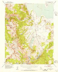
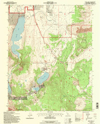
 1986 June Lake1986 Print · USGSThe Eastern Sierra near the Mono Basin is captured here in the mid-1980s, showcasing a landscape defined by volcanic activity and alpine lakes. Researchers can trace the development around June Lake, locate old PROSPECTS, and explore geological landmarks like Obsidian Dome and Mono Craters.
 - 1992 Map of June Lake, 1995 Print
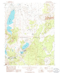
 1992 June Lake1995 Print · USGSThe Eastern Sierra highlands are captured here in the early nineties, showcasing the mountain lakes and volcanic terrain of the Mono Basin. You can trace the development of the June Mtn Ski Area and locate recreation sites near Gull Lake and Obsidian Dome.
 - 1994 Map of June Lake, 1997 Print
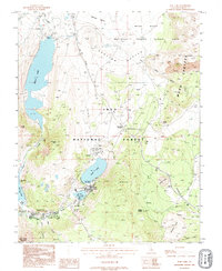
 1994 June Lake1997 Print · USGSThe eastern Sierra Nevada loop comes to life in the mid-1990s, centered on the glacial lakes and volcanic formations of the Mono Basin. Trace local landmarks like the PENSTOCK TRAMWAY, the shores of Silver Lake, and the massive Obsidian Dome in this detailed U.S. Forest Service revision.
 - 2012 Map of June Lake, 2012 Print
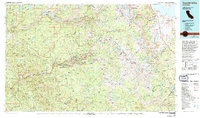
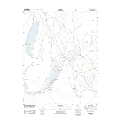 2012 June Lake2012 Print · USGSCovers June Lake, including Mono County, United States, and other nearby areas
 - 2015 Map of June Lake, 2015 Print
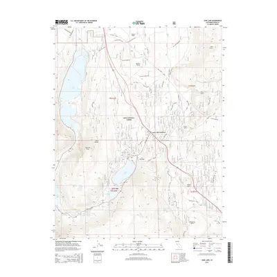 2015 June Lake2015 Print · USGSCovers June Lake, including Mono County, United States, and other nearby areas
 - 2018 Map of June Lake, 2018 Print
 2018 June Lake2018 Print · USGSCovers June Lake, including Mono County, United States, and other nearby areas
 - 2021 Map of June Lake, 2021 Print
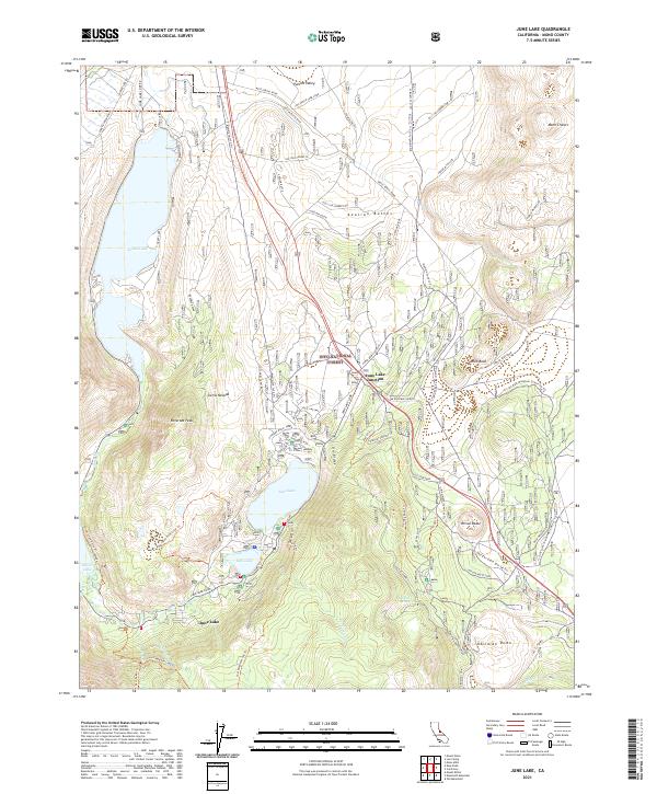 2021 June Lake2021 Print · USGSThe eastern Sierra Nevada loop comes alive in this contemporary survey of the Mono County lake country. Trace the roads and trails connecting June Lake Junction to Silver Lake, including volcanic landmarks like Obsidian Dome and the Mono Craters.
End of results
Showing maps 1-14 of 14
Top cities near June Lake
Frequently asked questions
- What are the different types of historical maps available for June Lake?
- What is the oldest map of June Lake?
- Where can I purchase historical maps of June Lake for my home or office?
- Where can I download high-res historical maps of June Lake?
- Are there historical topographic maps available for June Lake?
- Is there historical aerial imagery available for June Lake?
- Where are historical maps of June Lake sourced from?