Old Maps of Napa County, California for Hiking & Exploration
Hike through history with 102 historic maps of Napa County. Explore old trails, ghost towns, and forgotten backroads — perfect for outdoor adventurers and local explorers.
- Rediscover forgotten places: Map out old mining camps, roads, and footpaths that no longer exist on modern maps.
- Layer with modern tools: Combine with LiDAR or satellite views to plan hikes through historical terrain.
- Made for exploration: Popular among hikers, overlanders, and local history lovers.
Use these maps to find adventure and explore the hidden past of Napa County.
Napa County, CA maps
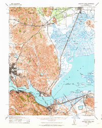
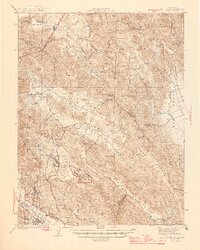
(102)- 1896 Map of Carquinez Strait, 1954 Print
 1896 Carquinez Strait1954 Print · USGSCovers Napa County, including Concord, Vallejo, and other nearby areas
 - 1898 Map of Karquines
 1898 Karquines1898 Print · USGSCovers Napa County, including Concord, Vallejo, and other nearby areas
 - 1901 Map of Karquines
 1901 Karquines1901 Print · USGSCovers Napa County, including Concord, Vallejo, and other nearby areas6 unique versions available
 - 1902 Map of Napa
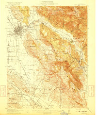
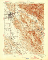
 1902 Napa1902 Print · USGSCovers Napa County, including Concord, Vallejo, and other nearby areas6 unique versions available
 - 1916 Map of Mare Island
 1916 Mare Island1916 Print · USGSCovers Napa County, including Vallejo, Richmond, and other nearby areas4 unique versions available
 - 1916 Map of Santa Rosa
 1916 Santa Rosa1916 Print · USGSCovers Napa County, including Santa Rosa, Petaluma, and other nearby areas3 unique versions available
 - 1921 Map of Mt. Vaca
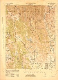
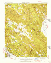
 1921 Mt. Vaca1921 Print · USGSCovers Napa County, including Fairfield, Vacaville, and other nearby areas
 - 1924 Map of Capay
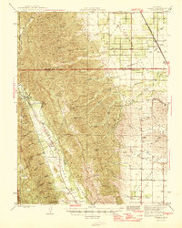
 1924 Capay1924 Print · USGSCovers Napa County, including Winters, Esparto, and other nearby areas
 - 1927 Map of Calistoga
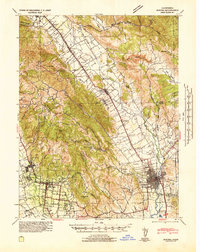
 1927 Calistoga1927 Print · USGSCovers Napa County, including Santa Rosa, Calistoga, and other nearby areas2 unique versions available
 - 1940 Map of Carquinez Strait, 1963 Print
 1940 Carquinez Strait1963 Print · USGSCovers Napa County, including Concord, Vallejo, and other nearby areas2 unique versions available
 - 1942 Map of Mare Island
 1942 Mare Island1942 Print · USGSCovers Napa County, including Vallejo, Richmond, and other nearby areas
 - 1942 Map of Carquinez
 1942 Carquinez1942 Print · USGSCovers Napa County, including Concord, Vallejo, and other nearby areas
 - 1942 Map of Sonoma
 1942 Sonoma1942 Print · USGSCovers Napa County, including Napa, Sonoma, and other nearby areas
 - 1942 Map of Mt. Vaca
 1942 Mt. Vaca1942 Print · USGSCovers Napa County, including Fairfield, Vacaville, and other nearby areas2 unique versions available
 - 1942 Map of St. Helena, 1966 Print
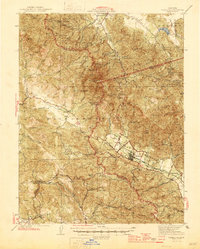
 1942 St. Helena1966 Print · USGSCovers Napa County, including Howell Mountain, Pope Valley, and other nearby areas
 - 1943 Map of Morgan Valley
 1943 Morgan Valley1943 Print · USGSCovers Napa County, including Knoxville, Yolo County, and other nearby areas
 - 1943 Map of Capay, 1945 Print
 1943 Capay1945 Print · USGSCovers Napa County, including Winters, Esparto, and other nearby areas
 - 1943 Map of Calistoga, 1955 Print
 1943 Calistoga1955 Print · USGSCovers Napa County, including Santa Rosa, Calistoga, and other nearby areas
 - 1944 Map of Santa Rosa
 1944 Santa Rosa1944 Print · USGSCovers Napa County, including Santa Rosa, Petaluma, and other nearby areas2 unique versions available
 - 1944 Map of Morgan Valley
 1944 Morgan Valley1944 Print · USGSCovers Napa County, including Knoxville, Yolo County, and other nearby areas2 unique versions available
 - 1945 Map of Capay
 1945 Capay1945 Print · USGSCovers Napa County, including Winters, Esparto, and other nearby areas
 - 1945 Map of Calistoga
 1945 Calistoga1945 Print · USGSCovers Napa County, including Santa Rosa, Calistoga, and other nearby areas2 unique versions available
 - 1945 Map of Rumsey
 1945 Rumsey1945 Print · USGSCovers Napa County, including Tancred, Guinda, and other nearby areas2 unique versions available
 - 1945 Map of St. Helena
 1945 St. Helena1945 Print · USGSCovers Napa County, including Howell Mountain, Pope Valley, and other nearby areas2 unique versions available
 - 1947 Map of Santa Rosa
 1947 Santa Rosa1947 Print · USGSCovers Napa County, including Santa Rosa, Concord, and other nearby areas
Showing maps 1-25 of 102
Top cities of Napa County
- Napa historical maps
- American Canyon historical maps
- Calistoga historical maps
- Yountville historical maps
Frequently asked questions
- What are the different types of historical maps available for Napa County?
- What is the oldest map of Napa County?
- Where can I purchase historical maps of Napa County for my home or office?
- Where can I download high-res historical maps of Napa County?
- Are there historical topographic maps available for Napa County?
- Is there historical aerial imagery available for Napa County?
- Where are historical maps of Napa County sourced from?