2020s Maps of Napa County, California
Explore 26 historic maps of Napa County from the 2020s. These maps offer a rare glimpse into what life looked like during the 2020s — showing old roads, neighborhoods, homes, and landmarks that have changed or disappeared over time.
Whether you're researching your family's past, planning a metal detecting trip, or studying how Napa County's landscape evolved across the 2020s, these high-resolution maps are a powerful tool for exploring the history of this region.
- Focus on a specific era: All maps on this page are from the 2020s, giving you a focused view of this time period.
- See what’s changed: Compare century-old streets, trails, and buildings to today's modern landscape using overlays and satellite layers.
- Research with precision: Use these maps for genealogy, historical research, land use analysis, or educational projects.
- View, download, or print: Maps are fully viewable online in high resolution, and can be downloaded or printed for your own records.
Start exploring Napa County's history through authentic maps from the 2020s. This is your window into the past.
Napa County, CA maps
(26)- 2021 Map of Kenwood, 2021 Print
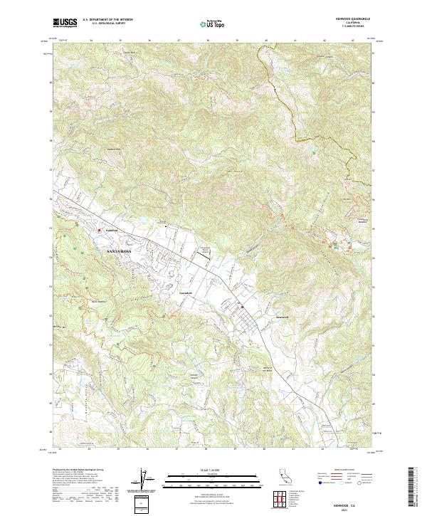 2021 Kenwood2021 Print · USGSSonoma County's eastern ridges and valley floors are captured here in the early twenty-first century as suburban development meets protected peaks. Researchers can identify local landmarks like the Pythian Home Cemetery, the historic Los Guilicos Warm Springs, and the Graywood Ranch Airport.
 - 2021 Map of Mount Saint Helena, 2021 Print
 2021 Mount Saint Helena2021 Print · USGSSonoma County's high ridges and thermal landscapes are shown here as they appeared in the early 2020s. Researchers can trace family names and local landmarks from Kellogg and Knights Valley to Evergreen Cem and The Geysers.
 - 2021 Map of Chiles Valley, 2021 Print
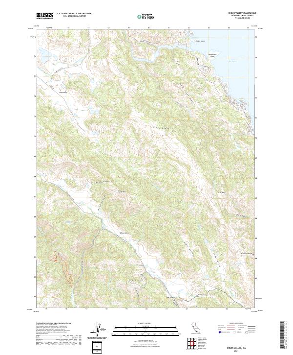 2021 Chiles Valley2021 Print · USGSNapa County's rugged eastern interior is documented here during the early twenty-first century, showing the intersection of deep valleys and rising peaks. Local historians can trace the relationship between agricultural lands in Chiles Valley and the shoreline of Lake Berryessa.
 - 2021 Map of Sonoma, 2021 Print
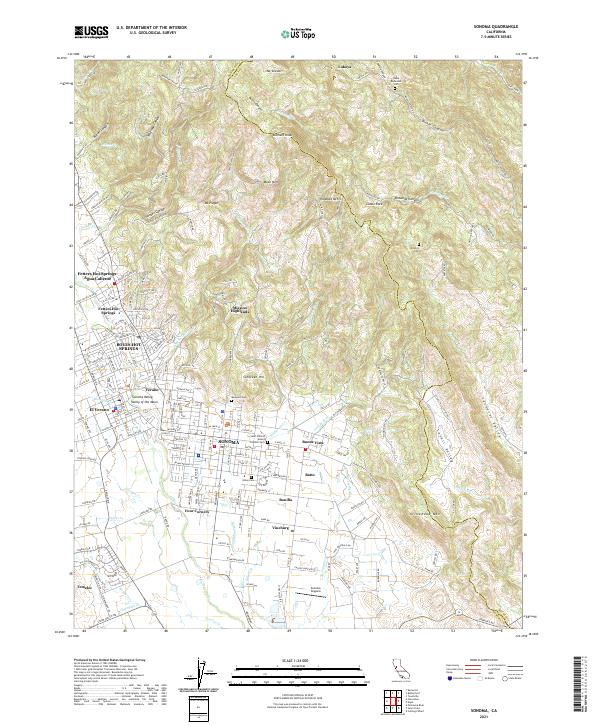 2021 Sonoma2021 Print · USGSSonoma and the surrounding Valley of the Moon are captured here in the early twenty-first century as the region's agricultural and resort heritage continues to evolve. Researchers can locate family sites at Mountain Cem or trace the development of legacy communities like Vineburg and El Verano.
 - 2021 Map of Walter Springs, 2021 Print
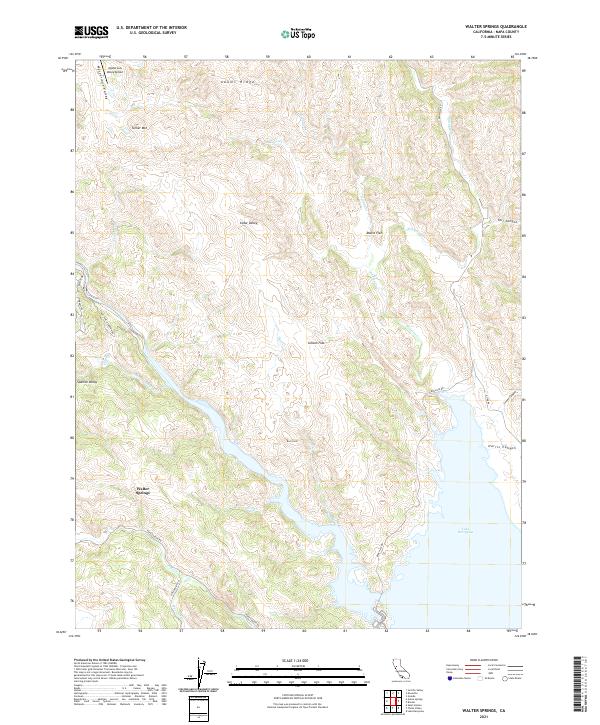 2021 Walter Springs2021 Print · USGSNapa County’s upland valleys and the northern shoreline of Lake Berryessa are captured here in the early twenty-first century. Genealogists and historians can trace the geography of isolated locales like Walter Springs, Moore Flat, and the curiously named Mysterious Valley.
 - 2021 Map of Monticello Dam, 2021 Print
 2021 Monticello Dam2021 Print · USGSThe interface of the coastal ranges and the valley floor comes into focus in this contemporary survey of the area around Winters. Local historians and genealogists can trace the rural landscape from the shores of Lake Berryessa to the heights of Edgar Peak and along the historic routes of Putah Creek.
 - 2021 Map of Guinda, 2021 Print
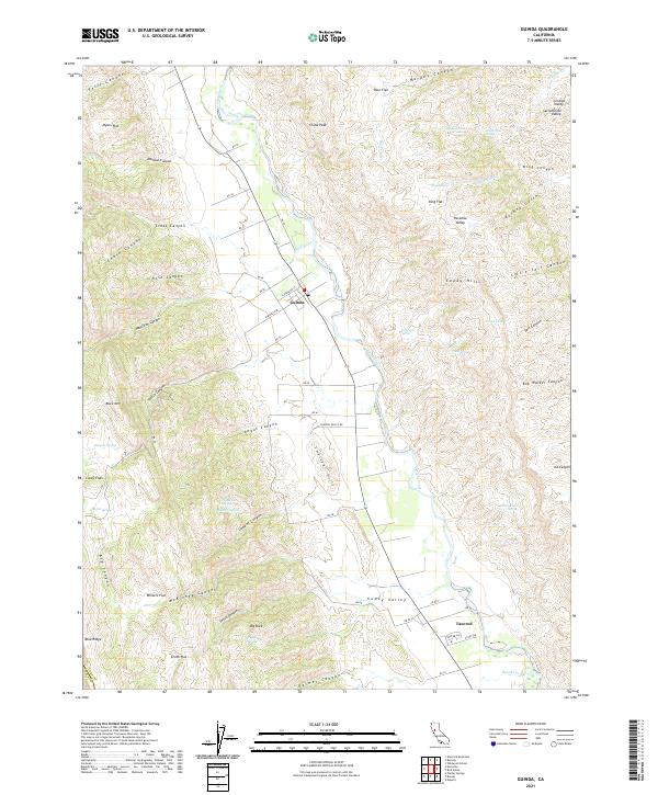 2021 Guinda2021 Print · USGSIn the northern Capay Valley during the early 2020s, the rural community of Guinda remains anchored by the waters of Cache Creek. Local researchers can trace family-named landmarks like Smith Flat and Casey Flats or identify remote springs such as DuBois Spring.
 - 2021 Map of Jericho Valley, 2021 Print
 2021 Jericho Valley2021 Print · USGSThe high interior valleys of Lake County are captured here in the early 21st century, showing a landscape of remote ridges and mountain springs. Researchers can trace historic access routes along Jerusalem Grade or locate family-named landmarks like Jim Davis Peak and Norman Springs.
 - 2021 Map of Mount George, 2021 Print
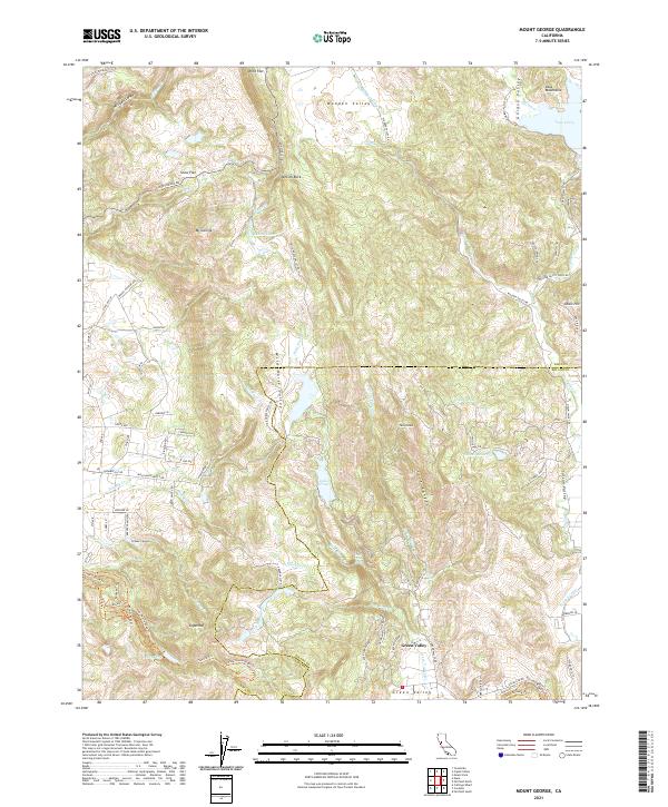 2021 Mount George2021 Print · USGSNapa and Solano Counties are mapped here in the modern era as a region of protected watersheds and rugged ridgelines. Researchers can trace intricate trail networks like the Bay Area Ridge Trail or locate landmarks such as Jenkins Rock and Green Valley Falls.
 - 2021 Map of Mount Vaca, 2021 Print
 2021 Mount Vaca2021 Print · USGSThe Vaca Mountains meet the Sacramento Valley floor in this recent survey of the Solano County foothills. Genealogists and hikers can trace the rural landscape around Bucktown, the heights of Mt Vaca, and the flight paths near Blake Sky Park.
 - 2021 Map of Mark West Springs, 2021 Print
 2021 Mark West Springs2021 Print · USGSThe foothills and canyons of Sonoma County are documented here in the early 2020s, showing the intersection of mountain terrain and rural settlements. Researchers can trace the winding paths of Petrified Forest Rd or locate landmarks like Mark West Springs and Lake Orth.
 - 2021 Map of Detert Reservoir, 2021 Print
 2021 Detert Reservoir2021 Print · USGSThe Lake and Napa County border country comes into sharp focus during this recent survey of the Mayacmas Mountains. Genealogists and historians can trace old access routes like the Oat Hill Mine Trl and Aetna Mine Rd near landmarks such as The Palisades.
 - 2021 Map of Sears Point, 2021 Print
 2021 Sears Point2021 Print · USGSThe Sonoma marshlands and San Pablo Bay shoreline come to life in this detailed recent survey. Genealogists and local historians can trace the foundations of Schellville, the remote outpost of Wingo, and the sprawling reaches of Skaggs Island.
 - 2021 Map of Aetna Springs, 2021 Print
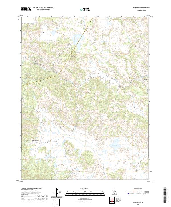 2021 Aetna Springs2021 Print · USGSNapa County’s northern interior hills are shown here in the early 2020s, highlighting the rural settlements and secluded valleys of the coastal range. Researchers can trace land use and water resources near Aetna Springs, Pope Valley, and the headwaters of Putah Creek.
 - 2021 Map of Lake Berryessa, 2021 Print
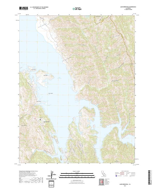 2021 Lake Berryessa2021 Print · USGSNapa County at the start of the 2020s shows a landscape dominated by the waters and complex shoreline of Lake Berryessa. Trace local history near Spanish Flat, find the Monticello Cem, or explore the steep drainages of Tin Can Canyon and Gosling Canyon.
 - 2021 Map of Saint Helena, 2021 Print
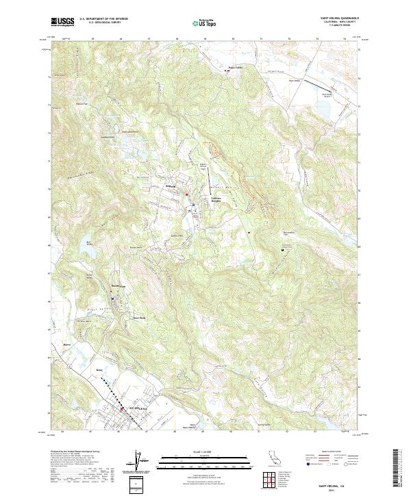 2021 Saint Helena2021 Print · USGSUpper Napa Valley and the surrounding mountains are detailed in this recent survey. Genealogists and local historians can trace the development of St. Helena, locate the Las Posadas Pioneer Cem, and explore the high-elevation campus of Pacific Union College.
 - 2021 Map of Capell Valley, 2021 Print
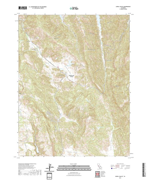 2021 Capell Valley2021 Print · USGSNapa County's eastern ridges and valleys are meticulously detailed in this early twenty-first-century survey. Local historians and land researchers can trace the roads and drainages around Moskowite Corner, Wooden Valley, and the Vaca Mountains.
 - 2021 Map of Napa, 2021 Print
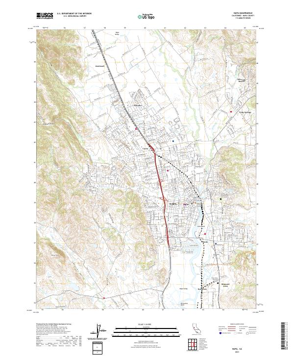 2021 Napa2021 Print · USGSThe Napa Valley is captured in this modern survey as a bustling hub of commerce and history. Trace the development of Napa and its surroundings near the Napa River, from Tulocay Cem to Napa Valley College.
 - 2021 Map of Knoxville, 2021 Print
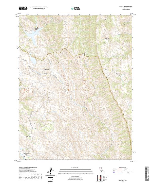 2021 Knoxville2021 Print · USGSThe Napa-Yolo county line area comes into focus in this recent survey of the ridgelands surrounding Knoxville. Researchers can trace the remote geography of Mysterious Valley, locate the Mysterious Valley Airport, and follow the winding course of Zim Zim Cr.
 - 2021 Map of Fairfield North, 2021 Print
 2021 Fairfield North2021 Print · USGSNorthern Solano County comes into focus in this 2021 study of the growing corridor between Fairfield and Vacaville. Genealogists can locate Fairmont Memorial Park and the Old Solano County Courthouse while tracing old crossroads like Mankas Corner.
 - 2021 Map of Calistoga, 2021 Print
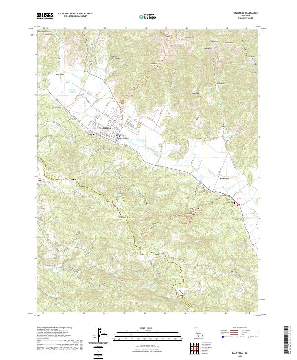 2021 Calistoga2021 Print · USGSNapa Valley's northern reaches are detailed here in the modern era, from the geothermal activity at Calistoga to the steep slopes of the Mayacmas Mountains. Researchers can locate family sites at the Calistoga Pioneer Cem or trace historic routes like the Old Lawley Toll Rd and Silverado Trl.
 - 2021 Map of Cuttings Wharf, 2021 Print
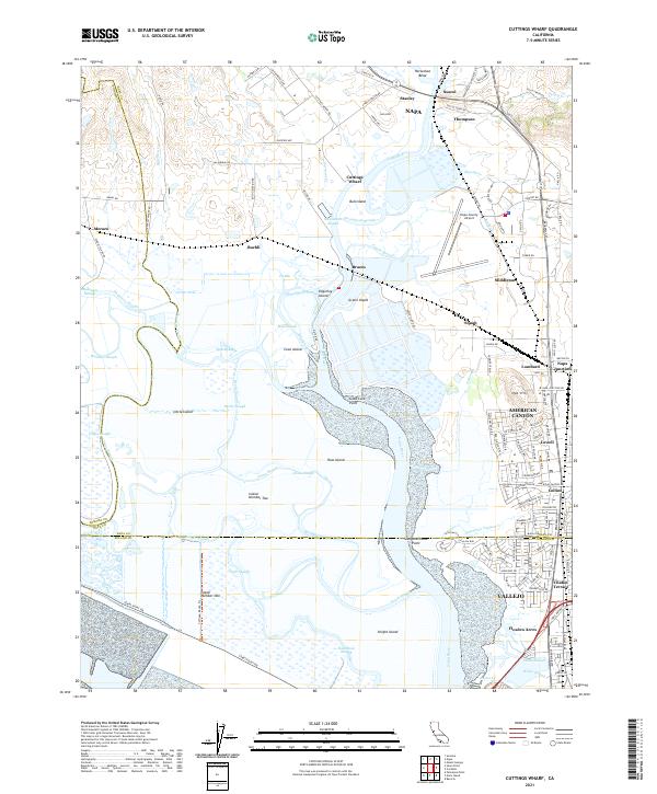 2021 Cuttings Wharf2021 Print · USGSThe marshes and tidal channels of the southern Napa Valley meet the growing industrial corridor of American Canyon. Trace the waterways of Napa River past Bull Island or find the early settlements at Cuttings Wharf and Buchli.
 - 2021 Map of Rutherford, 2021 Print
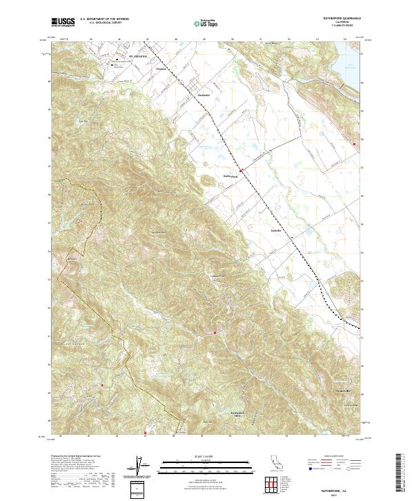 2021 Rutherford2021 Print · USGSThe heart of the Napa Valley is captured here in the early twenty-first century, spanning the famous corridor between St. Helena and Yountville. Researchers can trace property lines and landmarks like Zinfandel, Holy Cross Catholic Cem, and the terrain around Mt Veeder.
 - 2021 Map of Yountville, 2021 Print
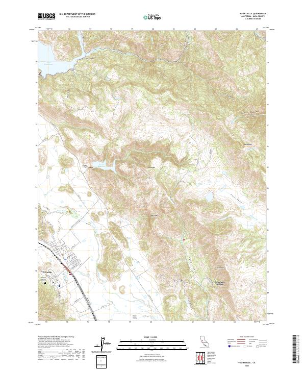 2021 Yountville2021 Print · USGSThe heart of the Napa Valley comes into focus in this recent survey, showing the established vineyards and rugged ridges of the Vaca Mountains. Local researchers can trace the roads around Yountville, find the Veterans Memorial Grove Cem, and explore the terrain of Stags Leap.
 - 2022 Map of Cordelia, 2022 Print
 2022 Cordelia2022 Print · USGSThe foothills of the Howell Mountains meet the expanding north bay communities in the early 2020s. Genealogists and historians can trace the development of Vallejo neighborhoods and find old landmarks like Elkhorn Peak, Cordelia, and the Terminal Reservoir.
Showing maps 1-25 of 26
Top cities of Napa County
- Napa historical maps
- American Canyon historical maps
- Calistoga historical maps
- Yountville historical maps
Frequently asked questions
- What are the different types of historical maps available for Napa County?
- What is the oldest map of Napa County?
- Where can I purchase historical maps of Napa County for my home or office?
- Where can I download high-res historical maps of Napa County?
- Are there historical topographic maps available for Napa County?
- Is there historical aerial imagery available for Napa County?
- Where are historical maps of Napa County sourced from?