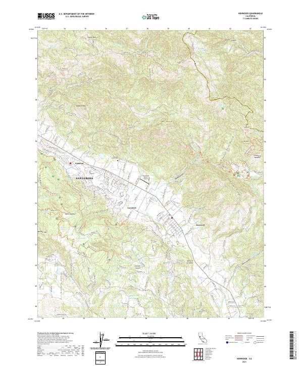
2021 Map of Kenwood
USGS Topo · Published 2021About this map
Sugarloaf Ridge dominates the eastern landscape of this Sonoma County survey, where the peaks of Mt Hood and Bald Mtn rise above the drainage of Sonoma Creek. The map documents a blend of residential growth and preserved terrain on the eastern edge of Santa Rosa, including the planned community of Oakmont and the historic Pythian Home Cemetery. The lower elevations reveal the geothermal and hydrological character of the region, featuring Los Guilicos Warm Springs and the ecologically significant Ledson Marsh.
Find a feature on this map
163 named features on this map. Tap any name to fly to it.
Don’t see what you’re looking for? This feature index may not catch every label — zoom into the map to look around manually.
Map Details
Editions of this 2021 Kenwood Map
This is the sole edition of this map. No revisions or reprints were ever made.
Other maps of this area

1902 · Napa
USGS Topo · 1:125,000

1916 · Santa Rosa
USGS Topo · 1:62,500

1927 · Calistoga
USGS Topo · 1:62,500

1942 · Sonoma
USGS Topo · 1:62,500

1942 · St. Helena
USGS Topo · 1:62,500

1943 · Calistoga
USGS Topo · 1:62,500

1944 · Santa Rosa
USGS Topo · 1:62,500

1945 · Calistoga
USGS Topo · 1:62,500

1945 · St. Helena
USGS Topo · 1:62,500

1947 · Santa Rosa
USGS Topo · 1:250,000