Old Maps of Yorba Linda, California
Explore 38 old maps of Yorba Linda, spanning from 1896 to today. These high-resolution historic maps reveal how streets, neighborhoods, landmarks, and natural features evolved over time — perfect for genealogy, metal detecting, research, and local history exploration.
What you can do with these maps:
- See how Yorba Linda changed over time: Compare historical maps to modern-day views to trace roads, homesites, rail lines & more.
- View detailed metadata: Each map includes creators, publishers, year, scale, and archive source.
- Overlay maps with satellite & LiDAR: Visualize the past alongside modern tools to explore terrain & human change.
- Trusted historical sources: Maps sourced from the USGS, Library of Congress, and other archives.
- Access maps your way: View online, download high-res files, or order prints for personal or research use.
Start exploring old maps of Yorba Linda to uncover forgotten places, hidden landmarks, and the deep history beneath your feet.
Yorba Linda, CA maps
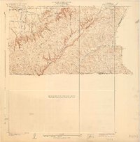
(38)- 1896 Map of Anaheim
 1896 Anaheim1896 Print · USGSCovers Yorba Linda, including Anaheim, Santa Ana, and other nearby areas
 - 1898 Map of Anaheim, 1899 Print
 1898 Anaheim1899 Print · USGSCovers Yorba Linda, including Anaheim, Santa Ana, and other nearby areas
 - 1901 Map of Southern California Sheet No. 1
 1901 Southern California Sheet No. 11901 Print · USGSCovers Yorba Linda, including Los Angeles, Long Beach, and other nearby areas11 unique versions available
 - 1901 Map of Anaheim
 1901 Anaheim1901 Print · USGSCovers Yorba Linda, including Anaheim, Santa Ana, and other nearby areas7 unique versions available
 - 1902 Map of Corona
 1902 Corona1902 Print · USGSCovers Yorba Linda, including Anaheim, Santa Ana, and other nearby areas7 unique versions available
 - 1904 Map of Southern California Sheet No. 1, 1905 Print
 1904 Southern California Sheet No. 11905 Print · USGSCovers Yorba Linda, including Los Angeles, Long Beach, and other nearby areas3 unique versions available
 - 1928 Map of La Brea
 1928 La Brea1928 Print · USGSCovers Yorba Linda, including Fullerton, Chino Hills, and other nearby areas3 unique versions available
 - 1932 Map of Orange
 1932 Orange1932 Print · USGSCovers Yorba Linda, including Anaheim, Santa Ana, and other nearby areas
 - 1933 Map of Prado
 1933 Prado1933 Print · USGSCovers Yorba Linda, including Anaheim, Ontario, and other nearby areas
 - 1935 Map of Olinda
 1935 Olinda1935 Print · USGSCovers Yorba Linda, including Anaheim, Fullerton, and other nearby areas
 - 1935 Map of Orange
 1935 Orange1935 Print · USGSCovers Yorba Linda, including Anaheim, Santa Ana, and other nearby areas2 unique versions available
 - 1941 Map of Prado
 1941 Prado1941 Print · USGSCovers Yorba Linda, including Anaheim, Ontario, and other nearby areas2 unique versions available
 - 1942 Map of Anaheim
 1942 Anaheim1942 Print · USGSCovers Yorba Linda, including Anaheim, Santa Ana, and other nearby areas2 unique versions available
 - 1942 Map of Corona, 1947 Print
 1942 Corona1947 Print · USGSCovers Yorba Linda, including Anaheim, Riverside, and other nearby areas2 unique versions available
 - 1943 Map of Corona
 1943 Corona1943 Print · USGSCovers Yorba Linda, including Anaheim, Riverside, and other nearby areas
 - 1947 Map of Santa Ana, 1949 Print
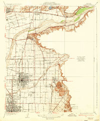
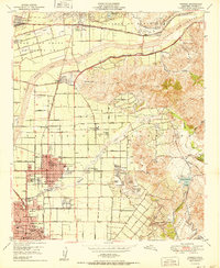
 1947 Santa Ana1949 Print · USGSCovers Yorba Linda, including San Diego, Anaheim, and other nearby areas
 - 1949 Map of Santa Ana
 1949 Santa Ana1949 Print · USGSCovers Yorba Linda, including San Diego, Anaheim, and other nearby areas
 - 1949 Map of Black Star Canyon, 1955 Print
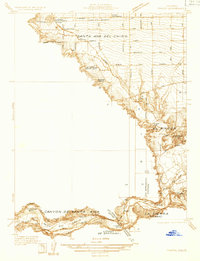
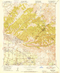
 1949 Black Star Canyon1955 Print · USGSCovers Yorba Linda, including Anaheim, Irvine, and other nearby areas2 unique versions available
 - 1949 Map of Orange, 1956 Print
 1949 Orange1956 Print · USGSCovers Yorba Linda, including Anaheim, Santa Ana, and other nearby areas
 - 1949 Map of Yorba Linda, 1957 Print
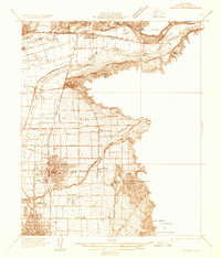
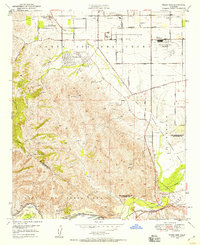
 1949 Yorba Linda1957 Print · USGSCovers Yorba Linda, including Anaheim, Fullerton, and other nearby areas2 unique versions available
 - 1949 Map of Prado Dam, 1958 Print
 1949 Prado Dam1958 Print · USGSCovers Yorba Linda, including Anaheim, Ontario, and other nearby areas2 unique versions available
 - 1950 Map of Prado Dam
 1950 Prado Dam1950 Print · USGSCovers Yorba Linda, including Anaheim, Ontario, and other nearby areas
 - 1950 Map of Yorba Linda
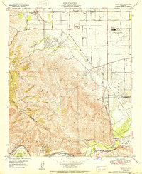
 1950 Yorba Linda1950 Print · USGSCovers Yorba Linda, including Anaheim, Fullerton, and other nearby areas
 - 1950 Map of Orange
 1950 Orange1950 Print · USGSCovers Yorba Linda, including Anaheim, Santa Ana, and other nearby areas
 - 1950 Map of Black Star Canyon
 1950 Black Star Canyon1950 Print · USGSCovers Yorba Linda, including Anaheim, Irvine, and other nearby areas
Showing maps 1-25 of 38
Top cities near Yorba Linda
- Anaheim historical maps
- Santa Ana historical maps
- Irvine historical maps
- Huntington Beach historical maps
- Ontario historical maps
- Garden Grove historical maps
See more
Top neighborhoods of Yorba Linda
Frequently asked questions
- What are the different types of historical maps available for Yorba Linda?
- What is the oldest map of Yorba Linda?
- Where can I purchase historical maps of Yorba Linda for my home or office?
- Where can I download high-res historical maps of Yorba Linda?
- Are there historical topographic maps available for Yorba Linda?
- Is there historical aerial imagery available for Yorba Linda?
- Where are historical maps of Yorba Linda sourced from?