1950s Maps of Placer County, California
Explore 61 historic maps of Placer County from the 1950s. These maps offer a rare glimpse into what life looked like during the 1950s — showing old roads, neighborhoods, homes, and landmarks that have changed or disappeared over time.
Whether you're researching your family's past, planning a metal detecting trip, or studying how Placer County's landscape evolved across the 1950s, these high-resolution maps are a powerful tool for exploring the history of this region.
- Focus on a specific era: All maps on this page are from the 1950s, giving you a focused view of this time period.
- See what’s changed: Compare century-old streets, trails, and buildings to today's modern landscape using overlays and satellite layers.
- Research with precision: Use these maps for genealogy, historical research, land use analysis, or educational projects.
- View, download, or print: Maps are fully viewable online in high resolution, and can be downloaded or printed for your own records.
Start exploring Placer County's history through authentic maps from the 1950s. This is your window into the past.
Placer County, CA maps
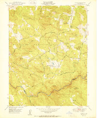
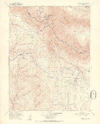
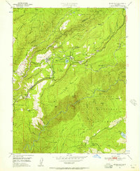
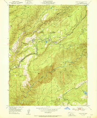
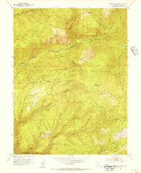
(61)- 1950 Map of Greenwood
 1950 Greenwood1950 Print · USGSThe California Gold Country near the El Dorado and Placer county line was undergoing significant change in the mid-twentieth century. Trace the legacy of mining through sites like Spanish Dry Diggings, Grit Mine, and the early reservoir development at Applegate.
 - 1950 Map of Wolf
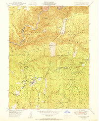
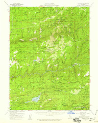
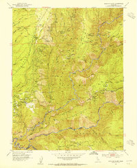
 1950 Wolf1950 Print · USGSThe Nevada and Placer County borderlands are captured here in the mid-twentieth century as military and agricultural interests shared the landscape. Researchers can trace the sprawling Camp Beale Military Reservation, the remote Pine Hill Mine, and family sites like Cranston Ranch.2 unique versions available
 - 1950 Map of Georgetown
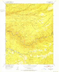
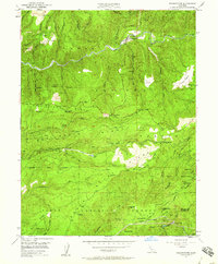
 1950 Georgetown1950 Print · USGSThe Mother Lode country north of Placerville appears here in the late 1940s, highlighting a landscape shaped by decades of mining. Researchers can trace historic sites like African Bar, find the Canyon Creek School, and locate mines such as the Josephine Mine.
 - 1950 Map of Lake Combie
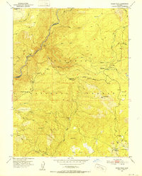
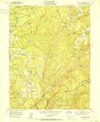
 1950 Lake Combie1950 Print · USGSThe Nevada and Placer County line comes alive in the late 1940s, showing a landscape defined by water engineering and pioneer history. You can trace the Probable Route of Donner Party near Lake Combie or locate the Stockton Hill Mine and Limekiln Sch.2 unique versions available
 - 1950 Map of Devil Peak, 1952 Print
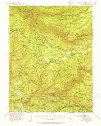
 1950 Devil Peak1952 Print · USGSThe deep canyons of the Sierra Nevada are surveyed here at mid-century as the gold-mining era gives way to forest management. You can trace early industrial footprints including the Dismantled Railroad and several inactive sites like the Clydesdale Mine and Pigeon Roost Mine.7 unique versions available
 - 1950 Map of Robbs Peak, 1952 Print
 1950 Robbs Peak1952 Print · USGSThe high Sierra backcountry of El Dorado County is documented here at mid-century, before significant modern development altered these forest drainages. Researchers can locate remote outposts like Uncle Toms Cabin, the Robbs Peak Lookout, and the historic Georgetown Divide.6 unique versions available
 - 1950 Map of Tunnel Hill, 1952 Print
 1950 Tunnel Hill1952 Print · USGSEl Dorado County timber and mining country come to life in the early fifties as the region's resource-based economy matured. Trace family-named landmarks and old extraction sites like Barton Cabin, the Kenna Mine, and the fire lookout at Bald Mtn Lookout.7 unique versions available
 - 1950 Map of Colfax, 1953 Print
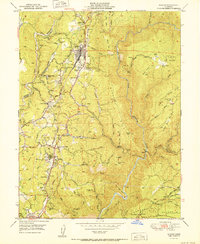
 1950 Colfax1953 Print · USGSPlacer and Nevada Counties are shown here during the early post-war years, as the Mother Lode's industrial footprint remained clearly visible. Genealogists and historians can trace the Southern Pacific line through historic sites like Illinoistown and active communities such as Foresthill and Weimar.4 unique versions available
 - 1950 Map of Rio Linda, 1955 Print
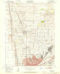
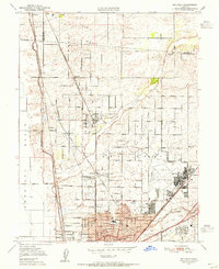 1950 Rio Linda1955 Print · USGSNorthern Sacramento at mid-century reveals the growth of Rio Linda and the strategic footprint of the military. Trace the 1950s landscape of McClellan Field, the campus of Grant Tech College, and the rail lines of the Sacramento Northern RR.
 - 1950 Map of Saddle Mountain, 1955 Print
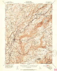
 1950 Saddle Mountain1955 Print · USGSEl Dorado County in the 1950s was a landscape defined by its river forks, timber camps, and deep-canyon gold mines. Genealogists and researchers can trace the locations of family-held properties like Bacchi Ranch and Morton Ranch or the remote Mosquito District School.5 unique versions available
 - 1950 Map of Dutch Flat, 1957 Print
 1950 Dutch Flat1957 Print · USGSThe Gold Country's high ridges and deep canyons are captured here in the mid-1950s as the modern highway began to follow the old emigrant trails. Genealogists and historians can trace the legacy of hydraulic mining through sites like Liberty Hill Diggings and find local landmarks such as the Gold Run Sch and Camel's Hump LO.8 unique versions available
 - 1950 Map of Alleghany, 1959 Print
 1950 Alleghany1959 Print · USGSThe Sierra Nevada gold fields appear in high detail during the mid-fifties, showing the massive hydraulic scars and active mining camps of the Yuba River forks. Genealogists and historians can locate vanished settlements like Moores Flat or trace the extensive Malakoff Diggings and Alpha Diggings.4 unique versions available
 - 1950 Map of Washington, 1960 Print
 1950 Washington1960 Print · USGSGold mining and early transit routes dominate this mid-century view of the Sierra Nevada foothills. Trace the legacy of the hydraulic era at Alpha Diggings, locate the historic Donner Trail, and find remote outposts like the Zeibright Mine.5 unique versions available
 - 1951 Map of Chicago Park
 1951 Chicago Park1951 Print · USGSGold Country settlement and industrial heritage are captured here in the early fifties. Genealogists and researchers can trace the Donner Trail, locate the Bear River School, and find old mines like You Bet and Red Dog.2 unique versions available
 - 1951 Map of Dutch Flat
 1951 Dutch Flat1951 Print · USGSThe Sierra Nevada foothills are shown here in the early fifties, detailing a landscape shaped by hydraulic mining and the railroad. Genealogists and historians can trace the Southern Pacific Railroad through Dutch Flat, Gold Run, and the Little York Diggings.
 - 1951 Map of Colfax
 1951 Colfax1951 Print · USGSMid-century Placer County is defined by the rail corridor and deep river canyons of the Sierra foothills. Genealogists can trace family names at Spring Garden Sch or locate mining sites like Rising Sun Mine and the Illinoistown (Site).2 unique versions available
 - 1951 Map of Foresthill
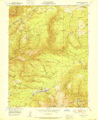 1951 Foresthill1951 Print · USGSIn the Gold Country of the 1950s, the Sierra Nevada ridges were defined by decades of mining and the timber industry. Researchers can trace the extensive Placer Diggings and historic claims like the Baltimore Mine, Mayflower Mine, and Morning Star Mine.
 - 1951 Map of Camp Far West
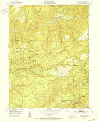
 1951 Camp Far West1951 Print · USGSYuba and Placer counties are shown in the early fifties as the military and ranching economy shaped the Bear River valley. Researchers can trace the Spenceville (Site), the Dairy Farm Mine, and the Lofton Cem.
 - 1951 Map of Washington
 1951 Washington1951 Print · USGSThe South Fork Yuba River and its gold-mining legacy are captured here in the mid-twentieth century. Genealogists can trace early habitation at the Washington townsite and former settlements like Relief or the Lowell Hill (Site).2 unique versions available
 - 1951 Map of Rio Linda
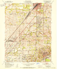
 1951 Rio Linda1951 Print · USGSSacramento County's northern outskirts undergo a period of post-war growth as military installations and suburban neighborhoods expand into the valley. Researchers can trace the development of McClellan Field, find family roots at Grant Mem Park, or follow the historic Sacramento Northern rail line.
 - 1951 Map of Citrus Heights, 1952 Print
 1951 Citrus Heights1952 Print · USGSNortheast of Sacramento in the early fifties, the landscape was quickly evolving from agricultural ranch lands into bustling suburbs. Genealogists and historians can trace the foundations of Citrus Heights through its early schools like Sylvan Sch and the industrial Dredge Tailings along the American River.3 unique versions available
 - 1952 Map of Westville
 1952 Westville1952 Print · USGSPlacer County's gold-mining and timber heartland is captured here in the early fifties, following the high ridges above the North Fork American River. Researchers can trace old operations like the Herman Mine and locate historic sites such as Damascus (Site) or the Forks House (Site).8 unique versions available
 - 1952 Map of Greek Store, 1954 Print
 1952 Greek Store1954 Print · USGSMid-century Placer County is revealed as a dense network of remote mining claims and high Sierra outposts. Genealogists and historians can trace defunct settlements at Star Town or locate family-named mines like Milletts Defeat and McKinley Mine.4 unique versions available
 - 1952 Map of Duncan Peak, 1954 Print
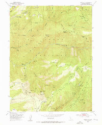
 1952 Duncan Peak1954 Print · USGSThe high ridges of the Tahoe National Forest come alive in the early fifties, detailing a rugged landscape of mining tunnels and fire lookouts. Trace historical gold operations at Secret House Mine or Golden Fleece Tunnel, and locate remote points like Duncan Peak Lookout.8 unique versions available
 - 1952 Map of Michigan Bluff, 1954 Print
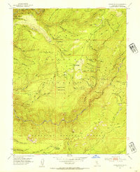
 1952 Michigan Bluff1954 Print · USGSThe Placer County gold country is surveyed here during the mid-twentieth century, revealing a landscape defined by deep river canyons and hydraulic mining legacy. Genealogists and historians can trace old claims like the Golden Gate Mine, locate the Cemetery at Michigan Bluff, and find remote locations like Maintop.7 unique versions available
Showing maps 1-25 of 61
Top cities of Placer County
- Roseville historical maps
- Rocklin historical maps
- Lincoln historical maps
- Auburn historical maps
- Loomis historical maps
- Meadow Vista historical maps
See more
Frequently asked questions
- What are the different types of historical maps available for Placer County?
- What is the oldest map of Placer County?
- Where can I purchase historical maps of Placer County for my home or office?
- Where can I download high-res historical maps of Placer County?
- Are there historical topographic maps available for Placer County?
- Is there historical aerial imagery available for Placer County?
- Where are historical maps of Placer County sourced from?