1950s Maps of San Benito County, California
Explore 25 historic maps of San Benito County from the 1950s. These maps offer a rare glimpse into what life looked like during the 1950s — showing old roads, neighborhoods, homes, and landmarks that have changed or disappeared over time.
Whether you're researching your family's past, planning a metal detecting trip, or studying how San Benito County's landscape evolved across the 1950s, these high-resolution maps are a powerful tool for exploring the history of this region.
- Focus on a specific era: All maps on this page are from the 1950s, giving you a focused view of this time period.
- See what’s changed: Compare century-old streets, trails, and buildings to today's modern landscape using overlays and satellite layers.
- Research with precision: Use these maps for genealogy, historical research, land use analysis, or educational projects.
- View, download, or print: Maps are fully viewable online in high resolution, and can be downloaded or printed for your own records.
Start exploring San Benito County's history through authentic maps from the 1950s. This is your window into the past.
San Benito County, CA maps
(25)- 1954 Map of Prunedale, 1956 Print
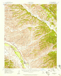
 1954 Prunedale1956 Print · USGSMonterey County's coastal wetlands and canyons are captured here in the mid-1950s, showing the early footprints of rural settlements. Researchers can trace land grant boundaries and local landmarks like Elkhorn Slough, the Southern Pacific line, and Prunedale.6 unique versions available
 - 1954 Map of Three Sisters, 1956 Print
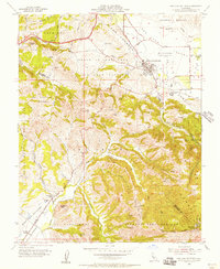
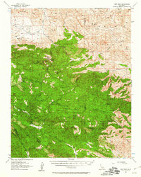
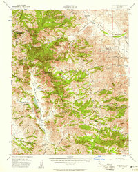
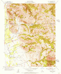 1954 Three Sisters1956 Print · USGSSan Benito and Santa Clara counties meet along the rugged ridgelines of the Diablo Range in the mid-1950s. Genealogists and local historians can trace legacy landholdings and rural landmarks like the Fairview Sch, Hawkins Ranch, and Rancho Las Cimas.5 unique versions available
 - 1955 Map of Santa Cruz
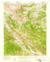
 1955 Santa Cruz1955 Print · USGSCoastal Monterey Bay and the fertile Salinas Valley are captured here during the post-war expansion of the mid-fifties. Researchers can trace the era's rail-and-road network via the Southern Pacific lines and find landmarks like Fort Ord or the Lonoak School.
 - 1955 Map of Hollister, 1956 Print
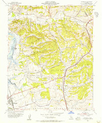
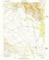
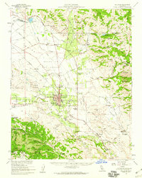
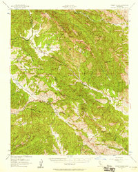
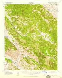
 1955 Hollister1956 Print · USGSHollister and the surrounding San Benito valley floor are captured here in the mid-fifties, just as the local community was expanding. Researchers can trace the Southern Pacific rail lines, the old San Benito County H S and Jr College, and early mountain roads through the San Andreas Rift Zone.5 unique versions available
 - 1955 Map of Chittenden, 1956 Print
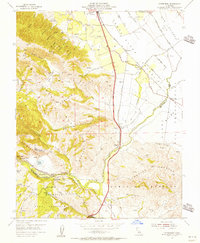 1955 Chittenden1956 Print · USGSThe junction of Santa Clara, Santa Cruz, and San Benito counties comes alive in this mid-fifties study of the Pajaro River corridor. Researchers can trace the Southern Pacific rail line through Pajaro Gap to find early settlements like Sargent and Chittenden.10 unique versions available
 - 1955 Map of Tres Pinos, 1956 Print
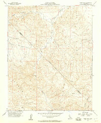
 1955 Tres Pinos1956 Print · USGSSan Benito County ranchlands and rural valleys come into focus during the mid-1950s as agriculture expanded along the local river systems. Genealogists and historians can locate family-named landmarks like Indart Ranch and a network of district schoolhouses including Southside Sch and Enterprise Sch.4 unique versions available
 - 1955 Map of Watsonville East, 1956 Print
 1955 Watsonville East1956 Print · USGSThe fertile Pajaro Valley and southern Santa Cruz Mountains are seen here in the mid-fifties, centered on a vital agricultural and rail corridor. Genealogists and local historians can trace family sites near Johnston Corner, the Pajaro Valley Memorial Park, and the Southern Pacific hub at Watsonville Junction.6 unique versions available
 - 1955 Map of San Felipe, 1956 Print
 1955 San Felipe1956 Print · USGSThe San Benito agricultural landscape is captured here in the mid-fifties, showing the rural expanses between the Santa Clara county line and the Hollister Valley. Genealogists can locate family-named landmarks like Hudner and school sites such as Pacheco Sch or Ausaymas Sch.4 unique versions available
 - 1955 Map of San Juan Bautista, 1956 Print
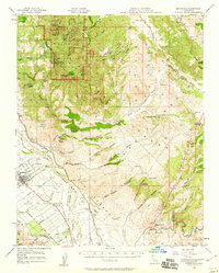
 1955 San Juan Bautista1956 Print · USGSSan Juan Bautista at the height of the mid-fifties is captured here along the shifting San Andreas Rift Zone. Researchers can trace the layout of the Mission, local school sites like Lagunita Sch, and the industry of the massive Cement Plant.5 unique versions available
 - 1955 Map of Monocline Ridge, 1957 Print
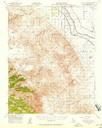
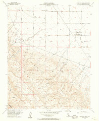 1955 Monocline Ridge1957 Print · USGSFresno and San Benito counties meet along the high desert crests of the mid-1950s California interior. Researchers can trace the development of the San Joaquin Valley floor from the Chaney Pumping Station to the remote outposts of Freeman Ranch and Ciervo Hill.4 unique versions available
 - 1955 Map of Soledad, 1957 Print
 1955 Soledad1957 Print · USGSThe Salinas River valley in the mid-1950s reveals a landscape of growing towns and institutional landmarks. Researchers can trace the layout of Soledad, locate the Mission Soledad, and explore local school sites like Mission Union School.4 unique versions available
 - 1955 Map of Hollister, 1960 Print
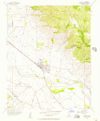
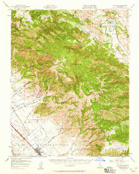
 1955 Hollister1960 Print · USGSSan Benito County in the mid-fifties is captured here during a time of agricultural prominence and steady town growth. Genealogists and local historians can trace the foundations of Hollister while locating rural landmarks like San Justo Sch and the Indart Ranch.2 unique versions available
 - 1956 Map of New Idria
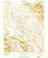
 1956 New Idria1956 Print · USGSThe Diablo Range's remote mining country is captured here in the mid-fifties, centered on the settlement of New Idria. Genealogists and historians can trace the industrial footprint of the San Carlos Mine, Alpine Mine, and the Jade Mill.3 unique versions available
 - 1956 Map of Tumey Hills, 1957 Print
 1956 Tumey Hills1957 Print · USGSThe dry hills of San Benito and Fresno counties are captured here in the mid-fifties, showing a landscape of resource exploration and seasonal creeks. Researchers can trace early industrial markers like Oil Wells, the Gaging Station on Panoche Creek, and a lonely Prospect among the Tumey Hills.4 unique versions available
 - 1956 Map of Panoche Valley, 1957 Print
 1956 Panoche Valley1957 Print · USGSMid-century San Benito and Fresno counties come alive in this map of ranchlands and remote mining outposts. Researchers can trace family-named sites and early industry at Mercey Hot Springs, the Panoche School, and the Juniper Mine.2 unique versions available
 - 1956 Map of San Ardo, 1958 Print
 1956 San Ardo1958 Print · USGSThe Salinas River valley and the Southern Pacific rail corridor thrive in the mid-fifties alongside the rugged Diablo Range foothills. Researchers can trace family roots in San Ardo and Docas or locate landmarks like the San Ardo Church and the Airline Highway.2 unique versions available
 - 1956 Map of Quien Sabe, 1958 Print
 1956 Quien Sabe1958 Print · USGSThe Diablo Range cattle country comes alive in the mid-1950s, showing a landscape of remote valleys and family-run grazing operations. Genealogists and historians can trace the foundations of the Quien Sabe Ranch and find landmarks like Schoolhouse Ridge and Haley Ranch.2 unique versions available
 - 1956 Map of Ortigalita Peak, 1958 Print
 1956 Ortigalita Peak1958 Print · USGSThe western San Joaquin Valley comes into focus in the mid-1950s as massive irrigation works reshaped the agricultural landscape. Genealogists and historians can trace family-run operations like Gaston Bide Ranch or find local landmarks like the Charleston School and Cotton Gin.2 unique versions available
 - 1956 Map of Priest Valley, 1958 Print
 1956 Priest Valley1958 Print · USGSMid-century Monterey County ranching country is captured here along the steep ridges of the Diablo Range. Researchers can trace remote pioneer legacies through sites like the Warthan Cemetery, the San Lorenzo School, and the winding Mustang Grade mountain road.2 unique versions available
 - 1957 Map of Santa Cruz
 1957 Santa Cruz1957 Print · USGSCentral California comes into sharp focus during the late fifties, from the fog-swept Monterey Bay to the sun-drenched San Joaquin Valley. Genealogists and historians can trace the mid-century footprints of Fort Ord Military Reservation, the Southern Pacific line, and the historic streets of San Juan Bautista.
 - 1957 Map of Hernandez Valley, 1958 Print
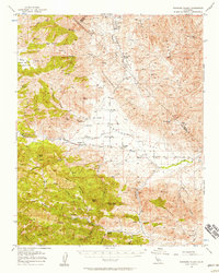
 1957 Hernandez Valley1958 Print · USGSThe rural San Benito and Monterey county line comes into focus in the 1950s, showing a rugged landscape of ranching and early oil exploration. Genealogists and historians can locate family holdings like De Alvarez Ranch, the isolated Bitterwater Tully School, and the Firefly Mine.2 unique versions available
 - 1957 Map of San Benito, 1958 Print
 1957 San Benito1958 Print · USGSThe Diablo Range interior in the late fifties was a network of remote ranches and isolated schoolhouses. Genealogists and historians can trace the foundations of the San Benito community and find landmarks like Cottonwood School and the Bradford Mine.2 unique versions available
 - 1957 Map of Greenfield, 1959 Print
 1957 Greenfield1959 Print · USGSThe Salinas Valley and Gabilan Range meet in this late 1950s survey, showing the agricultural expansion around Greenfield. Genealogists and historians can trace family-named sites like Mathews Ranch and old rail stops at Metz or Coburn along the Southern Pacific.3 unique versions available
 - 1957 Map of Gonzales, 1959 Print
 1957 Gonzales1959 Print · USGSCoastal range ranching and Salinas Valley agriculture meet in the late 1950s near the border of Monterey and San Benito counties. Researchers can trace the rail corridor of the Southern Pacific through Gonzales or locate rural landmarks like Cienega School and Paicines Ranch.2 unique versions available
 - 1958 Map of Santa Cruz
 1958 Santa Cruz1958 Print · USGSCoastal California and the central valleys are shown during the mid-fifties, capturing a landscape of massive military reserves and vital rail arteries. Genealogists and historians can trace the Southern Pacific line through Salinas or explore the early footprints of the Fort Ord Military Reservation and San Juan Bautista.2 unique versions available
End of results
Showing maps 1-25 of 25
Top cities of San Benito County
Frequently asked questions
- What are the different types of historical maps available for San Benito County?
- What is the oldest map of San Benito County?
- Where can I purchase historical maps of San Benito County for my home or office?
- Where can I download high-res historical maps of San Benito County?
- Are there historical topographic maps available for San Benito County?
- Is there historical aerial imagery available for San Benito County?
- Where are historical maps of San Benito County sourced from?