2020s Maps of San Benito County, California
Explore 39 historic maps of San Benito County from the 2020s. These maps offer a rare glimpse into what life looked like during the 2020s — showing old roads, neighborhoods, homes, and landmarks that have changed or disappeared over time.
Whether you're researching your family's past, planning a metal detecting trip, or studying how San Benito County's landscape evolved across the 2020s, these high-resolution maps are a powerful tool for exploring the history of this region.
- Focus on a specific era: All maps on this page are from the 2020s, giving you a focused view of this time period.
- See what’s changed: Compare century-old streets, trails, and buildings to today's modern landscape using overlays and satellite layers.
- Research with precision: Use these maps for genealogy, historical research, land use analysis, or educational projects.
- View, download, or print: Maps are fully viewable online in high resolution, and can be downloaded or printed for your own records.
Start exploring San Benito County's history through authentic maps from the 2020s. This is your window into the past.
San Benito County, CA maps
(39)- 2021 Map of Mariposa Peak, 2021 Print
 2021 Mariposa Peak2021 Print · USGSThe Diablo Range heights at the meeting of Merced and San Benito counties are captured here in the early twenty-first century. Researchers can trace remote mountain passes like Frenchs Pass, the open terrain of Quien Sabe Valley, and landmarks like Henrietta Peak.
 - 2021 Map of Tres Pinos, 2021 Print
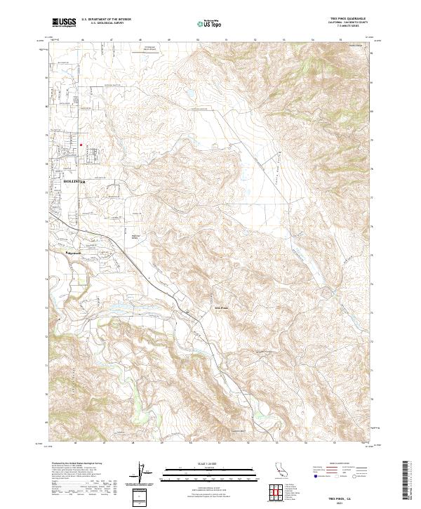 2021 Tres Pinos2021 Print · USGSThe outskirts of Hollister and the Santa Ana Valley appear here in the early 2020s, showing the intersection of suburban growth and ranching tradition. Researchers can trace the courses of the San Benito River and Tres Pinos Cr or locate landmarks like the Christensen Ranch Airport and Swanson Bluff.
 - 2021 Map of Ruby Canyon, 2021 Print
 2021 Ruby Canyon2021 Print · USGSThe high country of the Merced and San Benito county line is captured in this recent survey of the Diablo Range. Researchers can trace remote ranching routes like Mc Creery Ranch Rd and landmark elevations such as Ortigalita Ridge.
 - 2021 Map of Three Sisters, 2021 Print
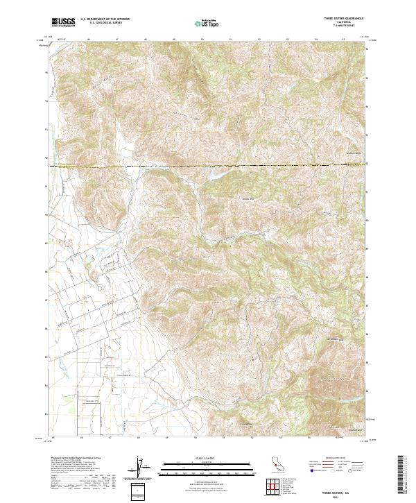 2021 Three Sisters2021 Print · USGSThe Diablo Range heights along the Santa Clara and San Benito county line come into focus during the early twenty-first century. Researchers can trace remote ridgelines and rural access routes like Tevis Trl, Lone Tree Rd, and the peaks of the Three Sisters.
 - 2021 Map of San Felipe, 2021 Print
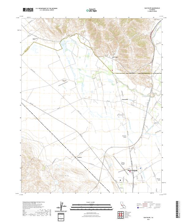 2021 San Felipe2021 Print · USGSThe northern reaches of San Benito County appear here in the early 2020s, where the agricultural valley floor meets the rising Diablo Range. Researchers can trace the water systems of San Felipe Lake and Tequisquita Slough or locate rural outposts like Dunneville and Hudner.
 - 2021 Map of Mount Johnson, 2021 Print
 2021 Mount Johnson2021 Print · USGSThe Gabilan Range and its high valleys are captured here in the early twenty-first century along the Monterey-San Benito border. Trace the remote network of family-named landmarks and canyon passes, from Mt Johnson and Gloria Lake to the winding La Gloria Rd.
 - 2021 Map of Panoche Pass, 2021 Print
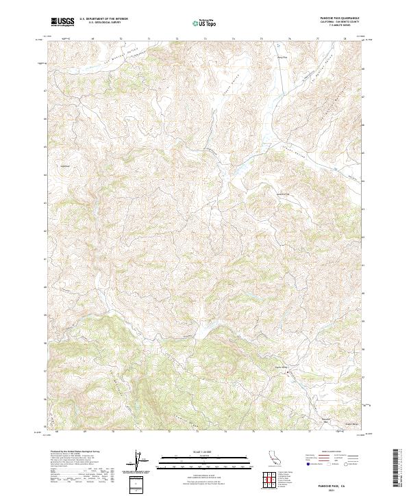 2021 Panoche Pass2021 Print · USGSSan Benito County's high ridges and ranch lands are documented here in the early twenty-first century. Researchers can trace remote transit routes like Panoche Rd and identify family-named landmarks including Payne Valley and Lankford Flat.
 - 2021 Map of Prunedale, 2021 Print
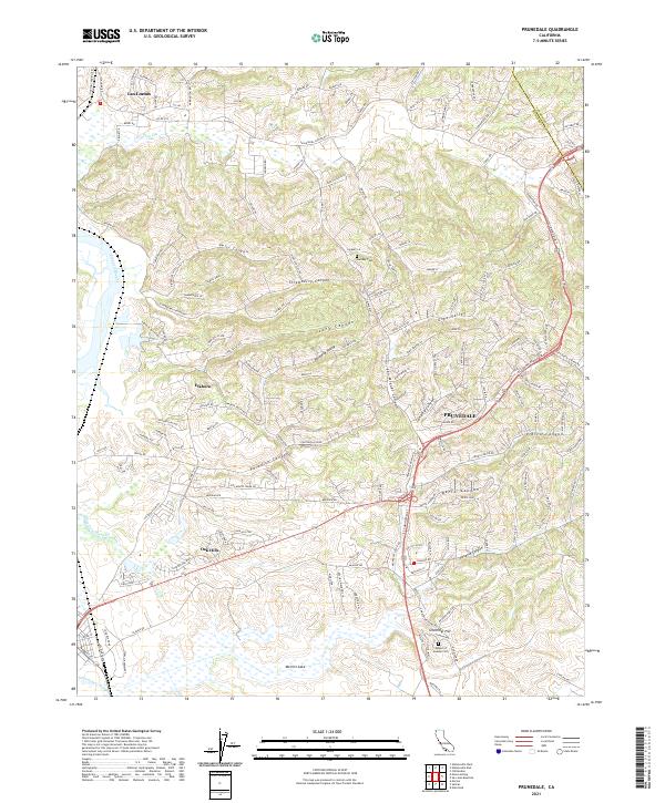 2021 Prunedale2021 Print · USGSNorthern Monterey County in the early twenty-first century reveals a landscape of tidal sloughs and canyon-carved hillsides. Genealogists and local historians can trace the roads around Prunedale, Hambey Cem, and the wetlands of Elkhorn Slough.
 - 2021 Map of Quien Sabe Valley, 2021 Print
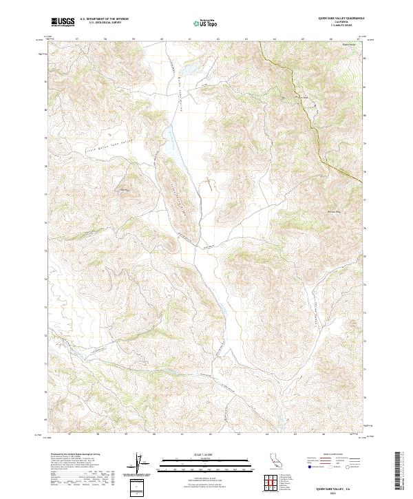 2021 Quien Sabe Valley2021 Print · USGSQuien Sabe Valley is shown here in the 2020s, highlighting the enduring ranching landscape of the Diablo Range. Researchers can trace historical routes like Quien Sabe Ranch Rd and find family-named landmarks such as Schoolhouse Ridge and Cibo Peak.
 - 2021 Map of Topo Valley, 2021 Print
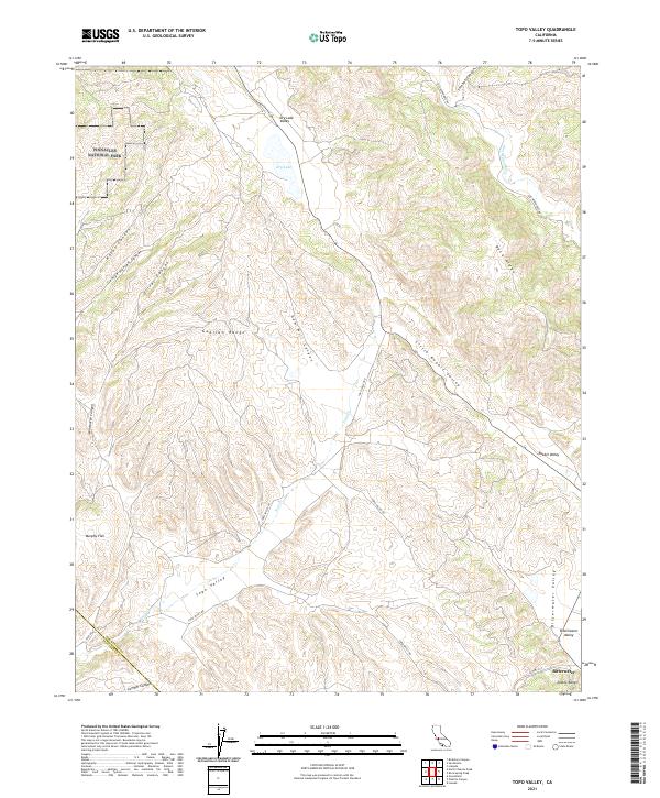 2021 Topo Valley2021 Print · USGSSan Benito County is shown here in its modern rural character, dominated by the ridges and canyons of the Coast Ranges. Genealogists and local historians can trace the remote settlement of Bitterwater and landmarks like Murphy Flat or Rabbit Valley.
 - 2021 Map of Cherry Peak, 2021 Print
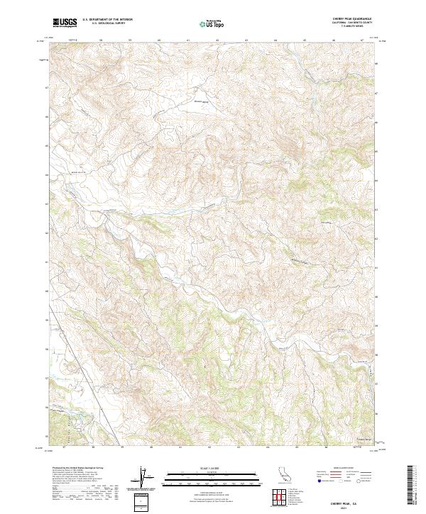 2021 Cherry Peak2021 Print · USGSSan Benito County ranch lands are documented here in the early twenty-first century, showcasing the terrain between the northern Gabilan Range and Diablo Range. Trace local landmarks like Cherry Peak and the drainage of Tres Pinos Cr.
 - 2021 Map of Watsonville East, 2021 Print
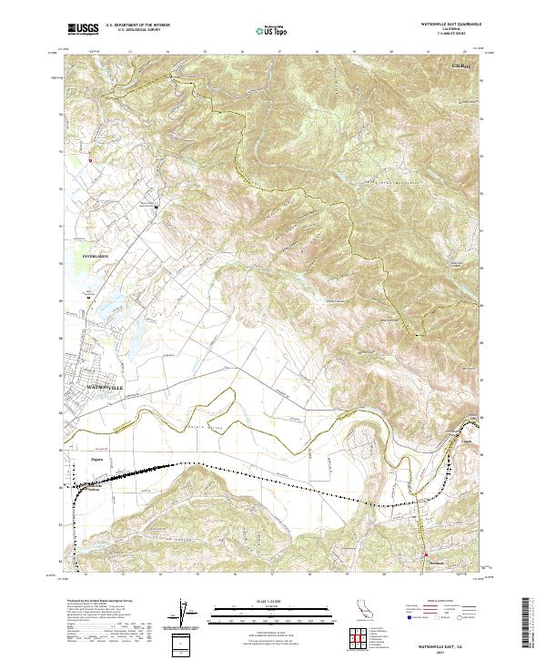 2021 Watsonville East2021 Print · USGSThe fertile Pajaro Valley and southern Santa Cruz Mountains meet in this recent survey of the tri-county border area. Researchers can trace land use patterns near Watsonville Junction or locate family sites at Saint Francis Cem and Aromas.
 - 2021 Map of San Benito, 2021 Print
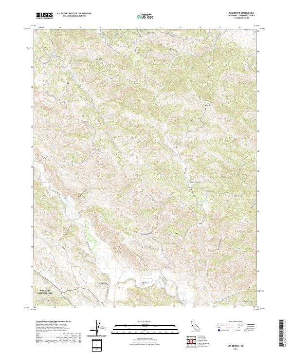 2021 San Benito2021 Print · USGSSan Benito and the high country of the Central Coast are captured here in the early twenty-first century. Researchers can trace the rugged topography of Pinnacles National Park and follow historic routes along Airline Hwy and the San Benito River.
 - 2021 Map of Pinalito Canyon, 2021 Print
 2021 Pinalito Canyon2021 Print · USGSMonterey and San Benito counties meet in this rugged canyon country as it appeared in 2021. Researchers can trace the winding course of San Lorenzo Cr and locate historical travel routes like Bitterwater Rd and Topo Valley Rd.
 - 2021 Map of San Juan Bautista, 2021 Print
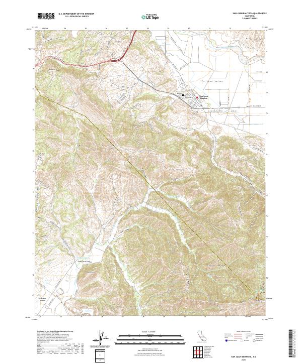 2021 San Juan Bautista2021 Print · USGSSan Juan Bautista and the rugged Gabilan Range are captured here in the early 2020s, showing the intersection of historic town life and mountain terrain. Researchers can trace the boundaries of San Juan Bautista Cemetery or locate landmarks like Fremont Peak and Lagunita Lake.
 - 2021 Map of Mount Harlan, 2021 Print
 2021 Mount Harlan2021 Print · USGSThe Gabilan Range of the Central Coast is captured here in the early twenty-first century, showing the rugged border between Monterey and San Benito counties. Researchers can trace remote high-country landmarks including Mt Harlan, Horseshoe Spring, and the length of Pescadero Cr.
 - 2021 Map of North Chalone Peak, 2021 Print
 2021 North Chalone Peak2021 Print · USGSPinnacles National Park and the high Gabilan Range are captured here in recent detail, showing the extensive trail network and volcanic summits of Monterey and San Benito counties. Hikers and historians can trace the routes of High Peaks Trl, locate North Chalone Peak, or explore the drainages of Bear Gulch.
 - 2021 Map of Bickmore Canyon, 2021 Print
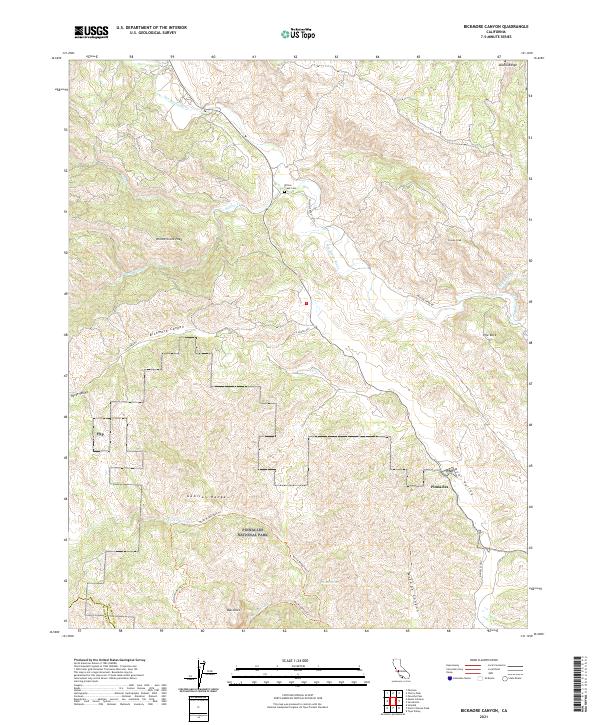 2021 Bickmore Canyon2021 Print · USGSSan Benito County’s high country is captured here in the modern era, showing the intersection of park lands and ranching history. You can trace the path of the San Benito River or locate the Willow Creek Cem and the peaks surrounding Pinnacles National Park.
 - 2021 Map of Soledad, 2021 Print
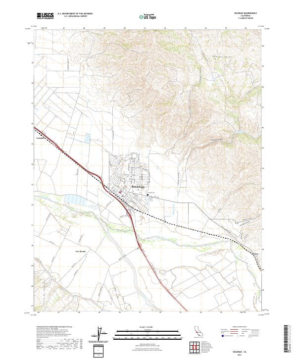 2021 Soledad2021 Print · USGSThe Salinas River valley in the early 2020s shows a landscape shaped by high mountain ranges and deep canyons. Researchers can trace the town grid of Soledad, locate the Soledad Cem, and find historic sites like Fort Romie and Camphora.
 - 2021 Map of Chittenden, 2021 Print
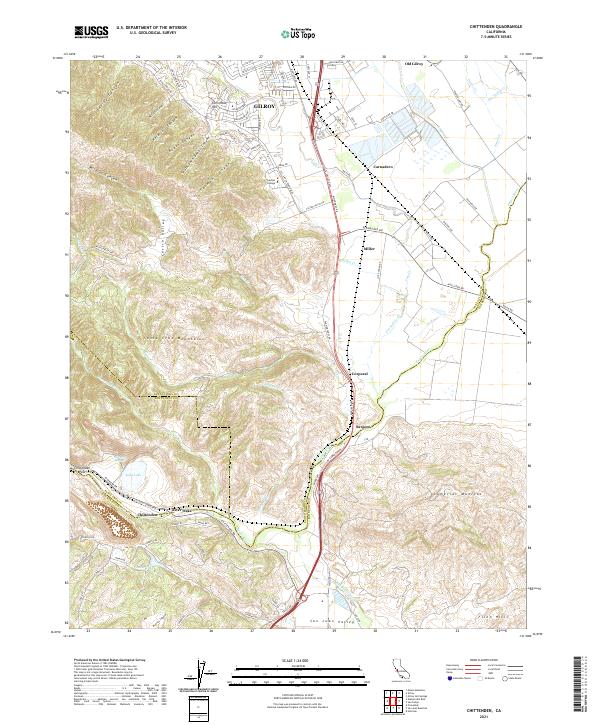 2021 Chittenden2021 Print · USGSThe southern Santa Clara Valley meets the foothills of the Santa Cruz Mountains in this recent survey. Local historians can trace the transition from GILROY to Old Gilroy and locate landmarks like Soda Lake, Gavilan College, and the historic Sargent settlement.
 - 2021 Map of Hollister, 2021 Print
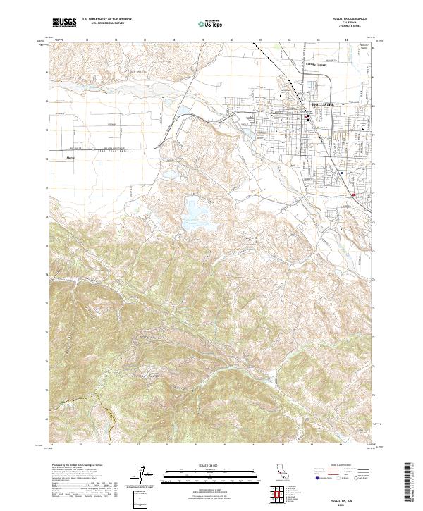 2021 Hollister2021 Print · USGSHollister and the surrounding Gabilan Range foothills are captured here in a period of modern growth and civic development. Researchers can trace local history through landmarks like Odd Fellows Cem, Cottage Corners, and the San Benito County Superior Court.
 - 2021 Map of Paicines, 2021 Print
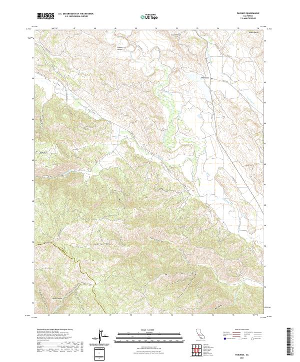 2021 Paicines2021 Print · USGSSan Benito County ranch lands and river valleys are captured here in the early twenty-first century. Genealogists and local historians can trace family-named landmarks like McPhails Peak, Matarana Gulch, and Alvisa Canyon.
 - 2021 Map of Lonoak, 2021 Print
 2021 Lonoak2021 Print · USGSSan Benito and Monterey counties meet in this 2021 study of a rugged ranching landscape within the Diablo Range. Researchers can trace historic property boundaries and isolated water sources like Lake Fanganyika, Eagle Mtn, and the small settlement of Lonoak.
 - 2021 Map of Rock Spring Peak, 2021 Print
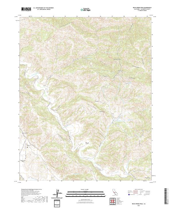 2021 Rock Spring Peak2021 Print · USGSSan Benito County’s high country in the Diablo Range is recorded here, showing a landscape defined by deep canyons and high peaks. Genealogists and researchers can locate the Bitterwater Cem and trace old routes like Old Hernandez Rd and Coalinga Rd.
 - 2021 Map of Priest Valley, 2021 Print
 2021 Priest Valley2021 Print · USGSThe high mountain corridors of the Diablo Range are surveyed here during the early twenty-first century. Researchers can locate remote burial sites at Clayton Cem and Williams Duckworth Cem or trace the winding waters of Lewis Cr through the valley.
Showing maps 1-25 of 39
Top cities of San Benito County
Frequently asked questions
- What are the different types of historical maps available for San Benito County?
- What is the oldest map of San Benito County?
- Where can I purchase historical maps of San Benito County for my home or office?
- Where can I download high-res historical maps of San Benito County?
- Are there historical topographic maps available for San Benito County?
- Is there historical aerial imagery available for San Benito County?
- Where are historical maps of San Benito County sourced from?