1960s Maps of San Benito County, California
Explore 29 historic maps of San Benito County from the 1960s. These maps offer a rare glimpse into what life looked like during the 1960s — showing old roads, neighborhoods, homes, and landmarks that have changed or disappeared over time.
Whether you're researching your family's past, planning a metal detecting trip, or studying how San Benito County's landscape evolved across the 1960s, these high-resolution maps are a powerful tool for exploring the history of this region.
- Focus on a specific era: All maps on this page are from the 1960s, giving you a focused view of this time period.
- See what’s changed: Compare century-old streets, trails, and buildings to today's modern landscape using overlays and satellite layers.
- Research with precision: Use these maps for genealogy, historical research, land use analysis, or educational projects.
- View, download, or print: Maps are fully viewable online in high resolution, and can be downloaded or printed for your own records.
Start exploring San Benito County's history through authentic maps from the 1960s. This is your window into the past.
San Benito County, CA maps
(29)- 1965 Map of Santa Cruz, 1968 Print
 1965 Santa Cruz1968 Print · USGSThe Central Coast and San Joaquin Valley meet here during the mid-sixties, capturing the growth of agricultural and coastal hubs. Trace the historic Southern Pacific RR lines and locate sites like the Presidio of Monterey or Pinnacles National Monument.
 - 1967 Map of Monarch Peak, 1968 Print
 1967 Monarch Peak1968 Print · USGSThe California Coast Ranges are captured here in the late sixties, showcasing the tectonic landscape of the San Andreas Rift Zone. Researchers can trace old transportation routes and landmarks like Peachtree Road and the Mustang Fire Control Station.3 unique versions available
 - 1968 Map of San Benito, 1971 Print
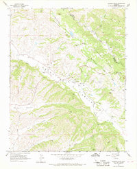
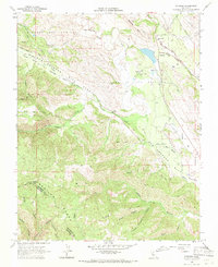
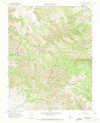
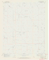
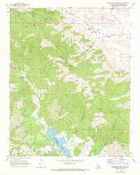
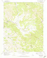
 1968 San Benito1971 Print · USGSThe high country of San Benito County in the late sixties is defined by ranching outposts and the prominent San Andreas Rift Zone. Genealogists and historians can trace local landmarks like Wilkinson Ranch, the Jefferson Sch, and the winding San Benito River.2 unique versions available
 - 1968 Map of Panoche Pass, 1971 Print
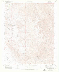
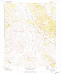
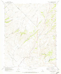
 1968 Panoche Pass1971 Print · USGSSan Benito County ranching and mining lands are caught in detail during the late sixties at the crossing of Panoche Pass. Local historians can trace family land at McCreery Ranch, locate the Bradford Mine, or study the remote infrastructure of the Antelope Fire Control Station.
 - 1968 Map of Mount Johnson, 1971 Print
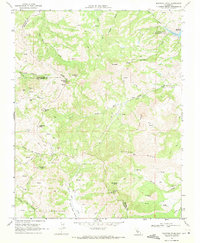
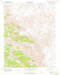
 1968 Mount Johnson1971 Print · USGSEastern Monterey County is shown here in the late sixties, where the high ridges of the Gabilan Range meet ranching corridors. Researchers can trace historic boundaries like Rincon de la Puente del Monte or follow the path of La Gloria Road toward Gloria Lake.3 unique versions available
 - 1968 Map of Paicines, 1971 Print
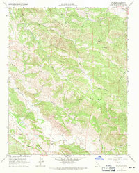
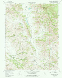
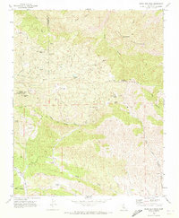
 1968 Paicines1971 Print · USGSSan Benito County ranching and geology are on full display in the late sixties as the San Benito River flows past Paicines. Researchers can locate rural landmarks like Willow Grove Sch, the Paicines Ranch, and trace the path of the San Andreas Rift Zone.2 unique versions available
 - 1968 Map of Ruby Canyon, 1971 Print
 1968 Ruby Canyon1971 Print · USGSThe ranchlands of the California Coast Ranges are mapped here during the late 1960s, showing a remote landscape of canyons and high ridges. Researchers can trace historic land use and movement through Cleveland Ranch, the Bonanza (Site), and the Ortigalita Ridge.
 - 1968 Map of Quien Sabe Valley, 1971 Print
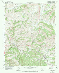
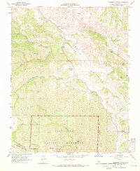
 1968 Quien Sabe Valley1971 Print · USGSIn the late 1960s, the high country of San Benito County remained a land of remote cattle operations and steep coastal peaks. Researchers can trace the layout of the Quien Sabe Ranch, the winding Santa Anita Road, and family-named landmarks like Cibo Peak.2 unique versions available
 - 1968 Map of Bickmore Canyon, 1971 Print
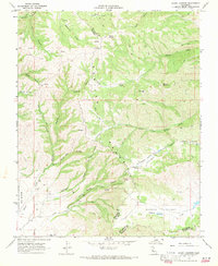
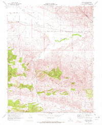
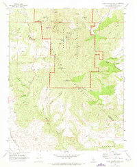
 1968 Bickmore Canyon1971 Print · USGSThe San Andreas fault line cuts directly through San Benito County in the late sixties, defining a landscape of isolated ranches and wilderness. Researchers can trace the heritage of Melendy Ranch, find the Willow Creek Cem, and explore the rugged northern boundary of Pinnacles National Monument.6 unique versions available
 - 1968 Map of Cherry Peak, 1971 Print
 1968 Cherry Peak1971 Print · USGSSan Benito County’s ranching heartland is shown in detail during the late sixties, where the hills meet the famous fault line. Local history researchers can locate Elkhorn Ranch, the San Andreas Rift Zone, and a small rural Cem.3 unique versions available
 - 1968 Map of Mt. Harlan, 1971 Print
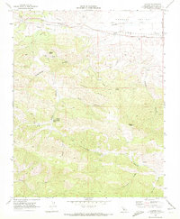
 1968 Mt. Harlan1971 Print · USGSThe high ridges of the Gabilan Range come into focus in the late sixties, showing the rugged divide between San Benito and Monterey counties. Researchers can trace remote sites like Thompson Cabin, the historic Encinal y Buena Esperanza grant line, and old quarries near Mt Harlan.2 unique versions available
 - 1969 Map of Mariposa Peak, 1971 Print
 1969 Mariposa Peak1971 Print · USGSThe high ridges and deep canyons of the Diablo Range are meticulously documented here in the late sixties. Local historians can trace old property lines at French Ranch and locate historical mining operations such as the Stayton Mine or the Mariposa Mine.3 unique versions available
 - 1969 Map of Cerro Colorado, 1972 Print
 1969 Cerro Colorado1972 Print · USGSThe high ridges of San Benito and Fresno counties are shown in the late sixties, a period when mercury and mineral prospecting still marked these slopes. Trace old jeep trails to remote sites like Mercey Mine, Lucky Strike Mine, and Vasquez Spring.3 unique versions available
 - 1969 Map of Llanada, 1972 Print
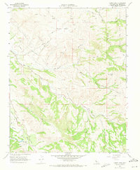
 1969 Llanada1972 Print · USGSSan Benito County in the late sixties reveals a landscape of isolated valleys and high peaks near the Llanada settlement. Genealogists and historians can trace family-named landmarks like Cherry Hill Cem, Moody Sulphur Spring, and Walker Peak.
 - 1969 Map of Ciervo Mtn, 1972 Print
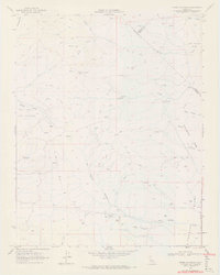
 1969 Ciervo Mtn1972 Print · USGSThe high desert border of Fresno and San Benito counties is captured here in the late sixties, showing a landscape defined by ranching and resource management. Trace the network of old jeep trails past remote water sources like Harris Spring, Cantua Well, and Borreguero Spring.2 unique versions available
 - 1969 Map of Mercey Hot Springs, 1972 Print
 1969 Mercey Hot Springs1972 Print · USGSThe Fresno and San Benito borderlands in the late sixties come into focus through this survey of the Little Panoche Valley. Researchers can trace the layout of Mercey Hot Springs, locate a mid-century Landing Strip, and follow the remote Jeep Trails through the Panoche Hills.2 unique versions available
 - 1969 Map of Ortigalita Peak, 1972 Print
 1969 Ortigalita Peak1972 Print · USGSThe Diablo Range backcountry of Merced and San Benito counties is captured in the late sixties, showing a landscape defined by ranching and high ridges. Researchers can trace historic fence lines and water sources like Carranza Spring or explore old mining sites near Ortigalita Peak.2 unique versions available
 - 1969 Map of Panoche, 1972 Print
 1969 Panoche1972 Print · USGSThe San Benito backcountry in the late sixties shows a landscape of remote ranching and energy extraction. Researchers can trace historic local routes like New Idria Road and locate sites like Panoche School or the Vallecitos Oil Field.2 unique versions available
 - 1969 Map of Hernandez Reservoir, 1973 Print
 1969 Hernandez Reservoir1973 Print · USGSSan Benito County's high country is captured here in the late sixties, showcasing the intersection of canyon ranching and energy exploration. Researchers can locate remote landmarks like The Adobe, the Oil Field, and old homesteads at Harrison Cabin.
 - 1969 Map of Topo Valley, 1973 Print
 1969 Topo Valley1973 Print · USGSSan Benito and Monterey counties are captured in the late sixties at the intersection of geology and ranching life. Genealogists and historians can trace family land at Sans Ranch, locate the remote Murphy Flat, or study the San Andreas Rift Zone.2 unique versions available
 - 1969 Map of Idria, 1973 Print
 1969 Idria1973 Print · USGSSan Benito County’s quicksilver mining district is shown in high detail during the late sixties. Researchers can trace the industrial layout of the New Idria Mine, the remote outpost of Idria, and numerous family-named claims like the Sampson Mine.2 unique versions available
 - 1969 Map of Santa Rita Peak, 1973 Print
 1969 Santa Rita Peak1973 Print · USGSThe Fresno and San Benito county line was a hub of high-altitude mining and ranching during the late sixties. Researchers can trace historic industrial footprints at Holman Mill (Site) or locate remote prospects like the Rita Mine and Archer Mine.2 unique versions available
 - 1969 Map of North Chalone Peak, 1973 Print
 1969 North Chalone Peak1973 Print · USGSThe high volcanic peaks of the Gabilan Range define this 1960s study of the Central Coast interior. Local historians can trace the early footprint of Pinnacles National Monument, from the Visitor Center to landmarks like Machete Ridge and South Chalone Peak.2 unique versions available
 - 1969 Map of Priest Valley, 1973 Print
 1969 Priest Valley1973 Print · USGSCoastal range highlands at the intersection of three counties are captured here in the late sixties, highlighting isolated ranching life. Genealogists can locate family sites like Williams-Duckworth Cem and the Priest Valley Sch along Lewis Creek.3 unique versions available
 - 1969 Map of Pinalito Canyon, 1973 Print
 1969 Pinalito Canyon1973 Print · USGSThe hills of Monterey and San Benito Counties are shown in detail during the late sixties, highlighting a landscape of deep canyons and seasonal creeks. Researchers can trace the path of Bitterwater Road past features like Becker Valley, San Lorenzo Creek, and the settlement of Pinalito.2 unique versions available
Showing maps 1-25 of 29
Top cities of San Benito County
Frequently asked questions
- What are the different types of historical maps available for San Benito County?
- What is the oldest map of San Benito County?
- Where can I purchase historical maps of San Benito County for my home or office?
- Where can I download high-res historical maps of San Benito County?
- Are there historical topographic maps available for San Benito County?
- Is there historical aerial imagery available for San Benito County?
- Where are historical maps of San Benito County sourced from?