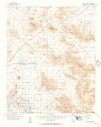
1950s Maps of Lucerne Valley, California
Explore 10 historic maps of Lucerne Valley from the 1950s. These maps offer a rare glimpse into what life looked like during the 1950s — showing old roads, neighborhoods, homes, and landmarks that have changed or disappeared over time.
Whether you're researching your family's past, planning a metal detecting trip, or studying how Lucerne Valley's landscape evolved across the 1950s, these high-resolution maps are a powerful tool for exploring the history of this region.
- Focus on a specific era: All maps on this page are from the 1950s, giving you a focused view of this time period.
- See what’s changed: Compare century-old streets, trails, and buildings to today's modern landscape using overlays and satellite layers.
- Research with precision: Use these maps for genealogy, historical research, land use analysis, or educational projects.
- View, download, or print: Maps are fully viewable online in high resolution, and can be downloaded or printed for your own records.
Start exploring Lucerne Valley's history through authentic maps from the 1950s. This is your window into the past.
Lucerne Valley, CA maps
(10)- 1953 Map of San Bernardino
 1953 San Bernardino1953 Print · USGSSouthern California underwent massive post-war growth as suburban sprawl reached the foothills of the San Bernardino Mountains. Genealogists and historians can trace the rail-and-road roots of the Inland Empire through the Union Pacific RR and Lake Arrowhead resorts.2 unique versions available
 - 1955 Map of Old Woman Springs, 1956 Print
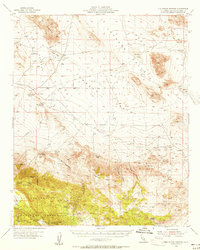 1955 Old Woman Springs1956 Print · USGSThe high desert of San Bernardino County is documented here in the mid-1950s, showing a landscape of vital desert springs and early mining. Researchers can trace historic water sources like Old Woman Springs and find mining sites including the Bessemer Mine and prospects.3 unique versions available
 - 1955 Map of Ord Mountains, 1956 Print
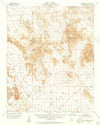 1955 Ord Mountains1956 Print · USGSThe High Desert south of Barstow was a land of solitary mines and strategic military targets during the mid-fifties. Researchers can locate remote extraction sites like the Quill Mine and Maumee Mine, or trace the vital springs of the Ord Mountains such as Taylor Spring.4 unique versions available
 - 1955 Map of Rodman Mountains, 1957 Print
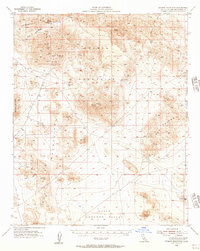 1955 Rodman Mountains1957 Print · USGSThe high Mojave desert of the mid-1950s reveals a landscape of volcanic fields and remote mining claims. Historians and researchers can trace the network of old Jeep Trails connecting the Silver Bell Mine, Indian Petroglyphs, and the Landing Field.3 unique versions available
 - 1956 Map of San Bernardino
 1956 San Bernardino1956 Print · USGSSouthern California's Inland Empire and High Desert come into focus in the mid-fifties as agriculture gives way to suburban and military growth. Trace early rail lines like the Pacific Electric or find remote landmarks like Camp Rock Mine and George AFB.
 - 1956 Map of Lake Arrowhead, 1957 Print
 1956 Lake Arrowhead1957 Print · USGSSan Bernardino County's transition from alpine forest to high desert is documented in the mid-1950s as mountain resorts and desert ranches expanded. Genealogists can locate family landmarks like Lone Wolf Colony, Hawes Ranch, and the Apple Valley School.5 unique versions available
 - 1957 Map of Apple Valley
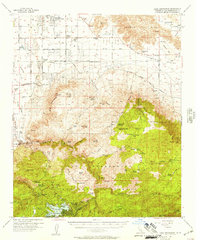
 1957 Apple Valley1957 Print · USGSApple Valley and its surrounding high desert valleys are captured here in the late fifties during a period of suburban growth and active mining. Genealogists and historians can trace early neighborhood layouts and find industrial landmarks like the Sidewinder Mining Railroad, Sidewinder Mine, and Catholic Hill.3 unique versions available
 - 1957 Map of San Bernardino
 1957 San Bernardino1957 Print · USGSSouthern California's Inland Empire and High Desert met during the postwar expansion of the late fifties. Genealogists and historians can trace the growth of San Bernardino and Redlands alongside remote landmarks like Edwards AFB and the Camp Rock Mine.
 - 1958 Map of San Bernardino, 1975 Print
 1958 San Bernardino1975 Print · USGSSouthern California’s Inland Empire and High Desert come into focus during the mid-century boom, showing the rise of suburbs and massive military installations. Researchers can trace the rail networks of the Union Pacific RR or locate landmarks like Norton AFB and Big Bear Lake.
 - 1959 Map of San Bernardino
 1959 San Bernardino1959 Print · USGSSouthern California underwent a massive transformation in the late fifties as suburban growth and military power reshaped the desert and valley. Researchers can trace the legacy of the Union Pacific Railroad and locate early footprints of Joshua Tree National Monument and Edwards Air Force Base.
End of results
Showing maps 1-10 of 10
Frequently asked questions
- What are the different types of historical maps available for Lucerne Valley?
- What is the oldest map of Lucerne Valley?
- Where can I purchase historical maps of Lucerne Valley for my home or office?
- Where can I download high-res historical maps of Lucerne Valley?
- Are there historical topographic maps available for Lucerne Valley?
- Is there historical aerial imagery available for Lucerne Valley?
- Where are historical maps of Lucerne Valley sourced from?