Old Maps of Lucerne Valley, California for Academic Research
Study the evolution of Lucerne Valley with 106 high-resolution historic maps. Whether you're teaching, researching, or modeling changes in land use, these maps provide essential visual documentation of urban, environmental, and geographic change.
- Analyze long-term change: Track patterns in development, transportation, and natural features.
- Ideal for environmental or urban studies: Support academic projects with primary historical map data.
- Use in the classroom or lab: Educators and researchers rely on these maps to bring historical context to life.
These maps are a powerful tool for teaching, research, and visualizing how Lucerne Valley has changed over the decades.
Lucerne Valley, CA maps
(106)- 1901 Map of Southern California Sheet No. 1
 1901 Southern California Sheet No. 11901 Print · USGSGreater Los Angeles at the dawn of the twentieth century is a landscape of growing citrus towns and a burgeoning rail network. Genealogists and historians can trace the early gridded streets of Hollywood and Pasadena or locate landmarks like Bear Lake and the Cahuilla Indian Reservation.6 unique versions available
 - 1902 Map of Deep Creek
 1902 Deep Creek1902 Print · USGSThe San Bernardino high country meets the desert edge at the turn of the century, showing a landscape of early ranches and timber harvesting. Genealogists and historians can trace Coxey Ranch, an early Saw Mill, and the original topography of Little Bear Valley.7 unique versions available
 - 1902 Map of San Gorgonio
 1902 San Gorgonio1902 Print · USGSSouthern California at the turn of the century reveals a land of high-desert ranches and remote mountain mining camps. Genealogists and historians can locate early landmarks like Box S Ranch, Old Woman Springs, and the Rose Mine.8 unique versions available
 - 1904 Map of Southern California Sheet No. 1, 1905 Print
 1904 Southern California Sheet No. 11905 Print · USGSSouthern California at the dawn of the twentieth century shows a landscape of citrus groves and coastal towns connected by rail. Genealogists and historians can trace early settlements like San Juan Capistrano, find remote sites like the Rose Mine, and study the original water systems of the Santa Ana River.2 unique versions available
 - 1932 Map of Barstow, 1956 Print
 1932 Barstow1956 Print · USGSIn the early 1930s, the High Desert economy centered on the Mojave River corridor and the steel rails of the Atchison Topeka and Santa Fe RR. Researchers can trace the early footprints of Barstow and Victorville or locate mining operations like the Apex Mine.
 - 1934 Map of Barstow
 1934 Barstow1934 Print · USGSThe Mojave Desert and its river-based corridor are captured here in the early thirties, during the heyday of Route 66. Researchers can trace the original Atchison Topeka and Santa Fe line and locate mining sites like the Western States Mine or the settlement at Helendale.3 unique versions available
 - 1947 Map of Lucerne Valley, 1955 Print
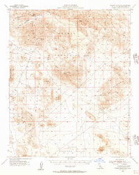
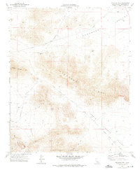
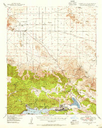 1947 Lucerne Valley1955 Print · USGSBig Bear Lake and the surrounding San Bernardino peaks meet the Mojave Desert in the late nineteen-forties. Genealogists and historians can trace old homesteads and mining claims like the Box S Ranch, Doble Mine (Aband), and Smarts Ranch.5 unique versions available
 - 1949 Map of Lucerne Valley
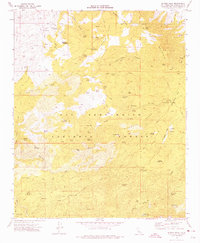
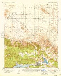 1949 Lucerne Valley1949 Print · USGSThe High Desert and San Bernardino mountains meet in the late 1940s, capturing a landscape of mountain resorts and mining history. Genealogists and historians can trace old community sites like Doble and Fawnskin or locate high-altitude mining operations such as the Rose Mine.2 unique versions available
 - 1953 Map of San Bernardino
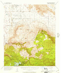
 1953 San Bernardino1953 Print · USGSSouthern California underwent massive post-war growth as suburban sprawl reached the foothills of the San Bernardino Mountains. Genealogists and historians can trace the rail-and-road roots of the Inland Empire through the Union Pacific RR and Lake Arrowhead resorts.2 unique versions available
 - 1955 Map of Old Woman Springs, 1956 Print
 1955 Old Woman Springs1956 Print · USGSThe high desert of San Bernardino County is documented here in the mid-1950s, showing a landscape of vital desert springs and early mining. Researchers can trace historic water sources like Old Woman Springs and find mining sites including the Bessemer Mine and prospects.3 unique versions available
 - 1955 Map of Ord Mountains, 1956 Print
 1955 Ord Mountains1956 Print · USGSThe High Desert south of Barstow was a land of solitary mines and strategic military targets during the mid-fifties. Researchers can locate remote extraction sites like the Quill Mine and Maumee Mine, or trace the vital springs of the Ord Mountains such as Taylor Spring.4 unique versions available
 - 1955 Map of Rodman Mountains, 1957 Print
 1955 Rodman Mountains1957 Print · USGSThe high Mojave desert of the mid-1950s reveals a landscape of volcanic fields and remote mining claims. Historians and researchers can trace the network of old Jeep Trails connecting the Silver Bell Mine, Indian Petroglyphs, and the Landing Field.3 unique versions available
 - 1956 Map of San Bernardino
 1956 San Bernardino1956 Print · USGSSouthern California's Inland Empire and High Desert come into focus in the mid-fifties as agriculture gives way to suburban and military growth. Trace early rail lines like the Pacific Electric or find remote landmarks like Camp Rock Mine and George AFB.
 - 1956 Map of Lake Arrowhead, 1957 Print
 1956 Lake Arrowhead1957 Print · USGSSan Bernardino County's transition from alpine forest to high desert is documented in the mid-1950s as mountain resorts and desert ranches expanded. Genealogists can locate family landmarks like Lone Wolf Colony, Hawes Ranch, and the Apple Valley School.5 unique versions available
 - 1957 Map of Apple Valley
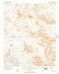 1957 Apple Valley1957 Print · USGSApple Valley and its surrounding high desert valleys are captured here in the late fifties during a period of suburban growth and active mining. Genealogists and historians can trace early neighborhood layouts and find industrial landmarks like the Sidewinder Mining Railroad, Sidewinder Mine, and Catholic Hill.3 unique versions available
 - 1957 Map of San Bernardino
 1957 San Bernardino1957 Print · USGSSouthern California's Inland Empire and High Desert met during the postwar expansion of the late fifties. Genealogists and historians can trace the growth of San Bernardino and Redlands alongside remote landmarks like Edwards AFB and the Camp Rock Mine.
 - 1958 Map of San Bernardino, 1975 Print
 1958 San Bernardino1975 Print · USGSSouthern California’s Inland Empire and High Desert come into focus during the mid-century boom, showing the rise of suburbs and massive military installations. Researchers can trace the rail networks of the Union Pacific RR or locate landmarks like Norton AFB and Big Bear Lake.
 - 1959 Map of San Bernardino
 1959 San Bernardino1959 Print · USGSSouthern California underwent a massive transformation in the late fifties as suburban growth and military power reshaped the desert and valley. Researchers can trace the legacy of the Union Pacific Railroad and locate early footprints of Joshua Tree National Monument and Edwards Air Force Base.
 - 1966 Map of San Bernardino
 1966 San Bernardino1966 Print · USGSThe San Bernardino Valley and Mojave Desert met during a period of massive military and suburban growth in the mid-sixties. Genealogists and historians can trace the development of Edwards Air Force Base, old desert mines like the Bagdad Chase Mine, and mountain communities near Big Bear Lake.
 - 1970 Map of Fairview Valley, 1975 Print
 1970 Fairview Valley1975 Print · USGSThe high desert of San Bernardino County comes into focus in this 1970 survey of industry and terrain. Researchers can trace the industrial layout of the Cement Plant and Red Top Mine or locate historic desert water sources like Isabelle Spring.
 - 1970 Map of Stoddard Well, 1975 Print
 1970 Stoddard Well1975 Print · USGSThe high desert of San Bernardino County was a hub of mineral exploration and transit during the early 1970s. Trace old desert roads and mining claims like the Sidewinder Mine, Early Mine, and the historic water stop at Stoddard Well.2 unique versions available
 - 1971 Map of Cougar Buttes, 1975 Print
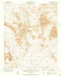
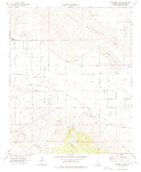
 1971 Cougar Buttes1975 Print · USGSLucerne Valley in the early 1970s shows a fascinating mix of industrial mining and ambitious desert subdivision. Trace family-named roads and mining history at the Old Woman Mine, Silver Reef Mine, and the celestial-themed grid of Comet Road.3 unique versions available
 - 1971 Map of Butler Peak, 1975 Print
 1971 Butler Peak1975 Print · USGSThe San Bernardino high country in the early seventies reveals a landscape shaped by mining, grazing, and mountain recreation. Researchers can locate remote mineral sites like Balanced Rock Mine, the historic Hawes Ranch, and the Pacific Crest National Scenic Trail.2 unique versions available
 - 1971 Map of Fifteenmile Valley, 1975 Print
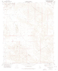
 1971 Fifteenmile Valley1975 Print · USGSThe high desert of San Bernardino County comes into focus during the early seventies as residential grids begin to mesh with the local ranching and rail landscape. Genealogists and historians can trace old homestead routes and industrial markers like the V P Mine, Deadman Point, and the Atchison Topeka and Santa Fe Railway.2 unique versions available
 - 1971 Map of Lucerne Valley, 1975 Print
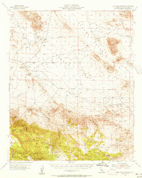
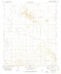
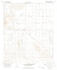 1971 Lucerne Valley1975 Print · USGSThe High Desert community of Lucerne Valley is captured here in the early seventies as residential grids expanded toward the dry lakebed. Researchers can locate family landmarks like Rabbit Springs, the local Grave, and the southern Atchison Topeka and Santa Fe rail line.3 unique versions available
Showing maps 1-25 of 106
Frequently asked questions
- What are the different types of historical maps available for Lucerne Valley?
- What is the oldest map of Lucerne Valley?
- Where can I purchase historical maps of Lucerne Valley for my home or office?
- Where can I download high-res historical maps of Lucerne Valley?
- Are there historical topographic maps available for Lucerne Valley?
- Is there historical aerial imagery available for Lucerne Valley?
- Where are historical maps of Lucerne Valley sourced from?