1960s Maps of San Diego County, California
Explore 54 historic maps of San Diego County from the 1960s. These maps offer a rare glimpse into what life looked like during the 1960s — showing old roads, neighborhoods, homes, and landmarks that have changed or disappeared over time.
Whether you're researching your family's past, planning a metal detecting trip, or studying how San Diego County's landscape evolved across the 1960s, these high-resolution maps are a powerful tool for exploring the history of this region.
- Focus on a specific era: All maps on this page are from the 1960s, giving you a focused view of this time period.
- See what’s changed: Compare century-old streets, trails, and buildings to today's modern landscape using overlays and satellite layers.
- Research with precision: Use these maps for genealogy, historical research, land use analysis, or educational projects.
- View, download, or print: Maps are fully viewable online in high resolution, and can be downloaded or printed for your own records.
Start exploring San Diego County's history through authentic maps from the 1960s. This is your window into the past.
San Diego County, CA maps
(54)- 1960 Map of Santa Ana
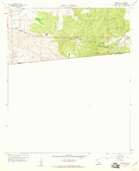
 1960 Santa Ana1960 Print · USGSSouthern California's coastal plains and inland deserts meet in this mid-century survey of the burgeoning Orange and Riverside county corridors. Researchers can trace the layout of early freeway systems, find tribal lands like the Soboba Indian Reservation, and locate military landmarks such as March Field.2 unique versions available
 - 1960 Map of Potrero, 1961 Print
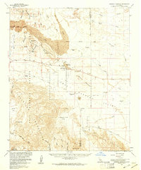
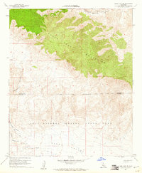
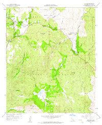
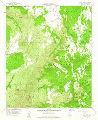
 1960 Potrero1961 Print · USGSThe San Diego backcountry at the dawn of the 1960s reveals a sparse landscape of mountain valleys and border settlements. Trace the winding San Diego and Arizona Eastern Railway through Canyon City or locate the old Cem in Potrero.4 unique versions available
 - 1960 Map of Viejas Mountain, 1961 Print
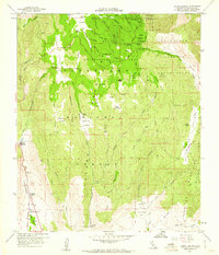
 1960 Viejas Mountain1961 Print · USGSThe Viejas Valley and surrounding San Diego County highlands are documented here during the early sixties, showing a landscape of tribal lands and national forest. Genealogists and local historians can trace family locations at The Willows, Lyster Ranch, and Kearchoffer Flat.5 unique versions available
 - 1960 Map of Beauty Mountain, 1961 Print
 1960 Beauty Mountain1961 Print · USGSThe high desert border between Riverside and San Diego Counties is captured here in the early sixties, showing a landscape of remote valleys and high peaks. Genealogists and historians can locate legacy outposts like Mitchell Camp, the Pawnee Mine, and trails through Chihuahua Valley.4 unique versions available
 - 1960 Map of Tule Springs, 1961 Print
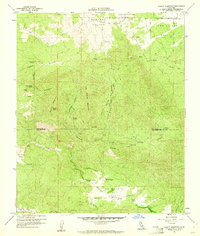
 1960 Tule Springs1961 Print · USGSSan Diego County's high country is captured here in the early sixties, showing the intersection of tribal lands and national forest. Researchers can locate remote family holdings like Sherilton Valley Ranch and landmarks like Cedar Creek Falls.5 unique versions available
 - 1960 Map of Borrego Mountain, 1961 Print
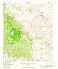
 1960 Borrego Mountain1961 Print · USGSThe Colorado Desert during the early sixties reveals a landscape of remote outposts and shifting sands within the Anza-Borrego Desert State Park. Traces of local history are preserved at the Little Borrego (Site), the USN Railroad, and the Elephant Tree Area.2 unique versions available
 - 1960 Map of Morena Reservoir, 1961 Print
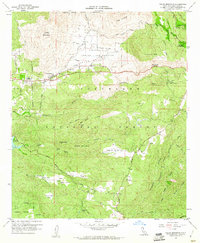
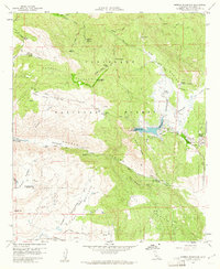 1960 Morena Reservoir1961 Print · USGSSan Diego County's high-country wilderness is documented here just as the post-war era of water management and forest service oversight was firmly established. Researchers can trace the rugged backcountry infrastructure of Morena Village, the Marine Memorial, and the Los Pinos Mtn fire lookout.5 unique versions available
 - 1960 Map of Borrego Mountain, 1961 Print
 1960 Borrego Mountain1961 Print · USGSSan Diego County's desert interior is captured in the early sixties as a playground for geology and exploration. Trace the early layout of Ocotillo Wells and navigate the primitive routes of Old Kane Spring Road and The Slot.4 unique versions available
 - 1960 Map of Cuyamaca Peak, 1961 Print
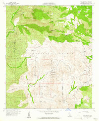
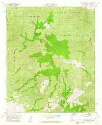
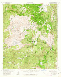
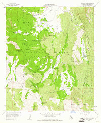 1960 Cuyamaca Peak1961 Print · USGSSan Diego’s high backcountry is detailed here in the early sixties, showing the extensive trail networks and campgrounds of the era. Genealogists and historians can trace the foundations of Cuyamaca Rancho State Park via the Stonewall Mine, Milk Ranch, and the Indian Exhibit.6 unique versions available
 - 1960 Map of Clark Lake NE, 1961 Print
 1960 Clark Lake NE1961 Print · USGSThe high desert borderlands of Riverside and San Diego counties are captured here in the early 1960s. Genealogists and desert researchers can trace the primitive Rockhouse Trail, locate isolated Ruins, and follow the deep cuts of Martinez Canyon.4 unique versions available
 - 1960 Map of Mount Laguna, 1961 Print
 1960 Mount Laguna1961 Print · USGSThe San Diego high country in the early sixties was a landscape of mountain ranches and strategic cold-war outposts. Genealogists and local historians can trace family landholdings like Flinn Ranch and Thing Ranch alongside the Mt Laguna Air Force Station.5 unique versions available
 - 1960 Map of Barrett Lake, 1961 Print
 1960 Barrett Lake1961 Print · USGSSan Diego's backcountry is captured here during the early sixties, showing the vital water infrastructure and ranching outposts of the Cleveland National Forest. Researchers can trace historic properties like Eichenlaub Ranch and the operations at Barrett Dam.5 unique versions available
 - 1960 Map of Bucksnort Mtn, 1961 Print
 1960 Bucksnort Mtn1961 Print · USGSThe high desert borderlands of Riverside and San Diego counties are captured here in the early sixties, showing a landscape defined by seasonal water and high peaks. Tracing the primitive roads through Terwilliger Valley, you can find remote landmarks like Tule Spring, Combs Peak, and Turkey Track.4 unique versions available
 - 1960 Map of Descanso, 1961 Print
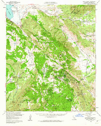
 1960 Descanso1961 Print · USGSSan Diego's high country during the early sixties shows a landscape defined by mountain camps and winding forest roads. Genealogists and historians can trace old homesteads and recreational sites from Hulburd Grove to the Pine Creek Bible Conference Ground.6 unique versions available
 - 1960 Map of Warners Ranch, 1961 Print
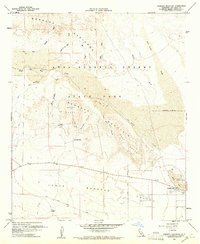
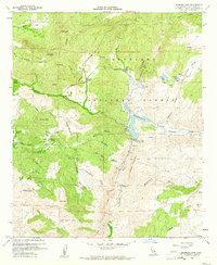
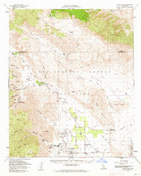
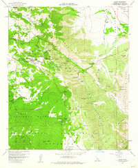
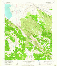 1960 Warners Ranch1961 Print · USGSSan Diego County's high valleys were a vital junction of ranching and early travel history at the start of the sixties. Genealogists and researchers can locate the Butterfield Stage Station, old mines, and the boundaries of the Santa Ysabel Indian Reservation.5 unique versions available
 - 1960 Map of Ranchita, 1961 Print
 1960 Ranchita1961 Print · USGSSan Diego's high desert transition is captured here in the early sixties, where mountain ridges meet the arid expanse. Genealogists and desert historians can locate the Montezuma Honor Camp, the small settlement of Ranchita, and remote sites like Grapevine Mine.3 unique versions available
 - 1960 Map of Tecate, 1961 Print
 1960 Tecate1961 Print · USGSThe California-Mexico borderlands come into focus at the start of the 1960s, showing a region shaped by water engineering and transit. Researchers can trace the Old Stage Route and explore the infrastructure of the San Diego City Conduit near Barrett Junction.3 unique versions available
 - 1960 Map of Hot Springs Mtn., 1961 Print
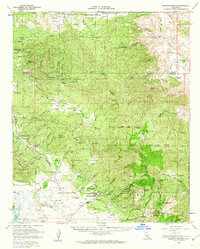
 1960 Hot Springs Mtn.1961 Print · USGSThe high backcountry of San Diego County is captured here in the early sixties, showing a landscape defined by isolated springs and tribal lands. Genealogists and historians can trace family-named sites like Taylor Ranch, the settlement of San Ignacio, and the remote Eagles Nest.6 unique versions available
 - 1960 Map of Clark Lake, 1962 Print
 1960 Clark Lake1962 Print · USGSBorrego Springs and the surrounding desert floor are shown in detail during the early sixties as the community took its modern shape. Researchers can trace the development of Christmas Circle and locate historic outposts like Middle Willows or the El Vado Historical Marker.3 unique versions available
 - 1960 Map of Warner Springs, 1962 Print
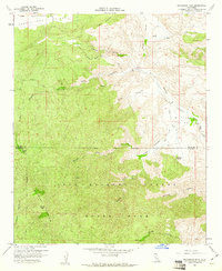
 1960 Warner Springs1962 Print · USGSWarner Springs and the San Diego back country appear here in the early sixties, a landscape of cattle ranges and mountain outposts. Researchers can trace the Survival Training School (US Navy), the remote village of San Ignacio, and the historic Warner Hot Spring.2 unique versions available
 - 1960 Map of Santa Ysabel, 1962 Print
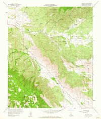
 1960 Santa Ysabel1962 Print · USGSSan Diego's backcountry in the early sixties was a landscape of historic stagecoach stops, gold mines, and mountain ranching. Genealogists and historians can trace old landmarks like the Butterfield Stage Station, the Banner Queen Mine, and the Spencer Valley Sch.3 unique versions available
 - 1960 Map of Santa Ysabel, 1962 Print
 1960 Santa Ysabel1962 Print · USGSSanta Ysabel and the surrounding San Diego County highlands are shown here in the early sixties. Researchers can trace rural school locations like Spencer Valley Sch and old mining sites including the Old Virginia Mine and Pride of the West Mine.5 unique versions available
 - 1960 Map of Mount Laguna, 1962 Print
 1960 Mount Laguna1962 Print · USGSSan Diego's high desert and mountain frontier are captured here in the early sixties, showing the transition from forest to the arid Anza-Borrego. Researchers can trace the Old Overland Stage Route, locate the La Posta Cem, and find family-named sites like Thing Ranch or McCain Ranch.2 unique versions available
 - 1960 Map of Cuyamaca Peak, 1962 Print
 1960 Cuyamaca Peak1962 Print · USGSThe San Diego backcountry comes into focus in the early sixties, showing the mountain communities and expansive parklands of the Cuyamaca region. Genealogists and hikers can trace old homesteads like Burney Ranch and historical sites such as Stonewall Mine or the Cuyamaca Lodge.2 unique versions available
 - 1960 Map of Julian, 1962 Print
 1960 Julian1962 Print · USGSJulian and its surrounding mountain camps are captured during the early 1960s, showing a landscape defined by its mining history and high-country ranching. Genealogists and historians can locate numerous named claims like the Roosevelt Mine and the Golden Chariot Mine, alongside the Banner Queen Trading Post.5 unique versions available
Showing maps 1-25 of 54
Top cities of San Diego County
- San Diego historical maps
- Chula Vista historical maps
- Oceanside historical maps
- Escondido historical maps
- Carlsbad historical maps
- El Cajon historical maps
See more
Frequently asked questions
- What are the different types of historical maps available for San Diego County?
- What is the oldest map of San Diego County?
- Where can I purchase historical maps of San Diego County for my home or office?
- Where can I download high-res historical maps of San Diego County?
- Are there historical topographic maps available for San Diego County?
- Is there historical aerial imagery available for San Diego County?
- Where are historical maps of San Diego County sourced from?