1990s Maps of San Diego County, California
Explore 61 historic maps of San Diego County from the 1990s. These maps offer a rare glimpse into what life looked like during the 1990s — showing old roads, neighborhoods, homes, and landmarks that have changed or disappeared over time.
Whether you're researching your family's past, planning a metal detecting trip, or studying how San Diego County's landscape evolved across the 1990s, these high-resolution maps are a powerful tool for exploring the history of this region.
- Focus on a specific era: All maps on this page are from the 1990s, giving you a focused view of this time period.
- See what’s changed: Compare century-old streets, trails, and buildings to today's modern landscape using overlays and satellite layers.
- Research with precision: Use these maps for genealogy, historical research, land use analysis, or educational projects.
- View, download, or print: Maps are fully viewable online in high resolution, and can be downloaded or printed for your own records.
Start exploring San Diego County's history through authentic maps from the 1990s. This is your window into the past.
San Diego County, CA maps
(61)- 1994 Map of La Mesa, 1998 Print
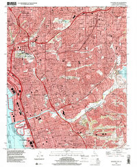
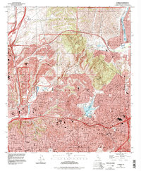 1994 La Mesa1998 Print · USGSSan Diego and La Mesa undergo significant mid-century suburban expansion as military and educational institutions anchor the landscape. Trace local development near San Diego State University, the historic Mission San Diego de Alcala, and Lake Murray.
 - 1994 Map of Jamul Mountains, 1998 Print
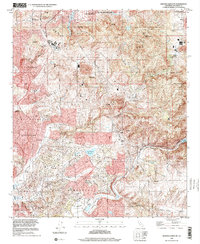
 1994 Jamul Mountains1998 Print · USGSSan Diego’s eastern expansion is clearly visible in the mid-1990s as suburban neighborhoods meet the rugged foothills of the Jamul Mountains. Researchers can trace the development of Chula Vista and Spring Valley alongside legacy sites like Fenton Ranch and the Steele Canyon Bridge.
 - 1994 Map of Del Mar, 2000 Print
 1994 Del Mar2000 Print · USGSCoastal San Diego County comes into focus in the mid-1990s as suburban growth reaches the mesas above the Pacific. Trace local landmarks like the Del Mar Race Track, the Univ Of Calif San Diego campus, and the Marine Corps Air Station Miramar.
 - 1996 Map of Collins Valley, 1999 Print
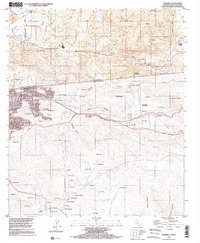
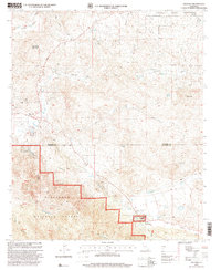
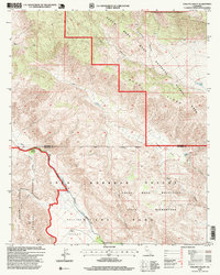 1996 Collins Valley1999 Print · USGSCollins Valley and the high desert canyons of the Riverside and San Diego county line are mapped here during the 1990s. Researchers can locate remote desert water sources like Cottonwood Spring and trace the paths through Jackass Flat and Middle Willows.
 - 1996 Map of Valley Center, 2000 Print
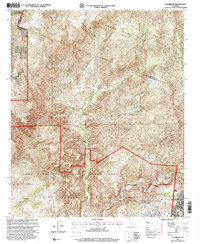
 1996 Valley Center2000 Print · USGSNorthern San Diego County in the mid-nineties shows the expanding urban interface of Escondido and rural Valley Center. Genealogists and local historians can trace the development of neighborhood schools like Conway Sch and landmarks like Valley Center Cem.
 - 1996 Map of La Jolla, 2000 Print
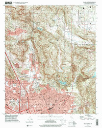
 1996 La Jolla2000 Print · USGSSan Diego's coastal neighborhoods and canyons are shown at a peak of late-century suburban density. Trace the footprints of iconic sites like Sea World, the Mission San Diego De Alcala, and the sprawling campus of University of California San Diego.
 - 1996 Map of San Marcos, 2000 Print
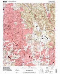 1996 San Marcos2000 Print · USGSSan Diego County's inland corridor shows rapid development during the late nineties as the cities of San Marcos and Vista expand into the surrounding foothills. Researchers can trace the layout of local neighborhoods and schools like Palomar College and San Marcos High Sch alongside the historic Oceanside and Escondido rail route.
 - 1996 Map of Point Loma, 2001 Print
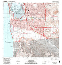
 1996 Point Loma2001 Print · USGSSan Diego and Coronado are shown here in the mid-nineties, capturing a landscape defined by massive naval installations and coastal neighborhoods. Researchers can trace the layout of Naval Air Station North Island, Balboa Park, and schools like Collier Jr High Sch.
 - 1996 Map of San Vicente Reservoir, 2001 Print
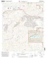
 1996 San Vicente Reservoir2001 Print · USGSSan Diego County's inland valleys and rugged highlands are captured here in the late nineties as residential growth met preserved ranch lands. Researchers can trace the bounds of the Miramar Sycamore Canyon Annex or locate historic homesteads at Goodan Ranch and Fernbrook.
 - 1996 Map of Rancho Santa Fe, 2001 Print
 1996 Rancho Santa Fe2001 Print · USGSCoastal San Diego County is captured here in the late nineties as residential development and regional water management reshaped the canyon lands. Trace family roots and land patterns near Rancho Santa Fe, the historical Olivenhain settlement, and Lake Hodges.
 - 1996 Map of Escondido, 2001 Print
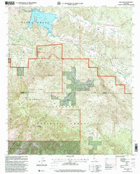
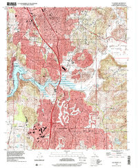 1996 Escondido2001 Print · USGSInland San Diego County entered the late nineties as a thriving suburban frontier centered around Escondido. Trace the growth of Rancho Bernardo and Poway alongside local landmarks like the San Diego Wild Animal Park and Lake Hodges.
 - 1996 Map of El Cajon, 2001 Print
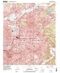 1996 El Cajon2001 Print · USGSThe valleys of East County were well-established suburban hubs by the late nineties. Genealogists and local historians can trace family-named sites and landmarks like Edgemoor Hospital, Cajon Speedway, and Lindo Lake.
 - 1996 Map of Poway, 2001 Print
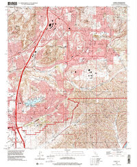 1996 Poway2001 Print · USGSPoway and the northern reaches of San Diego are shown here during the suburban expansion of the late nineties. Genealogists and local historians can trace the development of Scripps Ranch, find local schools like Pomerado Sch, or locate family sites at Dearborn Memorial Park.
 - 1996 Map of National City, 2001 Print
 1996 National City2001 Print · USGSThe South Bay and San Diego's eastern suburbs are captured here during a period of peak urban development. Researchers can trace neighborhood growth through Lincoln Acres and Bonita or find family landmarks like Mount Hope Cemetery.
 - 1996 Map of Tierra Del Sol, 2002 Print
 1996 Tierra Del Sol2002 Print · USGSThe high desert borderlands of San Diego County meet Baja California in the late nineties, documenting a landscape of international transit and tribal lands. Researchers can trace the Río Colorado Tijuana (Aqueduct) or locate family settlements near Tierra del Sol and Luis Echeverría (El Hongo).
 - 1996 Map of Potrero, 2002 Print
 1996 Potrero2002 Print · USGSThe international border near Potrero and Tecate is captured here in the mid-1990s, showing a landscape of high valleys and ranchos. Researchers can trace the Pacific Crest National Scenic Trail, find small clusters at Canyon City, and locate dozens of named Mexican ranchos like Establo 85.
 - 1996 Map of Campo, 2002 Print
 1996 Campo2002 Print · USGSThe California-Mexico border country comes alive in the mid-nineties, showing the rural community of Campo and the PACIFIC CREST NATIONAL SCENIC TRAIL. Genealogists and historians can trace the borderlands from Rancho Del Campo to Santa Margarita.
 - 1996 Map of Otay Mesa, 2002 Print
 1996 Otay Mesa2002 Print · USGSThe California-Mexico border at the end of the century reveals a unique landscape of industrial expansion and binational urban growth. Genealogists and historians can trace the contrast between rural sites like Otay Ranch and the dense neighborhoods of Tijuana including Chilpancingo and Murua.
 - 1996 Map of Imperial Beach, 2002 Print
 1996 Imperial Beach2002 Print · USGSCoastal San Diego County at the turn of the millennium shows a bustling borderland where intense suburban growth meets protected Pacific estuaries. Genealogists and historians can locate residential landmarks like Mt Olivet Cem, trace the route of the San Diego and Arizona Eastern RR, and study the massive Salt Evaporators on the bay.
 - 1996 Map of Otay Mountain, 2002 Print
 1996 Otay Mountain2002 Print · USGSThe San Ysidro Mountains straddle the international border in the mid-1990s, where high ridges overlook the river valleys of Baja California. Local history hunters can trace early mining and ranching at Donohoe Mine, Dulzura Community Center, and the remote Marron Valley.
 - 1997 Map of Aguanga, 2000 Print
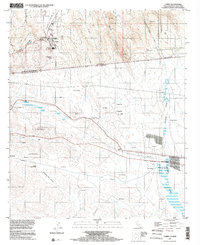
 1997 Aguanga2000 Print · USGSSouthern California’s interior transition from ranching valleys to national forest is captured here during the late 1990s. Genealogists and historians can locate the Oak Grove Stage Station Historical Marker and Camp Wright Historical Marker near Oak Grove.
 - 1997 Map of Fallbrook, 2000 Print
 1997 Fallbrook2000 Print · USGSThe foothills of San Diego County are captured here in the late nineties, where historic land grants meet modern military installations. Genealogists and local historians can locate early landmarks like De Luz Sch, Garnsey Ranch, and the winding path of Daily Road.
 - 1997 Map of Rodriguez Mountain, 2000 Print
 1997 Rodriguez Mountain2000 Print · USGSSan Diego County high country in the 1990s reveals a patchwork of ranching history and tribal lands. Local researchers can trace family landmarks at Melrose Ranch and Woods Valley or explore the rugged shores of Lake Wohlford.
 - 1997 Map of Alpine, 2000 Print
 1997 Alpine2000 Print · USGSThe San Diego foothills near Alpine appear in the late nineties as a blend of growing residential communities and expansive federal and tribal lands. Researchers can trace the boundaries of the Sycuan Indian Reservation or locate family landmarks like McClain Ranch and Murphy Ranch.
 - 1997 Map of Vail Lake, 2000 Print
 1997 Vail Lake2000 Print · USGSThe Riverside and San Diego county line area in the late nineties shows a landscape of wilderness and ranching history. Trace the Butterfield Stage Road or locate family history near the Crosley Homestead and Cottonwood Sch.
Showing maps 1-25 of 61
Top cities of San Diego County
- San Diego historical maps
- Chula Vista historical maps
- Oceanside historical maps
- Escondido historical maps
- Carlsbad historical maps
- El Cajon historical maps
See more
Frequently asked questions
- What are the different types of historical maps available for San Diego County?
- What is the oldest map of San Diego County?
- Where can I purchase historical maps of San Diego County for my home or office?
- Where can I download high-res historical maps of San Diego County?
- Are there historical topographic maps available for San Diego County?
- Is there historical aerial imagery available for San Diego County?
- Where are historical maps of San Diego County sourced from?