Old Maps of Escalon, California for Metal Detecting
Plan your next treasure hunt with 21 historic maps of Escalon. Find old homesites, ghost towns, trails, and gathering spots that may be lost to time — perfect for identifying promising metal detecting locations.
- Locate forgotten sites: Uncover places like long-lost settlements, abandoned rail lines, or gathering spots.
- Plan better hunts: Use map overlays combined with LiDAR or satellite views to narrow in on historically rich areas.
- Made for detectorists: Thousands of hobbyists use these maps to discover relics, coins, and hidden history.
Use these historic maps to boost your research and find new opportunities beneath the surface of Escalon.
Escalon, CA maps
(21)- 1914 Map of Avena
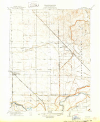
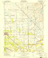
 1914 Avena1914 Print · USGSThe San Joaquin Valley comes into focus just before World War I as irrigation began to reshape the landscape. Genealogists and historians can trace old homesteads near Avena and Atlanta or locate rural school sites like Van Allen School and Four Tree School.
 - 1915 Map of Thalheim
 1915 Thalheim1915 Print · USGSThe Central Valley's burgeoning irrigation and rail networks are captured here during a period of rapid agricultural expansion. Researchers can trace the development of early settlements like Thalheim and Escalon alongside rural landmarks such as Burwood School and the Thompson Rancho.2 unique versions available
 - 1942 Map of Farmington
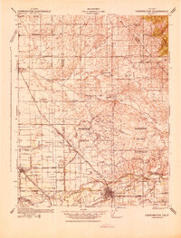 1942 Farmington1942 Print · USGSThe San Joaquin and Stanislaus border country is revealed in the early 1940s as a complex network of rail lines and irrigation canals. Genealogists and historians can trace old school districts like Burwood Sch, the tracks of the Southern Pacific, and the early layout of Escalon.
 - 1947 Map of San Jose, 1948 Print
 1947 San Jose1948 Print · USGSNorthern California's heartland is captured here just after the war, showing the rapid growth of the Santa Clara and Central Valleys. Researchers can trace the legacy of rail and water at Castle Air Force Base, Stockton, and the Hetch Hetchy Aqueduct.
 - 1952 Map of Avena, 1953 Print
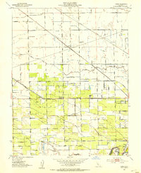 1952 Avena1953 Print · USGSSan Joaquin County agriculture is in full bloom during the early fifties, showcasing a complex grid of orchards and irrigation. Genealogists and rail historians can trace the paths of three different railroads and locate rural schoolhouses like Four Trees School and the town of Escalon.5 unique versions available
 - 1952 Map of Manteca, 1958 Print
 1952 Manteca1958 Print · USGSThe fertile San Joaquin Valley underwent significant post-war growth as irrigation and railroads connected agricultural hubs in the early fifties. Genealogists and local historians can trace rural school districts like Four Trees School and find industry landmarks such as the Sugar Refinery or the Union Memorial Cemetery.2 unique versions available
 - 1953 Map of Escalon, 1954 Print
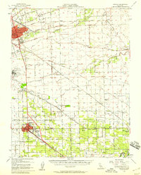
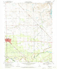
 1953 Escalon1954 Print · USGSSan Joaquin County agriculture and rail industry thrived mid-century as these two major railroads converged. Researchers can trace the layout of early schools like Union High Sch and Burwood Sch or locate family plots at Burwood Cem.
 - 1956 Map of San Jose
 1956 San Jose1956 Print · USGSCentral California in the mid-fifties reveals the transition from sprawling orchards to growing urban hubs like San Jose and Stockton. Genealogists and historians can trace the rail-era landscape of the Mother Lode through Chinese Camp and Tuttletown, or follow the water through the Joaquin River and Calaveras Reservoir.
 - 1962 Map of San Jose
 1962 San Jose1962 Print · USGSCentral California in the early sixties showcases the expansion of the San Joaquin and Santa Clara valleys. Researchers can trace the rail-to-road transition along the Southern Pacific RR or locate landmarks like Castle USAF Base and Loma Prieta.4 unique versions available
 - 1966 Map of San Jose
 1966 San Jose1966 Print · USGSCentral California in the mid-1960s reveals a landscape of massive irrigation projects and expanding Cold War military footprints. Researchers can trace the rail-and-river network of the San Joaquin Valley or locate specialized sites like Castle Air Force Base and the Sharp General Depot (Military).
 - 1968 Map of Escalon, 1971 Print
 1968 Escalon1971 Print · USGSThe Escalon area in the late sixties shows a thriving agricultural hub at the convergence of three major railroads. Genealogists can trace family names at Valley Home Cem, Burwood Sch, and along the banks of the Stanislaus River.4 unique versions available
 - 1989 Map of Stockton
 1989 Stockton1989 Print · USGSDuring the late 1980s, the California Delta and San Joaquin Valley saw a massive convergence of water infrastructure and military logistics. Researchers can trace the sprawling Lawrence Livermore Laboratory (Univ of Calif) and Sharpe Army Depot alongside the complex waterways of Union Island and Victoria Island.2 unique versions available
 - 1994 Map of Oakdale, 1995 Print
 1994 Oakdale1995 Print · USGSThe San Joaquin Valley meets the Sierra foothills in the mid-1990s, where massive reservoirs and canal networks fueled California's agricultural heartland. Researchers can trace the Hetch Hetchy Aqueduct, find the Sierra RR, and locate the Riverbank Army Ammunition Plant.2 unique versions available
 - 2012 Map of Escalon, 2012 Print
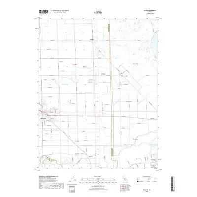
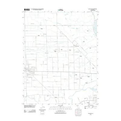 2012 Escalon2012 Print · USGSCovers Escalon, including Oakdale, Valley Home, and other nearby areas
 - 2012 Map of Avena, 2012 Print
 2012 Avena2012 Print · USGSCovers Escalon, including Ripon, Simms, and other nearby areas
 - 2015 Map of Avena, 2015 Print
 2015 Avena2015 Print · USGSCovers Escalon, including Ripon, Simms, and other nearby areas
 - 2015 Map of Escalon, 2015 Print
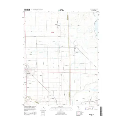 2015 Escalon2015 Print · USGSCovers Escalon, including Oakdale, Valley Home, and other nearby areas
 - 2018 Map of Escalon, 2018 Print
 2018 Escalon2018 Print · USGSCovers Escalon, including Oakdale, Valley Home, and other nearby areas
 - 2018 Map of Avena, 2018 Print
 2018 Avena2018 Print · USGSCovers Escalon, including Ripon, Simms, and other nearby areas
 - 2021 Map of Avena, 2021 Print
 2021 Avena2021 Print · USGSAgricultural life in the San Joaquin Valley is meticulously mapped in this recent survey. Researchers can trace the grid of rural settlements like Van Allen, Avena, and Alba, or locate family sites near Saint John's Catholic Cem.
 - 2021 Map of Escalon, 2021 Print
 2021 Escalon2021 Print · USGSSan Joaquin and Stanislaus counties come together in this contemporary look at the valley's deep-rooted agricultural corridor. Genealogists and local historians can trace family land via Burwood Cem, the settlement at Valley Home, and the northern edge of Oakdale.
End of results
Showing maps 1-21 of 21
Top cities near Escalon
- Stockton historical maps
- Modesto historical maps
- Manteca historical maps
- Ceres historical maps
- Riverbank historical maps
- Oakdale historical maps
See more
Frequently asked questions
- What are the different types of historical maps available for Escalon?
- What is the oldest map of Escalon?
- Where can I purchase historical maps of Escalon for my home or office?
- Where can I download high-res historical maps of Escalon?
- Are there historical topographic maps available for Escalon?
- Is there historical aerial imagery available for Escalon?
- Where are historical maps of Escalon sourced from?