
1914 Map of Avena
USGS Topo · Published 1914About this map
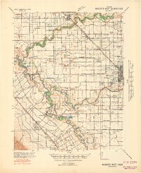
The agricultural development of the northern San Joaquin Valley is clearly defined here as of 1912, centered on the small siding of Avena and the neighboring Ellsworth PO. This landscape was undergoing a rapid transformation from dry ranching to intensive farming, facilitated by the expanding infrastructure of the South San Joaquin Irrigation District. A network of ditches and canals crosses the plains, supported by foundational roadways like Mariposa Road and Lone Tree Road.
Find a feature on this map
17 named features on this map. Tap any name to fly to it.
Don’t see what you’re looking for? This feature index may not catch every label — zoom into the map to look around manually.
Map Details
Editions of this 1914 Avena Map
This is the sole edition of this map. No revisions or reprints were ever made.
Other maps of this area

1914 · Burnham
USGS Topo · 1:31,680

1914 · Manteca
USGS Topo · 1:31,680

1915 · Ripon
USGS Topo · 1:31,680

1915 · Trigo
USGS Topo · 1:31,680

1915 · Peters
USGS Topo · 1:31,680

1915 · Salida
USGS Topo · 1:31,680

1915 · Thalheim
USGS Topo · 1:31,680

1916 · Riverbank
USGS Topo · 1:31,680

1939 · Modesto East
USGS Topo · 1:62,500
1941 · Modesto West
USGS Topo · 1:62,500