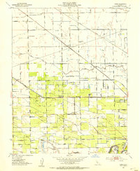
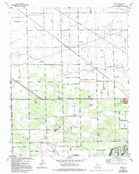
1952 Map of Avena
USGS Topo · Published 1953About this map
Lone Tree Creek meanders through a landscape defined by industrial agriculture and a dense network of early California railroads in the early 1950s. The region is bisected by several competing rail lines, including the Atchison Topeka and Santa Fe, the Southern Pacific, and the Tidewater Southern, which supported the transport of produce from the surrounding San Joaquin valley orchards and fields. Small agricultural loading points and settlements like Avena, Carrolton, and Van Allen dot the landscape alongside local landmarks like a winery near Simms. Public education is represented by rural schoolhouses such as Four Trees School and Wildwood Sch. Along the southern boundary, the Stanislaus River and the Main District Canal illustrate the vital role of water management in this high-production farming belt near the border of San Joaquin and Stanislaus counties.
Find a feature on this map
36 named features on this map. Tap any name to fly to it.
Don’t see what you’re looking for? This feature index may not catch every label — zoom into the map to look around manually.
Map Details
Editions of this 1952 Avena Map
5 editions found
Other maps of this area

1914 · Burnham
USGS Topo · 1:31,680

1914 · Manteca
USGS Topo · 1:31,680

1914 · Avena
USGS Topo · 1:31,680

1915 · Ripon
USGS Topo · 1:31,680

1915 · Trigo
USGS Topo · 1:31,680

1915 · Peters
USGS Topo · 1:31,680

1915 · Salida
USGS Topo · 1:31,680

1915 · Thalheim
USGS Topo · 1:31,680

1916 · Riverbank
USGS Topo · 1:31,680

1939 · Modesto East
USGS Topo · 1:62,500