Old Maps of Watsonville, California for Metal Detecting
Plan your next treasure hunt with 41 historic maps of Watsonville. Find old homesites, ghost towns, trails, and gathering spots that may be lost to time — perfect for identifying promising metal detecting locations.
- Locate forgotten sites: Uncover places like long-lost settlements, abandoned rail lines, or gathering spots.
- Plan better hunts: Use map overlays combined with LiDAR or satellite views to narrow in on historically rich areas.
- Made for detectorists: Thousands of hobbyists use these maps to discover relics, coins, and hidden history.
Use these historic maps to boost your research and find new opportunities beneath the surface of Watsonville.
Watsonville, CA maps
(41)- 1912 Map of Capitola, 1955 Print
 1912 Capitola1955 Print · USGSThe northern Monterey Bay coast thrived at the start of the twentieth century as a hub of rail transport and agriculture. Genealogists can locate family schoolhouses like Amesto School or Beach School and trace the early waterfront at Port Watsonville and Moss.2 unique versions available
 - 1914 Map of Capitola
 1914 Capitola1914 Print · USGSThe northern reaches of Monterey Bay come alive in this pre-war survey of the Central Coast. Researchers can trace the Southern Pacific RR through early settlements like Capitola and Aptos, or locate old landmarks like Camp Goodall and Liveoak School.6 unique versions available
 - 1915 Map of San Juan Bautista
 1915 San Juan Bautista1915 Print · USGSCentral Coast agriculture and railroad expansion converge in this 1910s study of the Pajaro Valley. Local historians can trace the Southern Pacific line past Watsonville Junction to the Mission San Juan Bautista.
 - 1916 Map of New Almaden
 1916 New Almaden1916 Print · USGSThe Santa Cruz Mountains and the Guadalupe River watershed are captured here during the mid-1910s. Researchers can trace the rail-to-mine connections of New Almaden or locate early schools like Vinehill School and the (Abandoned Town) near Almaden Canyon.
 - 1917 Map of San Juan Bautista
 1917 San Juan Bautista1917 Print · USGSThe fertile valleys of the Central Coast meet at the foot of the Santa Cruz Mountains during this era of agricultural expansion. Genealogists can trace family names across huge land grants and locate historic sites like Mission San Juan Bautista and the St Francis Orphan Asylum.6 unique versions available
 - 1919 Map of New Almaden, 1928 Print
 1919 New Almaden1928 Print · USGSThe Santa Cruz Mountains and the mercury mining district at New Almaden are shown here as they appeared just after the first world war. Researchers can trace the Southern Pacific rail line and locate numerous rural schoolhouses like Summit School and Eureka School.4 unique versions available
 - 1939 Map of San Juan Bautista, 1958 Print
 1939 San Juan Bautista1958 Print · USGSThe Central Coast landscape at the dawn of World War II is documented here, showing the intersection of Spanish-era ranchos and the Southern Pacific rail line. Researchers can trace the grounds of Mission San Juan Bautista, identify the Sargent Oil Field, and locate numerous rural schoolhouses like Carlton School.
 - 1940 Map of San Juan Bautista
 1940 San Juan Bautista1940 Print · USGSCentral California coastal and valley life at the start of the 1940s is captured here, where four counties meet. Genealogy researchers can trace family-named sites like Patrick Breen, old rural institutions like the St Francis Orphan Asylum, and the early Sargent Oil Fields.
 - 1940 Map of Capitola
 1940 Capitola1940 Print · USGSCoastal Monterey Bay comes alive in the late 1930s, showing a landscape of rail-linked beach towns and sprawling ranchos. Genealogists and historians can trace family-named schools and early airfields like Santa Cruz Airport, Camp McQuaide, and the original rail stops of the Southern Pacific.
 - 1940 Map of Los Gatos, 1961 Print
 1940 Los Gatos1961 Print · USGSThe Santa Cruz Mountains and southern Santa Clara Valley appear in the early 1940s, showing a landscape of mountain resorts and isolated summits. Researchers can trace the footprints of Alma College, the community at Holy City, and historical landmarks like Mine Hill.2 unique versions available
 - 1943 Map of Los Gatos
 1943 Los Gatos1943 Print · USGSThe Santa Cruz Mountains and Santa Clara Valley are seen here in the early 1940s, before widespread development reshaped the landscape. Researchers can trace historic mountain communities like Holy City, old rural schools such as Hester Creek Sch, and the high-elevation Loma Prieta Lookout.
 - 1947 Map of San Jose, 1948 Print
 1947 San Jose1948 Print · USGSNorthern California's heartland is captured here just after the war, showing the rapid growth of the Santa Clara and Central Valleys. Researchers can trace the legacy of rail and water at Castle Air Force Base, Stockton, and the Hetch Hetchy Aqueduct.
 - 1948 Map of Santa Cruz
 1948 Santa Cruz1948 Print · USGSThe Central Coast and San Joaquin Valley meet in this mid-century look at the region's agricultural and military geography. Genealogists and historians can trace the paths of El Camino Real, locate family farms near Hollister, or study the footprint of the Fort Ord Military Reservation.2 unique versions available
 - 1954 Map of Watsonville West, 1955 Print
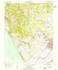 1954 Watsonville West1955 Print · USGSCoastal Santa Cruz County thrived as an agricultural and rail center in the mid-1950s, bridging the gap between the Pajaro River and the Monterey Bay bluffs. Genealogists and local historians can trace the growth of Watsonville and Freedom, locating family-named landmarks like the Monte Vista Christian Sch and the McQuiddy Sch.6 unique versions available
 - 1955 Map of Santa Cruz
 1955 Santa Cruz1955 Print · USGSCoastal Monterey Bay and the fertile Salinas Valley are captured here during the post-war expansion of the mid-fifties. Researchers can trace the era's rail-and-road network via the Southern Pacific lines and find landmarks like Fort Ord or the Lonoak School.
 - 1955 Map of Loma Prieta, 1956 Print
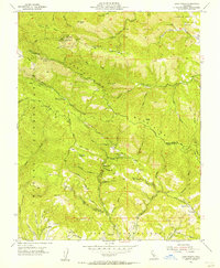 1955 Loma Prieta1956 Print · USGSThe Santa Cruz Mountains in the mid-fifties are captured here as a mix of high-altitude technology and deep canyon settlements. Researchers can find old landmarks like the Eureka Sch (Aband), the Future Farmers of America Camp, and the secluded cabins at Sveadal.6 unique versions available
 - 1955 Map of Watsonville East, 1956 Print
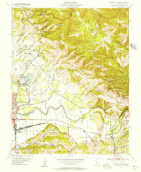 1955 Watsonville East1956 Print · USGSThe fertile Pajaro Valley and southern Santa Cruz Mountains are seen here in the mid-fifties, centered on a vital agricultural and rail corridor. Genealogists and local historians can trace family sites near Johnston Corner, the Pajaro Valley Memorial Park, and the Southern Pacific hub at Watsonville Junction.6 unique versions available
 - 1956 Map of San Jose
 1956 San Jose1956 Print · USGSCentral California in the mid-fifties reveals the transition from sprawling orchards to growing urban hubs like San Jose and Stockton. Genealogists and historians can trace the rail-era landscape of the Mother Lode through Chinese Camp and Tuttletown, or follow the water through the Joaquin River and Calaveras Reservoir.
 - 1957 Map of Santa Cruz
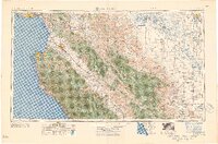 1957 Santa Cruz1957 Print · USGSCentral California comes into sharp focus during the late fifties, from the fog-swept Monterey Bay to the sun-drenched San Joaquin Valley. Genealogists and historians can trace the mid-century footprints of Fort Ord Military Reservation, the Southern Pacific line, and the historic streets of San Juan Bautista.
 - 1958 Map of Santa Cruz
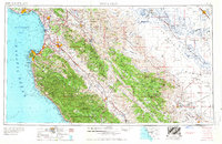 1958 Santa Cruz1958 Print · USGSCoastal California and the central valleys are shown during the mid-fifties, capturing a landscape of massive military reserves and vital rail arteries. Genealogists and historians can trace the Southern Pacific line through Salinas or explore the early footprints of the Fort Ord Military Reservation and San Juan Bautista.2 unique versions available
 - 1962 Map of San Jose
 1962 San Jose1962 Print · USGSCentral California in the early sixties showcases the expansion of the San Joaquin and Santa Clara valleys. Researchers can trace the rail-to-road transition along the Southern Pacific RR or locate landmarks like Castle USAF Base and Loma Prieta.4 unique versions available
 - 1965 Map of Santa Cruz, 1968 Print
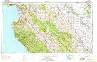 1965 Santa Cruz1968 Print · USGSThe Central Coast and San Joaquin Valley meet here during the mid-sixties, capturing the growth of agricultural and coastal hubs. Trace the historic Southern Pacific RR lines and locate sites like the Presidio of Monterey or Pinnacles National Monument.
 - 1966 Map of San Jose
 1966 San Jose1966 Print · USGSCentral California in the mid-1960s reveals a landscape of massive irrigation projects and expanding Cold War military footprints. Researchers can trace the rail-and-river network of the San Joaquin Valley or locate specialized sites like Castle Air Force Base and the Sharp General Depot (Military).
 - 1974 Map of Monterey, 1977 Print
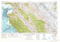 1974 Monterey1977 Print · USGSThe Central Coast and San Joaquin Valley meet in this mid-seventies survey of the Monterey region. Genealogists and historians can locate Spanish-era sites like the San Antonio de Padua Mission, early industrial markers such as the New Idria Mine, and coastal landmarks like the Point Sur Lighthouse.
 - 1978 Map of San Jose
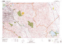 1978 San Jose1978 Print · USGSSanta Clara County and the East Bay hills are captured in the late seventies, showing the suburban sprawl of San Jose alongside the rural Central Valley. Trace the paths of the Southern Pacific railroad and find landmarks like New Almaden and Lick Observatory.
Showing maps 1-25 of 41
Top cities near Watsonville
- San Jose historical maps
- Salinas historical maps
- Santa Cruz historical maps
- Gilroy historical maps
- Morgan Hill historical maps
- Marina historical maps
See more
Top neighborhoods of Watsonville
Frequently asked questions
- What are the different types of historical maps available for Watsonville?
- What is the oldest map of Watsonville?
- Where can I purchase historical maps of Watsonville for my home or office?
- Where can I download high-res historical maps of Watsonville?
- Are there historical topographic maps available for Watsonville?
- Is there historical aerial imagery available for Watsonville?
- Where are historical maps of Watsonville sourced from?