1950s Maps of Stanislaus County, California
Explore 40 historic maps of Stanislaus County from the 1950s. These maps offer a rare glimpse into what life looked like during the 1950s — showing old roads, neighborhoods, homes, and landmarks that have changed or disappeared over time.
Whether you're researching your family's past, planning a metal detecting trip, or studying how Stanislaus County's landscape evolved across the 1950s, these high-resolution maps are a powerful tool for exploring the history of this region.
- Focus on a specific era: All maps on this page are from the 1950s, giving you a focused view of this time period.
- See what’s changed: Compare century-old streets, trails, and buildings to today's modern landscape using overlays and satellite layers.
- Research with precision: Use these maps for genealogy, historical research, land use analysis, or educational projects.
- View, download, or print: Maps are fully viewable online in high resolution, and can be downloaded or printed for your own records.
Start exploring Stanislaus County's history through authentic maps from the 1950s. This is your window into the past.
Stanislaus County, CA maps
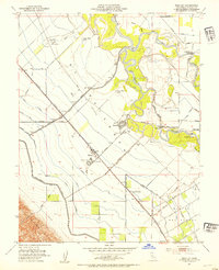
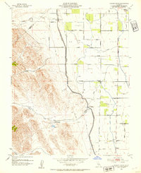
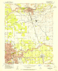
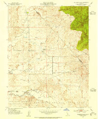
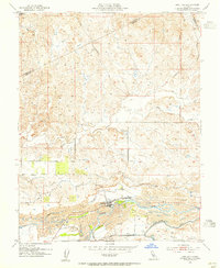
(40)- 1952 Map of Avena, 1953 Print
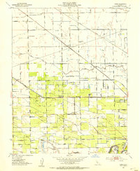 1952 Avena1953 Print · USGSSan Joaquin County agriculture is in full bloom during the early fifties, showcasing a complex grid of orchards and irrigation. Genealogists and rail historians can trace the paths of three different railroads and locate rural schoolhouses like Four Trees School and the town of Escalon.5 unique versions available
 - 1952 Map of Newman, 1954 Print
 1952 Newman1954 Print · USGSThe San Joaquin Valley's agricultural landscape is captured here in the early 1950s, showing the critical rail and water systems that drove the region. Genealogists can trace family holdings along Stuhr Road or locate landmarks like the Canal Sch and West Side Hosp.4 unique versions available
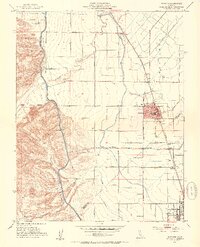
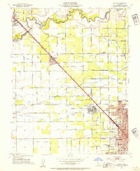
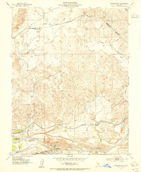
 - 1952 Map of Crows Landing, 1954 Print
 1952 Crows Landing1954 Print · USGSThe Stanislaus County riverlands appear in the early fifties as a landscape of intensive orchard farming and strategic military aviation. Researchers can trace family-named roads and rail history along the Southern Pacific through Patterson and Crows Landing.7 unique versions available
 - 1952 Map of Ripon, 1954 Print
 1952 Ripon1954 Print · USGSThe San Joaquin and Stanislaus rivers meet in this early 1950s survey of California's agricultural heartland. Trace irrigation history through the Hetch Hetchy Aqueduct and find family sites at Mapes Ranch or the San Joaquin School.
 - 1952 Map of Westley, 1954 Print
 1952 Westley1954 Print · USGSAgricultural life in Stanislaus County during the early fifties is centered on the river junctions and the railroad corridor. Researchers can trace the layout of Westley and Grayson, locating local landmarks like the Grayson Sch and the Farm Labor Center.
 - 1952 Map of Vernalis, 1954 Print
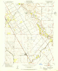
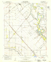 1952 Vernalis1954 Print · USGSThe San Joaquin riverfront is shown at a mid-century turning point when major water projects and rail lines reshaped the Central Valley. Genealogists and historians can trace the San Joaquin City (Site), the New Jerusalem School, and crossings like Durham Ferry Road.3 unique versions available
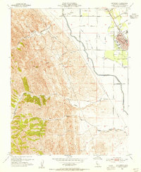
 - 1952 Map of Manteca, 1958 Print
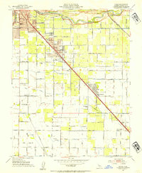
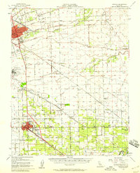 1952 Manteca1958 Print · USGSThe fertile San Joaquin Valley underwent significant post-war growth as irrigation and railroads connected agricultural hubs in the early fifties. Genealogists and local historians can trace rural school districts like Four Trees School and find industry landmarks such as the Sugar Refinery or the Union Memorial Cemetery.2 unique versions available
 - 1953 Map of Ceres, 1954 Print
 1953 Ceres1954 Print · USGSStanislaus County thrived as an agricultural and rail hub in the early fifties, anchored by the Tuolumne River. Genealogists and local historians can trace rural school districts like Shackelford School and Monte Vista Sch or locate the sprawling Lakewood Memorial Park.2 unique versions available
 - 1953 Map of Howard Ranch, 1954 Print
 1953 Howard Ranch1954 Print · USGSThe Central Valley meets the foothills in the 1950s as the Delta-Mendota Canal transforms the Merced and Stanislaus landscape. Researchers can trace rural life via Howard Ranch, Cottonwood School, and the family-named grid of Taglio Road.4 unique versions available
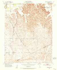
 - 1953 Map of Farmington, 1954 Print
 1953 Farmington1954 Print · USGSFarmington and its surrounding San Joaquin ranchlands are documented here in the early fifties during a period of significant water management. Genealogists and local historians can trace family-named sites like Funck and Gotri or the path of the Southern Pacific railroad near the Farmington Dam.
 - 1953 Map of Brush Lake, 1954 Print
 1953 Brush Lake1954 Print · USGSModesto and the surrounding Central Valley agriculture come into focus in the mid-fifties as urban expansion meets the river bottoms. Genealogists can locate family-named landmarks like Shiloh School, Westport Union School, and the Rancho Del Puerto.2 unique versions available
 - 1953 Map of Escalon, 1954 Print
 1953 Escalon1954 Print · USGSSan Joaquin County agriculture and rail industry thrived mid-century as these two major railroads converged. Researchers can trace the layout of early schools like Union High Sch and Burwood Sch or locate family plots at Burwood Cem.
 - 1953 Map of Riverbank, 1954 Print
 1953 Riverbank1954 Print · USGSMid-century Modesto and Riverbank are shown here as the postwar agricultural economy is being joined by major industrial and aviation expansion. Researchers can find many family landmarks, including Belpassi School, the Riverbank Ordnance Plant, and the small settlement of D'Accardo.
 - 1953 Map of Salida, 1954 Print
 1953 Salida1954 Print · USGSStanislaus County agriculture and early urbanization are captured here just as the post-war boom reached the Central Valley. Genealogists and local historians can locate several rural schoolhouses like Ransom Sch or trace the extensive irrigation works from Lateral No 8 to the Hetch Hetchy Aqueduct.2 unique versions available
 - 1953 Map of Oakdale, 1955 Print
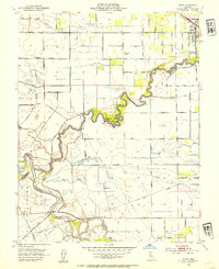
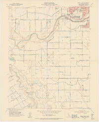
 1953 Oakdale1955 Print · USGSOakdale and the surrounding Stanislaus County plains were defined by a robust rail-and-canal economy in the early fifties. Researchers can trace the dual tracks of the Southern Pacific and Atchison Topeka and Santa Fe Railroad near the Orange Blossom Bridge.
 - 1953 Map of Solyo, 1955 Print
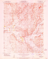
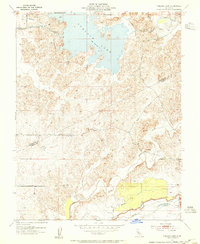
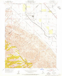 1953 Solyo1955 Print · USGSThe San Joaquin Valley and the Diablo Range foothills meet in the mid-1950s, showing a landscape of massive water infrastructure and military aviation. Trace the path of the Hetch Hetchy Aqueduct or locate the Rising Sun School and the Naval Auxiliary Air Station.4 unique versions available
 - 1953 Map of Bachelor Valley, 1955 Print
 1953 Bachelor Valley1955 Print · USGSThe ranchlands of Stanislaus and Calaveras counties are captured here in the early 1950s as flood control projects began reshaping the landscape. Genealogists and local historians can locate Eugene, St Joseph Ch, and the sprawling Rancheria Del Rio Estanislao land grant.
 - 1953 Map of Cooperstown, 1955 Print
 1953 Cooperstown1955 Print · USGSThe Stanislaus and Tuolumne county line comes alive in the 1950s as a landscape of irrigation and heavy industry. Genealogists and historians can trace the Sierra Railroad through Cooperstown or locate the Roberts Ferry School and riverside Dredge Tailings.
 - 1953 Map of Patterson, 1955 Print
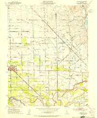
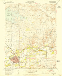
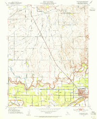
 1953 Patterson1955 Print · USGSIn the early fifties, this Stanislaus County town serves as a hub for Central Valley agriculture as irrigation canals transformed the landscape. Genealogists and researchers can trace the town's radial layout and find landmarks like North Mead Sch, the Farm Labor Center, and the Vanormer Pumping Station.4 unique versions available
 - 1953 Map of Montpelier, 1955 Print
 1953 Montpelier1955 Print · USGSEastern Stanislaus County in the early fifties shows a landscape of growing irrigation networks and rural rail hubs. Genealogists can trace family holdings near Montpelier and Hickman or locate landmarks like the Grain Elevator and Southern Pacific railroad.
 - 1953 Map of Snelling, 1955 Print
 1953 Snelling1955 Print · USGSIn the early fifties, the area around the Merced River shows the lasting impact of industrial gold dredging. Researchers can trace the water infrastructure of the North Side Canal or locate local landmarks like Halterman and Snelling.
 - 1953 Map of Paulsell, 1955 Print
 1953 Paulsell1955 Print · USGSEastern Stanislaus County appears here during the early fifties, showing a landscape defined by the arrival of intensive irrigation and rail transport. Researchers can trace the path of the Sierra Railroad and locate water infrastructure like the Dallas Warner Reservoir and Modesto Main Canal.
 - 1953 Map of Waterford, 1955 Print
 1953 Waterford1955 Print · USGSWaterford and the surrounding agricultural lands are captured here in the mid-1950s as irrigation systems reshaped the landscape. Researchers can trace the Southern Pacific rail line through Claribel and locate regional landmarks like the local Winery and Gravel Pits.
 - 1953 Map of Turlock Lake, 1955 Print
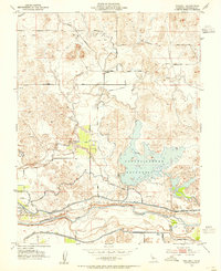
 1953 Turlock Lake1955 Print · USGSThe Stanislaus and Merced county line is captured here in the mid-1950s, a time when irrigation projects were reshaping the Central Valley landscape. Researchers can trace the development of Turlock Lake and the vital Main Canal, or locate family sites along Davis Road and Olsen Road.2 unique versions available
 - 1953 Map of Denair, 1955 Print
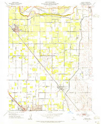 1953 Denair1955 Print · USGSStanislaus County thrived as a railroad and irrigation hub in the early fifties, with the Atchison Topeka and Santa Fe cutting diagonally through the valley. Researchers can trace local roots at the Denair Cemetery or locate old school sites like Lowell and Gratton School.
Showing maps 1-25 of 40
Top cities of Stanislaus County
- Modesto historical maps
- Turlock historical maps
- Ceres historical maps
- Riverbank historical maps
- Patterson historical maps
- Oakdale historical maps
See more
Frequently asked questions
- What are the different types of historical maps available for Stanislaus County?
- What is the oldest map of Stanislaus County?
- Where can I purchase historical maps of Stanislaus County for my home or office?
- Where can I download high-res historical maps of Stanislaus County?
- Are there historical topographic maps available for Stanislaus County?
- Is there historical aerial imagery available for Stanislaus County?
- Where are historical maps of Stanislaus County sourced from?