Old Maps of Stanislaus County, California for Hiking & Exploration
Hike through history with 333 historic maps of Stanislaus County. Explore old trails, ghost towns, and forgotten backroads — perfect for outdoor adventurers and local explorers.
- Rediscover forgotten places: Map out old mining camps, roads, and footpaths that no longer exist on modern maps.
- Layer with modern tools: Combine with LiDAR or satellite views to plan hikes through historical terrain.
- Made for exploration: Popular among hikers, overlanders, and local history lovers.
Use these maps to find adventure and explore the hidden past of Stanislaus County.
Stanislaus County, CA maps
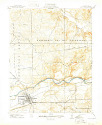
(333)- 1889 Map of Jackson
 1889 Jackson1889 Print · USGSThe Mother Lode foothills thrive in the late nineteenth century as mining and rail expansion reshape the landscape between the San Joaquin Valley and the Sierra Nevada. Genealogists and historians can trace the early layout of Jackson, locate vanished sites like Lancha Plana, and follow the path of the San Joaquin and Sierra Nevada Railroad.
 - 1892 Map of Jackson
 1892 Jackson1892 Print · USGSThe California Gold Country comes alive in the late nineteenth century as mining settlements and river-side camps define the landscape. Genealogists and historians can trace family roots through Mokelumne Hill, San Andreas, and the remote Whiskey Slide.
 - 1893 Map of Sonora
 1893 Sonora1893 Print · USGSThe Mother Lode region comes alive in the early 1890s, showing a landscape defined by mining camps and early river crossings before the big dams. Genealogists and historians can trace old settlements like Chinese Camp and Big Oak Flat, or locate industrial sites like the Olsen Mine and Hobron Mill.
 - 1896 Map of Sonora
 1896 Sonora1896 Print · USGSThe Mother Lode gold country is shown in the late nineteenth century as mining towns and river crossings defined the Sierra Nevada foothills. Genealogists and researchers can trace early routes through Chinese Camp and Coulterville, or locate industrial sites like the Red Cloud Mine and Benton Mill.
 - 1897 Map of Jackson
 1897 Jackson1897 Print · USGSAmador and Calaveras counties are shown here during the late nineteenth-century mining era, when the Mother Lode's river-and-rail economy was in full swing. Genealogists can trace family roots through settlements like Mokelumne Hill, San Andreas, and the remote Whiskey Slide.
 - 1897 Map of Sonora
 1897 Sonora1897 Print · USGSThe Mother Lode region at the close of the nineteenth century is revealed here through its gold-country towns and rugged mining infrastructure. Trace the early footprints of Sonora, Coulterville, and Hornitos alongside sites like the Red Cloud Mine and Ward Ferry.8 unique versions available
 - 1898 Map of Sonora, 1932 Print
 1898 Sonora1932 Print · USGSThe Mother Lode region at the close of the nineteenth century reveals a complex world of river dams and mining camps. Genealogists can trace family names at Chinese Camp or Soulsbyville and locate early industry at the Red Cloud Mine and Bandarita Mine.
 - 1902 Map of Jackson
 1902 Jackson1902 Print · USGSAmador and Calaveras counties are captured at the height of the mining era in this late nineteenth-century survey. Genealogists and historians can trace the rail lines of the Stockton and Copperopolis Railroad and find long-established camps like Lancha Plana and Jesus Maria.7 unique versions available
 - 1913 Map of Dickenson
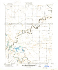
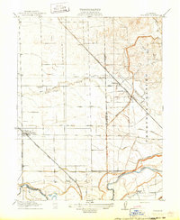
 1913 Dickenson1913 Print · USGSStanislaus County ranching country comes into focus in this early twentieth-century survey of the foothills. Local historians and genealogists can pinpoint the locations of rural schoolhouses such as Tilden School and Lafayette School along the winding course of Dry Creek.
 - 1913 Map of Romain
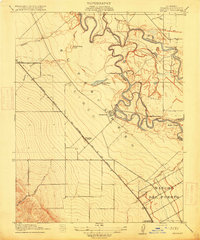
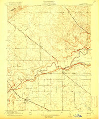
 1913 Romain1913 Print · USGSThe foothills of the Diablo Range meet the San Joaquin Valley floor in the early twentieth century. Researchers can trace early industrial infrastructure like the Southern Pacific R R and Rising Sun School near Romain.
 - 1914 Map of Avena
 1914 Avena1914 Print · USGSThe San Joaquin Valley comes into focus just before World War I as irrigation began to reshape the landscape. Genealogists and historians can trace old homesteads near Avena and Atlanta or locate rural school sites like Van Allen School and Four Tree School.
 - 1915 Map of Vernalis
 1915 Vernalis1915 Print · USGSThe San Joaquin Valley at the onset of the Great War reveals a landscape transitioning from river-bound trade to a rail-centric economy. Trace the development of San Joaquin City and the rural New Jerusalem School along the tracks of the Southern Pacific.
 - 1915 Map of Oakdale
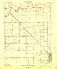
 1915 Oakdale1915 Print · USGSStanislaus County at the height of its early twentieth-century rail boom serves as a hub for three distinct railroads. Genealogists and local historians can trace the early town grid of Oakdale, locate the Booth School, and explore the massive Rancheria Del Rio Estanislao land grant.2 unique versions available
 - 1915 Map of Ripon
 1915 Ripon1915 Print · USGSRipon and the San Joaquin Valley river bottoms are captured here during the height of early twentieth-century agricultural development. Genealogists and researchers can trace local landmarks like Jackson School, the S. P. R. R. (Fresno Line), and the Owl Rod and Gun Club.2 unique versions available
 - 1915 Map of Trigo
 1915 Trigo1915 Print · USGSThe rural border of San Joaquin and Stanislaus counties comes to life in the early twentieth century as a network of creeks and rail lines. Trace family roots at Farmington or Trigo, and locate vanished sites like Wheatland School and Farm Cottage School.
 - 1915 Map of Paulsell
 1915 Paulsell1915 Print · USGSStanislaus County at the start of the twentieth century shows a landscape being reshaped by irrigation and rail. Researchers can trace the Sierra Railway of California through Paulsell and locate the early Horrs School near the Tuolumne River.2 unique versions available
 - 1915 Map of Westport
 1915 Westport1915 Print · USGSThe Stanislaus County plains south of Modesto appear here as a patchwork of irrigation canals and early school districts before the Great War. Genealogists and local historians can trace the foundations of rural life at Westport Church, Shiloh School, and along the banks of the Tuolumne River.
 - 1915 Map of Westley
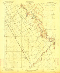
 1915 Westley1915 Print · USGSStanislaus County at the start of the twentieth century shows a landscape defined by the winding San Joaquin River and the arrival of the railroad. Genealogists and researchers can trace early settlements like Tuolumne City and Grayson or locate historic ranch boundaries like Rancho Del Puerto.3 unique versions available
 - 1915 Map of Salida
 1915 Salida1915 Print · USGSThe fertile plains north of Modesto are captured here just before the First World War, showing a landscape transformed by complex irrigation. Genealogists can locate family homesteads near rural landmarks like Wood Colony School or along the Southern Pacific tracks in Salida.2 unique versions available
 - 1915 Map of Thalheim
 1915 Thalheim1915 Print · USGSThe Central Valley's burgeoning irrigation and rail networks are captured here during a period of rapid agricultural expansion. Researchers can trace the development of early settlements like Thalheim and Escalon alongside rural landmarks such as Burwood School and the Thompson Rancho.2 unique versions available
 - 1915 Map of La Grange, 1957 Print
 1915 La Grange1957 Print · USGSThe foothills of the Sierra Nevada meet the valley floor in the early 1900s, centered on the vital waterworks of the Tuolumne River. Researchers can trace the early infrastructure of La Grange Dam and find family-history landmarks like the Live Oak School and Basso Bridge.
 - 1916 Map of Three Tree Flat
 1916 Three Tree Flat1916 Print · USGSThe foothills of the Central Valley meet early irrigation projects in the mid-1910s during a period of rapid agricultural growth. Genealogists can locate family-named landmarks like Tilden School, Dickenson School, and the early footprint of the Turlock Reservoir.2 unique versions available
 - 1916 Map of Mitchell School
 1916 Mitchell School1916 Print · USGSStanislaus and Merced counties appear here during the expansion of Central Valley irrigation and rail at the start of the Great War. Genealogists can locate several rural schoolhouses like Tegner School and Helmar School along the Electric R R.
 - 1916 Map of Crows Landing
 1916 Crows Landing1916 Print · USGSStanislaus County was entering a new era of irrigated agriculture in the mid-1910s as traditional ranching gave way to rail-side settlements. Researchers can trace the early growth of Patterson and Crows Landing along the Southern Pacific and the complex Main Canal system.2 unique versions available
 - 1916 Map of Cressey
 1916 Cressey1916 Print · USGSMerced County agriculture and transit were rapidly expanding when this survey was conducted. Researchers can trace early railroad siding towns like Ballico and Cressey or locate family roots near Madison School and the Merced River.
Showing maps 1-25 of 333
Top cities of Stanislaus County
- Modesto historical maps
- Turlock historical maps
- Ceres historical maps
- Riverbank historical maps
- Patterson historical maps
- Oakdale historical maps
See more
Frequently asked questions
- What are the different types of historical maps available for Stanislaus County?
- What is the oldest map of Stanislaus County?
- Where can I purchase historical maps of Stanislaus County for my home or office?
- Where can I download high-res historical maps of Stanislaus County?
- Are there historical topographic maps available for Stanislaus County?
- Is there historical aerial imagery available for Stanislaus County?
- Where are historical maps of Stanislaus County sourced from?