1950s Maps of Yuba County, California
Explore 26 historic maps of Yuba County from the 1950s. These maps offer a rare glimpse into what life looked like during the 1950s — showing old roads, neighborhoods, homes, and landmarks that have changed or disappeared over time.
Whether you're researching your family's past, planning a metal detecting trip, or studying how Yuba County's landscape evolved across the 1950s, these high-resolution maps are a powerful tool for exploring the history of this region.
- Focus on a specific era: All maps on this page are from the 1950s, giving you a focused view of this time period.
- See what’s changed: Compare century-old streets, trails, and buildings to today's modern landscape using overlays and satellite layers.
- Research with precision: Use these maps for genealogy, historical research, land use analysis, or educational projects.
- View, download, or print: Maps are fully viewable online in high resolution, and can be downloaded or printed for your own records.
Start exploring Yuba County's history through authentic maps from the 1950s. This is your window into the past.
Yuba County, CA maps
(26)- 1950 Map of Oregon House
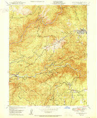
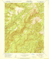
 1950 Oregon House1950 Print · USGSYuba County ranching and timber lands are captured here just after the mid-century, before modern development altered the rural landscape. Local historians can trace the foundations of Oregon House and Virginia Ranch, or locate the sites of the Peoria School and sawmill.
 - 1950 Map of French Corral
 1950 French Corral1950 Print · USGSThe Sierra foothills around the Yuba and Nevada County line are shown here in the years following the Second World War. Researchers can trace historic gold-country sites like French Corral, the San Juan Mine, and the Rice Crossing townsite.
 - 1950 Map of Forbestown
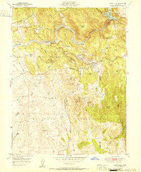
 1950 Forbestown1950 Print · USGSThe Sierra Nevada foothills are captured mid-century during a shift from gold mining to timber and water management. Genealogists and historians can locate legacy sites like Old Forbestown, the Indian Cemetery, and inactive gold workings such as the Carlyle Mine.
 - 1950 Map of Clipper Mills
 1950 Clipper Mills1950 Print · USGSThe Butte and Yuba county line is captured here in the mid-twentieth century, showing a landscape of mining claims and mountain ranches. Researchers can locate historic sites like the Monte de Oro Mine, Clipper Mills School, and the remote holdings at Maynards Ranch.2 unique versions available
 - 1950 Map of Challenge
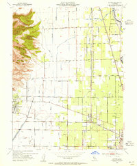
 1950 Challenge1950 Print · USGSThe northern Sierra foothills around Challenge are captured here at mid-century, before modern development reshaped the timber and mining landscape. Genealogists and researchers can trace family holdings like Indiana Ranch and the Girot Ranch or locate old operations at the Horseshoe Mine.3 unique versions available
 - 1950 Map of Strawberry Valley
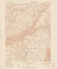
 1950 Strawberry Valley1950 Print · USGSThe Gold Country of the northern Sierras comes into focus at mid-century, showing the overlapping boundaries of Plumas and Tahoe National Forests. Genealogists and researchers can trace historical mining sites and river bars like Brandy City, Strawberry Valley, and the Palace Mine.
 - 1950 Map of Camptonville
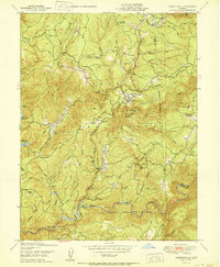 1950 Camptonville1950 Print · USGSThe northern Sierra foothills are documented here in the mid-century, showing a landscape defined by deep river canyons and high-altitude ranching. Researchers can locate specific family lands and historic sites like Sleighville House, Joubert Diggings, and Freemans Crossing.
 - 1950 Map of Rackerby
 1950 Rackerby1950 Print · USGSThe foothills of the Sierra Nevada are surveyed here in the mid-twentieth century as mining and ranching shaped the local landscape. Genealogists can locate family landmarks like the Upham Cem, Willow Glen Ranch, and schools in Sharon Valley and Rackerby.
 - 1950 Map of American House
 1950 American House1950 Print · USGSThe Plumas National Forest backcountry is documented here during the post-war era, showing a landscape defined by timber, water, and early mining. Trace local history through sites like American House, the Lexington Hill Lookout, and the Sanborn Mine.2 unique versions available
 - 1951 Map of Camp Far West
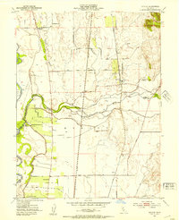
 1951 Camp Far West1951 Print · USGSYuba and Placer counties are shown in the early fifties as the military and ranching economy shaped the Bear River valley. Researchers can trace the Spenceville (Site), the Dairy Farm Mine, and the Lofton Cem.
 - 1951 Map of Smartville
 1951 Smartville1951 Print · USGSThe foothills of Yuba County appear here in the early fifties, caught between a mining past and a military present. Researchers can trace the legacy of the gold rush through the Blue Point Mine, the China Ditch, and the historic Timbuctoo (Site).2 unique versions available
 - 1952 Map of Olivehurst, 1953 Print
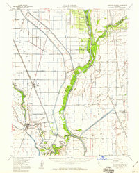
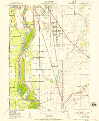 1952 Olivehurst1953 Print · USGSThe Yuba and Feather River floodplains in the early fifties show a fascinating mix of orchard land, rail corridors, and new suburban growth. Genealogists can locate family landmarks like Boardman Ranch or trace the early foundations of Ella Sch and Olivehurst School.5 unique versions available
 - 1952 Map of Nicolaus, 1953 Print
 1952 Nicolaus1953 Print · USGSIn the early 1950s, the Sutter County river basin was a vital hub of rail and agriculture at the junction of two major rivers. Trace local roots through the Nicolaus Cem, Fairview Church, and the many tracks of the Southern Pacific and Sacramento Northern railroads.4 unique versions available
 - 1952 Map of Gridley, 1953 Print
 1952 Gridley1953 Print · USGSThe fertile plains between Gridley and Live Oak are shown in high detail during the early fifties, a time of peak agricultural production in the Sacramento Valley. Genealogists and local historians can locate many rural landmarks including the Live Oak Cemetery, the County Fairground, and the West Liberty School.4 unique versions available
 - 1952 Map of Yuba City, 1954 Print
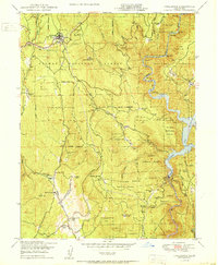
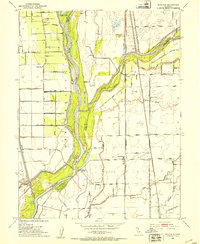
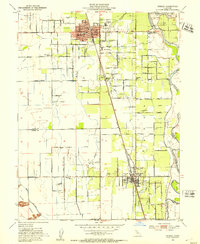
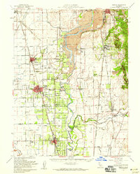
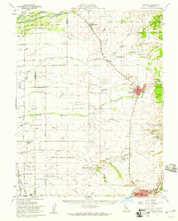
 1952 Yuba City1954 Print · USGSMarysville and Yuba City are captured at their mid-century confluence during an era of significant expansion and industrial activity. Genealogists can locate family landmarks like Marysville Cemetery, while historians can trace the SOUTHERN PACIFIC rails and the Dantoni agricultural colony.5 unique versions available
 - 1952 Map of Honcut, 1954 Print
 1952 Honcut1954 Print · USGSThe northern Sacramento Valley's agricultural heartland is documented here during the mid-century expansion of its orchard and rail networks. Researchers can trace historic boundaries and family-named landmarks like Robinsons Corner, La Finca Orchards, and the junction of the Western Pacific railroad.3 unique versions available
 - 1952 Map of Sutter, 1955 Print
 1952 Sutter1955 Print · USGSThe Sacramento Valley's agricultural heartland is captured here in the early fifties, where the volcanic Sutter Buttes meet a network of canals and rail lines. Researchers can locate family landmarks such as Franklin Home Site Church, the rural Encinal Sch, and the busy Packing Plant near the Feather River.4 unique versions available
 - 1952 Map of Knights Landing, 1959 Print
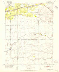
 1952 Knights Landing1959 Print · USGSMid-century Sutter and Yolo counties are defined here by a complex network of levees, bypasses, and river bends. Genealogists and local historians can trace family-named sites like Fairview Cemetery and Wilson School alongside the bustling rail lines of the Southern Pacific.2 unique versions available
 - 1952 Map of Gridley, 1959 Print
 1952 Gridley1959 Print · USGSThe agricultural heart of the Sacramento Valley is captured here in the early fifties, showing the intricate canal networks and rail lines of the day. Researchers can trace family roots through the Onstott Ranch, Lone Tree School, and the Gridley-Biggs Cem.2 unique versions available
 - 1952 Map of Marysville, 1959 Print
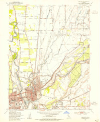
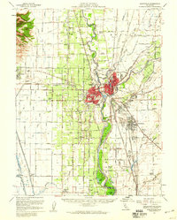 1952 Marysville1959 Print · USGSThe Yuba-Sutter region at mid-century reveals a landscape of river-driven agriculture and expanding rail hubs. Researchers can trace the development of Yuba City and Marysville alongside rural landmarks like Plumas Lake and the Sutter Nat Wildlife Refuge.3 unique versions available
 - 1953 Map of Sheridan, 1954 Print
 1953 Sheridan1954 Print · USGSSheridan and the surrounding ranchlands are captured here in the early 1950s, showing the intersection of the Central Valley’s water and rail networks. Researchers can trace historic land boundaries like the Johnson Grant Rancho and old infrastructure along the Southern Pacific railroad.4 unique versions available
 - 1953 Map of Lincoln, 1959 Print
 1953 Lincoln1959 Print · USGSMid-century Placer County is captured here during a period of agricultural stability and industrial growth. Researchers can trace family ranching legacies at WF Fiddyment Ranch or explore the clay industry near Clayton and Lincoln.2 unique versions available
 - 1955 Map of Forbestown, 1965 Print
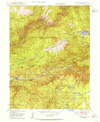 1955 Forbestown1965 Print · USGSThe rugged gold country of Butte County comes into focus in this mid-century survey, documenting a landscape shaped by timber and mining. Genealogists and historians can trace the foundations of Forbestown, locate the Indian Cemetery, and follow the Feather River Railway past the Gold Bank Mine.
 - 1956 Map of Sacramento
 1956 Sacramento1956 Print · USGSMid-century California unfolds from the delta to the high Sierra, capturing a landscape of growing valley cities and burgeoning military airbases. Genealogists and historians can trace the rail lines and river towns from Woodland to Lodi, or explore the foothill settlements of Placerville and Jackson.2 unique versions available
 - 1957 Map of Sacramento, 1966 Print
 1957 Sacramento1966 Print · USGSIn the mid-twentieth century, the California heartland was a hub of river transport, rail lines, and military airbases. Genealogists and historians can trace the development of Gold Country towns like Angels Camp and Sonora or follow the path of the Southern Pacific RR through the growing suburbs of Sacramento.4 unique versions available
Showing maps 1-25 of 26
Top cities of Yuba County
- Linda historical maps
- Olivehurst historical maps
- Marysville historical maps
- Plumas Lake historical maps
- Wheatland historical maps
Frequently asked questions
- What are the different types of historical maps available for Yuba County?
- What is the oldest map of Yuba County?
- Where can I purchase historical maps of Yuba County for my home or office?
- Where can I download high-res historical maps of Yuba County?
- Are there historical topographic maps available for Yuba County?
- Is there historical aerial imagery available for Yuba County?
- Where are historical maps of Yuba County sourced from?