Old Maps of Stanfield Hill, California for Hiking & Exploration
Hike through history with 17 historic maps of Stanfield Hill. Explore old trails, ghost towns, and forgotten backroads — perfect for outdoor adventurers and local explorers.
- Rediscover forgotten places: Map out old mining camps, roads, and footpaths that no longer exist on modern maps.
- Layer with modern tools: Combine with LiDAR or satellite views to plan hikes through historical terrain.
- Made for exploration: Popular among hikers, overlanders, and local history lovers.
Use these maps to find adventure and explore the hidden past of Stanfield Hill.
Stanfield Hill, CA maps
(17)- 1888 Map of Smartsville
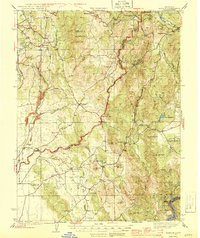
 1888 Smartsville1888 Print · USGSGold Country was in its industrial prime during the late eighteen-hundreds, with deep-shaft mines and hydraulic camps dotting the Sierra foothills. Researchers can trace early family holdings and mining claims through landmarks like French Corral, the North Star Mine, and the historic settlement of Timbuctoo.
 - 1891 Map of Smartsville
 1891 Smartsville1891 Print · USGSGold Country in the late nineteenth century was a landscape of deep mines and timber rails. This survey allows researchers to trace the industrial footprint of the Idaho and North Star Mine alongside vanished camps like Condemned Bar and French Corral.
 - 1892 Map of Smartsville
 1892 Smartsville1892 Print · USGSThe gold-bearing ridges of the Sierra foothills are captured here in the late nineteenth century, showing the height of the hard-rock mining boom. Researchers can trace the narrow-gauge rail lines and locate famous claims including the Empire Mine, Idaho Mine, and the Sulphuret Works.
 - 1894 Map of Smartsville
 1894 Smartsville1894 Print · USGSIn the mid-1880s, the Sierra foothills around Nevada City and Grass Valley were a hive of mining and ranching activity. Genealogists and historians can trace old homesteads like Lanes Ranch, follow the Nevada Co Narrow Gauge RR, and locate forgotten camps like Rough & Ready.
 - 1895 Map of Smartsville
 1895 Smartsville1895 Print · USGSThe Northern Mother Lode thrives during the peak of industrial quartz mining in the late nineteenth century. Researchers can trace the complex rail and mine networks of Nevada City and Grass Valley, alongside historic outposts like Smartsville and Rough & Ready.6 unique versions available
 - 1941 Map of Bangor, 1958 Print
 1941 Bangor1958 Print · USGSThe Butte and Yuba County foothills are captured in the early 1940s, showing a landscape of scattered mining claims and rural homesteads. Genealogists can trace family roots through several local landmarks like Upham Cem, Wyandotte Sch, and the Phoenix Mine.
 - 1944 Map of Bangor
 1944 Bangor1944 Print · USGSThe foothills of the Sierra Nevada are captured here during the early 1940s, showing a landscape defined by gold mining and timber production. Researchers can pinpoint long-standing landmarks such as Hansonville, the Blue Lead Mine, and several rural burial grounds like Upham Cem.2 unique versions available
 - 1948 Map of Oregon House, 1956 Print
 1948 Oregon House1956 Print · USGSThe Yuba County foothills are captured here in the late 1940s, showing a landscape of family ranches and early water engineering. Genealogists can locate family landmarks like Carmichael Ranch and Virginia Ranch or the historic Peoria Sch.3 unique versions available
 - 1950 Map of Oregon House
 1950 Oregon House1950 Print · USGSYuba County ranching and timber lands are captured here just after the mid-century, before modern development altered the rural landscape. Local historians can trace the foundations of Oregon House and Virginia Ranch, or locate the sites of the Peoria School and sawmill.
 - 1958 Map of Chico, 1962 Print
 1958 Chico1962 Print · USGSMid-century Northern California comes to life across the Central Valley and high Sierras as the postwar economy transformed the landscape. Trace the rail lines of the Southern Pacific RR, locate family roots near Chico Cem, or explore the early layout of Paradise and Beale Air Force Base.4 unique versions available
 - 1960 Map of Chico
 1960 Chico1960 Print · USGSThe Northern California high country and Sacramento Valley meet in this 1960s-era landscape of mining towns and river settlements. Trace the rail-and-water economy of the gold country through the Empire Mine, Beale Air Force Base, and the Western Pacific Railroad.
 - 1993 Map of Yuba City, 1994 Print
 1993 Yuba City1994 Print · USGSThe Sacramento Valley and Sierra Nevada foothills meet in the 1990s, where agricultural bypasses and river networks surround the iconic Sutter Buttes. Researchers can trace the rail corridors of the Southern Pacific and Western Pacific through hubs like Marysville and Gridley.
 - 1995 Map of Oregon House
 1995 Oregon House1995 Print · USGSUpper Yuba County in the mid-1990s showcases a landscape shaped by reservoir systems and rural ranching. Researchers can trace local landmarks like the Oregon House Sch, Pal O Mine Ranch, and the historical water routes of Scott Ditch.
 - 2012 Map of Oregon House, 2012 Print
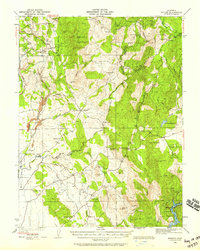
 2012 Oregon House2012 Print · USGSCovers Stanfield Hill, including Oregon House, Rancho Loma Rica, and other nearby areas
 - 2015 Map of Oregon House, 2015 Print
 2015 Oregon House2015 Print · USGSCovers Stanfield Hill, including Oregon House, Rancho Loma Rica, and other nearby areas
 - 2018 Map of Oregon House, 2018 Print
 2018 Oregon House2018 Print · USGSCovers Stanfield Hill, including Oregon House, Rancho Loma Rica, and other nearby areas
 - 2021 Map of Oregon House, 2021 Print
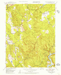
 2021 Oregon House2021 Print · USGSThe foothills of Yuba County are documented here during a period of modern water management and rural settlement. Researchers can trace the layout of Oregon House, the infrastructure of Merle Collins Reservoir, and local landmarks like the Old Aerodrome.
End of results
Showing maps 1-17 of 17
Top cities near Stanfield Hill
Frequently asked questions
- What are the different types of historical maps available for Stanfield Hill?
- What is the oldest map of Stanfield Hill?
- Where can I purchase historical maps of Stanfield Hill for my home or office?
- Where can I download high-res historical maps of Stanfield Hill?
- Are there historical topographic maps available for Stanfield Hill?
- Is there historical aerial imagery available for Stanfield Hill?
- Where are historical maps of Stanfield Hill sourced from?