Old Maps of Waldo Junction, California for Hiking & Exploration
Hike through history with 17 historic maps of Waldo Junction. Explore old trails, ghost towns, and forgotten backroads — perfect for outdoor adventurers and local explorers.
- Rediscover forgotten places: Map out old mining camps, roads, and footpaths that no longer exist on modern maps.
- Layer with modern tools: Combine with LiDAR or satellite views to plan hikes through historical terrain.
- Made for exploration: Popular among hikers, overlanders, and local history lovers.
Use these maps to find adventure and explore the hidden past of Waldo Junction.
Waldo Junction, CA maps
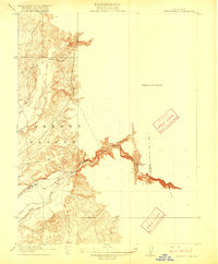
(17)- 1888 Map of Smartsville
 1888 Smartsville1888 Print · USGSGold Country was in its industrial prime during the late eighteen-hundreds, with deep-shaft mines and hydraulic camps dotting the Sierra foothills. Researchers can trace early family holdings and mining claims through landmarks like French Corral, the North Star Mine, and the historic settlement of Timbuctoo.
 - 1891 Map of Smartsville
 1891 Smartsville1891 Print · USGSGold Country in the late nineteenth century was a landscape of deep mines and timber rails. This survey allows researchers to trace the industrial footprint of the Idaho and North Star Mine alongside vanished camps like Condemned Bar and French Corral.
 - 1892 Map of Smartsville
 1892 Smartsville1892 Print · USGSThe gold-bearing ridges of the Sierra foothills are captured here in the late nineteenth century, showing the height of the hard-rock mining boom. Researchers can trace the narrow-gauge rail lines and locate famous claims including the Empire Mine, Idaho Mine, and the Sulphuret Works.
 - 1894 Map of Smartsville
 1894 Smartsville1894 Print · USGSIn the mid-1880s, the Sierra foothills around Nevada City and Grass Valley were a hive of mining and ranching activity. Genealogists and historians can trace old homesteads like Lanes Ranch, follow the Nevada Co Narrow Gauge RR, and locate forgotten camps like Rough & Ready.
 - 1895 Map of Smartsville
 1895 Smartsville1895 Print · USGSThe Northern Mother Lode thrives during the peak of industrial quartz mining in the late nineteenth century. Researchers can trace the complex rail and mine networks of Nevada City and Grass Valley, alongside historic outposts like Smartsville and Rough & Ready.6 unique versions available
 - 1915 Map of Spenceville
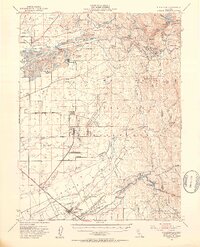
 1915 Spenceville1915 Print · USGSIn the California foothills before the era of major dams, the Bear River and Johnson Rancho defined the local landscape. Genealogists and historians can trace old property lines and river landmarks like McCourtney Crossing and Fenton Ravine.2 unique versions available
 - 1949 Map of Wheatland, 1953 Print
 1949 Wheatland1953 Print · USGSYuba and Nevada counties appear here during the postwar transition of the late 1940s, showing a landscape defined by massive gold dredging and military expansion. Genealogists and historians can trace the foundations of Camp Beale Military Reservation or locate early mining sites like Timbuctoo and the Pennsylvania Mine.3 unique versions available
 - 1949 Map of Camp Far West, 1959 Print
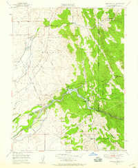 1949 Camp Far West1959 Print · USGSThe foothills of Yuba and Placer counties are captured here in the late 1940s, dominated by the sprawling Bear River and the Camp Beale military grounds. Researchers can locate the Spenceville Site, the Dairy Farm Mine, and the Camp Far West Historic Site.5 unique versions available
 - 1951 Map of Camp Far West
 1951 Camp Far West1951 Print · USGSYuba and Placer counties are shown in the early fifties as the military and ranching economy shaped the Bear River valley. Researchers can trace the Spenceville (Site), the Dairy Farm Mine, and the Lofton Cem.
 - 1958 Map of Chico, 1962 Print
 1958 Chico1962 Print · USGSMid-century Northern California comes to life across the Central Valley and high Sierras as the postwar economy transformed the landscape. Trace the rail lines of the Southern Pacific RR, locate family roots near Chico Cem, or explore the early layout of Paradise and Beale Air Force Base.4 unique versions available
 - 1960 Map of Chico
 1960 Chico1960 Print · USGSThe Northern California high country and Sacramento Valley meet in this 1960s-era landscape of mining towns and river settlements. Trace the rail-and-water economy of the gold country through the Empire Mine, Beale Air Force Base, and the Western Pacific Railroad.
 - 1993 Map of Yuba City, 1994 Print
 1993 Yuba City1994 Print · USGSThe Sacramento Valley and Sierra Nevada foothills meet in the 1990s, where agricultural bypasses and river networks surround the iconic Sutter Buttes. Researchers can trace the rail corridors of the Southern Pacific and Western Pacific through hubs like Marysville and Gridley.
 - 1995 Map of Camp Far West
 1995 Camp Far West1995 Print · USGSYuba and Placer counties meet here in the mid-nineties, where the foothills rise above the sprawling airfield and the reservoir. Researchers can trace the Overland Emigrant Road and locate historical landmarks like Spenceville and the Lofton Cem.
 - 2012 Map of Camp Far West, 2012 Print
 2012 Camp Far West2012 Print · USGSCovers Waldo Junction, including Placer County, Nevada County, and other nearby areas
 - 2015 Map of Camp Far West, 2015 Print
 2015 Camp Far West2015 Print · USGSCovers Waldo Junction, including Placer County, Nevada County, and other nearby areas
 - 2018 Map of Camp Far West, 2018 Print
 2018 Camp Far West2018 Print · USGSCovers Waldo Junction, including Placer County, Nevada County, and other nearby areas
 - 2022 Map of Camp Far West, 2022 Print
 2022 Camp Far West2022 Print · USGSThe foothills of the Sacramento Valley meet the Sierra Nevada edge in the early 2020s, centered on the tri-county waters of the Camp Far West Reservoir. Local researchers can locate family burial sites like Lofton Cem and trace the residential layout of Beale AFB.
End of results
Showing maps 1-17 of 17
Top cities near Waldo Junction
- Lincoln historical maps
- Auburn historical maps
- Wheatland historical maps
- Rough and Ready historical maps
Frequently asked questions
- What are the different types of historical maps available for Waldo Junction?
- What is the oldest map of Waldo Junction?
- Where can I purchase historical maps of Waldo Junction for my home or office?
- Where can I download high-res historical maps of Waldo Junction?
- Are there historical topographic maps available for Waldo Junction?
- Is there historical aerial imagery available for Waldo Junction?
- Where are historical maps of Waldo Junction sourced from?