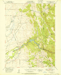
1951 Map of Camp Far West
USGS Topo · Published 1951About this map
Camp Far West Reservoir serves as a central landmark in this 1951 landscape, where the Bear River forms a winding border between Yuba, Nevada, and Placer counties. This survey captures a moment when the Camp Beale Military Reservation dominated the northern terrain, characterized by expansive ranch lands and ravines like Albion Ravine and Long Ravine. The map provides significant genealogical and industrial value, noting the Dairy Farm Mine and the Lofton Cem. Of particular historical interest is the designation of the Camp Far West (Historic Site) and the Spenceville (Site), marking the locations of former pioneer-era settlements. To the south, the Thermalands area and the Valley View School indicate the early 20th-century educational and agricultural infrastructure supporting local families and the Camp Far West Ranch.
Find a feature on this map
32 named features on this map. Tap any name to fly to it.
Don’t see what you’re looking for? This feature index may not catch every label — zoom into the map to look around manually.
Map Details
Editions of this 1951 Camp Far West Map
This is the sole edition of this map. No revisions or reprints were ever made.
Other maps of this area

1888 · Smartsville
USGS Topo · 1:125,000

1891 · Sacramento
USGS Topo · 1:125,000

1891 · Smartsville
USGS Topo · 1:125,000

1892 · Sacramento
USGS Topo · 1:125,000

1892 · Smartsville
USGS Topo · 1:125,000

1893 · Sacramento
USGS Topo · 1:125,000

1894 · Smartsville
USGS Topo · 1:125,000

1895 · Smartsville
USGS Topo · 1:125,000

1910 · Sheridan
USGS Topo · 1:31,680

1910 · Lincoln
USGS Topo · 1:31,680