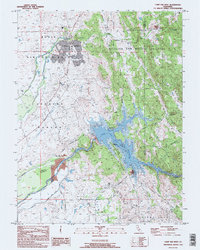
1995 Map of Camp Far West
USGS Topo · Published 1995About this map
The Bear River corridor marks the transition from the valley floor to the foothills during the mid-1990s, dominated by the sprawling infrastructure of Beale Air Force Base and the Camp Far West Reservoir. This period captures the landscape just before significant modern development altered the rural interface between Yuba and Placer counties. Historical layers remain visible through the Camp Far West (Historic Site) and the Spenceville (Site), highlighting the area's legacy of early California settlement. Transportation history is preserved on the map by the Overland Emigrant Road and Emigrant Road, which cut through the eastern foothills. The Spenceville Wildlife and Recreation Area occupies much of the rugged northeastern quadrant, while smaller local landmarks like the Lofton Cem and Valley View Sch provide valuable points of reference for genealogists tracking family roots in the Thermalands region.
Find a feature on this map
28 named features on this map. Tap any name to fly to it.
Don’t see what you’re looking for? This feature index may not catch every label — zoom into the map to look around manually.
Map Details
Editions of this 1995 Camp Far West Map
This is the sole edition of this map. No revisions or reprints were ever made.
Other maps of this area

1888 · Smartsville
USGS Topo · 1:125,000

1891 · Sacramento
USGS Topo · 1:125,000

1891 · Smartsville
USGS Topo · 1:125,000

1892 · Sacramento
USGS Topo · 1:125,000

1892 · Smartsville
USGS Topo · 1:125,000

1893 · Sacramento
USGS Topo · 1:125,000

1894 · Smartsville
USGS Topo · 1:125,000

1895 · Smartsville
USGS Topo · 1:125,000

1910 · Sheridan
USGS Topo · 1:31,680

1910 · Lincoln
USGS Topo · 1:31,680