1950s Maps of Arapahoe County, Colorado
Explore 21 historic maps of Arapahoe County from the 1950s. These maps offer a rare glimpse into what life looked like during the 1950s — showing old roads, neighborhoods, homes, and landmarks that have changed or disappeared over time.
Whether you're researching your family's past, planning a metal detecting trip, or studying how Arapahoe County's landscape evolved across the 1950s, these high-resolution maps are a powerful tool for exploring the history of this region.
- Focus on a specific era: All maps on this page are from the 1950s, giving you a focused view of this time period.
- See what’s changed: Compare century-old streets, trails, and buildings to today's modern landscape using overlays and satellite layers.
- Research with precision: Use these maps for genealogy, historical research, land use analysis, or educational projects.
- View, download, or print: Maps are fully viewable online in high resolution, and can be downloaded or printed for your own records.
Start exploring Arapahoe County's history through authentic maps from the 1950s. This is your window into the past.
Arapahoe County, CO maps
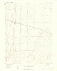
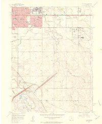
(21)- 1950 Map of Englewood
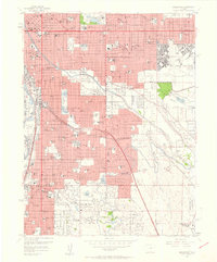
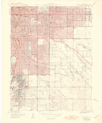 1950 Englewood1950 Print · USGSDenver and Englewood are seen during a period of rapid post-war expansion, blending urban civic centers with emerging suburban country clubs. Researchers can trace historic burial sites at Fairmount Cemetery or locate the settlement of Sullivan near the Highline Canal.
 - 1953 Map of Denver, 1964 Print
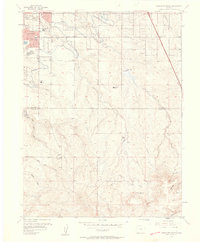
 1953 Denver1964 Print · USGSDenver and the Colorado Front Range are captured here during a decade of post-war growth and military expansion. Researchers can trace the sprawling rail lines of the Union Pacific, locate the State Capitol, and explore historic mountain mining hubs like Central City.6 unique versions available
 - 1954 Map of Limon
 1954 Limon1954 Print · USGSThe Eastern Colorado plains and the Kansas borderlands come alive in the mid-fifties, showing the vital rail-and-road corridor through Limon. Genealogists and historians can trace the Chicago Rock Island & Pacific line through Burlington and find remote outposts like Arickaree and Anton.4 unique versions available
 - 1954 Map of Watkins, 1956 Print
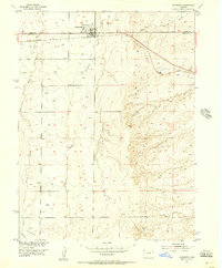
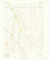
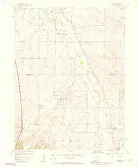
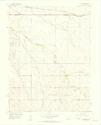
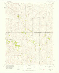
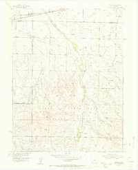 1954 Watkins1956 Print · USGSArapahoe County in the mid-1950s is shown here as a landscape transitioning between agricultural roots and Cold War military activity. Researchers can locate the historic Watkins townsite, the Union Pacific rail line, and the expansive Lowry Air Force Base Bombing Range.7 unique versions available
 - 1955 Map of Strasburg NW, 1956 Print
 1955 Strasburg NW1956 Print · USGSArapahoe and Adams counties in the mid-1950s reveal a landscape of military aviation and prairie infrastructure. Researchers can trace the Lowry Air Force Base Bombing Range or locate the historic Old Victory Highway.4 unique versions available
 - 1955 Map of Watkins SE, 1956 Print
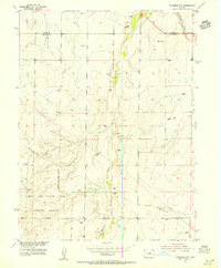
 1955 Watkins SE1956 Print · USGSThe Arapahoe and Elbert county line in the mid-1950s was a site of significant military operations and shifting rural life. Genealogists and historians can trace the Military Reservation Boundary and find the site of the Sehley Sch (Aban'd) near Box Elder Creek.6 unique versions available
 - 1955 Map of Strasburg, 1956 Print
 1955 Strasburg1956 Print · USGSMid-century Strasburg on the Colorado High Plains is captured here as a vital stop along the Union Pacific railroad. Genealogists and local historians can trace the town's development through its agricultural Elevators, Gas Tanks, and rural utilities like the Pipeline.3 unique versions available
 - 1956 Map of Peoria, 1957 Print
 1956 Peoria1957 Print · USGSThe rural crossing at Peoria is captured here in the mid-fifties, showing the vital intersection of prairie ranching and heavy infrastructure. Researchers can trace the Union Pacific rail line and locate industrial markers like the Truck Inspection Station and several early wells.4 unique versions available
 - 1956 Map of Byers, 1958 Print
 1956 Byers1958 Print · USGSByers is captured here in the mid-1950s as a vital railroad town on the high plains of Arapahoe County. Family historians and researchers can locate the local Cem, the Bellview Sch, and early water infrastructure like the Hopewell Ditch.5 unique versions available
 - 1957 Map of Denver
 1957 Denver1957 Print · USGSDenver and the Colorado Front Range are seen here during a mid-century period of intense military and urban expansion. Trace the footprints of the Rocky Mountain Arsenal, the early United States Air Force Academy, and the Lowry AF Base.
 - 1957 Map of Limon
 1957 Limon1957 Print · USGSThe High Plains of Eastern Colorado and Western Kansas come alive in the mid-1950s, showing the vital rail-and-road connections of the era. You can trace the path of the Chicago Rock Island and Pacific through towns like Limon, Stratton, and Burlington or find the early footprint of Bonny Reservoir.
 - 1957 Map of Parker, 1958 Print
 1957 Parker1958 Print · USGSParker and the surrounding Douglas County ranch lands are caught in a moment of early development during the late fifties. Genealogists and historians can locate the Parker townsite, the Cemetery, and early infrastructure like the Aurora Water Supply.2 unique versions available
 - 1957 Map of Fort Logan, 1958 Print
 1957 Fort Logan1958 Print · USGSDenver's southwestern suburbs were in a period of significant postwar growth during the late fifties, blending military grounds with new residential tracts. Local historians can trace the footprints of the Fort Logan Military Reservation, the campus of Loretto Heights College, and the sprawling Federal Center.
 - 1957 Map of Coal Creek, 1958 Print
 1957 Coal Creek1958 Print · USGSEast of Denver in the late fifties, this area was a strategic hub of military aviation and High Plains ranching. Trace the early boundaries of the Naval Air Station (Buckley Field) and locate local landmarks like Coal Creek Sch.3 unique versions available
 - 1957 Map of Highlands Ranch, 1958 Print
 1957 Highlands Ranch1958 Print · USGSDouglas and Arapahoe counties are shown here in the late fifties as the area south of Denver began its suburban transition. Genealogists and local historians can trace the foundations of Greenwood Village, the footprint of Cheese Ranch, and the early site of Bar None Airport.2 unique versions available
 - 1957 Map of Fitzsimons, 1958 Print
 1957 Fitzsimons1958 Print · USGSAurora and eastern Arapahoe County are captured here during a mid-century era of rapid growth and military activity. Researchers can find specific local landmarks like Mount Nebo Cem, Fitzsimons Army Hospital, and the Drive-in Theater.2 unique versions available
 - 1957 Map of Littleton, 1958 Print
 1957 Littleton1958 Print · USGSLittleton and the South Platte River valley are shown in the late fifties as suburban growth begins to overtake older ranch lands. Genealogists and local historians can trace the foundations of Littleton, find the Centennial Racetrack, and locate rural settlements like Acequia and Riverside.2 unique versions available
 - 1957 Map of Englewood, 1958 Print
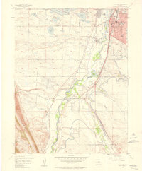
 1957 Englewood1958 Print · USGSDenver and Englewood are seen during a period of intense mid-century expansion, from the downtown state buildings to the nascent suburbs. Researchers can locate vanished institutions and early aviation sites like Lowry Air Force Base and Stapleton Field Municipal Airport.
 - 1957 Map of Piney Creek, 1958 Print
 1957 Piney Creek1958 Print · USGSThe high plains southeast of Denver appear here in the mid-fifties, dominated by the Lowry Air Force Base Bombing Range. Researchers can trace the historic Smoky Hill Road and locate a rural Cem near Sulphur Gulch.3 unique versions available
 - 1958 Map of Limon
 1958 Limon1958 Print · USGSEastern Colorado and the Kansas border meet in this late-fifties study of High Plains rail and river systems. Researchers can trace the path of the Chicago Rock Island and Pacific through Limon and Burlington, or locate the Bonny Dam and Bonny Reservoir.
 - 1958 Map of Denver
 1958 Denver1958 Print · USGSDenver and the Colorado Front Range are captured here during the mid-century suburban boom. Trace the footprints of military installations like Buckley Air Force Base alongside the established rail networks of the Colorado & Southern Ry.
End of results
Showing maps 1-21 of 21
Top cities of Arapahoe County
- Centennial historical maps
- Littleton historical maps
- Englewood historical maps
- Greenwood Village historical maps
- Cherry Hills Village historical maps
- Sheridan historical maps
See more
Frequently asked questions
- What are the different types of historical maps available for Arapahoe County?
- What is the oldest map of Arapahoe County?
- Where can I purchase historical maps of Arapahoe County for my home or office?
- Where can I download high-res historical maps of Arapahoe County?
- Are there historical topographic maps available for Arapahoe County?
- Is there historical aerial imagery available for Arapahoe County?
- Where are historical maps of Arapahoe County sourced from?