Old Maps of Arapahoe County, Colorado for Academic Research
Study the evolution of Arapahoe County with 183 high-resolution historic maps. Whether you're teaching, researching, or modeling changes in land use, these maps provide essential visual documentation of urban, environmental, and geographic change.
- Analyze long-term change: Track patterns in development, transportation, and natural features.
- Ideal for environmental or urban studies: Support academic projects with primary historical map data.
- Use in the classroom or lab: Educators and researchers rely on these maps to bring historical context to life.
These maps are a powerful tool for teaching, research, and visualizing how Arapahoe County has changed over the decades.
Arapahoe County, CO maps
(183)- 1890 Map of East Denver
 1890 East Denver1890 Print · USGSDenver and the surrounding plains are captured in the late frontier era as a complex web of irrigation canals and iron rails. Researchers can trace early water systems like the High Line Ditch or locate early settlements such as Parker's and Scranton.
 - 1899 Map of West Denver
 1899 West Denver1899 Print · USGSThe Denver metropolitan area and its western foothills appear in the late Victorian era as a burgeoning rail and irrigation hub. Researchers can trace the early footprints of Denver, Golden, and Littleton, alongside industrial sites like the Louisville Coal Mine and the grounds of Fort Logan.
 - 1935 Map of East Denver Nos. 3 and 4
 1935 East Denver Nos. 3 and 41935 Print · USGSSoutheast Denver and the surrounding High Plains are captured here in the mid-1930s as residential growth began to push into Douglas County. Researchers can locate early landmarks like Fairmount Cemetery, the settlement of Sullivan, and the Melvin Sch.
 - 1939 Map of Coal Creek, 1955 Print
 1939 Coal Creek1955 Print · USGSThe rural boundary of Arapahoe and Adams counties is captured here in the late 1930s, showing the high plains before urban expansion. Genealogists and local historians can trace the paths of Airline Road and the Union Pacific railroad, or find the site of the old Coal Creek Sch.
 - 1940 Map of Englewood
 1940 Englewood1940 Print · USGSBefore the postwar boom, South Denver and Englewood were a landscape of grand country clubs and critical water infrastructure. Trace the early boundaries of Lowry Field Military Reservation and historic sites like Sullivan and the University of Denver.
 - 1940 Map of Piney Creek
 1940 Piney Creek1940 Print · USGSThe High Plains of the late Depression era come to life here as the tri-county borders of Arapahoe, Douglas, and Elbert converge. Researchers can trace the rugged drainage patterns of Piney Creek, Sulphur Gulch, and Coal Creek before the landscape was altered by modern development.
 - 1941 Map of Fitzsimons
 1941 Fitzsimons1941 Print · USGSArapahoe County was a landscape of military expansion and rural education just before the war. Trace the early boundaries of the Fitzsimons General Hospital and find local landmarks like Pleasant View Sch and the High Line Canal.2 unique versions available
 - 1941 Map of Fort Logan
 1941 Fort Logan1941 Print · USGSThe western edges of Denver and the community of Sheridan are captured here just before the mid-century population boom. Researchers can trace the layout of the Fort Logan Military Reservation and locate local landmarks like Loretto Heights College and Sloan Lake.
 - 1942 Map of Highland Ranch
 1942 Highland Ranch1942 Print · USGSThe northern Douglas County ranchlands appear here in the early 1940s as a quiet expanse of large family estates and critical water canals. Researchers can trace the early boundaries of Highland Ranch, locate the Cheese Ranch, and find rural landmarks like Curtis Sch and the Englewood Dam.
 - 1942 Map of Parker
 1942 Parker1942 Print · USGSSoutheast of Denver in the late thirties and early forties, this landscape shows the rural agricultural roots and water management systems of Douglas County. Genealogists can locate family-named landmarks and community centers like Parker, Melvin, and the Happy Canyon Sch.
 - 1942 Map of Littleton
 1942 Littleton1942 Print · USGSLittleton and the South Platte River valley appear here just before the mid-century boom, shaped by a vital network of railroads and reservoirs. Researchers can trace early rural life at Deer Creek Sch, the riverside siding at Struby, and the waters of Marston Lake.2 unique versions available
 - 1942 Map of Piney Creek
 1942 Piney Creek1942 Print · USGSThe Colorado high plains southeast of Denver appear as a quiet rural landscape in the early 1940s, just as modern infrastructure began to take shape. Genealogists and historians can trace the early drainage and road networks along Piney Creek, Sulphur Gulch, and Coal Creek.2 unique versions available
 - 1942 Map of Coal Creek
 1942 Coal Creek1942 Print · USGSThe Colorado high plains east of Denver show a landscape of intermittent streams and section-line roads in the late thirties. Genealogists and historians can locate the Coal Creek Sch and trace the path of the Union Pacific and Airline Road.
 - 1944 Map of Englewood
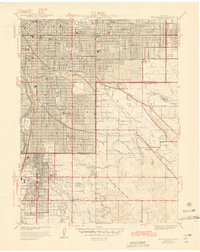 1944 Englewood1944 Print · USGSDenver and its southern suburbs appear during a period of significant mid-century growth and military expansion. Genealogists and local historians can trace the early grids of Englewood, find the original University of Denver campus, or locate family plots in Fairmount Cemetery.
 - 1948 Map of Fort Logan
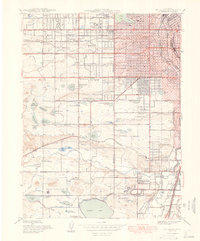 1948 Fort Logan1948 Print · USGSSouthwest Denver and Jefferson County emerge as a hub of military, medical, and educational institutions in the years following the war. Genealogists and historians can locate specific sites like the Craig Colony sanatorium, Loretto Heights College, and the sprawling Fort Logan Military Reservation.
 - 1948 Map of Fitzsimons
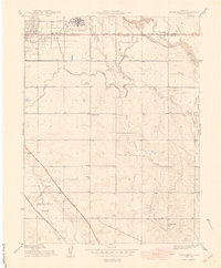 1948 Fitzsimons1948 Print · USGSThe eastern edges of Denver and Aurora were defined by major military installations and high-plains irrigation in the late 1940s. Genealogists and historians can trace the early development of Smoky Hill Park and the grounds of Fitzsimons General Hospital.
 - 1949 Map of Highland Ranch
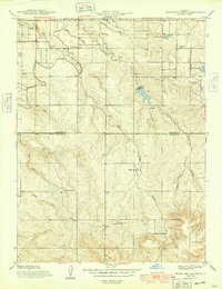 1949 Highland Ranch1949 Print · USGSArapahoe and Douglas counties were still defined by sprawling cattle operations and critical water infrastructure during the late 1940s. Genealogists and local historians can locate early landmarks like Cheese Ranch, Curtis Sch, and the original Highland Ranch headquarters.2 unique versions available
 - 1949 Map of Parker
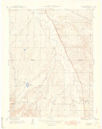 1949 Parker1949 Print · USGSThe high plains south of Denver are captured here in the late 1940s, a period of rural agriculture before the region's rapid suburban growth. Genealogists and historians can trace old homestead routes and irrigation works like the Arapaho Canal or find the sites of Cherry Creek Sch and Melvin.
 - 1950 Map of Englewood
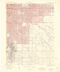 1950 Englewood1950 Print · USGSDenver and Englewood are seen during a period of rapid post-war expansion, blending urban civic centers with emerging suburban country clubs. Researchers can trace historic burial sites at Fairmount Cemetery or locate the settlement of Sullivan near the Highline Canal.
 - 1953 Map of Denver, 1964 Print
 1953 Denver1964 Print · USGSDenver and the Colorado Front Range are captured here during a decade of post-war growth and military expansion. Researchers can trace the sprawling rail lines of the Union Pacific, locate the State Capitol, and explore historic mountain mining hubs like Central City.6 unique versions available
 - 1954 Map of Limon
 1954 Limon1954 Print · USGSThe Eastern Colorado plains and the Kansas borderlands come alive in the mid-fifties, showing the vital rail-and-road corridor through Limon. Genealogists and historians can trace the Chicago Rock Island & Pacific line through Burlington and find remote outposts like Arickaree and Anton.4 unique versions available
 - 1954 Map of Watkins, 1956 Print
 1954 Watkins1956 Print · USGSArapahoe County in the mid-1950s is shown here as a landscape transitioning between agricultural roots and Cold War military activity. Researchers can locate the historic Watkins townsite, the Union Pacific rail line, and the expansive Lowry Air Force Base Bombing Range.7 unique versions available
 - 1955 Map of Strasburg NW, 1956 Print
 1955 Strasburg NW1956 Print · USGSArapahoe and Adams counties in the mid-1950s reveal a landscape of military aviation and prairie infrastructure. Researchers can trace the Lowry Air Force Base Bombing Range or locate the historic Old Victory Highway.4 unique versions available
 - 1955 Map of Watkins SE, 1956 Print
 1955 Watkins SE1956 Print · USGSThe Arapahoe and Elbert county line in the mid-1950s was a site of significant military operations and shifting rural life. Genealogists and historians can trace the Military Reservation Boundary and find the site of the Sehley Sch (Aban'd) near Box Elder Creek.6 unique versions available
 - 1955 Map of Strasburg, 1956 Print
 1955 Strasburg1956 Print · USGSMid-century Strasburg on the Colorado High Plains is captured here as a vital stop along the Union Pacific railroad. Genealogists and local historians can trace the town's development through its agricultural Elevators, Gas Tanks, and rural utilities like the Pipeline.3 unique versions available
Showing maps 1-25 of 183
Top cities of Arapahoe County
- Centennial historical maps
- Littleton historical maps
- Englewood historical maps
- Greenwood Village historical maps
- Cherry Hills Village historical maps
- Sheridan historical maps
See more
Frequently asked questions
- What are the different types of historical maps available for Arapahoe County?
- What is the oldest map of Arapahoe County?
- Where can I purchase historical maps of Arapahoe County for my home or office?
- Where can I download high-res historical maps of Arapahoe County?
- Are there historical topographic maps available for Arapahoe County?
- Is there historical aerial imagery available for Arapahoe County?
- Where are historical maps of Arapahoe County sourced from?