1960s Maps of Arapahoe County, Colorado
Explore 16 historic maps of Arapahoe County from the 1960s. These maps offer a rare glimpse into what life looked like during the 1960s — showing old roads, neighborhoods, homes, and landmarks that have changed or disappeared over time.
Whether you're researching your family's past, planning a metal detecting trip, or studying how Arapahoe County's landscape evolved across the 1960s, these high-resolution maps are a powerful tool for exploring the history of this region.
- Focus on a specific era: All maps on this page are from the 1960s, giving you a focused view of this time period.
- See what’s changed: Compare century-old streets, trails, and buildings to today's modern landscape using overlays and satellite layers.
- Research with precision: Use these maps for genealogy, historical research, land use analysis, or educational projects.
- View, download, or print: Maps are fully viewable online in high resolution, and can be downloaded or printed for your own records.
Start exploring Arapahoe County's history through authentic maps from the 1960s. This is your window into the past.
Arapahoe County, CO maps
(16)- 1960 Map of Denver
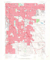
 1960 Denver1960 Print · USGSDenver and the Colorado Front Range are seen here at a pivotal moment of postwar expansion into the plains and foothills. Researchers can trace the mid-century rail network of the Denver & Rio Grande Western RR and locate historic institutional landmarks like Buckley Field and the Colorado School of Mines.
 - 1961 Map of Strasburg SW, 1962 Print
 1961 Strasburg SW1962 Print · USGSThe high plains of eastern Colorado served as a strategic military zone in the early sixties. Researchers can trace the boundaries of the Lowry Air Force Base Bombing Range and locate points like Bomb and Fuse along Kiowa Creek.5 unique versions available
 - 1965 Map of Fitzsimons, 1966 Print
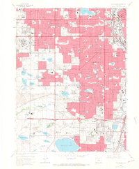
 1965 Fitzsimons1966 Print · USGSAurora and East Denver are captured during a period of intense mid-century growth, as military installations and suburban neighborhoods began to transform the plains. Genealogists and historians can locate dozens of local landmarks like Fitzsimons General Hospital, Highline Canal, and Meadow Hills Country Club.8 unique versions available
 - 1965 Map of Englewood, 1967 Print
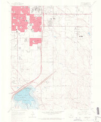
 1965 Englewood1967 Print · USGSDenver and Englewood are shown during a period of rapid suburban maturation in the mid-sixties. Local researchers can trace the development of Lowry Air Force Base, the historic Fairmount Cemetery, and the urban sprawl surrounding the University of Denver.9 unique versions available
 - 1965 Map of Fort Logan, 1967 Print
 1965 Fort Logan1967 Print · USGSMid-century Denver and its southwestern suburbs are seen here during a period of rapid growth. Researchers can trace institutional footprints like Fort Logan and the Federal Correctional Institute alongside old rail lines and Marston Lake.5 unique versions available
 - 1965 Map of Parker, 1967 Print
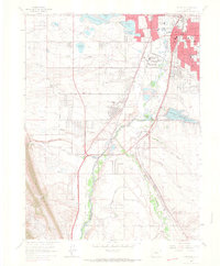
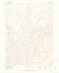
 1965 Parker1967 Print · USGSThe Douglas and Arapahoe county line area in the mid-sixties shows a landscape of rural gulches transitioning toward suburban development. Researchers can trace the early layout of Grandview Estates, the Lewis Cem, and the massive Cherry Creek Reservoir.7 unique versions available
 - 1965 Map of Highlands Ranch, 1967 Print
 1965 Highlands Ranch1967 Print · USGSThe Highlands Ranch area is captured here during the mid-sixties as suburban neighborhoods began to push south from Denver. Researchers can trace the early footprint of Littleton and Greenwood Village alongside historic rural properties like McArthur Ranch and Cheesman Ranch.8 unique versions available
 - 1965 Map of Littleton, 1967 Print
 1965 Littleton1967 Print · USGSSouth of Denver in the mid-1960s, this area shows the early suburban transformation of the South Platte valley. Trace the dual rail lines serving Blakeland or locate landmarks like Centennial Racetrack and Columbine Airpark.5 unique versions available
 - 1966 Map of Coal Creek, 1967 Print
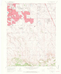
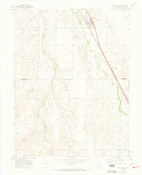
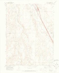
 1966 Coal Creek1967 Print · USGSArapahoe County land east of Aurora is captured here in the mid-1960s as suburban expansion began to reach the prairie. Researchers can trace the early footprint of Buckley Air National Guard Base and the now-defunct East Colfax Airpark.6 unique versions available
 - 1966 Map of Piney Creek, 1967 Print
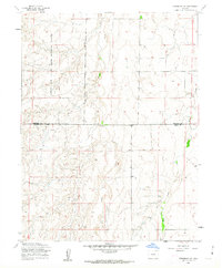
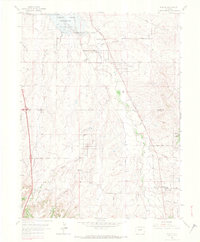
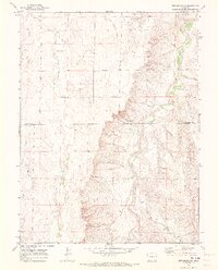
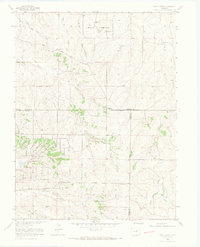 1966 Piney Creek1967 Print · USGSArapahoe County underwent significant infrastructure planning in the mid-1960s as high plains ranching began to meet modern utility needs. Researchers can trace the Military Reservation, an old Cem, and the route of Smoky Hill Road.6 unique versions available
 - 1968 Map of Deer Trail, 1973 Print
 1968 Deer Trail1973 Print · USGSThe Eastern Plains town of Deer Trail is shown here in the late sixties as the high-speed transit of the Union Pacific and Interstate 70 began to reshape the old prairie landscape. Genealogists and local historians can trace the Evergreen Cem, the Rodeo Ground, and the winding paths of East Bijou Creek.
 - 1969 Map of Noonen Reservoir SW, 1973 Print
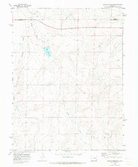
 1969 Noonen Reservoir SW1973 Print · USGSThe high plains of eastern Colorado are captured here in the late sixties at the crossing of the Arapahoe and Elbert county lines. Researchers can trace the path of the Union Pacific railroad along East Bijou Creek or locate local landmarks like Lowland.
 - 1969 Map of Noonen Reservoir, 1973 Print
 1969 Noonen Reservoir1973 Print · USGSThe high plains of the Adams and Arapahoe county line are shown here in the late sixties as a landscape of open drainage and early infrastructure. Researchers can trace the path of Muddy Creek toward the Noonen Reservoir or locate specific Gravel Pits and a cross-country Pipeline.
 - 1969 Map of Strasburg SE, 1973 Print
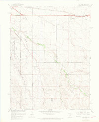
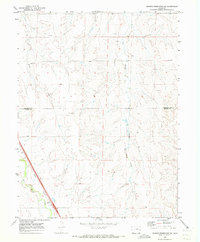
 1969 Strasburg SE1973 Print · USGSThe high plains of eastern Colorado are documented here in the late sixties, showing the rural divide between Arapahoe Co and Elbert Co. Researchers can trace old drainage routes like West Bijou Creek and identify landmarks such as the Gravel Pit or early Pipeline routes.2 unique versions available
 - 1969 Map of Deer Trail, 1973 Print
 1969 Deer Trail1973 Print · USGSDeer Trail sits at the crossroads of the High Plains and major rail lines in the late sixties. Trace the local landscape through family-named landmarks like Evergreen Cem, the Rodeo Ground, and the drainages of East Bijou Creek.3 unique versions available
 - 1969 Map of Byers SW, 1973 Print
 1969 Byers SW1973 Print · USGSHigh plains ranching and resource extraction dominate this late 1960s landscape on the Arapahoe and Elbert county line. Trace local transit and infrastructure along Exmore Road and Ridge Road or locate specific points like Gravel Pits and Hay Gulch.3 unique versions available
End of results
Showing maps 1-16 of 16
Top cities of Arapahoe County
- Centennial historical maps
- Littleton historical maps
- Englewood historical maps
- Greenwood Village historical maps
- Cherry Hills Village historical maps
- Sheridan historical maps
See more
Frequently asked questions
- What are the different types of historical maps available for Arapahoe County?
- What is the oldest map of Arapahoe County?
- Where can I purchase historical maps of Arapahoe County for my home or office?
- Where can I download high-res historical maps of Arapahoe County?
- Are there historical topographic maps available for Arapahoe County?
- Is there historical aerial imagery available for Arapahoe County?
- Where are historical maps of Arapahoe County sourced from?