1890s Maps of Baca County, Colorado
Explore 10 historic maps of Baca County from the 1890s. These maps offer a rare glimpse into what life looked like during the 1890s — showing old roads, neighborhoods, homes, and landmarks that have changed or disappeared over time.
Whether you're researching your family's past, planning a metal detecting trip, or studying how Baca County's landscape evolved across the 1890s, these high-resolution maps are a powerful tool for exploring the history of this region.
- Focus on a specific era: All maps on this page are from the 1890s, giving you a focused view of this time period.
- See what’s changed: Compare century-old streets, trails, and buildings to today's modern landscape using overlays and satellite layers.
- Research with precision: Use these maps for genealogy, historical research, land use analysis, or educational projects.
- View, download, or print: Maps are fully viewable online in high resolution, and can be downloaded or printed for your own records.
Start exploring Baca County's history through authentic maps from the 1890s. This is your window into the past.
Baca County, CO maps
(10)- 1891 Map of Albany
 1891 Albany1891 Print · USGSThe Colorado-Kansas borderlands were a crossroads of historic transit in the early 1890s. Genealogists and historians can trace the paths of the Santa Fe Trail and Texas Trail past frontier outposts like Albany and Kline Ranche.
 - 1891 Map of Higbee
 1891 Higbee1891 Print · USGSSoutheastern Colorado’s high plains and canyon country are captured in the late 1880s, showcasing a frontier landscape. Trace early water sources like Alkali Springs and follow the deep cuts of Smith Canon near the isolated outpost of Higbee.
 - 1891 Map of Springfield
 1891 Springfield1891 Print · USGSSoutheastern Colorado is captured in the late frontier era just after the county's founding. Researchers can trace the early layout of Springfield and its relationship to the seasonal waters of Sand Arroyo and Bear Creek.
 - 1892 Map of Vilas
 1892 Vilas1892 Print · USGSSoutheast Colorado and the Kansas borderland are shown here in the early 1890s, when ranching and the cattle trade dominated the high plains. Genealogists and historians can trace the Texas Trail and early settlements like Boston, Vilas, and Mathews Ranch.5 unique versions available
 - 1892 Map of Two Butte
 1892 Two Butte1892 Print · USGSSoutheastern Colorado appears here in the early 1890s, when ranching outposts and pioneer trails defined the high plains. Researchers can trace the original Santa Fe Trail and locate early settlements such as Brookfield, Mulvane, and the Longshore Ranch.
 - 1892 Map of Mt Carrizo
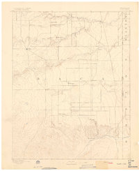
 1892 Mt Carrizo1892 Print · USGSSoutheastern Colorado in the early 1890s remained a landscape of high mesas and vital water holes. Historians can trace the original topography of Las Animas and Baca counties, locating critical sites like Carrizo Springs and Willow Spring.7 unique versions available
 - 1893 Map of Higbee
 1893 Higbee1893 Print · USGSSoutheastern Colorado’s canyon country is documented in the 1890s at the meeting point of Otero, Bent, and Las Animas counties. Genealogists and historians can trace early ranching footprints at JJ Ranch, the settlement at Higbee, and landmarks like Alkali Springs.6 unique versions available
 - 1893 Map of Two Butte
 1893 Two Butte1893 Print · USGSSoutheastern Colorado appears here in the early 1890s, where high plains ranching and the legendary Santa Fe Trail met. Genealogists can trace early outposts like Brookfield, Atlanta, and the remote Longshore Ranch.5 unique versions available
 - 1893 Map of Springfield
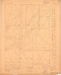
 1893 Springfield1893 Print · USGSSoutheast Colorado at the end of the frontier era centers on the early development of Springfield and the ranching lands of Baca County. Genealogists and historians can trace the original wagon road networks and early border geography along the Colorado Oklahoma Boundary Line and Red Cañon.4 unique versions available
 - 1893 Map of Albany
 1893 Albany1893 Print · USGSThe high plains of the Colorado-Kansas border are documented here in the early 1890s, when overland travel routes still shaped the land. Local historians can trace the paths of the Santa Fe Trail and Texas Trail past early settlements like Albany and Kline Ranche.5 unique versions available
End of results
Showing maps 1-10 of 10
Top cities of Baca County
- Springfield historical maps
- Walsh historical maps
- Campo historical maps
- Pritchett historical maps
- Vilas historical maps
- Two Buttes historical maps
Frequently asked questions
- What are the different types of historical maps available for Baca County?
- What is the oldest map of Baca County?
- Where can I purchase historical maps of Baca County for my home or office?
- Where can I download high-res historical maps of Baca County?
- Are there historical topographic maps available for Baca County?
- Is there historical aerial imagery available for Baca County?
- Where are historical maps of Baca County sourced from?