Old Maps of Baca County, Colorado for Genealogy
Trace your family roots with 422 historic maps of Baca County. These high-res maps reveal old neighborhoods, homesites, landmarks, and streets — helping you uncover where your ancestors lived and how the area evolved over time.
- Explore historic neighborhoods: Identify where your relatives may have lived in the 1800s or 1900s.
- Compare maps over time: Trace the changes in streets, buildings, and landmarks for multi-generational research.
- Perfect for genealogy & ancestry research: Used by family historians and researchers to map out lineage and migration.
These maps are an incredible resource for exploring your personal connection to Baca County's past.
Baca County, CO maps
(422)- 1891 Map of Albany
 1891 Albany1891 Print · USGSThe Colorado-Kansas borderlands were a crossroads of historic transit in the early 1890s. Genealogists and historians can trace the paths of the Santa Fe Trail and Texas Trail past frontier outposts like Albany and Kline Ranche.
 - 1891 Map of Higbee
 1891 Higbee1891 Print · USGSSoutheastern Colorado’s high plains and canyon country are captured in the late 1880s, showcasing a frontier landscape. Trace early water sources like Alkali Springs and follow the deep cuts of Smith Canon near the isolated outpost of Higbee.
 - 1891 Map of Springfield
 1891 Springfield1891 Print · USGSSoutheastern Colorado is captured in the late frontier era just after the county's founding. Researchers can trace the early layout of Springfield and its relationship to the seasonal waters of Sand Arroyo and Bear Creek.
 - 1892 Map of Vilas
 1892 Vilas1892 Print · USGSSoutheast Colorado and the Kansas borderland are shown here in the early 1890s, when ranching and the cattle trade dominated the high plains. Genealogists and historians can trace the Texas Trail and early settlements like Boston, Vilas, and Mathews Ranch.5 unique versions available
 - 1892 Map of Two Butte
 1892 Two Butte1892 Print · USGSSoutheastern Colorado appears here in the early 1890s, when ranching outposts and pioneer trails defined the high plains. Researchers can trace the original Santa Fe Trail and locate early settlements such as Brookfield, Mulvane, and the Longshore Ranch.
 - 1892 Map of Mt Carrizo
 1892 Mt Carrizo1892 Print · USGSSoutheastern Colorado in the early 1890s remained a landscape of high mesas and vital water holes. Historians can trace the original topography of Las Animas and Baca counties, locating critical sites like Carrizo Springs and Willow Spring.7 unique versions available
 - 1893 Map of Higbee
 1893 Higbee1893 Print · USGSSoutheastern Colorado’s canyon country is documented in the 1890s at the meeting point of Otero, Bent, and Las Animas counties. Genealogists and historians can trace early ranching footprints at JJ Ranch, the settlement at Higbee, and landmarks like Alkali Springs.6 unique versions available
 - 1893 Map of Two Butte
 1893 Two Butte1893 Print · USGSSoutheastern Colorado appears here in the early 1890s, where high plains ranching and the legendary Santa Fe Trail met. Genealogists can trace early outposts like Brookfield, Atlanta, and the remote Longshore Ranch.5 unique versions available
 - 1893 Map of Springfield
 1893 Springfield1893 Print · USGSSoutheast Colorado at the end of the frontier era centers on the early development of Springfield and the ranching lands of Baca County. Genealogists and historians can trace the original wagon road networks and early border geography along the Colorado Oklahoma Boundary Line and Red Cañon.4 unique versions available
 - 1893 Map of Albany
 1893 Albany1893 Print · USGSThe high plains of the Colorado-Kansas border are documented here in the early 1890s, when overland travel routes still shaped the land. Local historians can trace the paths of the Santa Fe Trail and Texas Trail past early settlements like Albany and Kline Ranche.5 unique versions available
 - 1954 Map of Dalhart, 1967 Print
 1954 Dalhart1967 Print · USGSThe High Plains at the junction of four states come alive in the mid-fifties, showing a landscape of rail-hub towns and cattle country. Trace the Old Santa Fe Trail or locate mid-century industrial sites like the Dry ice plant and Carbon Dioxide Works.2 unique versions available
 - 1955 Map of La Junta, 1966 Print
 1955 La Junta1966 Print · USGSSoutheastern Colorado during the mid-fifties is captured here as a sprawling network of ranching outposts and rail sidings. Researchers can locate vanished landmarks like the Sunderland School, trace the isolated Lycan Post Office, or find the Bomb target (abandoned) on the western plains.3 unique versions available
 - 1958 Map of La Junta
 1958 La Junta1958 Print · USGSSoutheast Colorado and the Kansas borderlands appear in the late fifties as a landscape of isolated ranching outposts and vital rail junctions. Researchers can trace the lineage of vanished post offices and rural school sites like the Lycan Post Office and Sunderland School.2 unique versions available
 - 1958 Map of Dalhart
 1958 Dalhart1958 Print · USGSThe High Plains of the tri-state border region come alive in this mid-century survey of the ranching and rail territory around the Texas Panhandle. Genealogists and historians can trace the paths of the Atchison Topeka & Santa Fe Ry, military outposts like Dalhart Air Force No 1, and early settlements such as Pasamonte and Texline.2 unique versions available
 - 1962 Map of Dalhart
 1962 Dalhart1962 Print · USGSThe High Plains and volcanic peaks of the tri-state area are shown in detail during the early sixties. Genealogists and historians can trace the rail corridors of the Fort Worth and Denver and find industrial sites like the Cactus Ordnance Works or the Beaver Meade & Englewood Grain Elevator.
 - 1968 Map of La Junta
 1968 La Junta1968 Print · USGSSoutheastern Colorado and the high plains appear in remarkable detail during the late 1960s, showing the intersection of irrigation, ranching, and rail. Genealogists can trace family footprints at the Lycan Post Office, Konantz Cem, and across numerous named cattle ranches.
 - 1968 Map of Autograph Cliff NW, 1971 Print
 1968 Autograph Cliff NW1971 Print · USGSThe Oklahoma-Colorado borderlands come alive in this late-sixties survey of the Cimarron River valley. Genealogists and historians can trace the rugged topography of the Kenton region, locating a small Cem and the reaches of the Comanche National Grassland.
 - 1968 Map of Kenton, 1971 Print
 1968 Kenton1971 Print · USGSKenton and the high mesa country of the Oklahoma Panhandle are documented here during the late sixties. Researchers can trace the unique topography of the tri-state border area, locating landmarks like the Kenton Cem, Robbers Roost Peak, and Coopers Trail.3 unique versions available
 - 1969 Map of Kenton NE, 1971 Print
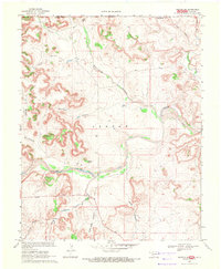 1969 Kenton NE1971 Print · USGSThe Oklahoma Panhandle and Colorado borderlands meet along the river in the late sixties. Researchers can trace the rugged drainage of Gallinas Canon and Carrizo Creek or locate landmarks like Castle Rock and the local Cem.
 - 1969 Map of Razor Blade Mesa, 1971 Print
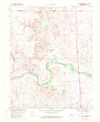 1969 Razor Blade Mesa1971 Print · USGSThe Oklahoma Panhandle's Cimarron River valley is mapped here in the late sixties as the high mesas meet the state line. Genealogists and local historians can locate the Garrett Cemetery, the railroad stop at Castaneda, and the tracks of the Atchison Topeka and Santa Fe.
 - 1971 Map of Lycan SE, 1973 Print
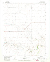 1971 Lycan SE1973 Print · USGSThe Colorado and Kansas borderlands come alive in this early 1970s survey of the High Plains. Genealogists and historians can trace the remote section lines of Baca and Stanton counties, following the paths of Beaty Creek, Buffalo Creek, and a lone Spring.
 - 1971 Map of Big Rock Grange, 1973 Print
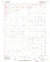 1971 Big Rock Grange1973 Print · USGSSoutheast Colorado in the early seventies shows a landscape defined by ranching and essential infrastructure. Genealogists and historians can trace family-named water sources and landmarks like Big Rock Grange, North Horse Creek, and the local Gravel Pit.
 - 1971 Map of Sturgis, 1973 Print
 1971 Sturgis1973 Print · USGSThe Oklahoma Panhandle in the early seventies centers on the rail-side community of Sturgis and the surrounding energy fields. Local researchers can trace the Atchison Topeka and Santa Fe railroad corridor past Goff and the local Roadside Park.
 - 1971 Map of Lycan NE, 1973 Print
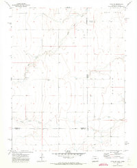 1971 Lycan NE1973 Print · USGSThe Colorado-Kansas borderlands in the early seventies reveal a landscape of isolated prairie settlements and ranching infrastructure. Trace family history at the Amerine Cem or follow the drainage of North Bear Creek and Little Bear Creek.
 - 1971 Map of Plains Community, 1973 Print
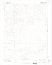 1971 Plains Community1973 Print · USGSThe high plains of Colorado and Kansas come into focus in the early 1970s, showing a landscape defined by ranching and rural education. Genealogists and local historians can locate the Star School and the tiny outpost of Betty among the drainages of Two Butte Creek.3 unique versions available
Showing maps 1-25 of 422
Top cities of Baca County
- Springfield historical maps
- Walsh historical maps
- Campo historical maps
- Pritchett historical maps
- Vilas historical maps
- Two Buttes historical maps
Frequently asked questions
- What are the different types of historical maps available for Baca County?
- What is the oldest map of Baca County?
- Where can I purchase historical maps of Baca County for my home or office?
- Where can I download high-res historical maps of Baca County?
- Are there historical topographic maps available for Baca County?
- Is there historical aerial imagery available for Baca County?
- Where are historical maps of Baca County sourced from?